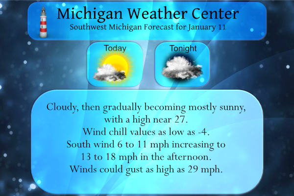
We have 11° this morning in Otsego (at 6:30 am) with a dusting of new snow overnight. Yesterday’s high temp was 18.5° with a low of 10°. We will see another cold and mainly dry day today. The region will see increasing wind with gusts near 30 mph. Then temperatures will rebound to about the […]
We have 16° at 6:30 this morning. Yesterday’s high was 35° before a brisk west wind behind a cold front dropped the temps to a low of 16.5°. With dry air in place, there were no lake effect snows. Temperatures north of Grand Rapids are in the single digits this morning and in negative territory […]
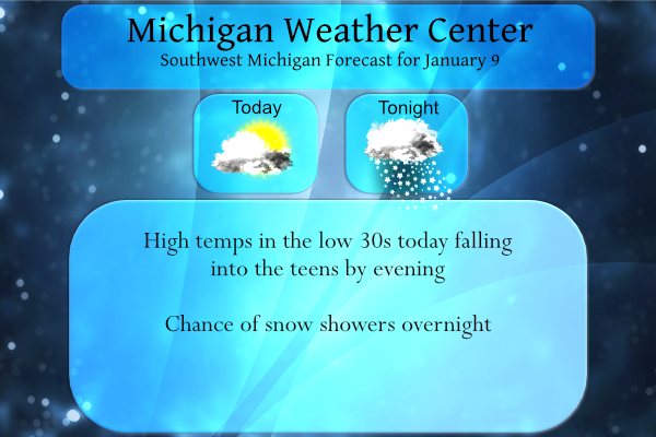
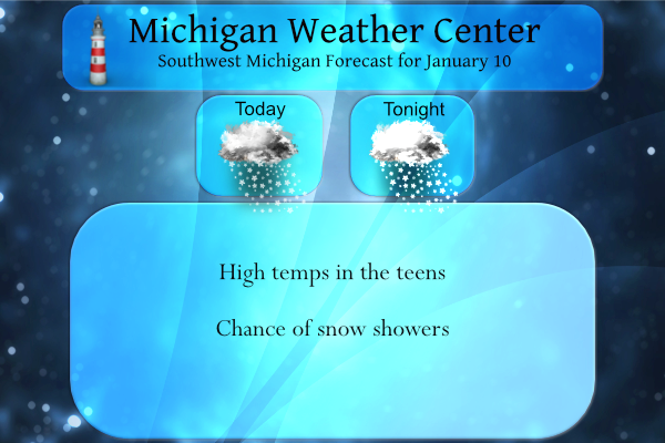
We had some freezing drizzle overnight with less than a tenth of an inch in most locations. We have 34° at 5:30 this morning. Temps will be falling throughout the day into the teens by late this afternoon. Yesterday’s high was 32.5° recovering from a low of 6.4° which was one of our coldest mornings […]

Winters Past There are sometimes when I have a hard time coming up with new ideas for this post. This week I will take a look at some winters in the past. One of the things I will be looking at are as some who post on here that winter only last one or two […]
We have had 7 inches of snow so far from lake effect which brings us to 10 inches for the month and 23 inches for the season. Some areas in Kent and Ottawa counties have seen well over a foot of the white stuff. Grand Rapids broke a daily snowfall record for Jan. 5, with […]

We have about five inches of fresh snow on the ground (not official as I haven’t made it out to where the wind hasn’t been blowing). Most of this fell late afternoon and overnight when the winds switched to the west. This brings us to 21 inches for the season, halfway to our total for […]
We will have a wild and blustery day today for a good portion of Michigan. The areas in pink will meet warning criteria the blue areas are where advisories are in place. Heavy lake effect snow is expected in the warning area. Total snow accumulations of 4 to 10 inches. Winds gusting as high as […]

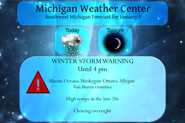
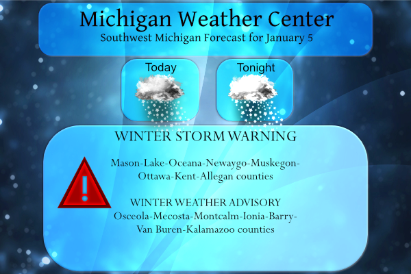
We have our first winter storm warning for this year for the counties in pink. Travel in western Lower Michigan will be greatly impacted Wednesday by snow showers, heavy at times, areas of blowing snow, and slick roads. Near blizzard conditions with whiteouts may occur and a few power outages are possible. Winds will diminish […]
Yesterday was a great day for snow cleanup or enjoying outside winter activities such as skiing out at Bittersweet (they were packed yesterday). I got to use my snowblower for the first time this season. Yesterday’s high was 24° and the low 17°. We currently have 19° at 8 am. Forecast Discussion The main focus […]
We had 2.5 inches of liquid precipitation for December and 5.2 inches of snow, if we include November we have a snowfall total of 13.1 inches. Our biggest snowfall last year was on February 16 when we had 5.5 inches. In 2020 the biggest snowfall was 8 inches on 1/20. Big snowstorms have been few […]