The NWS will be busy today looking at storm damage between Decatur and Battle Creek. From what I saw from photos and on Radarscope there were definitely multiple tornados from last evening’s storms. Once verified by the NWS, it would be interesting if this was a record for the number of tornados from one system in a day for Michigan in a relatively small area. Below is the preliminary storm map from the SPC. You can click on the link for the report’s storm data. Below that is a Radarscope screenshot.
As a side note, please don’t post CPC outlook maps during a storm outbreak it is unnecessary and distracting.

Storm Reports from 05/07

Radarscope image from 6:20 pm
I can’t post images from the local media but you can go to WWMT and WOODTV to see them. If you are expecting packages coming from the FedEx distribution center I suspect you will have to wait as it suffered significant damage, thankfully all the employees are safe.
Here in Otsego, we had torrential rain with thunder and lightning. The rainfall total was 1.25 inches from the storms.
NWS Forecast
Weather History
1976: A freeze hits Lower Michigan with Grand Rapids and Muskegon setting record lows of 27 degrees.
1880: A tornado destroyed two homes and a barn two miles east of Kalamazoo. No one was injured.
On May 8, 1964, an F4 tornado moved through Chesterfield Township in southern Macomb County, touching down at 4:59 pm. This tornado touched down north of Mt. Clemens and moved across Chesterfield Township near the Lake St. Clair shoreline before entering Lake St. Clair southwest of New Baltimore. This was the strongest tornado to ever hit Macomb County and was responsible for 13 fatalities.
1784: A deadly hailstorm in South Carolina hits the town of Winnsborough. The hailstones, measuring as much as nine inches in circumference, killed several persons, and a great number of sheep, lambs, and birds.
1902: On May 7th, Martinique’s Mount Pelee began the deadliest volcanic eruption in the 20th century. On this day, the city of Saint Pierre, which some called the Paris of the Caribbean, was virtually wiped off the map. The volcano killed an estimated 30,000 people. Click HERE for more information from the History.com.
1979: Widespread damage occurred in the Tampa Bay area. The 19 tornadoes reported are the most in one day in Florida history. Three people drowned in Pinellas County where flooding was most severe. Rainfall amounts of 18 inches in 24 hours were reported with 12.73 inches falling at Tampa, FL; with 7.84 inches of that in just six hours. The worst hit was the Polk County community of Auburndale where a tornado made a direct hit on the Auburndale School. Flying debris hurt only eight students. An 83-year-old woman was killed as she hid in an unreinforced concrete block storage shed. 98 trailers were damaged or destroyed, and 40 people were injured.
2003: This was the second of three consecutive days with strong to violent tornadoes around Oklahoma City. A violent F4 tornado that affected Moore, Oklahoma City, Midwest City and Choctaw took on a path very similar to the 5/3/1999 devastating tornado. This particular storm back in 2003 affected areas from Newcastle and Moore to Del City and Choctaw. Although over 130 people were injured, there were no fatalities.
2009: A deadly derecho squall line crosses far southern Illinois at midday devastating the Carbondale area on its way across a 1,200-mile swath of terrain covering sections of nine states. Hundreds of homes and businesses are damaged or destroyed in Kansas, Kentucky, Illinois, Kentucky, and Missouri. The wind gusts to 106 mph in the Carbondale area with sustained winds measured at up to 90 mph. In southern Illinois, the storm system peels siding and roofs off homes and other buildings, blowing out car windows and tearing up trailer parks. Click HERE for more information.
Forecast Discussion
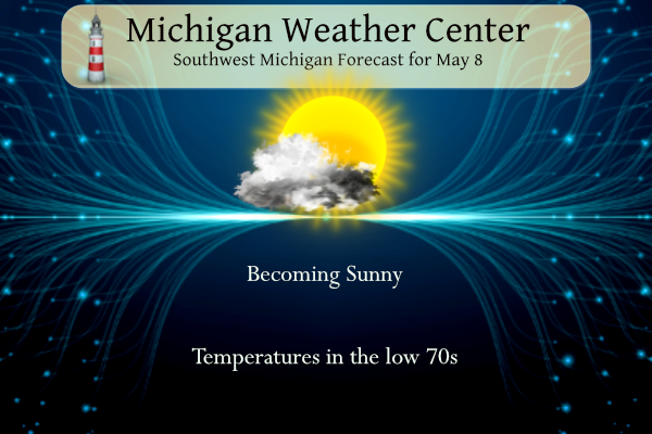
- Dry and mostly sunny today

The upper-level shortwave trough and surface low associated with
yesterday`s thunderstorms is scooting east toward New England today,
while its former parent low over the Dakotas begins to fill and
shear out. There will be a narrow zone of ridging with 500 mb height
rises over our area along with drier air moving through, keeping us
mostly sunny until clouds increase late in the evening. There should
be only a moderate breeze from the west becoming northwest.

- Rain and chance thunderstorm tonight through Thursday

Remnants of the Dakota low phasing with a southward-moving
positively tilted trough from northern Ontario are expected to
develop a surface low across Illinois-Indiana-Ohio tonight. To its
north will be a period of likely rain for much of the day Thursday
across southern to central Lower Michigan. Some MUCAPE may be
present in southern Michigan which could be enough for some rumbles
of thunder. Some questions remain as to the northward extent of a
soaking rainfall, and also rainfall totals. HREF member model mean
rain totals suggest 0.5 to 1.0 inch rain totals are most likely
(though much less near/north of US-10), however, 1.5 inch totals are
possible in some spots.

- Showers on Saturday

Shortwave ridging should bring fair weather for Friday into Friday
night but clouds will be moving in after midnight as a shortwave
trough approaches, with rain moving back in for Saturday. This
trough is less amplified than previous runs but some diurnal
enhancement of the showers Saturday afternoon is still possible
given the steep lapse rates. Isolated thunderstorms are possible and
even some small hail with any deeper updrafts.

Cool air in northerly flow on the back side of the sfc low results
in low temperatures in the upper 30s to lower 40s Saturday night
with scattered frost potential in the colder outlying areas.

The trough moves east on Sunday but there is low confidence with
forecast details next week, although there is model agreement on a
longwave trough forming across the central/eastern CONUS by late in
the week.
Portage tornado was rated EF2. Estimated peak winds of 135mph. 11 mile path. 300yds wide
Wow 1mph away from an EF-3. Quite the tornado
One of our local TV mets said until yesterday, a Tornado Emergency had never been issued in the state of Michigan.
Glad to hear there were no deaths or serious injuries from the storms yesterday in our area!!
Also good call by the NWS for the tornado watch and early warnings. I think the event was handled very well by everyone
I agree. NWS did a fantastic job. The tornado watch came with plenty of lead time. Warnings were great as well.
Anyone else’s pets seems a little nervous/scared yesterday? Both my dog and cat would not leave my side. They followed me all over and wanted to be right by me. That’s not usually the case. Almost as if they could sense something was up with the weather. Only one other time have I seen such behavior from my pets and a tornado occurred about 2 miles from my house. I remember the blinds of the house getting sucked into the screen then moving back to get sucked into the screen again. Something felt off even to me. My dog was… Read more »
Not here. Our dog was as chill as usual.
Yeah I remember you posting that Nathan. Crazy day.
Yesterday around 3 I did say “ For some reason I have a feeling this tornado threat is going to pane out today… hopefully I am wrong but something about the setup seems really optimal”. It had that feeling yesterday for sure especially south of GR
Our dogs were chill, but at times would seem anxious as well. They were all about us being next to us. Lol
GR is +6.5 degrees in May. Still without a single below average temp day.
Ellen baca said last night was the first a tornado emergency has ever been issued here.
Anyone see the mobile home picked up and pierced right through a tree in Sherwood near Union City? Horrible damage. I have to say I don’t think I’ve ever seen so many PDS warnings in this state like we did last night.
Ellen is from Portage, at one point she became a tad emotional when the tornado was moving through that area. Don’t blame her, I know some people from there also.
Yes I don’t blame her either. The zone this tornado went through is where I was a delivery driver for a while. I know all the neighborhoods there snd even got to know some of the people.
Yes, Blake stepped right in…thought it was nice of him.
I had family that went for dinner right before this all happened…they were like 2 streets away. I was so nervous!! Called other family that lives in that area…they were all good
The official H/L yesterday at Grand Rapids was 69/50 there was 0.28” of rainfall. The highest wind gust was 39 MPH out of the NW. There was 23% of possible sunshine. For today the average H/L is 67/46 the record high of 89 was in 1926 and the record low of 27 was in 1976. Last year the H/L was 31/51 and there was 0.10” of rain.
Slim
Here in MBY I had 0.34” of rainfall yesterday. The overnight low here in my yard was 49 and at this time with clear skies it is 52.
Slim
Here is the report from CNN with multiple photos:
https://www.cnn.com/2024/05/08/weather/tornadoes-michigan-tuesday-storms-wednesday/index.html
That looks like there was a good bit of damage.
Slim
From the article – “There have been 13 consecutive days of tornado reports across US”
The past two weeks have been intense, for sure.
Like SS said, last night was one for the history books.