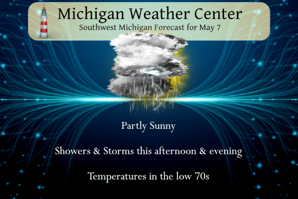
Yesterday’s high was 73° and the low was 46°. We will start today dry with showers and thunderstorms developing. Some severe weather is possible this afternoon and evening with the potential for damaging wind gusts, large hail, and isolated tornadoes. The best chance for severe weather will be late in the afternoon and evening.
Hazardous Weather Outlook
This hazardous weather outlook is for portions of southwest Lower
Michigan.

.DAY ONE...Today and Tonight

Thunderstorms are likely this afternoon through evening. While
lightning is a hazard in any thunderstorm, some storms may be
locally severe, with briefly stronger wind gusts or large hail.

.DAYS TWO THROUGH SEVEN...Wednesday through Monday

Winds and waves on Lake Michigan may be hazardous to small craft
on Thursday.

.SPOTTER INFORMATION STATEMENT...

Spotter activation may be needed today, most likely between 4 PM
and 10 PM.
SPC Day One Outlook

NWS Forecast
Weather History
1947: Cold and snow prevail across Lower Michigan with lows in the upper 20s and highs only in the upper 30s to lower 40s.
1974: Temperatures tumble as cold high pressure builds into Lower Michigan. Record lows on this date include 22 degrees at Lansing, 25 at Grand Rapids, and 27 at Muskegon.
On May 7, 1974, a two-day span of record lows occurred in Detroit on the 6th with 31 degrees and on the 7th with 27 degrees.
1840: A powerful tornado wrecked many boats at the Natchez Landing in Mississippi then plowed through the city on the bluff. The tornado killed 317 people and injured 109 others. The storm is currently the second deadliest tornado on record. The actual death toll could be higher as slaves were not counted.
1993: Serious flooding occurred in central Oklahoma following torrential rain and hail on this date through the 8th. Rainfall amounts on this date were generally around one inch. Oklahoma City, OK then recorded 6.64 inches of rain on the 8th, the third greatest daily rainfall amount ever observed in the city. Extensive flooding resulted, which killed four people, and the fire department had to rescue 183 others. More than 2,000 homes and businesses were damaged or destroyed. Damages were estimated at $8 million.
1989: Thirty-two cities in the central and eastern U.S. reported record low temperatures for the date, and 24-hour snowfall totals of 7.2 inches at Buffalo and 10.7 inches at Rochester New York were records for May.
Forecast Discussion
- Afternoon-evening thunderstorms, possibly severe

On the southeast periphery of a maturing low over the Dakotas, a 500
mb trough and vorticity maximum will move from the central Plains to
the western Great Lakes today. Upper level height falls and an
approaching left exit region of a 250 mb jet streak will broadly
support ascent and cooling in the midlevels. In the lower levels,
the nose of a southerly 850 mb jet will slide through northern
Indiana and southern Michigan while a surface warm front is
expected to progress northward to roughly a Muskegon-Jackson line
during the afternoon. A frontal triple point and possibly a
deepening surface pressure field is expected in the vicinity of
Chicago/Milwaukee by late afternoon.

Ongoing line of thunderstorms marching from the Plains to
Mississippi river valley overnight is expected to arrive in
southwest Lower Michigan around 11 AM to Noon and progress
northeastward toward Clare by 3-4 PM while weakening as it moves
into a more stable environment. Severe weather is not likely with
this first round, though lightning may still be a hazard for
southwest locations. In its wake, rapid moistening of the low levels
(through some combination of rainfall and advection) along with
cooling mid-upper levels (with the arrival of the 500 mb trough) is
likely to support development of scattered thunderstorms (possibly
severe) between 4-10 PM, even if there is considerable cloud cover.
HREF mean surface-based CAPE in southwest Michigan reaches 1000 J/kg
by 5 PM, south of a Muskegon-Jackson line, though even if
convective inhibition of the surface remains high, there may be
a less-inhibited effective unstable layer above the surface on
both sides of the warm front.

Most of the CAMs show similar character of convection this evening,
with a mode of scattered to numerous cells of small to moderate
width evolving into clusters across southern Michigan, and perhaps
other quasi-linear thunderstorms farther north crossing Lake
Michigan. These storms should be strongly sheared, given an expected
0-3 km wind difference of 30 to 40 knots. The magnitude of 0-1 km
streamwise vorticity available for the given storm motion is
questionable, however. There may be cells which briefly encounter a
more favorable environment to attain supercell characteristics,
perhaps in vicinity of the warm front, or with less predictable
environmental modification from preceding cells or interactions
between cells. Can`t really rule out any severe hazard in this
environment, though the most likely limiting factors may be if
potential instability isn`t realized or if updraft width remains
modest.

- Rain on Thursday and Saturday

A couple shortwave troughs will result in chances for showers
peaking Thursday and Saturday. Confidence is above average with good
model agreement and ensemble support. One trend that has been noted
since yesterday is a further south shift in the track of the low on
Thursday which could mean the rain stays south of central Lower
Michigan. This is not yet completely reflected in the current grids.

An area of mid-level frontogenesis north of a low pressure center
tracking across the Ohio Valley will result in rain moving in late
Wednesday night and continuing through Thursday afternoon. Northerly
flow on the back side of the low will advect in a cool Canadian
airmass. We will have to watch for frost potential if skies clear
out Thursday night.

Shortwave ridging should continue the fair weather for Friday into
Friday night but clouds will be moving in after midnight as the next
shortwave trough approaches, with rain moving back in for Saturday.
The trough cits off into a 500 mb low across our area by Saturday
and there could be some diurnal enhancement of the showers Saturday
afternoon. Given the steep lapse rates, some thunder is possible and
even some hail with any deeper updrafts.

The low lifts out gradually early next week but there is low
confidence on how quick the showers end, with model differences and
ensemble spread increasing after Sunday.
Portage tornado: https://youtu.be/xg68DMp5N5g?si=mM7aBEtNDJjjJUDT
Thanks for sharing.
Well…this goes on the list bad days.
Yes one in the history book too
1.25 inches of rain for us (in my rain gauge)
Anyone heard word on the Fed Ex building that was hit ??
Only that it’s located near Portage and damage was sustained
I heard on Ryan Hall..they reported that off duty emergency being called in massive casualty.and people trapped in basement.
Don’t know if this will work from Michigan storm chasers …https://www.facebook.com/share/p/S5MpjkR553no82si/?mibextid=qi2Omg
Sounds like a trailer park got hit too
Read everyone at fed ex is accounted for….
tornado in Mendon (from wwmt)
Wow!!!
That’s crazy
* Severe Thunderstorm Warning for…
Muskegon County in west central Michigan…
Oceana County in west central Michigan…
* Until 715 PM EDT.
* At 611 PM EDT, severe thunderstorms were located along a line
extending from 9 miles west of Montague to 15 miles west of Grand
Haven, moving east at 40 mph.
HAZARD…60 mph wind gusts and quarter size hail.
SOURCE…Radar indicated.
This is my Radarscope image showing 5 tornados at 6:20
https://michigan-weather-center.org/620-5-7
Oh my goodness
Holy smokes. Multiple PDS and even a tornado emergency right now. 4” hail in Union City. WOW
Incredible!
That’s 5 days old
Thanks for listening and I appreciate you being part of the fan club! I love it!
Thank goodness we’re only 64 degrees…helps to keep things from getting well out of hand.
TORNADO WATCH 196 IS IN EFFECT UNTIL 1100 PM EDT FOR THE FOLLOWING LOCATIONS MIC015-023-025-037-045-059-065-067-075-091-115-080300- /O.NEW.KWNS.TO.A.0196.240507T2055Z-240508T0300Z/ MI . MICHIGAN COUNTIES INCLUDED ARE BARRY BRANCH CALHOUN CLINTON EATON HILLSDALE INGHAM IONIA JACKSON LENAWEE MONROE
Oh boy….🌪️
* Severe Thunderstorm Warning for…
Van Buren County in southwestern Michigan…
Allegan County in southwestern Michigan…
* Until 615 PM EDT.
* At 445 PM EDT, severe thunderstorms were located along a line
extending from 8 miles northwest of South Haven to near Decatur,
moving northeast at 50 mph.
HAZARD…60 mph wind gusts and quarter size hail.
Rocky was asking for these yesterday, so I thought I’d oblige!!
…A TORNADO WARNING REMAINS IN EFFECT UNTIL 515 PM EDT FOR SOUTHERN BERRIEN COUNTY… At 435 PM EDT, a severe thunderstorm capable of producing a tornado was located over New Buffalo, or 9 miles northeast of Trail Creek, moving northeast at 45 mph. HAZARD…Tornado and ping pong ball size hail. SOURCE…Radar indicated rotation. IMPACT…Flying debris will be dangerous to those caught without shelter. Mobile homes will be damaged or destroyed. Damage to roofs, windows, and vehicles will occur. Tree damage is likely. This dangerous storm will be near… Three Oaks and Shorewood-Tower Hills-Harbert around 440 PM EDT. Berrien Springs around… Read more »
SUMMARY…Additional supercells are expected to develop and
intensify from the Lake Michigan vicinity southward towards the
Wabash Valley. Large hail and severe wind gusts will be possible,
with the tornado threat increasing as supercells mature into
Indiana.
Michael…I do not like the colors on that map!!!
For some reason I have a feeling this tornado threat is going to pane out today… hopefully I am wrong but something about the setup seems really optimal
Here??? 😩
Let’s not attract anything seriously damaging. Sadly, this sunshine is adding fuel to the mix…
Tornado Watch
MICHIGAN COUNTIES INCLUDED ARE
ALLEGAN BERRIEN CASS KALAMAZOO KENT OTTAWA ST. JOSEPH VAN BUREN
Another soaking rain here to keep everything super green.
MD upstream:
https://www.spc.noaa.gov/products/md/md0676.html
We’ll see what pushes through…
Getting moderately dark to the SW at this time the current temperature here is now at 70. There is some lightning with this line but not much.
Slim
Quite the tornado in Barnsdall yesterday, they even issued a rare tornado emergency. The velocities at the couplet were 100mph both ways… obviously that’s well above the ground, but pretty intense. And a debris ball on radar through the town
…Strong thunderstorms will impact portions of Calhoun, Van Buren,
Allegan, Kent, Ottawa, Barry, Muskegon and Kalamazoo Counties through
1245 PM EDT
…
At 1122 AM EDT, Doppler radar was tracking strong thunderstorms along
a line extending from 31 miles east of Wind Point to near Bristol.
Movement was northeast at 45 mph.
HAZARD…Winds in excess of 40 mph.
SOURCE…Radar indicated.
The overnight low here in MBY was 52 and the current temperature is 55 with cloudy skies.
Slim
The official H/L yesterday at Grand Rapids was 69/50 there was no rainfall. The highest wind speed was 18 MPH out of the E. The sun was out 68% of the time. For today the average H/L is 67/45 the record high of 89 was set in 1965 the record low of 25 was set in 1974 the most rainfall of 1.70” fell in 1932. Last year the H/L was 77/53 and there was 0.41” of rainfall.
Slim
Nearly 190 storm reports were made across the US on Monday, according to the Storm Prediction Center, including the tornado that hit Barnsdall, Oklahoma, leaving at least one person dead and extensive damage. There were more than 100 high wind gust reports, with the most notable being an 82 mph gust reported in Chester, Oklahoma. So far, there have been more than 70 large hail reports, with the most notable being a hail report of 4 inches in diameter reported in Moonlight, Kansas. More than 7 million people remain under tornado watches at this time across parts of Oklahoma, Arkansas,… Read more »
Nice call by the SPC in issuing the high risk. It certainly has been a very active couple of weeks.