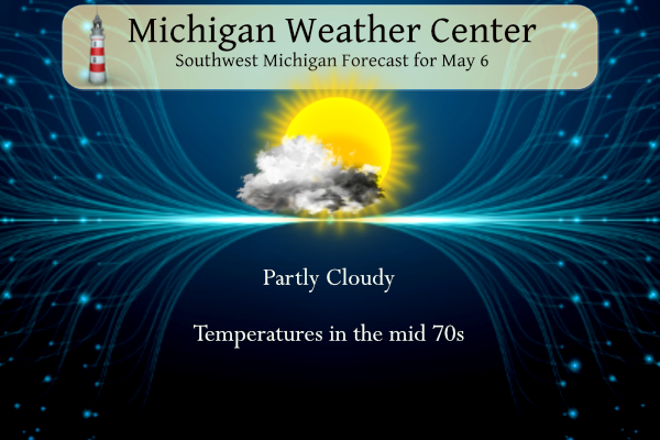
Yesterday we had a high of 66° and a morning low of 49°. We have had 1.24 inches of rain for the month and 8.50 inches for the spring thus far. Today will be fair with temperatures rising into the low to mid 70s before our next system arrives tomorrow with more rain and storms.
SPC Day Two

SPC Day Three

NWS Forecast
Weather History
1902: A tornado injures two people and destroys several barns east of Maple Rapids in Clinton County. Another tornado destroys several barns near Tekonsha in Calhoun County.
On May 6, 1947, in Detroit, the Rouge River crested to a height of 23 feet (with flood stage being 15 feet).
1876: A tornado, estimated at F3 intensity, tracked four miles across Chicago, Illinois. The damaged buildings included a candy factory, a hospital, a freight depot, and a church. The tornado moved out over Lake Michigan and was observed to have multiple vortices by a reporter. Further south in Illinois, a tornado blew a moving passenger train off the tracks near Neoga, injuring all 19 people aboard.
1937: The German passenger airship LZ 129 Hindenburg caught fire and was destroyed during its attempt to dock with its mooring mast at Naval Air Station Lakehurst in Manchester Township, New Jersey, United States. Of the 97 people on board (36 passengers and 61 crewmen), there were 35 fatalities (13 passengers and 22 crewmen). One worker on the ground was also killed, making a total of 36 deaths. The Hindenburg was delayed two hours from docking due to thunderstorms in the area.
1975: A massive tornado hit Omaha, Nebraska killing three persons, injuring 133 others, and causing over 250 million dollars damage. The tornado struck during the late afternoon moving northeastward through the industrial and residential areas of west-central Omaha and lifting over the northern section of the city. The twister, which cut a swath ten miles long and as much as a quarter of a mile wide. It was the most costly in U.S. history up till that time. Click HERE for more information from the NWS Office in Omaha, Nebraska.
Forecast Discussion
- Strong to possibly severe storms possible on Tuesday

We are looking at a quiet period for the first 24-30 hours of the
forecast for the area. High pressure at the surface is nearly
overhead this morning, and the supporting upper ridge is west of the
area. We are seeing a veil of high clouds lifting north over the
area from a system that is centered south of the area near the Ohio
River Valley. Dry air at the lower levels will keep our dry forecast
going for today. The flow becoming a little more SE by later today
along with the building heights will warm temperatures a few degrees
over yesterday. The warmest temps will be found near the Lake
Michigan shoreline with the offshore flow.

Monday night and most of Tuesday morning will remain dry before rain
chances increase quickly Tuesday afternoon from the SW. A piece of
energy from the Severe weather outbreak expected over the Central
Plains this afternoon and evening will be lifting toward the area.
This part of the scenario looks rather benign as the wave and low
level jet accompanying it will be weakening. It will hold together
enough to bring a weakening band of showers and embedded thunder
through the area centered around the early to mid-afternoon time
frame. No severe weather is expected with this.

What does bear watching though is potentially a second round of
storms with a trend of increasingly favorable instability and shear
for late Tuesday and maybe evening into early Tuesday night. In the
wake of the initial showers and storms, we see a secondary short
wave approach the area from the WSW around the parent low complex.
Even though we see rain early that will temper sfc temperatures,
instability builds to over 1,000 J/kg. This is the result of the
short wave and associated colder mid level temps moving over the
moist low levels with dew points in the 60s.

Mid level winds will be increasing also, with 500 mb winds
increasing to around 60 knots or so. Given the aforementioned
instability, forcing arriving with the short wave, and deep layer
shear increasing to over 50 knots, we could be looking at some
strong to severe storms developing. Large hail looks to be the
biggest threat with mid level lapse rates around 7.0C/km, and some
of the storms likely to be rotating in the mid levels with the
strong shear, and microbursts will be possible too. An isolated
tornado can not be ruled out either at the leading edge of these
storms with some backed wind flow, and some initially decent low
level shear with the low level jet just starting to move away.

- Rain on Thursday and Saturday

A couple shortwave troughs will result in chances for showers
peaking Thursday and Saturday. Confidence is above average with good
model agreement and ensemble support.

An area of mid-level frontogenesis north of a low pressure center
tracking across the Ohio Valley will result in rain moving in late
Wednesday night and continuing through Thursday afternoon. Northerly
flow on the back side of the low will advect in a cool Canadian
airmass. We will have to watch for frost potential if skies clear
out Thursday night.

Shortwave ridging should continue the fair weather for Friday into
Friday night but clouds will be moving in after midnight as the next
shortwave trough approaches, with rain moving back in for Saturday.
There could be some diurnal enhancement of the showers Saturday
along with some thunder given steep lapse rates as the upper trough
axis moves through.
I was watching the 2013 Moore OK tornado coverage yesterday on youtube (I watch lots of tornado coverage events, I’m sure others do on here too)… they are in the high risk today…
I read that the US Air Force evacuated aircraft from McConnell AFB near Wichita due to the severe weather threat.
The extremely rare “high risk” has been issued by the SPC for OK and southern KS.
https://www.spc.noaa.gov/
https://www.spc.noaa.gov/products/outlook/day1otlk.html
“A regional outbreak of severe weather with multiple intense (EF3+), long-tracked tornadoes, as well as very large hail and severe thunderstorm gusts, is expected over parts of the south-central Plains from this afternoon through evening.”
Yikes a high risk in the middle of tornado alley… definitely going to be some intense twisters
Thanks MV. Someday I’ll figure out how to post a pic.
The second warmest winter ever is having an effect on ticks. I can tell you this: my son and I golfed yesterday and I had one on my leg afterwards. I guess I need to keep the ball in the fairway. 😃
https://www.mlive.com/weather/2024/05/tick-season-altered-by-michigans-second-warmest-winter.html
There sure is a lot of blue on the CPC maps! No wonder Andy has not been posting links to the long range outlooks multiple times per day! Incredible!
The official H/L yesterday at Grand Rapids was 69/52 there was 0.04” of rainfall the sun was out 59% of the time the highest wind speed was 16 MPH out of the NW. For today the average H/L is 66/45 the record high of 90 was set in 1959 the record low of 25 was set in 1968 the most rainfall of 1.22” fell in 1941. The most snowfall is a trace on several years the last time was in 1989. Last year the H/L was 64/50 and there was 0.03” of rainfall.
Slim