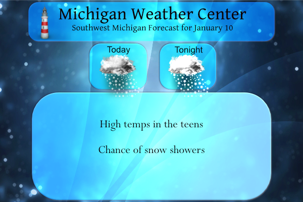
We have 16° at 6:30 this morning. Yesterday’s high was 35° before a brisk west wind behind a cold front dropped the temps to a low of 16.5°. With dry air in place, there were no lake effect snows.
Temperatures north of Grand Rapids are in the single digits this morning and in negative territory in the U.P. With the Great Lakes protecting us from extreme wind chills, we are lucky to be spared from what northern Minnesota is experiencing today as the coldest air of the season moves in.
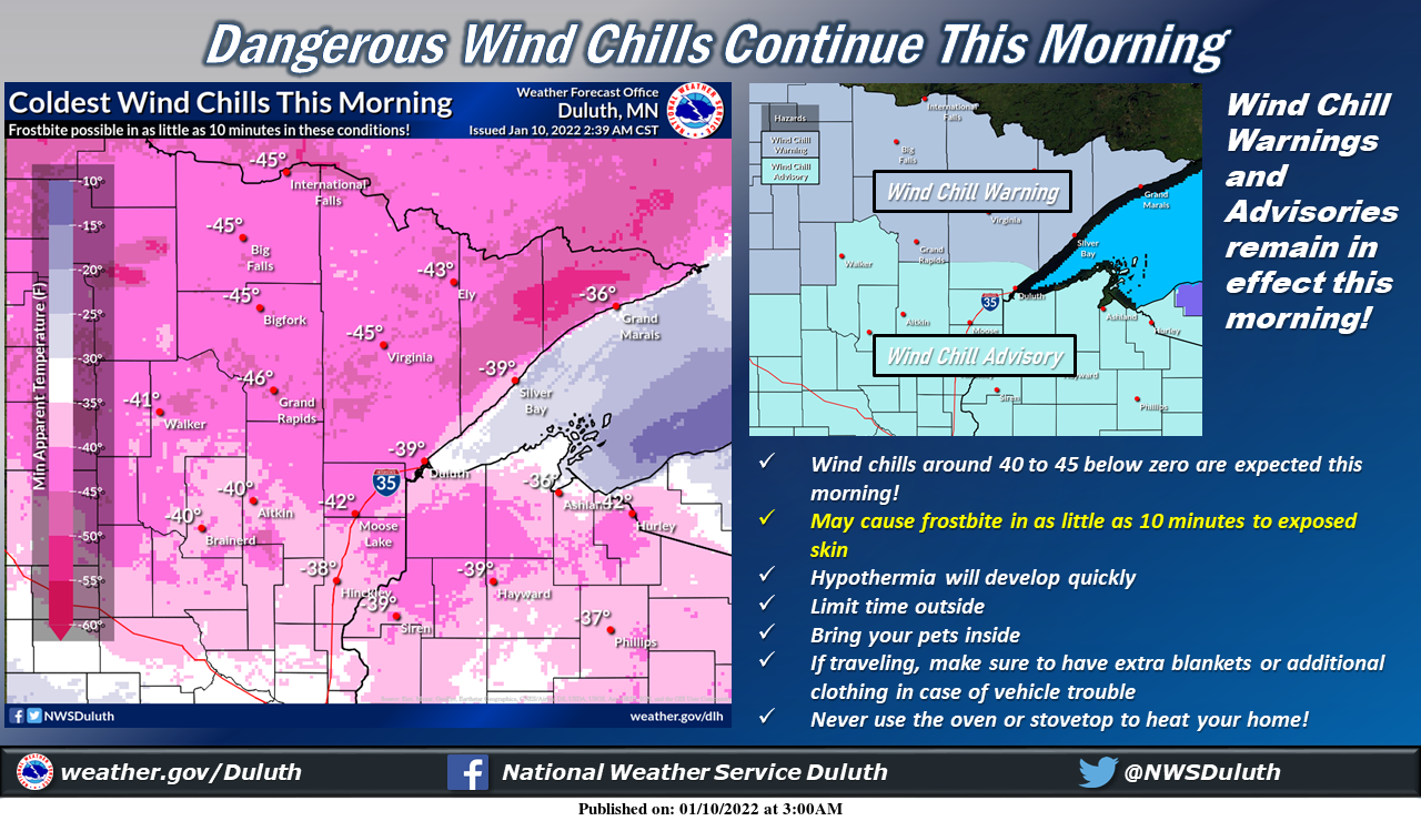
Dangerously cold conditions will continue this morning across the Northland, with wind chill values around 40 to 45 below zero. Wind Chill Warnings and Advisories remain in effect this morning!
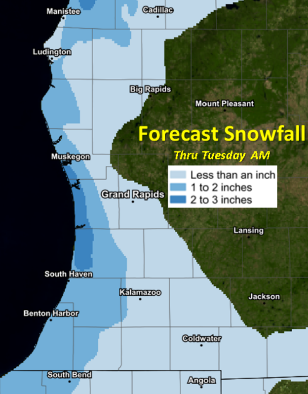
Light snow will accumulate 1-2” along the lakeshore today into tonight, with very little snow elsewhere. Some minor impacts to travel are possible especially for the evening commute along the lakeshore.
Hazardous Weather Outlook
Light lake effect snow showers may bring localized accumulations of an inch or two today and tonight west of Highway 131, which could also lead to hazardous travel conditions.
Forecast Discussion
- Cold with Lake Effect Showers into Tonight

The coldest air of the season thus far continues to funnel in with
850mb temps expected to drop to near -20C across lower Michigan.
Temperatures around daybreak this morning are expected to be in the
teens to single digits. West winds will still be just a touch breezy
compared to a typical morning with winds at around 10-15 mph, so
wind chills will be down into the -15F to 0F degree range early this
morning. Afternoon temps will only warm into the teens with wind
chills still hanging down in the -10F to 0F range.

Lake effect snow showers will then be the other point of focus for
the next 24 hours. Model soundings still show very shallow
moisture (easily limited to below 5000ft) with the DGZ also near
the surface. Therefore small flake sizes should limit
accumulations to about 1-2 inches across the lakeshore counties.
While snow accumulations should be limited compared to what we saw
last week, visibilities may still become restricted in heavier
snow showers leading to some hazardous travel. High pressure will
slide in Tuesday morning cutting off northwest flow and put a stop
to the lake enhanced showers.

- Warming Mid-Week

Strong high pressure will move to our southeast into the Ohio Valley
Tuesday with a surge of warm air advection kicking off Tuesday
afternoon. With a tight gradient setting up over lower Michigan,
southerly winds will turn gusty Tuesday afternoon and evening
with gusts up to 30-40mph possible. Temperatures will start out in
the single digits Tuesday morning, but will quickly warm
throughout the day and night into Wednesday. We will see a chance
for some light precip Wednesday into Thursday as a weak clipper
slides across our north, but limited moisture should keep much of
the light snow at bay.

- Possible End of the Week System

In true fashion, deterministic model guidance has diverged
considerably within the last 24 hours in regards to the possible
weekend system. The Canadian holds true to measurable snow, while
the GFS and Euro have backed off due to varying evolutions of the
upper level trough. Meanwhile, long range Euro and GFS ensembles
still suggest widely varying amounts of snow impacting the area.
So overall we still expect some amount of snow next weekend, but
with significant uncertainty still present in model guidance, the
details on amounts, timing, etc. are still very muddled.
Great winter so far and much more to come! Get ready to rock!
11 to 15 day out look below normal temps that means above average snowfall thanks Lake Michigan woo woo wooo woooo ….Up here on Boyne mountain it has snowed every day sofar snow snow snow 94% of the state of Michigan has snow on the ground who knew?? Its the most wonderful time of year …InDY
Almost half of the states had either their warmest December ever (10) or their 2nd warmest ever (14) and the country overall with it’s warmest at almost 7 degrees above average. Here in Michigan it was our 8th warmest over all.
Slim
Welcome to week 2 of winter. Back to below average seasonal snowfall by the end of the week or next?
Here is the definition of winter
Winter noun
win·ter | \ ˈwin-tər
1: the season between autumn and spring comprising in the northern hemisphere usually the months of December, January, and February or as reckoned astronomically extending from the December solstice to the March equinox
2: the colder part of the year
Note there is no mention of there having to be snow for it to be winter. So it has been winter since December 1st just like always.
Slim
Rock on Slim!
We are definitely at the coldest time of the year. The next 3 weeks are the coldest on average. Although if you like warmer weather… then that means average temperatures will start to rebound in a couple weeks (very slowly at first and, as we know, it is rarely “average” in Michigan)
Temperatures held steady overnight and the overnight low here was 13 at this time there is some very light snow falling with a temperature of 14. Temperatures are forecasted to hold steady today as the high is guessed at 15. The snow on the ground has compacted down to 8″ here as of this morning. All in all this week looks to he ho-mum with not a lot happing other than a warm up with the winds expected early in the warm up it will not feel all that warm.
Slim