Merry month of May Welcome to the merry month of May. According to a English travel site this is the weather that can be expected in the month of May here in Michigan. “May brings bright sunshine to Michigan as the cold and windy conditions abate significantly. The average daily temperatures are in the pleasant 58°F (14.4°C) to […]
Dry conditions persist across the state with the exception of the western counties of the U.P.. Here in Otsego, we have had 1.24 inches of rain for the month of April and 3.15 inches for March and April combined. There are a few showers moving through this morning which will not amount to much. The […]
We have some drizzle this morning passing through Otsego with a temp of 49°. Most of the rain today will fall mainly south of Grand Rapids with the greater amounts in SE Michigan. Rainfall amounts of a tenth to a quarter-inch will fall in Grand Rapids and a quarter to a half in Kalamazoo. Of […]
After a sultry 83.7° for a high temp yesterday we have fallen to a warm 67° at 5 am this morning which is near our normal high for this time of year. Isolated strong to severe thunderstorms are possible early this morning with isolated hail and isolated damaging wind gusts possible. Showers and a few […]
We have a mild 51° at 7 am this morning with the promise of temps rising to near 80° today. The further south of Grand Rapids you are the warmer the temps will be. With the dry weather in place the past few days we have increases in tree pollen blowing in the breeze. […]
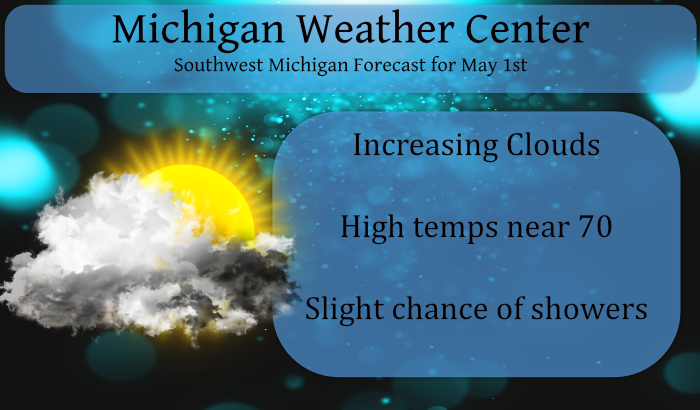
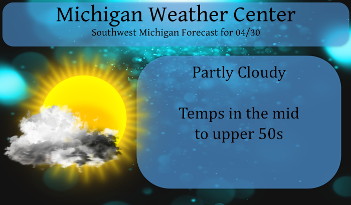
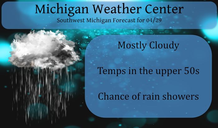
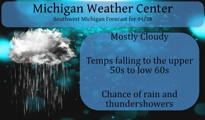
As we close out the month of April this week we will see warmer temps and a few shots at rain with a possible storm or two in SW Michigan. Our chances of snow and freezing temps though not nil becomes less of a factor as we move into May this weekend. We will probably […]

Many may scratch their heads trying to read the forecast discussions I put up in the daily blog so I decided to code the glossary back into the site, it can also be found in the menu bar. National Weather Service Glossary This glossary contains information on more than 2000 terms, phrases and abbreviations used […]
New Normal While some people like to call them “normal” I would rather call them “average” what I am talking about are the average temperatures, precipitation, snow fall amounts ect. NOAA will soon release a much-anticipated update of U.S. climate data for placing recent weather conditions—such as heat waves and flooding rain—into historical context. Climatologists from […]

Yesterday we had a brief heavy snow shower which caused some accumulation on my decks, about a tenth of an inch of liquid moisture. Our high was 49.3°, last night’s low so far is 33° with a heavy frost. Tomorrow we will see a day of scattered showers on the order of .25 to .50 […]
We had a high temp of 41.4° yesterday and a low of 24° overnight. We had a few light to moderate snow showers yesterday but it only amounted to a trace. After recovering from a hard freeze in many areas this morning, temperatures will approach 50 degrees during the afternoon which is more acceptable but […]