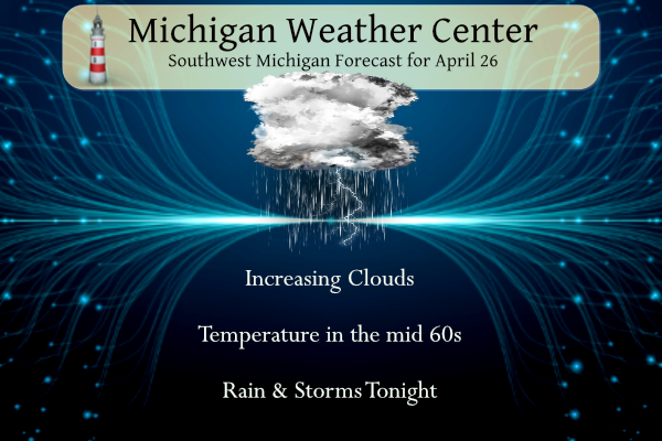
We finally have a warmer and moist airmass moving in from the south to push the cold air back into Canada. Temperatures will rise to the mid-60s today with rain moving in overnight. We have 38° at 6 am, 10° warmer than yesterday morning. The Frost warnings and advisories expire at 8 am.
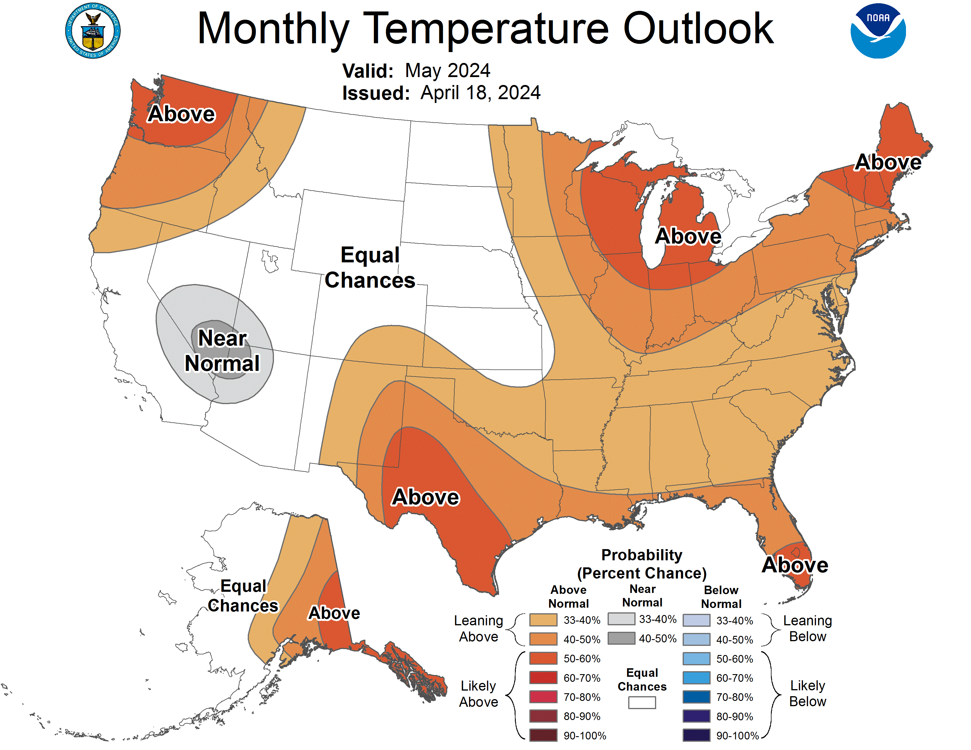
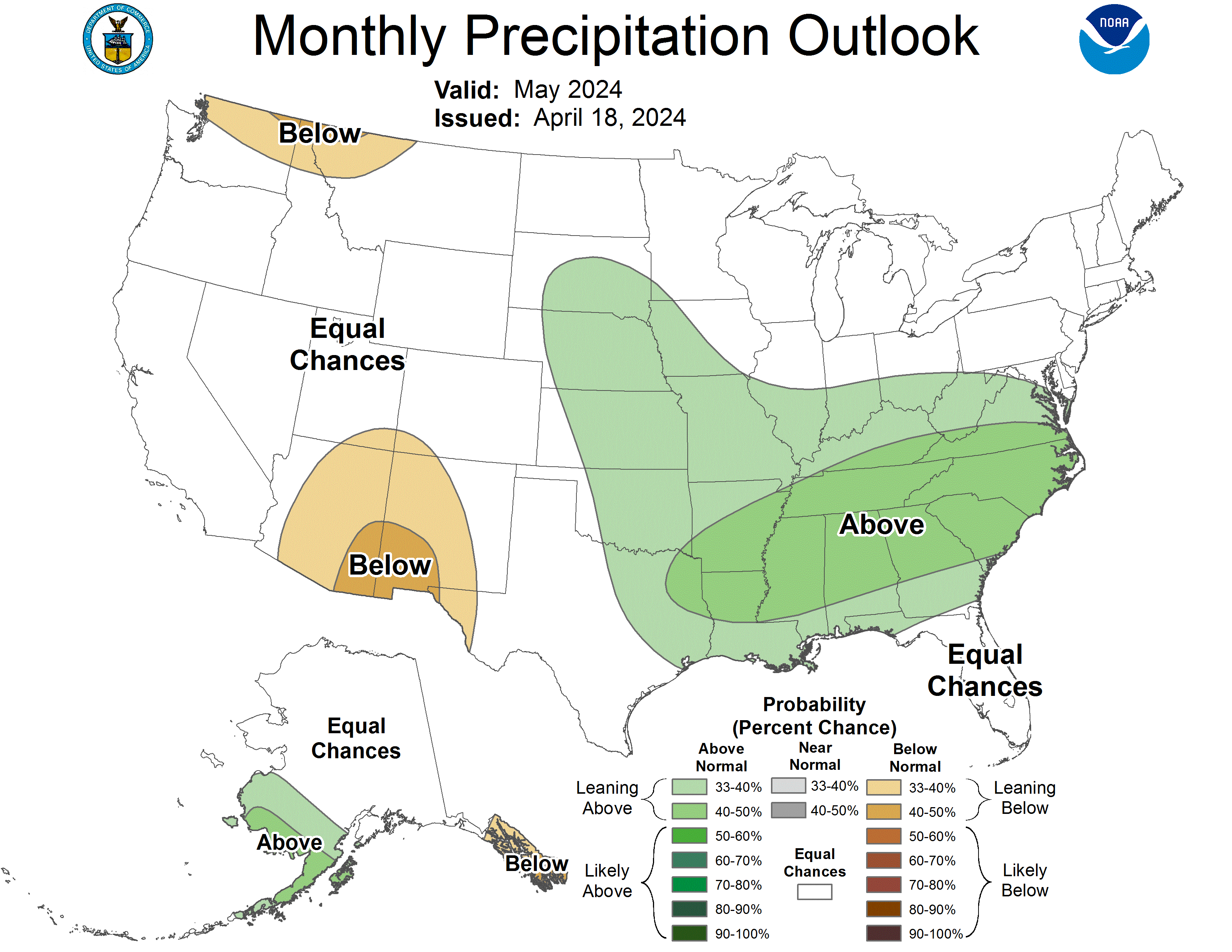
CPC May Outlook
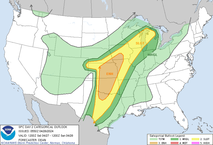
SPC day Two Outlook
NWS Forecast
Scattered thunderstorms are expected overnight. Severe weather is
not expected however. Main threat tonight will be occasional
cloud to ground lightning strikes.
Thunderstorms are expected Saturday afternoon into Saturday night.
Some of these storms could become strong to severe with hail and
wind being the main threats. Highest likelihood of storms during
this time frame will be Saturday night across Central Lower
Michigan.
Weather History
1915: A record three-day spell of warm weather in the 80s peaks with a high of 88 degrees at Grand Rapids and Lansing.
On April 26, 2009, it was a sunny and very warm day with a record high of 86 set in Detroit.
1884: Tornadoes were hard to capture on old cameras with their hard-to-use glass plate negatives. The first recorded photograph of a tornado was taken on this date by A.A. Adams near Garnett, Kansas.
1978: An unusually strong occluded front swept out of the Gulf of Alaska and produced the first April thunderstorm of record at Fairbanks. Pea-size hail fell northeast of Fairbanks from thunderstorms whose tops were less than 8000 feet.
1986: The Chernobyl nuclear power station in Kiev Ukraine suffered a massive explosion. The radioactive cloud of particles and gas carried westward and northwestward, contaminating large areas of Europe in the following week.
Forecast Discussion
- Occasional showers and storms tonight through Monday

A ridge aloft will slide eastward today and allow a weakening
upper shortwave to move into Minnesota tonight. At the surface a
warm front will move into the area tonight. Surface dew points
tonight will surge into the 50s tonight with MUCAPE values
increasing to around 500 j/kg late. Today will mainly be dry with
a lowering and thickening cloud base ahead of the warm front.
Tonight, showers and a few storms are expected as the instability
increases overnight. Not expecting any strong storms given the
lack of instability associated with the nocturnal minimum.

Saturday we will be in the warm sector of the system as it weakens
and moves into Canada off to our north and west. We are in the day
2 SPC outlook with a slight risk for areas to the north and west
of Grand Rapids. We certainly could see some warm sector
convection on Saturday, but this looks to be scattered and
relatively low chance. What convect we do see in the day 2 period
would likely come Saturday night as upstream storms and the
associated cold front sag in from the northwest. Given bulk shear
Saturday night is near 40 knots over Central Lower and MUCAPE
values will be in excess of 1,000 j/kg cannot disagree with a
threat of some severe weather, but overall feel our chances are
not great. Main factors that would lead away from severe weather
Saturday night are a low level jet that is forecast to weakening
as is the system to the west. We will obviously be monitoring for
severe weather both Saturday afternoon and night, but feeling is
it may not be a slam dunk event.

Chances for showers and storms continue Sunday into Monday as
another plains upper shortwave works northward into Canada. We
will again be downstream of the better activity most likely but
the warm and showery weather will continue. Best chances in this
time frame will likely be Sunday afternoon on the warm front
across Central Lower Michigan. Day 3 only has us in general
thunder from SPC and cannot argue with that.

Highest rainfall totals from this weekend into early next week
will be west of Lake Michigan where the deeper moisture and more
importantly stronger dynamics will be in play. We are still
looking at solid rain in our area though through Monday night
however on the order of 0.50 inches towards Jackson to 1.50 inches
up near Ludington. If we see any hydro issues at all it will
likely be to the north of the Grand River basin up along the
Muskegon and Pere Marquette. Given the totals we are forecasting
though over multiple days we think the rivers will be able to
handle it.

- Briefly Dry Tuesday, then Additional Showers Wednesday/Thursday

A break in precipitation is expected Tuesday as brief weak ridging
moves in place. Conditions turn active with showers Wednesday and
Thursday as a cold front associated with an upper shortwave dives
into the region. An 850mb thermal trough falls into the region late
in the week leading to cooler temperatures starting Thursday. Summer-
like temps in the 70s through the first half of next week will fall
into the low 60s Thursday and Friday.
>>>>>Breaking Weather Alert>>>>> today was yet another below normal temp day! What a pattern and what a week of cold temps!! Who would have thought?
Finally warmer air! That is a good statement after having 7 out of 8 days with below to well below normal temps! It has been a very cold week despite some people spewing warm weather hype and telling me we are having seasonal temps! If 5 to 10 degrees below normal is seasonable then it
has been pretty typical!
https://encrypted-tbn0.gstatic.com/images?q=tbn:ANd9GcQGKzHVGDAF0-pmxkL_B1X3ZeerOdEq1a3zEcKwNeDnhA&s
Looks like my plants and flowering bushes around my yard survived the freeze yesterday. Thank God!
No freeze here last night. Jesse, how did it go with your fruit trees??
The overnight low here in MBY was 35 and the current temperature is 36 with clear skies. There isn’t any frost here in my yard at this time.
Slim
The official H/L yesterday at Grand Rapids was 56/28. That low of 28 will be the coldest low for this April, the warmest low for any April since 2010 and the 4 warmest all time low. (note there have been many years with a low of 29 and 28) There was no rainfall yesterday and the sun was out 93% of the time. For today the average H/L is 62/41 the record high of 88 was set in 1915 and the record low of 24 was set in 2007. The most rain fall of 1.48” was in 1995, Last year… Read more »
Wild temp swings this time of year. Four consecutive days in the 70s last week, two freeze warnings this week, and then back in the 70s for at least six consecutive days starting tomorrow. .