This is the last weekend of April and next Wednesday is the start of May so it is now time to look at some May averages and records.
May is the fifth month of the year, and here in the Northern Hemisphere it is the last month of spring. Late May typically marks the start of the summer vacation season in the United States and Canada. At Grand Rapids we start the month off with 14 hours and 7 minutes of daylight and end the month with 15 hours and 7 minutes for a gain of one hour.
In Grand Rapids the average high starts out at 64.3 and ends the month at 74.9. The average low starts out at 43.2 and ends the month at 53.8. The all-time high for May is 95 on May 31, 1934. On May 28, 2018 the high reached 94. The record low of 21 was set on May 1st, 1903. The most snow fall on any day in May is 5.5” and that amount fell on May 10th in 1902 and that same amount of 5.5” was reported on May 9th, 1923. The record wettest May is 10.01” and that fell in May of 2001 and the driest May was in 1936 when just 0.72” fell. . There has been a total of 12 years when measurable snow fell in May The last time was on May 1st, 1994. Here are some May top 5’s
The average May mean at Grand Rapids is 59.2
Warmest mean temperature
- 1977 65.7
- 1896 65.3
- 1982 65.0
- 2018 64.8
- 1911 64.5
Coldest mean temperature
- 1997 50.3
- 1924 50.7
- 1945 50.7
- 1947 51.1
- 1917 51.7
Snowiest May’s of record
- 1902 5.5”
- 1923 5.5”
- 1954 3.0”
- 1940 0.8”
- 1935 0.4”
Wettest May’s of record
- 2001 10.01”
- 2000 9.59”
- 2004 9.29”
- 1981 8.29”
- 1911 7.18”
Driest May’s of record
- 1936 0.72”
- 1987 0.94”
- 1925 0.98”
- 1961 1.03”
- 1971 1.05”
The early morning hours of Sunday, May 31, 1998, brought one of the most memorable storm events to Michigan. A derecho — a long-lived line of intense, fast-moving thunderstorms producing widespread destructive winds — tore through much of the Great Lakes region.
The official H/L yesterday at Grand Rapids was 64/34 there was 0.01” of rainfall and the sun was out 52% of the time. The average wind speed was 13.1MPH and the highest wind was 33 MPH out of the SE. For today the average H/L is 63/42 the record high of 85 was set in 1990 and the record low of 27 was set in 1928. The most rainfall of 1.90” was in 1956 the record snowfall was 0.2” in 2004. Last year the H/L was 64/29. Here in MBY I had 0.09” of rain since 7AM yesterday and the overnight low of 53 was around midnight. At the current time it is cloudy and 58 here.
AREA FORECAST DISCUSSION
NATIONAL WEATHER SERVICE GRAND RAPIDS MI
355 AM EDT SAT APR 27 2024
KEY MESSAGES
– SLIGHT RISK FOR STORMS THIS EVENING AND TONIGHT
– SCATTERED SHOWERS AND STORMS INTO SUNDAY EVENING
– CHANCES FOR RAIN ALMOST EVERY FORECAST PERIOD SUN NIGHT THROUGH FRI
– CONTINUED WARM RIGHT THROUGH THE UPCOMING WORK WEEK
DISCUSSION
ISSUED AT 355 AM EDT SAT APR 27 2024
– SLIGHT RISK FOR STORMS THIS EVENING AND TONIGHT
MICHIGAN SITS IN THE WARM SECTOR OF A SURFACE LOW CURRENTLY CENTERED
OVER NORTHWEST IOWA / SOUTHEAST MINNESOTA. AS THAT LOW TRAVERSES
NORTHEAST INTO LAKE SUPERIOR TODAY, SCATTERED SHOWERS AND STORMS
WILL MOVE THROUGH THE AREA. A PATCH OF THESE WARM SECTOR SHOWERS
IS CURRENTLY TRAVELING NORTHEAST FROM IL/IN INTO SOUTHERN MI THIS
MORNING. ELEVATED INSTABILITY WILL INCREASE THROUGH THE MORNING,
SO SOME RUMBLES OF THUNDER ARE POSSIBLE.
BETTER CHANCES FOR STRONG TO SEVERE STORMS EXIST LATER THIS EVENING
AND OVERNIGHT AS A COLD FRONT MOVES IN FROM THE NORTHWEST.
SURFACE HEATING BUILDS INSTABILITY THROUGHOUT THE DAY WITH HREF
MUCAPE UP TO 1000 J/KG AND BULK SHEAR NEAR 35 TO 40 KNOTS. LOW-
LEVEL CONVERGENCE WILL FOCUS STORM INITIATION NEAR THE SURFACE
BOUNDARY NEAR AND NORTH OF A LINE FROM MUSKEGON TO CLARE. SPC
MAINTAINS A SLIGHT RISK FOR THAT AREA TODAY, WITH MARGINAL TO THE
SOUTHEAST. MAIN TIMING FOR THE STRONG TO SEVERE STORMS WILL BE
FROM 8PM TO ABOUT 2AM WITH WIND AND HAIL AS THE PRIMARY STORM
THREATS.
– SCATTERED SHOWERS AND STORMS INTO SUNDAY EVENING
ACTIVE WEATHER WILL CONTINUE INTO SUNDAY, THOUGH THE RISK FOR SEVERE
WEATHER IS LOW. ANOTHER UPPER LOW WILL EJECT OUT OF THE SOUTHERN
PLAINS WITH ITS ASSOCIATED SURFACE LOW MOVING INTO THE REGION
SUNDAY. WE REMAIN IN THE WARM SECTOR OF THIS SURFACE LOW WITH
HREF MUCAPE UP TO 500-1000 J/KG BY THE AFTERNOON. SO EXPECT
CONTINUED SHOWERY CONDITIONS WITH SOME WEAK STORMS. HREF
PROBABILITY-MATCHED MEAN TOTAL QPF BY SUNDAY EVENING PUSHES 1 TO
1.75 INCHES FOR AREAS NORTH OF A LINE FROM MUSKEGON TO SAGINAW.
– CHANCES FOR RAIN ALMOST EVERY FORECAST PERIOD SUN NIGHT THROUGH FRI
THE SAYING ABOUT “APRIL SHOWERS” WILL BE VERY APPLICABLE TO OUR
FORECAST OVER THE NEXT 7 DAYS DESPITE CROSSING INTO THE MONTH OF
MAY. CHANCES FOR PRECIPITATION WILL BE IN THE FORECAST EACH 12 HOUR
FORECAST PERIOD THROUGH FRIDAY WITH THE EXCEPTION OF TUESDAY.
THE SYSTEM AFFECTING OUR WEATHER THIS WEEKEND WILL EXIT THE AREA TO
THE EAST ON MONDAY INTO MONDAY NIGHT. CHANCES FOR SHOWERS AND
THUNDERSTORMS WILL EXIST SUNDAY NIGHT THROUGH MONDAY NIGHT. SUNDAY
NIGHT A WARM FRONT WILL BE SLOWLY LIFTING NORTHWARD. MONDAY WE WILL
BE POSITIONED IN THE WARM SECTOR OF THE WEAKENING SYSTEM AND MONDAY
NIGHT THE COLD FRONT GOES EAST. LOOKING AT ECMWF AND GFS ENSEMBLE
MEMBER PLOTS OF CAPE IT IS CLEAR TO SEE THAT DEEP MOISTURE REMAINS
RESULTING IN CAPE IN EVERY ENSEMBLE MEMBER. SHOWERS AND STORMS ARE
IN THE FORECAST EACH OF THESE 3 FORECAST PERIODS. LACK OF UPPER
SUPPORT IN TERMS OF A SIGNIFICANT SHORTWAVE WILL LIKELY LIMIT AND
SEVERE POTENTIAL, BUT STRENGTH OF THE LOW LEVEL JET (30-45 KNOTS)
SUGGEST WE WILL NEED TO MONITOR. AS OF NOW, THE SPC HAS US IN
GENERAL THUNDER FOR SUNDAY NIGHT THROUGH MONDAY NIGHT.
ONE DRY FORECAST PERIOD ON TUESDAY WITH RIDGING MOVING THROUGH THE
GREAT LAKES WILL BE SHORT LIVED AS RAIN CHANCES REAPPEAR TUESDAY
NIGHT. TUESDAY NIGHT A COLD FRONT MOVES IN ASSOCIATED WITH A
SHORTWAVE ALOFT OFF TO OUR NORTHWEST. THURSDAY A WARM FRONT WILL TRY
TO PUSH IN FROM THE SOUTH WITH A LOW REMAINING IN THE AREA THEN
TOWARDS FRIDAY.
– CONTINUED WARM RIGHT THROUGH THE UPCOMING WORK WEEK
GFS AND ECMWF MOS GUIDANCE SHOWS HIGHS IN GRAND RAPIDS IN THE 70S
MONDAY THROUGH FRIDAY. 850MB TEMPERATURES ARE SUPPORTIVE OF THE WARM
WEATHER THEME AS WELL WITH +8C TO +14C IN PLACE MUCH OF THE TIME.
NORMAL HIGHS ARE IN THE LOW 60S THIS TIME OF YEAR SO WE WILL BE AT
LEAST 10 DEGREES ABOVE SEASONAL NORMALS. BOTTOM LINE TO THE FORECAST
IS WARM AND SHOWERY THROUGH THE PERIOD
Detailed Forecast for Grand Rapids
Today
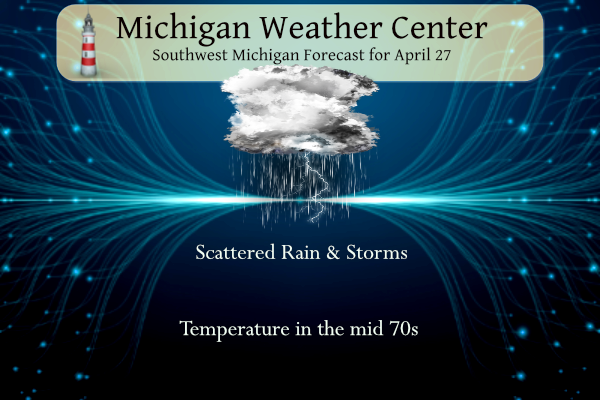
Showers and thunderstorms before 10am, then a slight chance of showers and thunderstorms after 2pm. High near 76. Breezy, with a southwest wind 14 to 20 mph, with gusts as high as 34 mph. Chance of precipitation is 90%. New rainfall amounts of less than a tenth of an inch, except higher amounts possible in thunderstorms.
Tonight
A chance of showers and thunderstorms, then showers likely and possibly a thunderstorm after 2am. Mostly cloudy, with a low around 64. South southwest wind 9 to 16 mph, with gusts as high as 28 mph. Chance of precipitation is 70%. New rainfall amounts between a tenth and quarter of an inch, except higher amounts possible in thunderstorms.
Sunday
Showers and possibly a thunderstorm. High near 71. Southwest wind around 8 mph, with gusts as high as 18 mph. Chance of precipitation is 80%. New rainfall amounts between a quarter and half of an inch possible.
Sunday Night
Showers likely and possibly a thunderstorm before 8pm, then a chance of showers and thunderstorms between 8pm and 2am, then showers likely and possibly a thunderstorm after 2am. Mostly cloudy, with a low around 61. East wind around 10 mph. Chance of precipitation is 70%. New rainfall amounts between a quarter and half of an inch possible.
Monday
Showers and possibly a thunderstorm. High near 73. South southwest wind 14 to 18 mph, with gusts as high as 30 mph. Chance of precipitation is 80%.
Monday Night
Showers likely and possibly a thunderstorm before 8pm, then a chance of showers and thunderstorms between 8pm and 2am. Mostly cloudy, with a low around 52. Chance of precipitation is 60%.
Tuesday
Mostly sunny, with a high near 68.
Tuesday Night
Partly cloudy, with a low around 54.
Wednesday
A chance of showers and thunderstorms after 2pm. Mostly sunny, with a high near 76.
Wednesday Night
A chance of showers and thunderstorms. Mostly cloudy, with a low around 58.
Thursday
A chance of showers and thunderstorms. Partly sunny, with a high near 73.
Thursday Night
A chance of showers and thunderstorms. Mostly cloudy, with a low around 52.
Friday
Partly sunny, with a high near 65.
A few of these “gusts” are getting stronger. Just had the neighbor’s tree land on our patio. Keep an eye on tonight’s weather.
Just went full sun, blue skies. Are we damaging our “protective” Cap?
Feels like summer again today!
73 at 11a. Will we hit 80?
Forecast calls for 79… gonna be close
Nice day for MSU commencement. Lots of people around EL and campus.
Humid this morning. Lots of incredible footage out there of the massive tornadoes in Nebraska and Iowa yesterday. One looked to be two miles wide or more. Again, just incredible.