As we close out the month of April this week we will see warmer temps and a few shots at rain with a possible storm or two in SW Michigan. Our chances of snow and freezing temps though not nil becomes less of a factor as we move into May this weekend.
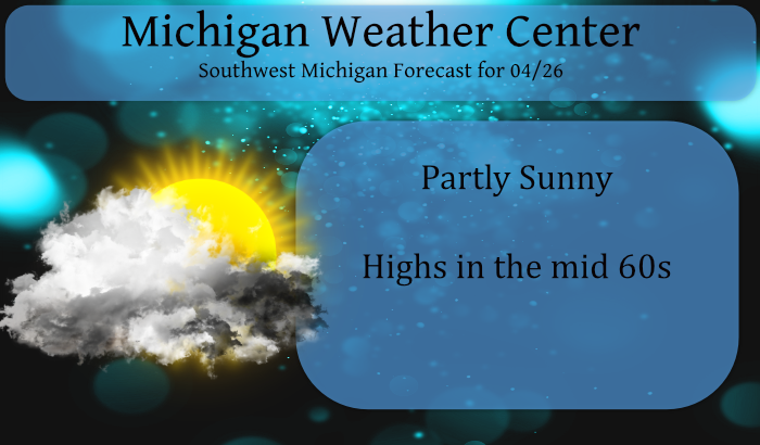
We will probably experience our first 80° day tomorrow (dependant on cloud cover) though it will be short-lived it will give us a fleeting glimpse of summer. Chances of rain are less than 20% today (we may see a few sprinkles) increasing to better than 60% late Tuesday through Thursday. Temps will cool down to near to slightly below normal by the end of the week. ‘Normals’ for this week are low to mid-60s.
Forecast Discussion
-- Slight chance of a storm with hail Monday night --

First, reflectivity seen on radar this morning is almost entirely
virga from altostratus above 6,000 feet. Can`t rule out a sprinkle
or flurry this morning if any precip can make it through the dry
low-level air.

An intriguing borderline but potentially sneaky storm environment
exists for late Monday night, essentially giving a low
probability of isolated storm cells capable of producing hail in
central Michigan north of Muskegon/GR/Lansing. 700-500 mb lapse
rates of 7.5 or 8 degrees C/km associated with a large EML plume
will advect in after midnight. 850-700 moisture and warm air
transport will occur earlier in the evening amid a southwesterly
jet, with most models keeping a layer of saturated warm air
lingering in that layer past midnight even as the core of the low
level jet becomes more westerly and focused south of Michigan.

Between this moist layer below and the EML above will be a
cap/CINH that will likely prevent convection, though a number of
HREF members are showing a few hours during the overnight where
the magnitude of the cap is curiously low. It`s always difficult
to know how reality will pan out with the strength of this
elevated cap at the base of the EML relative to the moist layer
beneath, but there is a low chance that it may allow some
convection overnight.

One other negative factor preventing higher probability of precip
overnight is a lack of convergent forcing in the moist layer in
the absence of a low-level jet nose. However, if a cell or two is
able to develop, 500-1000 J/kg of MUCAPE and convective parcels
rising through fairly steep lapse rates in the -10 C to -30 C
layer would support the potential for hail.


-- Warm Tuesday, occasional chances for showers or storms --

Ensemble support for a warm Tuesday remains on track, with highs
ranging from the mid 70s in central to lower 80s in southern MI.
Surface parcels will be strongly capped, though thunderstorms
could develop late in the day or during the night as another round
of moisture transport associated with a low-level jet moves in.

The surface front will tend to sag southeast through Michigan on
Wednesday, and a wave of low pressure along the front on Thursday
may provide additional chances for showers or storms.


-- Cooler late in the week, unsettled weekend --

There remains considerable spread among the ensemble member
solutions late in the week, but Friday will most likely be a
rather cool day as northwest flow behind the Rossby wave trough
brings in some 850 mb air of roughly 0 degrees C. There is a
tendency in most ensemble solutions for another western CONUS
trough to move in during the weekend, setting up the possibility
of warmer temperatures amid southwesterly flow returning by
either Saturday or Sunday, though precipitation chances are
difficult to pinpoint given various shortwaves potentially moving
through this pattern.
Facts the wind chills today were below 40 degrees until around 1 pm! Incredible cold!
Perfect day again today. Low 60’s and plenty of sun. Rather humorous the two cold nuts on here are calling this a cold day. It was 63 degrees, average high is 63 degrees. One would think that someone that loves temps in the teens and 20’s would find the 60’s to be rather warm compared to that.
GR is +0.3 degrees for the month and Lansing is +1.5 for the month. It has been a typical roller coaster April with a +23 warmest day and -16 coldest day. Need some rain, though, as both locations are more than one inch below average for the month.
Low temps down into the 30’s again later this week! Wow!
Temps still in the 50’s with 20mph winds! Forget golf!
Beautiful golf weather this evening!!
https://forecast.weather.gov/MapClick.php?x=142&y=163&site=grr&zmx=&zmy=&map_x=142&map_y=163#.YIcyHiX3YlQ
Unrelated news, I just had my second covid vaccine. So far no side effects, hopefully it stays that way 😀
Weatherwise, looks like we are likely done with any more accumulating snow for the season (last time we had an inch+ I think was back in late February). But definitely not out of the clear for frost (and maybe a freeze), as it looks like Friday may be a chilly day.
Good job on the vaccine! We need as many people to get the vaccine as possible, however there a lot of ignorant people out there that don’t want the vaccine and don’t want to wear a mask! The ignorance is unbelievable!! No vaccine = getting covid 19 and possibly dying and extending the pandemic! Ridiculous!
Here comes another BIG warmup! I love it!
+1000000! Who knew?!!?
With May a few days away let’s hope so what a cool Springs we are having….But then again not really sure mid 50’s are so warm this time of year are they ?? lol…Yes we are getting there slowly….INDY
You know it INDY! Keep the facts coming! We have been in a big time cold snap!
Just another very cold windy Spring day in west MI! 12 noon and wind chills in the 30’s! The incredible cold just keeps rocking! Maybe ANDY is golfing right now! Rock n roll will never die baby!
Great day for skiing and snowshoeing too!
Thanks for the idea though, might have to hit a twilight round after work now that it’s close to 60 out!
The sun is out here now. I am sure it will start to warm up.
It should as the angle of the sun is now the same as August 15th
Slim
The official overnight low at GRR looks to be 37 so far. Here at my house the low so far has been 39. There have been a few sprinkles of rain here. At this time it is cloudy and somewhat breezy and 39.
Slim
18 days now below average in April crazy especially for that blow torch that was fired many weeks ago lol… Will we make it 19 today DDDDDD stay tuned…..May Spring Summer is close ….INDY
So far this April there have been 10 days warmer than average and 15 days below average many days on both sides have been 10° or more from average.
Slim
We are in the midst of an incredible cold stretch!