
I usually have a weather history post on Wednesdays but with the multiple hazards in place, I will forego that today. We reached 50° yesterday with a low of 26°. We had .50 of an inch of rain (not official) from my digital rain gauge – I will have to melt the precip in my […]
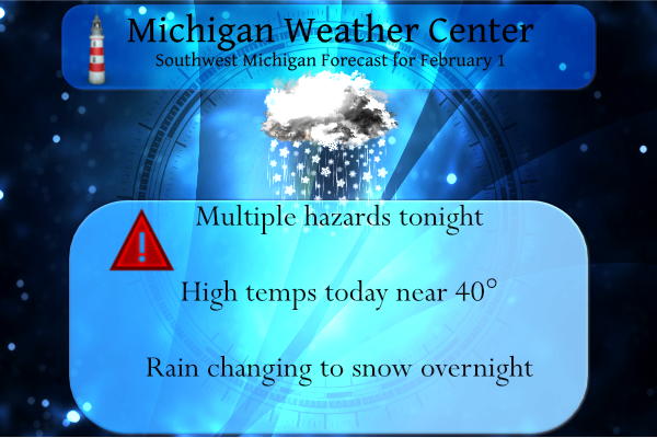
It took a while but we did have the sky party clear yesterday late afternoon. Our high temp was 32° and the low was 23°. Rain should move in late this afternoon turning to snow after midnight. As the anticipated winter storm approaches southern Michigan we have multiple hazards in place for tonight through […]
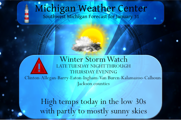
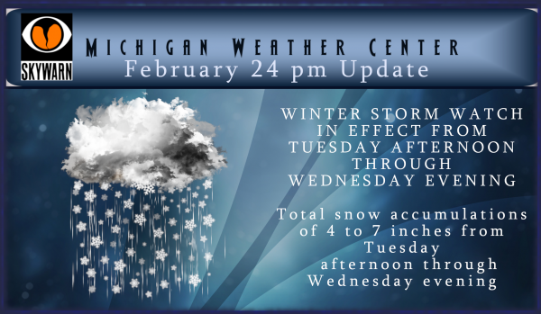
Well, here we go. The NWS has released Winter Storm Watches for southern Michigan for Tuesday night through Thursday. I am sure counties will be added or deleted before the actual event but we are given plenty of time to prepare. This just goes to show how computer models can change from one run to […]
We have a winter storm warning in place for Mason, Lake, Osceola, Clare, Oceana, Newaygo and Mecosta counties. Snowfall totals in these counties from the recent model data are guessing accumulations of 4 to 9 inches and a light glaze of ice. There is a winter storm watch for Kalkaska, Crawford, Oscoda, Alcona, Manistee, Wexford, […]
We continue to watch the progress of the developing storm system which is once again giving a more southerly track from the model data posted yesterday afternoon. Clinton, Barry, Eaton, Ingham, Van Buren, Kalamazoo, Calhoun and Jackson counties for total snow accumulations of 3 to 6 inches possible. The heaviest snow is likely to be […]
Yesterday we reached 51° with the sun shining all day. At the end of my post on Sunday, I said “This week will feature a more active pattern as clouds increase tonight bringing in rain or mix Monday night and Tuesday. In the second half of the week, the colder air returns with the possibility […]