While we have already had some severe weather in parts of Michigan it would be a good time to look at some of weather events that we could encounter over the coming months.
SPECIAL WEATHER STATEMENT: This can be issued when there are storms that do not meet the severe criteria but could have higher winds small hail or very heavy rain fall. When there happen over the last there could be a SPECIAL MARINE STATEMENT
Severe Thunderstorm Watch
This is issued by the National Weather Service when conditions are favorable for the development of severe thunderstorms in and close to the watch area. A severe thunderstorm by definition is a thunderstorm that produces one inch hail or larger in diameter and/or winds equal or exceed 58 miles an hour. The size of the watch can vary depending on the weather situation. They are usually issued for a duration of 4 to 8 hours. They are normally issued well in advance of the actual occurrence of severe weather. During the watch, people should review severe thunderstorm safety rules and be prepared to move to a place of safety if threatening weather approaches. A Severe Thunderstorm Watch is issued by the Storm Prediction Center in Norman, Oklahoma. Prior to the issuance of a Severe Thunderstorm Watch, SPC will usually contact the affected local National Weather Service Forecast Office (see map above) and they will discuss what their current thinking is on the weather situation. Afterwards, SPC will issue a preliminary Severe Thunderstorm Watch and then the affected NWFO will then adjust the watch (adding or eliminating counties/parishes) and then issue it to the public by way of a Watch Redefining Statement. During the watch, the NWFO will keep the public informed on what is happening in the watch area and also let the public know when the watch has expired or been cancelled.
Severe Thunderstorm Warning
Is issued when either a severe thunderstorm is indicated by the WSR-88D radar or a spotter reports a thunderstorm producing hail one inch or larger in diameter and/or winds equal or exceed 58 miles an hour; therefore, people in the affected area should seek safe shelter immediately. Severe thunderstorms can produce tornadoes with little or no advance warning. Lightning frequency is not a criteria for issuing a severe thunderstorm warning. They are usually issued for a duration of one hour. They can be issued without a Severe Thunderstorm Watch being already in effect. Severe Thunderstorm Warning is issued by your National Weather Service Forecast Office.
So just what is a severe thunderstorm?
Severe Thunderstorm
A thunderstorm that produces a tornado, winds of at least 58 mph (50 knots or ~93 km/h), and/or hail at least 1″ in diameter. Structural wind damage may imply the occurrence of a severe thunderstorm. A thunderstorm wind equal to or greater than 40 mph (35 knots or ~64 km/h) and/or hail of at least ½” is defined as approaching severe.
Guide for determining hail sizes:
- less than 0.50″ Pea
- 0.50″ – Marble/Mothball
- 0.75″ – Dime/Penny
- 0.88″ – Nickel
- 1.00″ – Quarter
- 1.25″ – Half Dollar
- 1.50″ – Walnut/Ping Pong
- 1.75″ – Golf Ball
- 2.00″ – Hen Egg
- 2.50″ – Tennis Ball
- 2.75″ – Baseball
- 3.00″ – Tea Cup
- 4.00″ – Grapefruit
- 4.50″ – Softball
Tornado Watch
This is issued by the National Weather Service when conditions are favorable for the development of tornadoes in and close to the watch area. Their size can vary depending on the weather situation. They are usually issued for a duration of 4 to 8 hours. They normally are issued well in advance of the actual occurrence of severe weather. During the watch, people should review tornado safety rules and be prepared to move a place of safety if threatening weather approaches.
A Tornado Watch is issued by the Storm Prediction Center (SPC) in Norman, Oklahoma. Prior to the issuance of a Tornado Watch, SPC will usually contact the affected local National Weather Forecast Office (NWFO), see map below, and they will discuss what their current thinking is on the weather situation. Afterwards, SPC will issue a preliminary Tornado Watch and then the affected NWFO will then adjust the watch (adding or eliminating counties/parishes) and then issue it to the public. After adjusting the watch, the NWFO will let the public know which counties are included by way of a Watch Redefining Statement. During the watch, the NWFO will keep the public informed on what is happening in the watch area and also let the public know when the watch has expired or been cancelled.
Tornado Warning
This is issued when a tornado is indicated by the WSR-88D radar or sighted by spotters; therefore, people in the affected area should seek safe shelter immediately. They can be issued without a Tornado Watch being already in effect. They are usually issued for a duration of around 30 minutes.
A Tornado Warning is issued by your local National Weather Service office (NWFO), see map below. It will include where the tornado was located and what towns will be in its path. If the tornado will affect the nearshore or coastal waters, it will be issued as the combined product–Tornado Warning and Special Marine Warning. If the thunderstorm which is causing the tornado is also producing torrential rains, this warning may also be combined with a Flash Flood Warning. If there is an ampersand (&) symbol at the bottom of the warning, it indicates that the warning was issued as a result of a severe weather report.
After it has been issued, the affected NWFO will follow it up periodically with Severe Weather Statements. These statements will contain updated information on the tornado, and they will also let the public know when warning is no longer in effect.
The official H/L yesterday at Grand Rapids was 71/50 there was 0.63” of rain fall the sun was out 43% of the possible time. The highest wind gust was 31 MPH out of the W. For today the average H/L is 66/44 the record high of 88 was set in 1949 the record low of 26 was set in 1971 and 2005. The most rain fall of 1.06” fell in 1902 the most snow fall of 0.4” was in 1954. Last year the H/L was 64/38. The overnight low here in MBY was 48 there was 0.3” of rainfall since 7 AM yesterday at the current time it is cloudy and 52.
AREA FORECAST DISCUSSION
NATIONAL WEATHER SERVICE GRAND RAPIDS MI
349 AM EDT SAT MAY 4 2024
KEY MESSAGES
– FOG AND STRATUS THROUGH THIS MORNING
– SHOWERS AND STORMS EXPECTED TONIGHT
– DRY MONDAY, OTHERWISE UNSETTLED MOST OF NEXT WEEK
– COOLING OFF TOWARD THE END OF NEXT WEEK
DISCUSSION
ISSUED AT 349 AM EDT SAT MAY 4 2024
– FOG AND STRATUS THROUGH THIS MORNING
OUR FIRST FOCUS OUT OF THE GATE THIS MORNING IS THE FOG/STRATUS THAT
IS STEADILY SPREADING WESTWARD FROM SE LOWER. THIS CAN BE SEEN WELL
OVER THE PAST COUPLE OF HOURS ON THE NIGHTTIME MICROPHYSICS CHANNEL
AS THE THICKER CIRRUS HAS THINNED OUT A BIT, AND AS THE LOW
CLOUDS/FOG ARE MOVING WEST OF THE CIRRUS SHIELD.
OUR INITIAL THOUGHT THIS MORNING IS THAT STRATUS WILL BE MORE
FAVORED VS. FOG. THIS MOISTURE IS ADVECTING/EXPANDING TO THE WEST AS
LOW LEVEL MOISTURE WITH THE SYSTEM YESTERDAY DID NOT MAKE IT FAR
EAST OF THE AREA. THEN, AS THE FLOW HAS BECOME MORE ENE, IT IS
TAKING THAT MOISTURE AND BRINGING IT BACK OVER THE AREA, OR
EXPANDING IT TO THE AREA AS THE COOLING ATMOSPHERE CONDENSES.
THERE IS A BIT OF WIND ALOFT THIS MORNING, WHICH IS WHY WE FAVOR
STRATUS VS. DENSE FOG. THAT SAID, WINDS HAVE DECOUPLED WELL, AND A
COUPLE OF SITES TO OUR N AND E HAVE DROPPED DOWN TO LESS THAN A MILE
IN FOG. WE WILL CONTINUE TO MONITOR THE TRENDS THIS MORNING. ONCE
THE SUNRISES, THE LOW LEVEL MOISTURE WILL LIFT AND MIX OUT, PROBABLY
TOWARD NOON/EARLY AFTERNOON. THEN THERE SHOULD BE A FAIR AMOUNT OF
SUNSHINE AND WARMER AIR ONCE AGAIN.
– SHOWERS AND STORMS EXPECTED TONIGHT
THE BREAK IN THE WEATHER WE SEE TODAY WILL BE BRIEF, WITH SHOWERS
AND STORMS TO BECOME LIKELY TOWARD AND AFTER MIDNIGHT TONIGHT. WE
WILL SEE A SHORT WAVE TRY TO APPROACH THE AREA TONIGHT FROM THE WSW.
THIS SHORT WAVE WILL BE WEAKENING AS IT APPROACHES THE AREA, BUT
WILL HOLD ON TO ENOUGH OF ITS STRENGTH THE DRIVE A COLD FRONT INTO
THE AREA.
THE COLD FRONT WILL BE ABLE TO WORK WITH SOME INSTABILITY AHEAD OF
IT, ON THE ORDER OF A FEW HUNDRED J/KG OF MU CAPE INTO THE NIGHT.
ELEVATED LI’S ARE FORECAST TO BE AROUND -1 TO -3C AHEAD OF THE
FRONT. MODELS ARE IN FAIRLY GOOD AGREEMENT BRING A BROKEN LINE OF
SHOWERS AND STORMS THROUGH. WITH THE INSTABILITY BEING ELEVATED, AND
IT BEING NIGHT TIME, SEVERE WEATHER THREAT IS FAIRLY LOW. MOST OF,
OR ALL OF THIS SHOWER AND STORM ACTIVITY SHOULD BE EAST OF THE AREA
TOWARD DAYBREAK ON SUNDAY. CLOUDS SHOULD CLEAR OUT THROUGH THE DAY,
AND TEMPERATURES WILL CLIMB UP TO AROUND 70 WITH JUST A TAD COOLER
AIR COMING IN.
– DRY MONDAY, OTHERWISE UNSETTLED MOST OF NEXT WEEK
GUIDANCE IS IN GOOD AGREEMENT SHOWING HIGH PRESSURE BOTH ALOFT AND
AT THE SFC IN PLACE ON MONDAY, PROVIDING MOSTLY SUNNY AND PLEASANT
CONDITIONS WITH HIGHS 70-75. THERE IS ALSO STILL GOOD AGREEMENT
THAT A SHORTWAVE AND SFC CYCLONE WILL IMPACT THE AREA TUESDAY
AFTERNOON AND NIGHT, WITH POPS OF 60-90 PERCENT DURING THIS TIME.
INITIALLY WE SEE A WARM FRONT LIFTING NORTH TUESDAY AFTERNOON BUT
THEN THE COLD FRONT SWEEPS IN QUICKLY FROM THE WEST TUESDAY NIGHT AS
A DEEPENING SFC LOW TRACKS THROUGH WI. CAN’T RULE OUT SOME STRONG TO
SEVERE STORMS, BUT THE MAIN RISK COULD END UP BEING SOUTH OF MI
SINCE THE WARM SECTOR MAY NOT MAKE IT THIS FAR NORTH OR STICK AROUND
LONG ENOUGH DUE TO OCCLUSION OF THE SFC SYSTEM.
A PERIOD OF DRY WEATHER IS PROBABLE BEHIND THE TUESDAY NIGHT SYSTEM
FOR AT LEAST THE FIRST HALF OF WEDNESDAY, BUT ANOTHER SHORTWAVE AND
SFC TROUGH ASSOCIATED WITH APPROACHING LONGWAVE TROUGH BRINGS A
RENEWED THREAT OF SHOWERS AND STORMS BY WEDNESDAY EVENING. A REPEAT
OF THAT IS POSSIBLE THURSDAY TOO AS ADDITIONAL WAVES ROTATE THROUGH
THE BASE OF THE NEARING UPPER TROUGH.
– COOLING OFF TOWARD THE END OF NEXT WEEK
UNSETTLED/SHOWERY PATTERN PERSISTS THROUGH THE END OF NEXT WEEK AS
THE OLD NRN PLAINS UPPER LOW CONTINUES SLOWLY EASTWARD AND
EVENTUALLY SETS UP SHOP NEAR LAKE SUPERIOR. OUR WARM STRETCH FINALLY
COMES TO AN END BY THURSDAY OR FRIDAY AS PROGRESSIVELY COLDER AIR
FILTERS SOUTH AROUND THE UPPER LOW. BELOW NORMAL TEMPS APPEAR LIKELY
AS WE HEAD INTO NEXT WEEKEND.
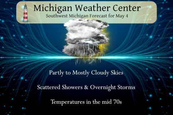
Detailed Forecast For Grand Rapids
Today
A 10 percent chance of showers and thunderstorms after 5pm. Mostly cloudy, with a high near 79. East wind around 9 mph becoming south southeast in the afternoon.
Tonight
Showers and thunderstorms likely before 11pm, then showers likely and possibly a thunderstorm between 11pm and 2am, then a chance of showers and thunderstorms after 2am. Mostly cloudy, with a low around 54. Light and variable wind becoming west 5 to 8 mph in the evening. Chance of precipitation is 60%. New rainfall amounts of less than a tenth of an inch, except higher amounts possible in thunderstorms.
Sunday
A 30 percent chance of showers before 8am. Mostly cloudy, then gradually becoming sunny, with a high near 71. North northwest wind 8 to 10 mph.
Sunday Night
Mostly clear, with a low around 50. North northwest wind 5 to 7 mph becoming east northeast after midnight.
Monday
Sunny, with a high near 73. East southeast wind 10 to 14 mph.
Monday Night
A 30 percent chance of showers after 2am. Partly cloudy, with a low around 54.
Tuesday
Showers, mainly after 8am. High near 75. Chance of precipitation is 80%.
Tuesday Night
Showers and possibly a thunderstorm, mainly before 2am, then a chance of showers and thunderstorms after 2am. Partly cloudy, with a low around 57.
Wednesday
A chance of showers before 8am, then a chance of showers after 2pm. Mostly sunny, with a high near 78.
Wednesday Night
Showers likely, mainly between 8pm and 2am. Mostly cloudy, with a low around 56.
Thursday
A chance of showers. Partly sunny, with a high near 70.
Thursday Night
A chance of showers. Mostly cloudy, with a low around 51.
Friday
A chance of showers. Partly sunny, with a high near 65.
Not sure how many days ago the NWS updated their website, but the AFD page has a new look. I like it! Sometimes when they change the site I don’t like it: https://forecast.weather.gov/product.php?site=GRR&issuedby=GRR&product=AFD&format=CI&version=1&glossary=1
At least on my phone – I need to turn my phone 90 degrees (horizontal/landscape) in order to view 100% of the text.
INDY is seeing a lot of Blue on the map around the middle of May?? Anyone else ?? Crazy 🤪 INDY
There looks to be a cool down just in time for the “3 chilly saints”
Slim
We always seem to cool down briefly around May 10-15… and then the permanent warmth of summer usually sets in
That is the 3 chilly saints.
Slim
What? A cool down in mid May! How is that possible with the constant warm weather hype! Incredible!