We are about to put 2023 into the history book and turn over to 2024.
Some weather history for New years Eve and New Years Day at Grand Rapids. The average H/L for Grand Rapids on December 31st is 33.6/21.3 and for January 1st it is 32.4/21.0. The record high for December 31st is 60 in 1965. I was in Alpena that day and the high there was 62. The coldest maximum at Grand Rapids was 12 in 2017 the record low of -14 was in 1976 the warmest minimum was 45 in 2012. The most snow fall of 9.7” was in 1997. The most snow OTG was 13” in 2000. Last year the H/L was 38/32 and there was no snow OTG. For News Day the record high of 56 was set in 1897 in more recent times there was a high of 55 in 2011. The coldest maximum was 13 in 1968 the record low of -15 was in 1964 and 1968. The largest snowfall of 5.7” fell in 1995 and the most snow OTG was 12” in 2001. The H/L on New Years day 2023 was 42/23 with 0.15” of rainfall and there was no snow OTG.
On average January is the coldest month of the year at Grand Rapids with a mean of 24.8° on average it is also the snowiest month with 22.6” and the average rain/meted snowfall is 2.52”. While on average January is the coldest month there have been many years where February has been colder and in 1960 and 1931 March was colder than January. There also have been many years where December or February have had more snowfall. The coldest January at Grand Rapids was in 1912 with a mean of 11.8° The warmest January on record is 34.2 in 1932. None of the top 10 coldest January’s happened in the last 23 years the last top ten was in 1994 with a mean of 14.5° Last year had the 5th warmest with a mean of 31.7. 2006 was the 3rd warmest with 33.2 and 2020 was the 7th warmest with 31.3° The most snowfall of 46.8” was in 1999. In the last 23 years 2004 is in 5th place with 44.2” and 2014 is in 7th place with 41.9” The lowest January snowfall of 0.8” was in 1933 the only January so far in the last 23 years in the top ten least snowy January’s was in 2001 with 4.1” good for 7th place. It is now time to see if the warmth and low snowfall totals continue into January 2024.
The official H/L at Grand Rapids yesterday was 42/32. There was 0.03” of rainfall. There was no sunshine. With the mean temperature of 38.6 this will be the 2nd warmest December on record here in Grand Rapids. With the current December snowfall of just 1.3” depending on how much snow fall is reported tomorrow this will either be the 2nd or 3rd least snowy December of record. And the seasonal total of just 3.2” plus what may or may not fall tomorrow the winter of 2023/24 will be the least total snowfall at the start of a winter season. For today the average H/L is 33/22 the record high of 60 was set in 1936 and the record low of -11 was set in 1976 the wettest December 30th was in 1972 with 1.75” the most snowfall of 7.0” fell in 2001the most OTG was in 1909 with 14” Last year the H/L was 54/38 and there was just a trace of snow on the ground.
The current temperature here in MBY is 24 and there is a lot of frost on the cars that are parked outside. This is the first time in 8 nights that it has gotten into the 20’s
REA FORECAST DISCUSSION
NATIONAL WEATHER SERVICE GRAND RAPIDS MI
335 AM EST SAT DEC 30 2023
LATEST UPDATE...
SHORT TERM/LONG TERM/MARINE
SHORT TERM
(TODAY THROUGH SUNDAY)
ISSUED AT 335 AM EST SAT DEC 30 2023
-- WINDOW OF CLEAR SKIES CLOSING UP TODAY --
THE EARLY MORNING FEATURES CLEAR SKIES FOR A LARGE PART OF THE AREA,
WHICH IS HELPING CREATE PATCHY (FREEZING) FOG OR A HEAVY FROST AS
TEMPERATURES DIP INTO THE UPPER 20S. THERE COULD BE A FEW SLICK
SPOTS THIS MORNING.
SATELLITE SHOWS LAKE-ENHANCED LOW-LEVEL CLOUDS MAKING INROADS FROM
THE NORTH AND WEST. THE HREF MEMBER MODELS REMAIN FAIRLY PESSIMISTIC
OVER THE PROSPECT OF SUNSHINE TODAY, WHICH GIVEN THE TIME OF YEAR IS
REASONABLE. THERE MAY BE PERIODS OF SUNSHINE BUT WOULDN'T WANT TO
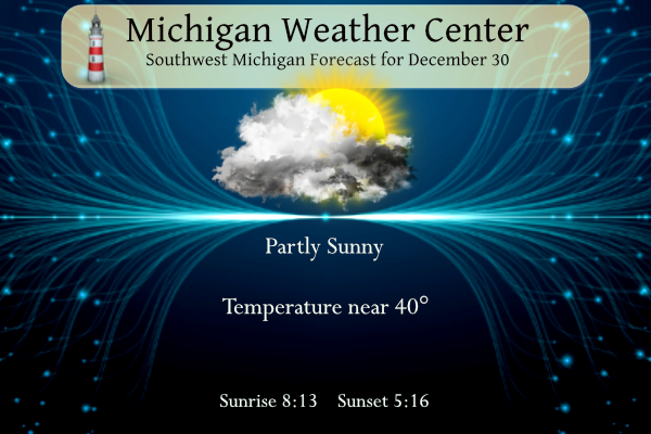
CALL IT ANYTHING MORE THAN PARTLY SUNNY. GRR HAS NOT HAD A MOSTLY
SUNNY DAY SINCE DECEMBER 15.
-- SNOW SHOWERS ON SUNDAY --
LOW PRESSURE AT THE SURFACE ASSOCIATED WITH A FAIRLY ROBUST UPPER
LEVEL TROUGH WILL PASS THROUGH LOWER MICHIGAN ON SUNDAY. THE QUALITY
OF MOISTURE IN THE MID-LEVELS AND DGZ MAY NOT FAVOR MUCH MORE THAN
SPORADIC MODERATE SNOW BURSTS, RESULTING IN INCONSISTENT TRACE TO 1
INCH ACCUMULATIONS ACROSS THE AREA. TEMPERATURES MUCH OF THE DAY ARE
ALSO EXPECTED TO BE A TOUCH ABOVE 32. CAN'T RULE OUT LIGHT FREEZING
DRIZZLE AT THE ONSET AROUND DAYBREAK MAINLY IN CENTRAL MICHIGAN.
LONG TERM
(SUNDAY NIGHT THROUGH FRIDAY)
ISSUED AT 335 AM EST SAT DEC 30 2023
-- SNOW SHOWERS END EARLY MONDAY --
SYNOPTIC SHOW SHOWERS LINGER INTO SUNDAY EVENING WITH THE UPPER LOW
STILL IN THE VICINITY, BUT PASSAGE OF THE SFC AND UPPER TROUGHS
FOLLOWED BY DRYING/SUBSIDENCE FROM THE NORTH WILL END THE SNOW
OVERNIGHT. EXCEPTION WILL BE ALONG THE IMMEDIATE LK MI COAST WHERE A
FEW LIGHT LAKE EFFECT SNOW SHOWERS MAY PERSIST THROUGH EARLY NEW
YEARS DAY IN THE NORTHERLY FLOW BEFORE RIDGING AND WARM ADVECTION
ARRIVE MONDAY AFTERNOON.
-- MIDWEEK LAKE EFFECT SNOW SHOWERS --
AFTER A DRY AND BREEZY TUESDAY WITH HIGHS NEAR 40, A COLD FRONT
COMES THROUGH ON TUESDAY NIGHT WITH H8 TEMPS FALLING TO -12C BEHIND
IT ON WEDNESDAY. THAT WILL SUPPORT A PERIOD OF LAKE EFFECT SNOW BUT
IT SHOULD BE RELATIVELY BRIEF SINCE THE UPPER TROUGH DOES NOT FULLY
DIG IN OR STICK AROUND FOR VERY LONG. ALSO SFC RIDGING IS ALREADY
BUILDING IN FROM THE WEST LATER WEDNESDAY NIGHT. STILL, SOME LIGHT
ACCUMULATIONS DO APPEAR POSSIBLE MIDWEEK IN FAVORED NORTHWEST FLOW
LOCATIONS NEAR AND WEST OF HWY 131.
-- MAINLY DRY TO END NEXT WEEK --
FAMILIAR ZONAL FLOW ALOFT RESUMES FOR THURSDAY THROUGH SATURDAY, SO
THE LATE WEEK PERIOD LOOKS PREDOMINATELY DRY/UNEVENTFUL WITH A
CONTINUATION OF ABOVE NORMAL TEMPERATURES.
As of now, the snow maps are trending the right direction and agree with the teleconnector signals! I love it! Who wouldn’t want some snowstorms this time of year?
https://www.pivotalweather.com/model.php?p=snku_acc-imp&rh=2023123012&fh=384
Great News …. Still 80 days of winter left and the teleconnectors still signal colder and snowier by mid January! Bring it on!! Winter rocks!
Good news, the sunset is 5:30 in 2 weeks, and civil twilight is until 6! Finally starting to gain in the evening
“ As of now, no major storm systems or arctic blasts are on the horizon.” I love it! Who wouldn’t want a short winter? Keep the mild temps going!
And Spring is right around the corner!
https://days.to/until/spring
Bring on the cold and snow!!!! Who wouldn’t want snow this time of year? Wow, wow, WOW!!
Just another above average temp day with no snow! This winter has been fantastic!
Still don’t understand why Rocky does not move to Canada? Tons of cold and snow, Socialist Authoritarian government and very strict Covid and Anti Gun laws. That would seem to be his paradise
Not sure why you don’t explore life further south or in California?
The 8-14 day precip outlook is almost all green across the country. Aside from southern Texas and Alaska. Not sure I’ve seen that before
Yes and just think, the warm weather fanatics think that means all rain for us! How wrong could they be! Last winter season we had above normal temps with well above normal snowfall! How is that possible? Bring on the SNOW!!!!!!!!!!!!!!!!!!!
The current temp is 1 below zero at Anchorage, Alaska with a Dense Fog Advisory in effect. I’m sure the landscape looks beautiful this morning.
Yes AK is a great place – any season is awesome up there! Great scenery, fishing and wildlife!
Sub freezing here this morning for the first time in awhile. A few patches of black ice too. Use caution if you venture out this morning.
Get ready…..when the pattern changes around mid January it could be wild! Bring on the cold and snow! Who wouldn’t want snow this time of year? Incredible!