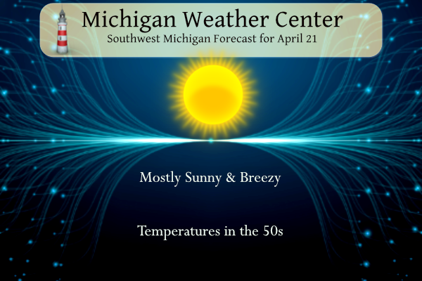
Yesterday we reached 47° with some sun and a gusty wind which made it feel much colder. It will be sunny and breezy today, with temperatures about 10 degrees warmer than yesterday. Dry conditions will result in elevated fire danger today, especially this afternoon as the gusty winds reach their peak. In my area due to the lack of snow leaves in the woods didn’t get a chance to compost the way they should so there is a lot of dry flammable material on the ground.
NWS Forecast
Weather History
1923: A tornado struck three miles west of Scottville in Mason County. It destroyed an unoccupied home and carried pieces of it over a mile.
1967: A tornado outbreak hits from Missouri to Michigan, killing 58 people. The worst of the damage was in northern Illinois, where dozens of people were killed in Belvidere and Oak Lawn. At least seven tornadoes hit Michigan, injuring more than 50 people and destroying dozens of homes. A tornado moved across the southern outskirts of Grand Rapids, doing heavy damage. Thirty-two people were injured and a total of 65 buildings were destroyed and another 60 heavily damaged. Another tornado injured eight people and killed 34 sheep as it moved from Westphalia to the south edge of Fowler in Clinton County.
2013: Heavy spring rains caused severe flooding. The Grand River crested at 21.85 feet in downtown Grand Rapids on the 22nd, with fish being photographed from the submerged windows of buildings along the river.
On April 21, 1976, an F2 tornado moved through Shiawassee County at 3:35 PM. This tornado was one of the most damaging tornadoes in Shiawassee County since 1950 and caused 1 injury and over $500,000 in damage.
1885: A tornado struck the town of Denison, Texas in 1883 that destroyed a church. The congregation rebuilt the church. On this date, a second tornado destroyed the newly rebuilt church.
1967: Severe thunderstorms spawned 48 tornadoes in the Upper Midwest. The hardest hit was northern Illinois where sixteen tornadoes touched down during the afternoon and evening hours causing fifty million dollars in damage. On that Friday afternoon, tornadoes struck Belvidere IL and the Chicago suburb of Oak Lawn, killing 58 persons.
1988: After having had just twelve rainouts in the previous twenty-six years at Dodger Stadium, the third day of heavy rain in southern California rained out a doubleheader at Dodger Stadium, which had been scheduled due to rainouts the previous two days.
Forecast Discussion
- Elevated Fire Danger Today, Cold Tonight

As expected, frost and freeze issues tonight are low due to the
stratus deck in place across lower Michigan. Have seen a few sites
briefly dip below freezing during breaks in the clouds but the time
frame for any one site is short.

Clouds exit with the departure of the low level moisture field this
morning resulting in a breezy day with plenty of sunshine. These
breezy conditions with gusts to 30 mph and clear skies will promote
strong mixing allowing afternoon RH values to fall into the 25-30
percent range, especially east of US131. These combine to create an
elevated fire danger across much of the area with conditions
approaching red flag warning criteria, especially across Mid-
Michigan. Highs today will be in the low to mid 50s.

Temperatures fall back into the upper 20s to 30s tonight as winds
die off and few clouds expected. Given marginal temperatures for
frost/freeze criteria and dry conditions hampering frost potential,
will not be issuing any sort of headline with this package. Will
defer to the subsequent shift for headline decisions.

Monday then continues to warm with highs in the 60s as the thermal
trough across the area exits to the east. Clouds increase ahead of
our next system but mostly sunny skies still generally expected.

- More Rounds of Frost/Freeze Risk Midweek

After a few warmer nights, a reinforcing shot of cold air descends
on Lower Michigan for the middle of the week. Many growers in our
area will be watching with concern as temperatures look like they
will drop into the upper 20s in some of the areas with the most
sensitive fruit tree conditions. Tuesday and Wednesday nights will
be the area of concern, but Wednesday Night will probably end up
being the coldest, as the surface ridge axis moves overhead and
winds in the column drop to near-zero. The cloud forecast will need
to be watched closely as any low clouds that form will keep things
warmer, but at this point that is looking unlikely, so favorable
radiational cooling conditions are expected.

- Typical Unsettled Spring Weather This Week

Overall the weather pattern this week will be a typical spring
rollercoaster. A northern stream wave will briefly pull up some
warmer air with marginal (<500 j/kg) instability Monday night and
Tuesday, producing some rain and maybe a few rumbles of thunder. A
cold front then drives through Tuesday night setting the stage for
the chilly midweek weather. The rollercoaster continues late in the
week as an upper wave ejects from the four corners region of the
Southwest and moves toward the Minnesota/Wisconsin area - driving
another airmass replacement into our area as warm and moist air
rushes northward. This airmass will be warm enough that we could see
temperatures approach 70 even under cloudy conditions. Depending on
the diurnal timing of any embedded shortwaves, as well as any breaks
in the clouds, we will likely be looking at thunderstorm risks as
all of Lower Michigan comes firmly under the influence of deep
southwesterly flow by Saturday. Currently models are keeping
instability around/less than 1000 j/kg, but the specific details
will matter for any severe weather risks, and these will clarify as
we get closer in time.
What! A frost advisory! Who would have thought? Cold, cold, cold!!!
I hope it doesn’t dip too cold over the next few days. Fruit trees are all in full bloom!
Just like Andy said – Another great Spring golf day! Wind chills around 40 degrees with 20 to 25 mph wind gusts. Wow!
Dress for the conditions and enjoy the outdoors! 🤣🤣🤣
Yep, I spent all day working outside in a tshirt, it was fine in the sun!
Very good day to work outside, but not for golf! Who would have thought?
Cold, cold, cold pattern! Below normal temps Friday, well below yesterday and they will keep coming! WOW, just wow, WOW!
Great article on Climate Change and some of the “settled science”
https://www.unionleader.com/opinion/oped-global-warming-dishonesty-is-the-real-inconvenient-truth/article_1b58ee76-9abd-59a3-9a8d-6922253495cb.html
Thanks for the laugh!!! I have not laughed out loud that much in a long, long time! Too funny!
This encapsulates the global warming theory quite well….
“Instead of saying that 97% of scientists agree with these theories, it would be more honest to say that 97% of climate scientists who are looking for government grants to study climate change agree with them.“
The fact that you actually believe this garbage is scary! You have my prayers and condolences!
Guarantee we’ll still be fine in 40 years despite the climate alarmism. We were supposed to be in a new ice age by now according to climate scientists in the 70’s but yet here we are. Boy who cried wolf anyone??
I wonder if the dinosaurs complained about climate chance?
More on climate change in tomorrow’s post…
I have a small lilac plant, so I covered the buds last night along with my bleeding heart plant.
Good move and plenty of freezing temps coming this week!