While we are now in meteorological winter this past Tuesday the Earth was at its closes point to the sun known as perihelion at 7:38 PM and is now heading out towards aphelion. Earth’s perihelion takes place in early January. The exact date shifts because the calendar year doesn’t perfectly match Earth’s orbit.
The word comes from Greek and literally means around (peri) the sun (helios). Aphelion is the point at which an orbiting body is furthest from the sun.
Earth’s perihelion takes place in early January. The exact date shifts because the calendar year doesn’t perfectly match Earth’s orbit. While this year it was on January 2nd in 2025 it will be on January 4th in 2026 it will be January 3rd in 2027 back to January 2nd and in 2028 it will be on January 5th
As for aphelion, that is when the Earth is the far point from the sun. This year it will be on July 5th The date for aphelion also happens on different days every year.
So bottom line is that here in the Northern Hemisphere we are closer to the sun in winter and farther from the sun in Summer. The difference is around 3 million miles.
Looking back at 2023
The highest reading was 93 on May, 31st , August 24th and September 5th. The lowest was 8 on January 31st The average H/L was 61.8/44.5 The mean for the year was 51.0 that is a departure of +1.7. 2023 was the 9th warmest on record at Grand Rapids. The last last low of 32° or lower was on April 27th. The first day with a low of 32 or lower was on October 23rd for a growing season of 199 days. There were 10 days of 90 or better, that is +2 days above average. There were only 8 days with highs below 32° that was well below the average 43 days. There were 72 days when the lows were below 32°, that was well below the average of 123 days. There were no days with lows of below 0 that is below the average of 3 days. There was a total of 37.43” of precipitation 30 year average is 34.36” there were 146 days of 0.01” or more that is average. There were 78 days of 0.10” of more 74 is average. There were 23 days of 0.50” or more 22 is average and 7 days of 1.00” or more and that is average. The most rain in 24hrs was 2.81 on August 14/15. There were 5230 HDD’s -1103 below average and 641 CDD’s -349 below average so even though 2023 was the 2nd warmest on record the energy use was below average. The highest wind speed was 53 MPH on February 15th the sun was out a total of 48% of the time. There were 154 clear days, 100 partly cloudy days and 110 cloudy days. For the year there were a reported 30 thunderstorms. 35 days with heavy rain, 127 days with light rain, 4 days with fr rain. 5 days with heavy snow, 50 days with light snow. Fog on 190 days visibility lest that ¼ mile on 31 days. The annual mean of 52.4 at Muskegon was the 2nd warmest the mean of 51.2 at Lansing was the 3rd warmest and the mean of 50.1 at Grand Rapids was the 7th warmest. So that is 2023 in review.
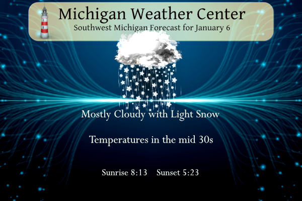
For today the average H/L is 32/20 the record high of 57 was set in 2008 the record low of -12 was set in 1998. The wettest was 0.96” that fell as 11” of snow in 1918. The most snow on the ground was 18” in 1999. Last year the H/L was 35/31 there was 0.14” on pricip and a total of 0.6” of snowfall.
LONG TERM
(SUNDAY NIGHT THROUGH FRIDAY)
ISSUED AT 232 AM EST SAT JAN 6 2024
– ACCUMULATING SNOW STARTING UP LATE MONDAY NIGHT/EARLY TUESDAY
THE LATEST RUNS OF THE MODELS SHOW STRONGER ISENTROPIC LIFT
DEVELOPING LATER MONDAY NIGHT INTO TUESDAY MORNING AS A LOW LEVEL
JET ARRIVES. THE MOISTURE DEEPENS UP AND LIFT INCREASES WHICH WILL
SUPPORT AN AREA OF SNOW TO SPREAD IN FROM THE SOUTHWEST. WITH
SURFACE TEMPERATURES BELOW FREEZING, A RISK FOR IMPACTS FOR THE
TUESDAY MORNING COMMUTE EXISTS AS THE SNOW COATS THE ROADS. THE
LOW LEVEL JET PULLS OFF TO THE NORTHEAST WHILE THE MID TO UPPER
LEVEL SYSTEMS HANGS BACK OFF TO THE SOUTHWEST MIDDAY TUESDAY. SO
AFTER THE INITIAL BURST WE MAY SEE A LULL. THEN THE MID TO UPPER
LEVEL SYSTEM PULLS IN TUESDAY AFTERNOON INTO TUESDAY NIGHT. THIS
FEATURE LOOKS RATHER DYNAMIC WITH STRONGER FGEN NOTED AND
WEAKNESS IN THE STABILITY, SO PRECIPITATION RATES WILL INCREASE.
MOST INDICATIONS ARE THAT THE 850 MB 0 DEG C ISOTHERM LIFTS UP
INTO CENTRAL PARTS OF THE CWA BY 00Z WEDNESDAY. THIS WOULD SUPPORT
A TRANSITION TO RAIN FURTHER SOUTH. NORTHERN PARTS OF THE CWA
WOULD LIKELY REMAIN ALL SNOW, WHICH IS WHERE THE HIGHEST TOTALS
WOULD BE. THE CANADIAN CONTINUES TO BE COLDER AND FURTHER SOUTH
WITH THE TRACK OF THE MID TO UPPER LEVEL WAVE AND WOULD SUPPORT
MAINLY SNOW FOR THE CWA, AND LIGHTER QPF FOR NORTHWEST ZONES. LOTS
OF SPREAD IN THE ENSEMBLE SNOWFALL FORECASTS STILL EXIST SO
UNCERTAINTY WITH THE EXTENT OF THE IMPACTS CONTINUES FOR THIS
PERIOD.
– ANOTHER WAVE FOR THURSDAY WITH LAKE EFFECT INTO FRIDAY
MODELS ARE SHOWING A MID LEVEL WAVE TRACKING EASTWARD THROUGH THE
AREA THURSDAY. A NEGATIVE TILT TO THIS FEATURE WAS NOTED AS WELL.
THUS DECENT LIFT IS POSSIBLE. WE COULD BE LOOKING AT A PERIOD OF
ACCUMULATING SNOW FROM THIS SYSTEM. ARCTIC AIR SPILLS IN BEHIND
THIS WAVE SO THAT WILL LIKELY GENERATE LAKE EFFECT SNOWS THAT
SHOULD CONTINUE INTO THURSDAY NIGHT AND POSSIBLY BEYOND. ANOTHER
SYNOPTIC WAVE IS SHOWN FOR NEXT WEEKEND SO THE SNOW MAY VERY WELL
CONTINUE TO PILE UP THEN.
It is lightly snowing here.
For the first time in a while I can actually see outside after dark thanks to the snow illuminating things! Allows for wildlife viewing after dark.
Still lightly snowing here.
INDY is going with 6 to 10 inches for GR don’t be surprised if the low pressure tracks through central Indian into Eastern Michigan and hits west Michigan hard Winter storm watches coming tomorrow afternoon let’s Go!! INDY
That would be great and we can always hope!
I’ve got good news and bad news! The bad news is the snowstorm for Tuesday is not looking good. The rain/snow line is too far North and the RDB model only shows about 1 – 3 inches of snow for GR. Now for the GOOD NEWS – the pattern is changing and we will be seeing a lot of cold and snowstorms during the month of January! Stay tuned for later updates!
Well the “big” storm is starting to look less and less impressive. It looks like some snow then rain. It looks to turn colder for the weekend and there could be some snow at that time.
Slim
Spot on Slim – the storm will be on the low side of accumulation, but plenty more chances later in the week and next week!
Yup. Typical, given how extremely warm this year has been. I wouldn’t be surprised if it shifts to even more rain. I am about 5 miles south of m46, so at the forecasted snow/rain line.
You know it – until the pattern fully flips and we get some good cold air in place, it is going to be tough to get a big snowstorm!
Ground and trees are coated in a layer of white here in Portland! Love it!
Those 2023 stats are insane. Only 8 days with the high below 32f!
Wow that is crazy. We never had prolonged cold weather last season, and this fall was relatively mild. But only 8 days… pretty shocking
And zero days with the low below zero.
In regards to the system coming in behind this first one, it’s too early to get into any specifics. GFS goes bonkers and spits out a low pressure in the 960s with very very windy conditions likely blizzard conditions. The Euro is a bit more tame. Close monitoring of the track and intensity will be needed once we get into next week but at this stage not going to invest a lot of time. Let’s get through the first one.
Rock on Kyle and we will see so many snowstorms this month it is a great idea to take them one at a time!
Model update for GR:
Euro: 5.8”
GFS: 11.9”
GEM: 5”
Lansing:
EURO: 3.5”
GFS: 5.3”
GEM: 7”
We will soon be in range for the 12KM/3KM NAM and HRRR so that will also help.
It’s about time to review the facts!
1. Winter rocks!
2. A Pattern change is imminent!
3. Multiple snow events in West MI over the next 2 weeks and probably beyond!
4. The warm weather fanatics can go hibernate for the next 3 months!
5. The polar vortex may be paying us a visit very soon!
6. You will want your snowblowers tuned and ready to go very soon!
7. Winter is the best season!
8. Rock n roll will never die!
While some have been talking about this for days, I’m seeing more people starting to think that system #2 may produce more snow for us than Tuesday’s. Too early to have an idea about system #3 (or #4?).
Here is Ryan Hall’s vid from yesterday:
https://m.youtube.com/watch?v=d-xn2-ORMdo&pp=ygUPcnlhbiBoYWxsIHknYWxs
The storm next weekend will be the biggest! Sometimes during a major pattern change, it takes awhile to make the full switch! By next weekend we will be entrenched in a cold and snowy pattern, so get ready!
Of course system #2 looks more impressive at this stage than this one. But obviously the focus is going to be on the nearest one.
At this stage, system #1 looks to be more impactful for the southern and southeastern US than up here.
System #1 is basically a non event for us! System 3 and 4 are the best chances!
It is looking much colder later in the week as well, so does make sense
That’s a good point, Nathan. The atmosphere has yet to get really cold.
Winter Weather Alert>>>>>>>real winter weather will be retuning next week! The snow will start by Tuesday and keep going on and off for weeks and it will get progressively colder! So forget about above normal temps and get ready to shovel. snowblow, snowshoe, ski, ice skate ice fish, etc, etc, etc! It is going to be wild! Rock n roll will never die!