As I have stated before, we get to interested on the weather pattern for our area for any given day without looking at the big picture of the cause and effect of global weather patterns. I think I have covered this before, however it is good to revisit it to have a better understanding of how the global circulations work and why it can be hard to statistically predict the weather for any given day with the ocean of the atmosphere constantly flowing and shifting patterns.
 Global Circulations explain how air and storm systems travel over the Earth’s surface. The global circulation would be simple (and the weather boring) if the Earth did not rotate, the rotation was not tilted relative to the sun, and had no water.
In a situation such as this, the sun heats the entire surface, but where the sun is more directly overhead it heats the ground and atmosphere more. The result would be the equator becomes very hot with the hot air rising into the upper atmosphere. That air would then move toward the poles where it would become very cold and sink, then return to the equator (above). One large area of high pressure would be at each of the poles with a large belt of low pressure around the equator.
 However, since the earth rotates, the axis is tilted, and there is more land mass in the northern hemisphere than in the southern hemisphere, the actual global pattern is much more complicated.
Instead of one large circulation between the poles and the equator, there are three circulations…
- Hadley cell – Low latitude air movement toward the equator that with heating, rises vertically, with poleward movement in the upper atmosphere. This forms a convection cell that dominates tropical and sub-tropical climates.
- Ferrel cell – A mid-latitude atmospheric circulation cell for weather named by Ferrel in the 19th century. In this cell the air flows poleward and eastward near the surface and equatorward and westward at higher levels.
- Polar cell – Air rises, diverges, and travels toward the poles. Once over the poles, the air sinks, forming the polar highs. At the surface air diverges outward from the polar highs. Surface winds in the polar cell are easterly (polar easterlies).
Between each of these circulation cells are bands of high and low pressure at the surface. The high-pressure band is located about 30° N/S latitude and at each pole. Low pressure bands are found at the equator and 50°-60° N/S.
Usually, fair and dry/hot weather is associated with high pressure, with rainy and stormy weather associated with low pressure. You can see the results of these circulations on a globe. Look at the number of deserts located along the 30°N/S latitude around the world. Now, look at the region between 50°-60° N/S latitude. These areas, especially the west coast of continents, tend to have more precipitation due to more storms moving around the earth at these latitudes.
Jet streams are relatively narrow bands of strong wind in the upper levels of the atmosphere. The winds blow from west to east in jet streams but the flow often shifts to the north and south. Jet streams follow the boundaries between hot and cold air.
Since these hot and cold air boundaries are most pronounced in winter, jet streams are the strongest for both the northern and southern hemisphere winters.
Why do the jet stream winds blow from west to east? Recall from the previous section what the global wind patterns would be like if the earth was not rotating. (The warm air rising at the equator will move toward both poles.)
We saw that the earth’s rotation divided this circulation into three cells. The earth’s rotation is responsible for the jet stream as well.
The motion of the air is not directly north and south but is affected by the momentum the air has as it moves away from the equator. The reason has to do with momentum and how fast a location on or above the Earth moves relative to the Earth’s axis.
Your speed relative to the Earth’s axis depends on your location. Someone standing on the equator is moving much faster than someone standing on a 45° latitude line. In the graphic (above right) the person at the position on the equator arrives at the yellow line sooner than the other two.
Someone standing on a pole is not moving at all (except that he or she would be slowly spinning). The speed of the rotation is great enough to cause you to weigh one pound less at the equator than you would at the north or south pole.
The momentum the air has as it travels around the earth is conserved, which means as the air that’s over the equator starts moving toward one of the poles, it keeps its eastward motion constant. The Earth below the air, however, moves slower as that air travels toward the poles. The result is that the air moves faster and faster in an easterly direction (relative to the Earth’s surface below) the farther it moves from the equator.

In addition, with the three-cell circulations mentioned previously, the regions around 30° N/S and 50°-60° N/S are areas where temperature changes are the greatest. As the difference in temperature increases between the two locations the strength of the wind increases. Therefore, the regions around 30° N/S and 50°-60° N/S are also regions where the wind, in the upper atmosphere, is the strongest.

The 50°-60° N/S region is where the polar jet located with the subtropical jet located around 30°N. Jet streams vary in height of four to eight miles and can reach speeds of more than 275 mph (239 kts / 442 km/h).
The actual appearance of jet streams result from the complex interaction between many variables – such as the location of high and low pressure systems, warm and cold air, and seasonal changes. They meander around the globe, dipping and rising in altitude/latitude, splitting at times and forming eddies, and even disappearing altogether to appear somewhere else.
Jet streams also “follow the sun” in that as the sun’s elevation increases each day in the spring, the average latitude of the jet stream shifts poleward. (By Summer in the Northern Hemisphere, it is typically found near the U.S. Canadian border.) As Autumn approaches and the sun’s elevation decreases, the jet stream’s average latitude moves toward the equator.

Jet streams are often indicated by a line on a weather map indicating the location of the strongest wind. However, jet streams are wider and not as distinct as a single line but are actually regions where the wind speed increases toward a central core of greatest strength.
One way of visualizing this is to consider a river. The river’s current is generally the strongest in the center with decreasing strength as one approaches the river’s bank. Therefore, it is said that jet streams are “rivers of air”.

The strength of the wind increases toward the core of the jet stream. It also does not reside at any one particular height but can extend across hundreds of miles wide and 1,000s of feet in height.
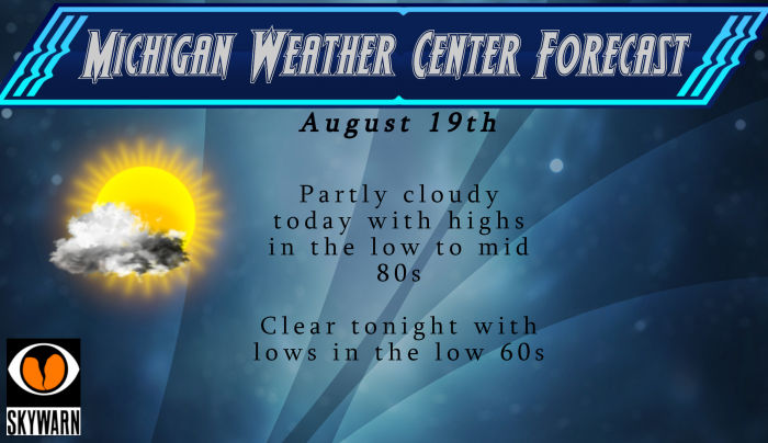
We will start the day with some patchy fog which will gradually clear out to bring us a partly cloudy day with highs in the low to mid 80s which is a bit above normal for this time of year. Tomorrow will feature even warmer air with slight chances of showers and an outside chance of a storm.
Midweek we will see a dryer, cooler airmass move in for more comfortable temps in the 70s…
Great post MV. A lot of info to take in. Thanks.
It got up to 82 here today. It really didn’t feel muggy till this evening – maybe because I was working in the garden- LOL!! Between watering and pulling weeds it felt hot out.
Who said 85 was out today with all the clouds around? Sorry. Ohh the twins just can’t get anything right today.
https://w1.weather.gov/data/obhistory/KGRR.html
Lol. Oopsie.
Get ready for the cold front! Much lowers dew points and multiple well below normal temp nights! Bring it and what a great summer!
Currently 81* degrees out at thee YARDofBRICKS NE of GR just about as average as they come this time of year not hot or cold summer’s end is perfect outside perfect….INDY
Average… Well, if you don’t count the mild overnight low or the fact NWS is predicting 85 degrees today LOL The spin continues from this character I call RockyIndy.
And who is talking about the overnight low? It’s looking like 85* degrees is out today with all the clouds around Sorry! Ohhh the trio that want it hot all the time! Why must we ask?? Why?? Lol…INDY
Nice try, RockyIndy. GR is currently at 83 degrees at 3pm which is already above average. There’s a good chance at 85 as forecasted.
The air feels great this morning. Lower dew points and great summer day!
With only seven 90* degrees days it’s been a piece of cake this summer the ice cream has not melted to fast lol….INDY
Yes a great summer with one minor heat wave and tons of great temps!
Maybe to the North, but not around here. I grabbed a screen shot this morning showing the dew points, 70 right over our house and even higher in other places.
[IMG]http://i66.tinypic.com/20qx5s2.jpg[/IMG]
70 dew point on August 19th and Rocky is somehow spinning it as feeling refreshing LOL
Yup, the man with two names is a spinner. Lol
Thick, muggy air this morning again. Dew points near 70 and not even a breeze. Just another above average day to add to the Summer total.
Bill has posted his first winter guess today. I will not go into you can go to his site and read it for your self. But MV post has some info on Bill’s thinking for the winter of 2019/20. I did not get much rain here at my house yesterday just 0.14″ so if I cut the grass I will have to water it so I might not cut it just yet.
Slim
Incredible I had more people come around 9pm to my party last night fired the grill back up by 915pm I was grilling in the dark with all the sprites I had must of forgot it was mid August already …lol.. Crazzy how much daylight we have lost already this Summer.. Have A Super Monday…INDY!!
That is late! The sunsets in Orlando at 8pm right now.
Orlando it further east then GR is so the sun will set earlier it is also further south so in the summer their days are shorter. For today the sun rise at Orlando is 6:56 AM and the sunset is 8:PM for 13:03 of daylight while at Grand Rapids the sunrise is 6:52 and the sunset is 8:39 for 13:46 of daylight.
Slim
Thanks Slim 13 hour days yup getting shorter that’s for sure ..INDY
August scorecard: 12 warm days, 6 below average days. Incredible!
Another good read with a lot of info MV! Feel like I’m starting every day with a class in school, but learning new stuff every day!
Get ready for the cold front and lows well down into the low to mid fifties by the middle of the week! Incredible!
Then get ready for more mid 80’s and above average temps. Imagine that!
What a summer! Great temps and not much humidity! Keep it coming!
Not much humidity?? Maybe sitting in your basement next to the de-humidifier.
Lol.
Are you crazy?