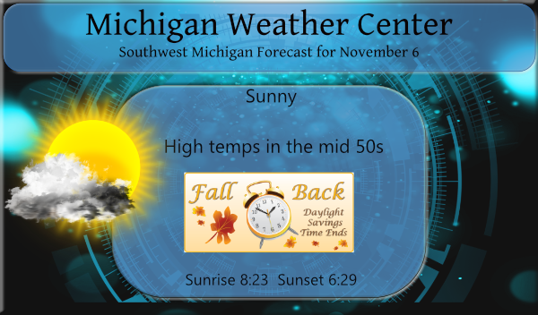
Back to “Winter Time”
On Sunday at at 2 AM or there about the time fall back to 1 AM. Officially we are going back to “standard” time, but I think since we are on “summer time” (officially daylight savings time) the names should be changed to the new standard time “summer time” and “winter time” I would much rather stay on the so called daylight savings time all year long. I would rather have a hour of extra daylight in the evening (or in the case of the winter late afternoon) then have the sun rise a hour earlier in the morning. Anyway, if you want to be “on time” don’t forget to change any clocks that don’t change by them selves this weekend. While I am at it why don’t the automakers put clocks in their cars that change when you cross from one time zone to another?
Also, for better or worse Sunday in my birthday. Not sure why one should celebrate getting older but hey that is the way it goes.
Speaking of anniversary’s next week in the anniversary of two of the biggest fall storms on the Great Lakes. In 1975 what is sometimes called the Edmund Fitzgerald storm happened on November 9th and 10th . A strong autumn storm tracked from the central U.S. through the Great Lakes region. While intense, it was not unusually strong for November. Early on the morning of November 9, a low pressure system was organizing in central Kansas and had a pressure of 29.53 inches (1000mb). By the evening of November 9, the low had moved northeast to eastern Iowa and had strengthened to 29.32 inches (993mb). During the next 12 hours, the storm system underwent its most rapid intensification as it moved northeast into Upper Michigan. On the morning of November 10, the low was located over Marquette, MI, and had a pressure of 29.00 inches (982mb). The low tracked northeast across Lake Superior that morning before reaching just southwest of James Bay in Ontario during the evening. Its pressure that evening was 28.88 inches (978mb). On Lake Superior Ship observations during the November 1975 storm showed sustained wind speeds of 30 to 45 knots from the northeast, east, or southeast prior to the low pressure system crossing the lake. As the low crossed the lake, winds shifted to the northwest and increased. Wind speeds of 50 knots were recorded over the eastern part of the lake. Ship observations indicated waves of 16 to 18 feet during the height of the storm.
Then November 1998 On the same date and almost to the same hours and following practically the same track as the November 1975 storm, a more intense storm system tracked northeast from the central U.S. through the Great Lakes region during the period of November 9-11, 1998. On the morning of November 9, a low pressure system was organizing in eastern Colorado. Its pressure at that time was 29.41 inches (996mb). The system tracked east and then curved northeast, reaching northwest Iowa on the morning of November 10. It had rapidly intensified with its pressure dropping to 28.70 inches (971mb). The storm system further strengthened to an unusually low 28.55 inches (967mb) as it tracked just east of Duluth, MN early in the evening of the 10th. By the morning of November 11th, the low was located in north central Ontario. Its pressure at that time was 28.58 inches (968mb).
The November 1998 storm produced widespread damaging winds across the upper Great Lakes region. On Lake Superior, the observing sites at Devils Island within Wisconsin’s Apostle Islands, at Rock of Ages and at Passage Island on the south and north ends of Isle Royale, respectively, and at Stannard Rock, 40 miles north of Marquette, all reported lengthy periods of gale force winds of 34 to 47 knots. Gusts frequently exceeded 50 knots. Wind directions were primarily east, southeast, and south as the storm center approached and then moved over western Lake Superior. The wind then shifted west and northwest as the low moved into Ontario. While wave observations were not available, the long duration of gale and occasional storm force wind (wind in excess of 47 knots) likely produced significant wave heights of 20 to 25 feet on the open waters of Lake Superior. Again, keep in mind that the rare peak waves could have been one-and-a-half to two times that height.
Don’t forget to change you clocks tonight.
Slim
It is GREAT to see the latest CPC shows below normal temps right into December! Bring on the SNOW!
The time change is the most ridiculous thing in the World! It needs to stop and fast! Stupid, stupid, stupid’!!!!!!!
Once again our snow deficit is on the rise again. Each day it’s going up a tenth of an inch or two. How far under can we get this season?
Like I always say, the whole time change thing needs to end. How they can push through ridiculous legislation about nonsense all the time but can’t push through something simple that everyone hates, ending the time change, is beyond me.
The overnight low both here at my house and at the airport was 31. There was widespread frost here this morning. At his time it is partly cloudy and 34 here. Tomorrow the sun will rise one hour later but will set one hour earlier.
Slim
Let it snow let it snow let it snow …Hard some to take in especially in November…Indy ….
Winter Time = the absolute best season and the best time of year! Get ready for the big transition to cold and snow by next weekend! Bring it!