As a reminder – set your clocks back tomorrow night before you go to bed and yes, Sunday night the sun will set around 5:30 pm bringing us a step closer to those long winters nights.
Yesterday’s high was 47° and the low was 32° with a trace of snow in the early morning.
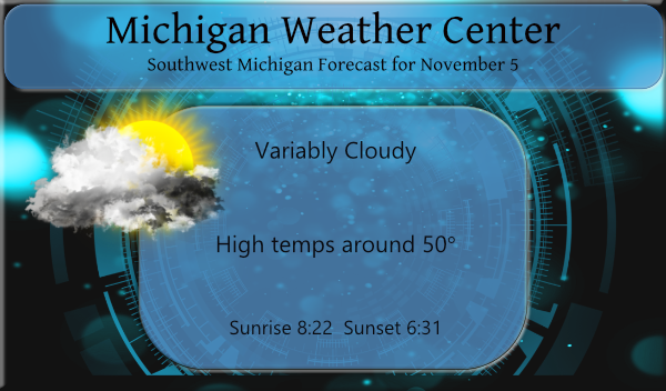
We will see the clouds break up today as we enter a quiet period weatherwise with slowly rising temps through early next week. This will be a good time to finish up yard work, with the exception of the leaves which haven’t fallen off the trees yet, we will be raking and mulching these through next week. It will also be a great time to get those Christmas lights on the house, next weekend may be a different story as the weather may take a turn for the worse.
Forecast Discussion
- Warm and dry Saturday through Monday

Today should be the last below normal temperature day for about a
week. Temperatures will average near 10 degrees above normal
Sunday into Monday.

A lead shortwave, coming out of the deepening upper trough just
off shore of western North America, sends a 90 knot 300 mb jet
across the Dakotas into the Michigan Upper Peninsula Saturday.
That will push a warm front through this area on Saturday. That
will be the first day you may notice it being significantly warmer
than the past week has been. The surface low associated with this
system tracks across Hudson Bay Saturday, so any precipitation
with the warm front will be well north of our area.

Meanwhile a 150 knot jet digs into the back side of the system
just off shore of western North America. That sends a
significantly stronger system our way for midweek. However, before
that gets to us there are large height rises from from near the
surface to over 200 mb Sunday into Monday. That brings us much
warmer temperatures. Afternoon highs will likely make it into the
60s away from Lake Michigan. The shortwave ridge will keep us dry
and provide sunshine Sunday and Monday.

- Not as warm and maybe showers Tuesday into Thursday

Then, for Tuesday and Wednesday, the weather gets sort of
glitchy. That next system that tracks toward the Great Lakes,
sends another surface low through Hudson Bay in the
Monday/Tuesday time frame. The polar jet axis by then is near 50N
(north of Lake Superior). That will bring a weak cold front
through this area Tuesday. The question here is how strong is that
trailing shortwave. The ECMWF has a much more significant
southern branch shortwave than does the GFS for Tuesday into
Wednesday and the ECMWF is also slower (strong shortwave travels
slower). The ECMWF version results in a surface wave on the front
that would bring showers into our area in the Tue/Wed time frame.
Being behind the cold front it will be not as warm then either,
even so highs should still get into the 50s both day.

- Much stronger system toward the weekend brings cold air back

Finally another system coming off of northern Asia now, boots the
system currently off shore of western North America, inland into
the central parts of Canada and the CONUS late next week. Another
deep trough develops over the north Pacific, but this one is
about 30 degrees of longitude farther west than the current system
is. That results in a longwave pattern that would cause an upper
trough over the this area. That in turn would bring the cold air
back to the Great Lakes. There are numerous model solutions
showing how this comes about. Some would have quite the fall
storm in this area toward next weekend, others have the storm well
north of here. All versions bring the cold air back. So we will
have to see how this plays out. I would imagine the current
version of the GFS is way to dry for next weekend. That is because
most of the ensemble members of the GFS do not support the
operational model solution. Just about all of the 50 ECMWF
ensembles have it wet here, and 20 of the 30 GFS ensemble members
have it wet too. The 05th/00z ECMWF operational model looks more
like most of the ensemble members. So, I would favor the ECMWF at
this point. In any event, it will get colder and more than likely
some lake effect snow should be expected.
It made my day when I put my radio on and they were playing Christmas music. I love listening to them. It is a great week to get lights up and do last cleanup before winter. We have alot of trees that have not lost any leaves. I saw a thing on tv that said it is still good planting time. I am not sure on that. I am debating on cleaning windows. Tonight we are baking cookies at my house and it smells so good. Cookies and Christmas movies!!
Wow check out mid November Winter will be rocking hard here we go!!! InDY
Check it out Indy! Rock n Roll will never die!
https://www.instantweathermaps.com/GFS-php/conussfc.php?run=2021110512&time=PER&var=ASNOWI&hour=384
50’s and 60’s and lots of sun the next several days. I love it!
The overnight low here was 32 it was mostly cloudy so that did keep the temperatures up. So far this fall season the coldest it has gotten here at my house is 29 but it has gotten down to 25 at the airport. We are now 5 days into November and there are still a lot of leaves on the trees. While the grass is still nice and green it looks to have slowed down in its growth so maybe one more cutting this fall? At this time it is mostly cloudy and 34 here.
Slim
I like starting work in the dark and ending work in the dark….not.
Yuletide update: three houses in our neighborhood have put up their Christmas lights. Fear not, I have yet to hear Mariah Carey on the radio.
It’s going to be a good weekend weather wise to get things ready for winter.