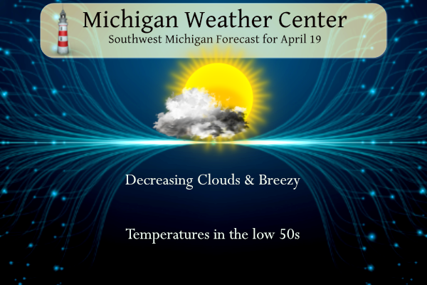
Morning clouds will give way to sunny skies today. It will become breezy with westerly winds occasionally gusting to 25 mph. It will be quite cool this weekend, especially at night when it’s looking like below-freezing temperatures will occur away from Lake Michigan. Temperatures will be in the low 50s today, mid-40s tomorrow, and low to mid-50s on Sunday. We will see plenty of sunshine through Monday before the next chance of rain moves in.
NWS Forecast
Weather History
1957: Less than a week after record low temperatures in the teens, high temperatures are pushing 80 degrees across Lower Michigan. Muskegon went from 19 degrees on the 15th to a high of 79 on this date, a rise of 60 degrees in four days.
On April 19, 1953, the temperature in Flint never rose above 35 degrees. This temperature was a record temperature, in that it was the lowest maximum temperature for that day. The next day, the record lowest maximum temperature for Flint was 34 degrees.
1775: The first engagement of the Revolutionary War took place under crisp, clear weather at Lexington-Concord.
1927: A deadly tornado outbreak occurred across the central part of Illinois, killing 21 people. The first tornado touched down near Hardin, traveling northeast through Carrollton, then skimmed the south side of Springfield. At Carrollton, a teacher was killed as she held the door of the school shut, saving the lives of her students. The second tornado, peaking at estimated F4 intensity, touched down on the southeast side of Springfield, then moved to affect the towns of Riverton, Buffalo Hart, Chestnut, and Cornland. In Buffalo Hart, only three houses were left standing, while the northern half of Cornland was leveled. The tornado track was 65 miles, ending in Ford County.
1986: A major storm system produced ten tornadoes in Texas. One of these tornadoes virtually annihilated the town of Sweetwater. The tornado struck at the unlikely time of 7:17 am. One person was killed, and 100 were injured.
Forecast Discussion
- Rain Showers End Early With Breezy Conditions Today

The current rain shield associated with a surface low progressing
northeast across the Central Great Lakes will exit the area by 12z
with drier air expected behind it. Most of the area will be mostly
sunny today, however late this afternoon some moisture in the 850-
700mb layer approaches areas north of M20 bringing a cloud deck that
will cross the area overnight.

One thing to watch today will be RH values, especially across
southern Michigan. Given the lighter nature of QPF tonight, some
guidance like the HRRR is trending towards lower minimum RH
values towards 30 percent this afternoon. If we can mix towards
lower RH values, breezy conditions with winds gusting 20-30 mph
may lead to a window of elevated fire weather concerns.


- Temperatures Fall Near Freezing Friday Night

Given the recent stretch of warmer weather, vegetation is starting
to become vulnerable to freezing temperatures. As troughing sets in
over the area and cold air advection begins, overnight temperatures
fall into the low to mid 30s. However, surface winds likely won`t
die off into the overnight hours thanks to a gradient associated
with a surface high to our west.This may keep enough mixing to
avoid a sharp near-ground temperature inversion.

Saturday then features partly cloudy skies becoming mostly sunny
during the afternoon. Continuing cold air advection will keep highs
in the 40s.

- Below Freezing lows for the Sun to Mon

The northwest flow continues Saturday night into Sunday keeping any
significant warming away from the region.   The flow then backs to
the west southwest for Sunday night into Monday.  Cooler than normal
temperatures will continue given this pattern.  Ensemble temperature
forecasts continue to support surface temps going below freezing at
night, especially for inland locations.  No noticeable trends were
seen in the latest runs. We will therefore maintain the current
forecasts showing a potential for subfreezing temps both nights. The
wind will likely not go calm for Saturday night, but later Sunday
night the wind will likely be lighter.  So some frost my occur then.

- Potential for a few storms Tuesday

Models are tracking the next wave of low pressure eastward through
northern parts of Lower MI Tuesday. The GFS does draw up enough
instability to warrant a few thunderstorms.  The Canadian and ECMWF
are more conservative with the instability but do show a similar
track, with southwest winds over the CWA on Tuesday.  We will
therefore feature a chance for thunderstorms for southern parts of
the CWA ahead of the frontal passage. Bulk shear values through 500
mb are shown to be strong with steeper mid level lapse rates so
trends will need to be monitored closely.
Here are the facts! Virtually every day next week we will see below normal temps! Despite the hype!
Mostly highs in the 60’s next week, who cares…
https://weather.com/weather/tenday/l/52aab230ef88e4f2bb12857231a5dd58392e78a71b90e01d57a11d827658eb55
Another positive with endangered species and beneficial global warming.
https://www.scientificamerican.com/article/trumpeter-swans-rebound-assist-global-warming/
Too funny!
Mid 50’s to mid 60’s starting Sunday and continuing to climb in temps for weeks on end after that!! Perfect spring weather! LETS ROCK!!!!
Some people are calling this pattern seasonable? And some will say above normal! We will see multiple below normal temp days this weekend and beyond! Get prepared now!
I think seasonable is a fair characterization. The upcoming days will be within five or so degrees from average – whereas lately it’s been double digits above average.
Too funny! Seasonable is now 5 degrees below normal. Sounds like the warm weather fanatics!
Here’s what I think: a temperature +/- 5 degrees from average is not remarkable. A temperature +/- double digits is something to write home about.
Seasonable (adj) –
1. expected at or suitable for a particular time of the year
2. expected at or suitable for a particular season
You can’t reason with a troll, Mark.
Very cold, windy weekend! At least we will see some sun! Incredible!
Looks like we’re reverting back to more seasonable temps for a bit. The grass is green and growing quickly. I mowed Wednesday night and I will be mowing again tomorrow.
The overnight low and current temperature was(is) 41 with clear skies at this time. I recorded 0.09” of rainfall from yesterday at 7 AM to today at 7AM
Slim
The official H/L yesterday at Grand Rapids was 55/47 there was 0.07” of rainfall the average wind speed was 5.4 MPH and the highest was 28 MPH out of the W. There was a reported 21% of possible sunshine. For today the average H/L is 59/39 the record high of 82 was set in 1985 the record low of 19 was set in 1897 the most rainfall of 1.89” fell in 1993 the most snowfall was 1.0” in 1953. Last year the H/L was 57/31 and there was 0.16” of rainfall.
Slim