Yesterday we managed to reach 47° with some afternoon sunshine, the morning low was 37°. We had another .64 of an inch of rain to add to our monthly total of 2.29 inches. It is currently 36° at 6 am.

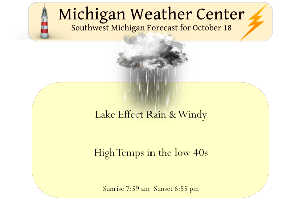
Lake-enhanced rain showers, mixed with snow or all wet snow, near Route 10 this morning will gradually spread inland by midafternoon as mainly rain showers. The heaviest rainfall will be near US-31 south of Holland today.
It will be windy today with winds gusting to 45 to 55 mph near the Lake Michigan shore (US-31 to lake shore) and 35 to 40 mph inland. Showers will be numerous south and west of Holland into mid-morning but the showers will become numerous inland by early afternoon. Some light snow is expected near and north of Route 10 into mid-morning, inland of US-131. Accumulations will be mostly less than an inch.
In the U.P. snowfall reports this morning are 8 inches in Ironwood and 16 inches in Giles.
Forecast Discussion
No headline changes are planned this morning; the strongest winds
are ahead of us and the headlines have that covered.

So far, the short range models have handled this system well,
including the lake-dominate band that we currently see on radar.
Little if any precipitation is falling inland. However, that will
likely change by the afternoon. Both the ECMWF/GFS show another strong
short wave rotating around the upper low and moving south across the
cwa. That should generate more showers throughout the day. As far as
precipitation types are concerned, rain showers will be the norm.
However, early this morning, we`ll likely see some snow mix in with
the showers over the far northern cwa and even that should be all
rain by noon or so. As the short wave moves through, the pressure
gradient will tighten and we`ll see the strongest winds develop
around mid day. Ensemble probability guidance shows the far
southwest lake shore with the highest chance of seeing 50 MPH and
mid 40 MPH speeds farther north along the lake shore. Thus, the Wind
Advisory looks good there. Of course, scattered power outages will
likely occur.

Once the short wave pivots through late in the day, precipitation
and winds will decrease through Wednesday. As the upper low moves
northeast, warner air will advect into the Great Lakes.  A deep
trough moving onshore the Pacific Northwest will result in a strong
south flow ahead of it east of the Rockies. High temperatures will
warm to around 70 by the weekend before the western trough moves
east and a cold front moves through early next week.
Another nice late November day?
I still have avoided any snow here. If I can make it past today without snowflakes then I should be safe until November (assuming the 2 week outlooks are correct).
Currently it is a re-feel of 28 here with a strong NW wind… brr!
While a trace of snowfall was reported at the NWS office it was more likely sleet than true snow. As it was a sleet/small hail event here in the NW side that briefly covered the ground.
Slim
Furnace cranking cloudy and its cold outside is it November?? INDY
Yesterdays official high of 46 is the average high for November 18th and the mean of 42 is the average mean for the day on November 10th so yes it did indeed fell like November yesterday.
Slim
For mid to late October yesterday was a rather cold day. The official H/L yesterday was 46/38 It was the 9th coldest maximum for the date at Grand Rapids the rain fall for the day was 0.52” a trace of snow fall was reported that ties the record for the date. There was no sunshine. Here at my house there was enough sleet to cover the ground for a while. The overnight low both here in MBY and at the airport has been 36. That is the current temperature here with a light mist falling. For today the average H/L… Read more »
Freeze warnings all the way down to the gulf coast. This is a monster low pressure system. It appears that many low temp records will be broken.
Interestingly, the forecasted low for Birmingham AL will be colder the next two nights than it will be here.
With the lakes and the clouds that they produce that is rather common for areas to our south to get a hard freeze before we do.
Slim