We have had .16 of an inch of rain which began last night. Yesterday’s high was 53ˆ and the low 35°. We have a wet and chilly 38° at 6:30 this morning here in Otsego.
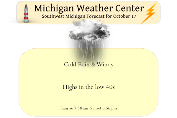
It won’t be pleasant today if you plan on being outside. Occasional showers will persist into Tuesday. Rain may mix with snow early this morning, then again tonight into Tuesday morning; some light (but brief) snow accumulations are possible on grassy areas. Gusty winds will also occur Monday and Tuesday; strongest gusts are expected at the lakeshore (45–55 mph), where some power outages are possible.
...WIND ADVISORY IN EFFECT FROM 2 PM THIS AFTERNOON TO 2 AM EDT
WEDNESDAY...

* WHAT...Northwest winds 20 to 30 mph with gusts up to 50 mph
  expected.

* WHERE...Mason, Oceana, Muskegon, Ottawa, Allegan and Van Buren
  counties.

* WHEN...From 2 PM this afternoon to 2 AM EDT Wednesday.

* IMPACTS...Gusty winds could blow around unsecured objects. Tree
  limbs could be blown down and scattered power outages may
  result.
Forecast Discussion
Forecast concerns today deal with wind potential today through
Tuesday and precipitation trends through Tuesday.

The evolution of a deep upper trough continues to unfold over the
Great Lakes. The result will be an intrusion of colder air,
increasing wind, and rain mixed with snow showers during the next 48
hours.

As the surface low over NE Lower deepens and drops south, a building
high over the Northern Plains will tighten the pressure gradient
over the U.P today. That tighter gradient moves south later today
and we`ll see our winds strengthen, especially near the lake shore.

The model trend in hourly probabilistic ensemble wind guidance has
been upward over the last few model cycles. This gives increasing
confidence we`ll realize wind advisory criteria along the lake
shore. That guidance shows a greater than 60 percent probability of
seeing 40 mph wind gusts at Ludington. At South Haven, the
probability jumps to 90 percent at 40 mph and 25 percent at 50 mph.

Bufkit overview along the lake shore show strong mixing into the 40-
50 kt layer so we are confident we`ll see wind advisory criteria. As
such, we have issued a Wind Advisory for the lake shore beginning
this afternoon and running through Tuesday evening. The main impacts
will be scattered power outages.

Lake effect convection will be in full production mode given lake
delta t`s around 20c, deep moisture and steep lapse rates. MUCAPE
values over the lake are progd to be in the 200-300 j/kg range with
some of that clipping the lake shore counties. Thus, isolated
thunderstorms are possible too, mainly west of US-131.

Tonight will be the best time to see snow showers. Two locations in
the cwa could see some accumulations. The first is over interior
portions of the northern cwa where higher elevations will lead to
colder temperatures. The second is over the far southwest cwa where
the NAMNest shows a strong band of convection moving SSE and
clipping the western lake shore from Allegan County to Van Buren
County. Dynamic cooling could compensate for the warm lake
temperatures to produce snow showers and accumulations may result.

Rain showers will continue Tuesday, but the precipitation will
quickly transition to rain as warmer air moves in as the low moves
east. Winds will begin to diminish Tuesday night and drier air will
return Wednesday. Although temperatures will be cold for the next
couple of days, highs will moderate back to the 60s by the weekend
as a stronger south wind develops.
Winter Storm Warning for the U.P.
...WINTER STORM WARNING REMAINS IN EFFECT UNTIL 11 AM EDT
TUESDAY...

* WHAT...Heavy, wet snow continues through Tuesday morning,
  resulting in poor travel conditions. Additional snow
  accumulations of 4 to 10 inches are expected in the higher
  terrain a few miles inland from Lake Superior with locally
  higher totals approaching 16 inches possible across the
  Michigamme Highlands. Near the shoreline, little or no snow
  accumulation will occur due to rain only mixing with the snow at
  times. Winds gusting as high as 45 mph through this evening
  then as high as 50 mph into early Tuesday morning.

* WHERE...Baraga and Marquette Counties.

* WHEN...Until 11 AM EDT Tuesday.

* IMPACTS...Travel could be very difficult to impossible in some
  high terrain areas. The hazardous conditions will impact the
  morning and evening commutes today and the Tuesday morning
  commute. Gusty winds and wet snow could bring down tree
  branches, resulting in potentially widespread power outages.
We’re getting our first frozen precip of the season. Tiny ice pellets all over our back deck.
I had small hail that came down hard enough to cover the ground. It has now mostly melted.
Slim
I’m up along M-46 in Montcalm County and it’s really starting to come down as snow now. No accumulations currently. 34 degrees
The good news is that this weather pattern shouldn’t last too long. We have some great weather coming later this week again.
It kind of reminds me of thanksgiving weather today (but way out of season!)
Good morning. The official H/L yesterday at Grand Rapids was 52/39 there was an official 0.19” of rain fall reported. And just 4% of possible sunshine. There was no reported snow fall. Here in MBY as of 8 AM this morning I recorded 0.54” of rain fall much of that falling overnight. There was a good amount of small hail in a heavy shower yesterday afternoon. The overnight low and current temperature here in my yard was/is 38. For today the average H/L is now down to 60/42 the record high of 84 was set in 1947 and the record… Read more »
Nice day – Mid October and wind chills in the low 30’s the next couple days! Wow, just wow!