Yesterday we had a high of 42° with howling winds. I will have a lot of leaves on the ground to deal with when they dry out.

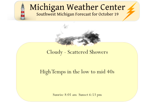
High temperatures will only reach the lower to mid-40s today. Cloudy skies and scattered rain showers are expected. A warm-up will begin Thursday with highs in the 50s and continue through the weekend with temperatures reaching the 70s in many locations.
Weather History for SW Michigan
October 16
1943: A snowstorm drops an inch or two of slushy snow across southwest Lower Michigan. The high temperature at Grand Rapids and Lansing is only 39 degrees.
October 17
1952: After a frosty morning with lows in the 20s, snowflakes fly across western Lower Michigan. An inch of snow accumulates at Muskegon.
2002: Cold weather arrives across western Lower Michigan with high temperatures only around 40 degrees and periods of wet snow mixing in with a cold rain.
October 18
1834: One of the first recorded tornadoes in Michigan strikes Kalamazoo, damaging several homes and businesses.
1972: It is an early taste of winter as a snowstorm hits Lower Michigan. The storm drops 4.6 inches of snow at Muskegon, the heaviest snow on record for so early in the season there.
1976: A cold snap drops the temperature at Grand Rapids to 19 degrees for an early season record.
2007: A tornado with top winds estimated at about 130 mph strikes Williamston in Ingham County. Two people are killed when their mobile home is demolished. Several other homes are heavily damaged.
October 19
1989: Four to five inches of snow falls across Lower Michigan as a record early season snowfall causes power outages and travel delays.
October 20
1992: One to three inches of snow blankets southwest Lower Michigan at the culmination of three days of wintry weather with lows around 30 degrees and highs in the lower 40s.
October 21
1974: It is one of the coldest mornings on record in western Lower Michigan with temperatures falling into the teens. Grand Rapids falls to 18 degrees, the lowest October temperature on record.
October 22
1953: An extended October warm spell culminates with record highs around 80 degrees. At Grand Rapids, it is the third consecutive day with record high temperatures.
Weather History for SE Michigan
October 16
On October 16, 1938, a two-day streak of 85 degrees occurred in Detroit. Both the 16th and 17th had 85 degrees as the high and these are records for both days.
October 17
On October 17, 1947, a three-day heat streak ended in Flint. Temperatures ranged from 86 degrees on the 15th, 82 degrees on the 16th and 84 degrees on the 17th.
October 18
On October 18, 2007, a strong and potent storm in the Upper Great Lakes drove a cold front through Lower Michigan during the evening and overnight hours on October 18th and 19th. The atmosphere ahead of the cold front was very warm, moist, and unstable. These conditions combined with the strong storm to produce a late-season and late-night tornado outbreak. Five tornadoes were confirmed in Southeast Michigan in Shiawassee (EF1 near Perry), Genesee (EF0 in Thetford Township), Tuscola (two EF1s near Millington and near Deford), and Huron (EF1 near Port Hope) Counties. Only a couple of minor injuries were reported. Total property damages were estimated around $1.5M.
Also on October 18, 1952, the overnight temperature dropped to 22 degrees in Flint, which is the record low temperature for the day. Curiously enough, the very next year, 1953, the daytime temperature rose to 82 degrees, setting the record high temperature for the day!
October 19
On October 19, 1989, 2.7 inches of snow and some sleet fell in Detroit, and Flint had 3.5 inches of snow.
October 20
On October 20, 2011, a deep low pressure tracked through Detroit and lead to strong northeast winds gusting to 60 mph in and around Saginaw Bay. The winds started during the evening hours of the 19th and continued through the overnight hours of the 20th. The prolonged nature of the very strong northeast winds pushed water from the Bay into the area rivers and streams including the Kawkawlin and Saginaw Rivers. Some low lying park areas were flooded in Bay County. Numerous trees and large branches were brought down across the northern Thumb and Tri-Cities regions, leading to power outages.
Also on October 20, 1972, a two-day cold steak ended with record lows in Detroit on the 19th, 22 degrees, and on the 20th, 19 degrees.
October 21
On October 21, 1974, a record low of 17 degrees was reached in Detroit.
October 22
On October 22, 1972, Flint reports 2.4 inches of rain on the 21st and the 22nd. A three-day period of cold rain engulfed Southeast Michigan. Around 3″ of rain fell around the Flint area into the Saginaw valley while Detroit received about 1.5″. Temperature highs were mainly in the 40s and 50s. Later October of 1972 was the 3rd coldest in Saginaw and 7th coldest in Flint and 11th coldest in Detroit.
Forecast Discussion
-- Lingering lake-effect showers today; not as windy --

A vertically stacked, post-mature cyclone remains centered near
Georgian Bay, with secondary cyclogenesis underway near James
Bay. Light stratiform precip over Lower MI has waned in coverage
since last evening as the midlevel trowal airstream (and
associated theta-e ridge) has become diffuse and QG forcing for
ascent has weakened. A "training" lake-effect rainband continues
to be sampled by KGRR radar over western Van Buren and far
southwestern Allegan counties, but rain rates in this band are
considerably lower than in the lake-effect bands earlier in the
week.

Low-level flow will gradually back westerly today, allowing
lingering lake-effect showers to advance inland. However, short-
range CAM guidance suggests that the cloud-bearing (moist) layer
will become shallower today and eventually separate from the
overlying DGZ, likely subduing shower activity overall. Chance PoPs
will be carried today in most areas, but expect that lake-effect
activity will be less robust today than on previous days.

-- Chance of showers Thu for northern/eastern forecast area --

A pronounced shortwave trough / vort max will dive southeastward
through the region Thu on the periphery of the departing stacked
low. Showers will be possible with this feature, and chance PoPs
will be maintained for northern/eastern counties, in broad agreement
with HREF and EPS probs.

-- Dry with a warming trend Fri-Sun --

Later this week and into the weekend, a midlatitude Rossby wave
packet will quickly propagate across the NE Pacific and into North
America, as evident in the latest time-longitude (Hovmoller) diagram
of EPS ensemble-mean 500-mb height anomalies averaged from 35-60N.
This wave packet will spur successive downstream development of the
longwave pattern, beginning with the amplification of a NE Pacific
ridge near 160W (Thu-Fri), followed by the development of a western
North America trough (Fri-Sat), and then the development/amplification
of an eastern North America ridge (Sat-Sun). Associated with this
eastern ridge, positive 500-mb height anomalies will become
established over Lower MI beginning Sat, supported by warming low-
level temps in sustained SW flow. Confidence is high that above-
normal high temps will be reached this weekend.

-- Rain chances Sun night into Tue --

As the aforementioned western North America trough digs/amplifies
this weekend, a lee cyclone should eventually consolidate near CO,
then subsequently emerge into the plains and approach the Great
Lakes. However, the timing of this process is not certain, with
implications for precip chances in the area early next week. Chance
PoPs will still be carried on Sun night, with somewhat higher
chances of rain on Mon-Tue.
What an incredible cold pattern! Wow, just wow! Our below normal temp Fall shows no sign of letting up!
Yesterday was a very cold mid-October day. The official H/L at Grand Rapids was 41/36 that 41 was the 4th coldest Maximum for any October 18th for Grand Rapids. There was 0.10” of rain all and 0% sunshine. No snow fall was reported. The overnight low both here in MBY and at GRR was 39 and that is the current temperature here with cloudy skies. For today the average H/L is now down to 59/41 The record high of 80 was set in 1910 and 1920. The record low of 19 was set in 1974. The record snow fall for… Read more »
The Gales of November came early this year. Now we will start the climb back to temps that are more common this time of year. This weekend looks great to put the final touches on winterization of the house and property.