It’s been 45 years since a powerful blizzard dropped up to 2 feet of snow in Southwest Michigan, establishing itself as one of the more memorable weather events in recent history.
The Great Blizzard of 1978 not only brought heavy snow totals – but also hurricane force winds. The storm brought traffic – both in the air and on land – to a complete standstill.
Snowfall records were set during the infamous Blizzard of 1978 which dumped 18.4” inches on the area. It is a calendar day record for Gerald R. Ford International Airport that still stands. Drifts as high as 5 feet clogged Int. 96 between Grand Rapids and Lowell, stranding more than 60 motorists. Schools stayed closed for days. According to Press archives, by 8:15 a.m. on January 26, Grand Rapids police cruisers were ordered off the roads unless necessary. Ambulances got stuck trying to get patients. At Butterworth Hospital, 140 nurses called to say they couldn’t make it in.
The incredible Blizzard of January 26-27th, 1978 evolved out of a winter that was famous for cold and storms. The Winter of 1977-78 thus far had been one the coldest, since records began, in many areas from the Rockies eastward to the Appalachians. Mammoth blizzards occurred late in January and early February from the Midwest to the East Coast as strong Arctic plunges dove south into the country and met up with the warmer winds from the deep south.
Record 24 hour snowfall totals from the storm included, 16.1 inches at Grand Rapids, 15.4 inches at Houghton Lake and 12.2 at Dayton, OH. Snowfalls for the entire storm (25-27th) included a whopping 30.0 inches at Muskegon (some of which was Lake Michigan enhanced), 19.3 inches at Lansing and 19.2 at Grand Rapids. Snowfalls were less over Southeast Lower Michigan (mainly because of the rain that fell for a period) and included 9.9 inches at Flint and 8.2 inches at Detroit.
I lived in Bay City in 1978 and was working 1st shift The day before we were in Ann Arbor as our youngest child had to go there for medical treatments almost ever month. We left AA around 6:30 PM and back then John McMurry Was a meteorologist for the Detroit radio station WJR he was my got weather guy back at the time (along with weather radio anyone remember that?) anyway John was all hyped up about this storm. The snow was mostly light until we reached Flint where it really pickup in intensity and by the time we reached Saginaw there was heavy snow falling. I went the bed with the intention of going to work the next day. When the alarm went off at 5 AM I could here the wind blowing outside and with I looked out he window the snow and blowing snow was so bad I could not see across the road I said this is not good, I went outside just as a heavy thundersnow storm started with the kind of thunder and lightning we have not seen at anytime in the last 5 or 6 years. The snow in the driveway was up to my hip so I went back in the house to call in to say I was not coming into work well. The line was busy and it stayed busy until past 9 AM Well the good news was work was closed that day and it was closed the next day as well. Even on Monday there were a lot of people still snowed in.
Now, for many the 1978 storm is their biggest mine happened on the same dates 11 years before. In 1967 I was still in High School and in many locations this storm was bigger then the 1978 storm but both were very similar. One big difference was that leading up to the 1967 storm it was warm not cold like it was in 1978. Here are some facts on the 1967 storm.
On Jan. 26-27, 1967, one of the biggest and baldest blizzards struck Michigan. It went down as one of the all-time worst blizzards in Michigan’s history mainly because of the way the weather conditions changed drastically in a short amount of time. In days leading up to the blizzard, some areas featured temperatures in the 50s and 60s.
Snowfall totals
Here’s the snowfall totals measured in some of Michigan’s cities after the 1967 storm:
Kalamazoo … 30 inches
Bay City……….30 inches
Battle Creek … 28.6 inches
Lansing … 24 inches
Saginaw … 23.8 inches
Flint … 22.7 inches
Grand Rapids … 18 inches
Jackson … 16 inches
Muskegon … 11 inches
The 1967 blizzard caught many Michigan residents off guard. In several locations, the temperatures were in the 50s and 60s, and then a couple of days later on Jan. 26 and 27, the blizzard dumped lots of really heavy snow in a relatively short period.
In Lansing, the temperature was 66 degrees on Jan. 24, 1967. Two days later, 24 inches of snow had fell.
In Grand Rapids, the warm temperatures produced records at that time of 62 degrees on Jan. 24, 1967 and 57 degrees on Jan. 25, 1967. Then the snow — a foot and half — fell.
One spot where the warm air kept the blizzard at bay was in Detroit. The Motor City officials had more than 1 inch of rain and 3.5 inches of snow.
In a day when schools seldom closed for snow day we had no school for 7 days. I know there are a lot of people who think of the GHD storm as the big daddy. I can tell you that storm did not even compare to the storms of 1967 and 1978. In the winter of 2014 the total snow on the ground came close to what it was in 1978 but there was not the wind and powerful thunder snow.
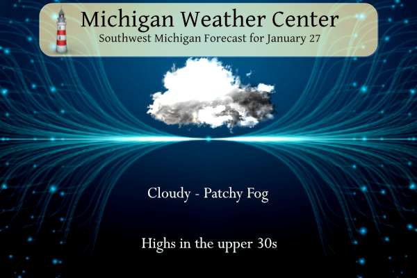
The big January thaw continues. Yesterday the official H/L at Grand Rapids was 37/34 there was 0.81” of rainfall. The day started with 4” of snow on the ground. There was no sunshine. For today the average H/L is 31/17 the record high of 62 was set in 1916 the record low of -12 was set in 2003 the record snow fall of 12.2” fell in 1967 the most snow on the ground was 27” in 1978. Last year the H/L was 35/18 there was 1.2” of snowfall and 3” on the ground. At the current time I have a temperature of 35. There are now a some bare spots in the yard.
AREA FORECAST DISCUSSION
NATIONAL WEATHER SERVICE GRAND RAPIDS MI
306 AM EST SAT JAN 27 2024

KEY MESSAGES

- LIGHT RAIN/SNOW CHANCES TONIGHT AND SUNDAY

- HIGHLY AMPLIFIED PATTERN NEXT WEEK WITH LOWER THAN AVERAGE
PREDICTABILITY

- MEDIUM CONFIDENCE IN SNOW ON TUESDAY BUT MARGINAL TEMPERATURES
SHOULD LIMIT IMPACTS AND ACCUMULATIONS
DISCUSSION

ISSUED AT 306 AM EST SAT JAN 27 2024

- LIGHT RAIN/SNOW CHANCES TONIGHT AND SUNDAY

THE LAST VESTIGES OF THE RAIN FROM THURSDAY NIGHT AND FRIDAY ARE ON
THEIR WAY OUT OF THE AREA THIS MORNING. THE UPPER SHORT WAVE
SUPPORTING THE RAIN IS STEADILY MOVING EAST, AND TAKING IT OUT OF
THE AREA. SHORT WAVE RIDGING WILL BUILD IN THIS MORNING, BUT IT WILL
NOT HAVE MUCH OF A NOTICEABLE EFFECT OTHER THAN ENDING THE RAIN.
RICH MOISTURE GETS TRAPPED UNDER THE STRENGTHENING SUBSIDENCE
INVERSION, AND CONTINUES TO WORK WITH THE EXISTING SNOWPACK TO
PRODUCE PLENTY OF FOG AND STRATUS.

WE WILL SEE PRECIPITATION CHANCES RETURN BEGINNING OVERNIGHT TONIGHT
AND LINGER INTO THE FIRST PORTION OF SUNDAY. THIS IS THE RESULT OF
THE LONG WAVE TROUGH LIFTING NE AND CLOSING OFF AS IT BRUSHES THE SE
PORTION OF THE AREA. THE PRECIPITATION WILL INITIALLY BE RAIN AT THE
ONSET TONIGHT, BUT WILL LIKELY TURN OVER TO MORE SNOW AS LOW LEVEL
TEMPS ALOFT COOL OFF A BIT, AND WHERE PRECIPITATION RATES ARE A
LITTLE BETTER.

WHETHER THIS IS RAIN OR SNOW, THIS EVENT DOES NOT APPEAR TO BE
IMPACTFUL FROM A TRAVEL STANDPOINT. SFC TEMPERATURES SHOULD STAY
ABOVE FREEZING THROUGH THE ENTIRE EVENT. ROAD TEMPS HAVE HAD A
CHANCE TO WARM UP A BIT WITH THE MILD TEMPS THE LAST FEW DAYS AND
WILL NOT HAVE A CHANCE TO COOL BELOW FREEZING FOR THIS EVENT. MODEL
ENSEMBLES AND PROBABILISTIC GRAPHICS INDICATE THAT THE HIGHEST SNOW
AMOUNTS (WHICH WOULD LIKELY BE ONLY ON ELEVATED SFCS AND EXISTING
SNOWPACK) ARE EXPECTED TO STAY BELOW AN INCH FOR THE SE AREA WHICH
HAS THE BEST CHANCE OF SNOW FOR OUR AREA. MOST OF THE RAIN AND SNOW
WITH THIS SYSTEM SHOULD MOVE OUT OF THE AREA BY LATE SUNDAY
AFTERNOON AS THE UPPER LOW LIFTS AWAY

- HIGHLY AMPLIFIED PATTERN NEXT WEEK WITH LOWER THAN AVERAGE
PREDICTABILITY

THE LARGE SCALE FEATURES AFFECTING THE WEATHER ACROSS THE CONUS NEXT
WEEK INCLUDE TROUGHS ON THE WEST AND EAST COASTS WITH AN ANOMALOUS
FULL LATITUDE RIDGE IN BETWEEN. THIS RIDGE EVENTUALLY CUTS OFF INTO
AN UPPER HIGH ACROSS CENTRAL CANADA AS THE WESTERN TROUGH GOES
NEGATIVE TILT AND EVENTUALLY MERGES WITH THE TROUGHING OR CLOSED LOW
ACROSS THE NE CONUS. THERE IS INCREASING MODEL SPREAD IN EXACTLY HOW
THIS EVOLUTION OCCURS, BUT IT APPEARS STORMINESS WILL BE LIMITED TO
A SHARP NORTHERN STREAM SHORTWAVE TROUGH BRINGING SNOW AND RAIN ON
TUESDAY.

- MEDIUM CONFIDENCE IN SNOW ON TUESDAY BUT MARGINAL TEMPERATURES
SHOULD LIMIT IMPACTS AND ACCUMULATIONS

THIS TROUGH ARRIVES MONDAY NIGHT AND TUESDAY WITH A CLIPPER TYPE LOW
DIVING IN FROM THE NORTHWEST. THE ENVIRONMENT WILL BE LACKING TRUE
ARCTIC AIR, BUT COLDER THERMAL PROFILES SUGGEST P-TYPE COULD BE
MOSTLY SNOW ALTHOUGH SURFACE TEMPERATURES WILL BE MARGINAL FOR
ACCUMULATIONS. SOME LIGHT ACCUMS ON PAVEMENT ARE POSSIBLE IN AREAS
WHERE MODERATE INTENSITY OF SNOW CAN OVERCOME SLIGHTLY ABOVE
FREEZING SFC TEMPS. THIS COULD IMPACT THE TUESDAY MORNING COMMUTE.
IT IS TOO EARLY TO PIN DOWN WHERE THIS WILL BE MOST LIKELY.
Detailed Forecast For Grand Rapids
Note there is a Flood Watch
Grand River near Comstock Park affecting Kent County.
Wasn’t there supposed to be blow torch starting last Monday?? Just curious 🤔….Looks like February maybe obove average snowfall to here it comes again. Rock n roll will never die….INDY
.
Yes some blow torch? Temps mid to upper 30’s and a rain snow mix next week! Wow! Some people never learn!
Yes, it’s been extremely mild. January is now finishing warmer than average.
Yes, Indy definitely not a blow torch, just some slightly above normal temps! What happened to temps in the 50’s they were hyping? Nowhere to be found! Who would have thought?
41 degrees here and the snow is all but gone, except for the piles. Not hardly a breeze today. The birds seem to be active.
Well my suspicions were correct. We have an ice blockage in Portland on the Grand River.
Not surprising considering all the snow and ice melt! Hopefully it won’t lead to some flooding.
Speaking of SNOW, the second week of Feb we will be making the transition back to colder and snowier! Rock n roll baby! I love it!