Today is the anniversary of the blizzard of 78 also known as the Clevland Superbomb which I remember well. More info is in the Weather History section.
We have had 3.18 inches of rain and melted snow so far this month in Otsego. The snowpack is becoming a slushy mess and the mud is sure to come soon. Below is the hydrological outlook posted yesterday by the NWS.
...Rising river levels and shifting river ice by this weekend...

Significant snowmelt is making for a sloppy mess across much of
southern Lower Michigan. Another round of rain moves into the area
after midnight tonight and will drop between 0.50 and 1.00 inches of
rain over the Grand and Kalamazoo River basins. As this rain and
snow melt eventually finds its way  into our rivers, we`ll see
noteworthy rises on the smaller streams and even on some of the
bigger rivers. This will be especially true along the Grand River
and the tributaries that flow into the Grand River around the
Lansing area.

Currently, we are expecting water levels on the Red Cedar, Looking
Glass, and Maple Rivers to rise to bankfull, and may even approach
minor flood levels this weekend. By early next week, this water will
be moving down the Grand River and may cause water to rise above
bankfull around Comstock Park.

The cold snap last week resulted in ice coverage on parts of the
Grand River, but this ice is weakening steadily with warmer
temperatures and light rain. This ice may start to shift and move as
the water starts to rise this weekend. While this creates a risk for
ice jams, the current threat level for this remains fairly low since
the ice never got very thick and is already losing considerable
strength. However, now is a good time to look around your yard,
collect loose items, and prepare for the upcoming rising water
levels.

This outlook means that elevated water levels and potential impacts
are possible, but not yet certain. Persons with interests along area
rivers should closely monitor the latest forecasts.
Forecast
Weather History
1967: Temperatures in the 20s are some 40 degrees colder than the day before, and heavy snow begins falling, piling up a foot or more along with increasing winds.
1978: A storm known as the Cleveland Superbomb moves north from the Gulf of Mexico and deepens explosively, becoming one of the worst blizzards in Midwest history. From one to two feet of snow falls across southern Lower Michigan, whipped into huge drifts by strong gusty winds. Several new records were set including a new record low sea level barometric pressure of 28.68, observed at 6:00 AM. At least 9 deaths were attributed to the blizzard, most roads were impassable, roofs collapsed under the weight of the snow, and the airport in Grand Rapids was closed from late on the 25th until the 27th. Governor Milliken declared a state of emergency and requested additional federal aid for snow removal.
On January 26, 2021, a low-pressure system brought widespread snow to the region with 3 to 5 inches observed north of I-69. Much of this occurred during the morning commute with visibilities dropping to around a quarter mile and snow quickly accumulating on the roads.
On January 26, 1978, a blizzard hit southeast Michigan. This caused the lowest all-time pressure to be recorded in Detroit: 28.34 inches!
U.S.A and Global Events for January 26th:
1700: A powerful earthquake struck the Pacific Northwest along the Cascadia Subduction zone. The estimated moment magnitude of 8.7-9.2 caused about a 1,000-kilometer rupture from mid-Vancouver Island to northern California. The ocean floor heaved upward approximately 20 feet, and within 10-20 minutes, a giant wave, 30-40 feet high, reached the shore. The earthquake caused a tsunami, which struck the coast of Japan. Click HERE for more information from Science on a Sphere by NOAA.
1772: Possibly the greatest snowfall ever recorded in the Washington DC area started on this day. When the storm began, Thomas Jefferson was returning home from his honeymoon with his new bride, Martha Wayles Skelton. The newlyweds made it to within eight miles of Monticello before having to abandon their carriage in the deep snow. Both finished the ride on horseback in the blinding snow. The newlyweds arrived home late on the night of January 26th. In Jefferson’s “Garden Book,” he wrote, “the deepest snow we have ever seen. In Albermarle, it was about 3. F. deep.”
1937: The wettest month ever in Cincinnati, Ohio, is January 1937, when 13.68 inches fell. Their average January amount is 3.00 inches of precipitation. The overabundance of precipitation over the Ohio River basin caused near-record to record flooding in Ohio, Indiana, Illinois, and Kentucky. On this day, the river gauge reached 80 feet in Cincinnati, the highest level in the city’s history. The Ohio River reached 57 feet in Louisville, Kentucky, on the 27th, setting a new record by ten feet. Seventy percent of the city was underwater at that time. The NWS Office in Louisville, Kentucky, has an informative webpage on this event.
Forecast Discussion
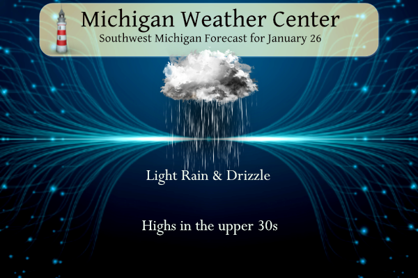
- Rain into tonight, then fog possible

Widespread light to moderate rain shrouds the area this morning, and
is expected to last into this evening. The more steady rain of this
system is over the area at this time, with the heaviest rains
occurring over the southern portion of the area as expected. This
more widespread rain is associated with the nose of the low level
jet just south of the area, and with the sfc low tracking in a
similar fashion.

The rain is expected to stick around much of the day, although it
will diminish in intensity a bit. We lose the low level jet forcing
and the sfc low by 12z. However, the way that the upper wave evolves
over the area, an elongated upper and sfc trough will linger back to
the west through this afternoon. We will see the rain continue, but
the best rain will likely migrate North a little to be concentrated
closer to the I-96 corridor.

There looks to be a short break in the rain, or tapering off of the
rain late this afternoon. This would be when the trough from this
morning moves entirely east of the area, and out ahead of the next
trough that will arrive here. The rain this evening should even be
lighter as we lose the better moisture from the earlier system.
There is a smaller chance that as the rain comes to an end by late
evening, the NE portion of the area toward Clare could see the rain
mix with some snow as the low level thermal profiles become marginal
for some light snow in the higher elevations.

This rain moves out, and we end up under a very light wind regime
for the overnight hours. With plenty of boundary layer moisture, fog
is looking more likely to develop and potentially become locally
dense. This will linger into Saturday morning and gradually
dissipate. Low clouds will likely linger for Saturday as moisture
gets trapped under ridging building in.

- Rising rivers and localized minor flooding remain possible

Significant snowmelt is ongoing, and is making for a sloppy mess
along and south of I-96. A 3rd and final round of rain is expected
today, and will significantly increase the amount of water
journeying toward our beautiful West Michigan creeks, streams, and
rivers. All rivers in the Grand and Kalamazoo basins will see
increases in water levels, but no widespread flooding is expected.
Rather, the most likely locations to reach minor flood stage over
the next few days (depending on exactly how much rain ends up
falling) are the smaller "tributary" streams in the Lansing area
that flow into the Grand River. Specifically, the Looking Glass at
Eagle, Maple River at Maple Rapids, and the Red Cedar River at East
Lansing. At the very least, these rivers will be rising to near
bankfull by early this weekend. Those with interests in these areas
should prepare now for rising water.

Eventually all this water will find it`s way downstream in the Grand
River. Comstock Park is particularly flood-prone, and by early next
week we could be seeing conditions above bankfull in that area, but
much will depend on how much of the snow melts tonight as well as
how much rain falls across the multi-county upstream area.

An additional factor to consider in all of this is the ice that
formed during the cold snap and persists across parts of the Lower
Grand river. Ice jams are always a risk during these warmups and
rain events, but the risk is lower than average this time for 2
reason. First, the ice likely didn`t get as thick/strong as it
sometimes does - largely because our cold snap was ultimately a
fairly short period of time. And secondly, the warmup has been
fairly gradual - giving the ice time to adjust and weaken in advance
of rising water levels. So while we do expect most or all of the ice
in the Grand River to be gone by next week at this time, early
indications are that the ice won`t have enough strength left to
cause much of an issue by the time it is forced to move.

- Low confidence for rain/snow on Sunday

The northern edge of the precip shield associated with an area of
mid-level frontogenesis is expected to pass close to or over the
southern forecast area with rain or snow Saturday night into Sunday.
Precip is expected to be light and skin temperatures only marginally
cold for any accumulations. At this point no travel impacts are
expected.

- Medium confidence for snow/rain Tuesday. Some travel impacts
possible.

A clipper type low associated with a sharp northern stream shortwave
trough arrives Monday night and Tuesday from the northwest. Although
the environment will again be lacking true arctic air, colder
thermal profiles suggest this could be a mostly snow event. Once
again, surface temperatures will be marginal for accumulations
although it could be cold enough Tuesday morning for some light
accums on pavement, which would impact the morning commute.
Still 53 of winter left! The warm weather nuts act like winter is over! How wrong can they be? Wait until the next snowstorm hits! It will be awesome! Incredible!
Anyone seen the ice jam pictures from Illinois? The overhead wide angle drone shot shows the water up to the bottom of the I-55 overpass with traffic still flowing across is. Scary picture. If it goes any higher that freeway will be shut down. Imagine the force being exerted on that bridge.
Nothing really surprising, but interesting data, nonetheless:
https://www.mlive.com/weather/2024/01/seasons-snowfall-is-not-adding-up-across-michigan.html
A “one snowstorm” winter with below average snowfall everywhere. I love it!
More than enough Winter on the way for everybody.
We’ve only had two weeks of winter so far, and the next 10 days look great, so any winter we do get should be a cake walk.
The warm weather nuts are in constant denial and declared winter over even before it started!
Fantastic looking 10 day!! High temps near to above 40 every day! What could be better??
https://weather.com/weather/tenday/l/b523690bfd952b86fef3627c919dd9855281a8da16b83c10bdd381c64ae12cbc
Great News>>>> still 53 days of winter left, so tons of time for more Cold and Snow! We will be seeing at least two more cold snaps and at least 2 more major snowstorms! The warm weather nuts are still living in fantasy land! Some things never change!
Fantasy would be calling for a snowstorm this weekend and saying temps were going to turn colder at the end of January. Yikes.
lol! We’re living in Fantasy Land?!?!! This has literally been a two week winter that started in mid-January. LOL!! Hell, I can look outside my window now and see the grass patches getting bigger & bigger! BRING ON SPRING!
Too funny – you guys just don’t get it! WOW, just wow, WOW! !
It rained hard here overnight. The rain hitting the roof woke me up. Not a whole lot of snow left here – think more green than white.
While there has been a lot of snow melt here the ground is still mostly covered and there is a good 2 to 3″ still on the ground. And of course the snow piles.
Slim
Just over 1 month to March… getting closer. It does look warm for the first half of February, I’d imagine we will get 1 more cool spell before the season starts to wrap up
Meh…Lets keep the warmth going through May!
I remember it well. December 16th, 2021. Less than 10 days before Christmas, and we hit a summery 63 degrees. And who can forget March 2021 when most of the month was in the 50’s, 60’s, and 70’s? The good ‘ol days!
Who wouldn’t want summer temps in March???
Another thing to point out is it’s Michigan’s birthday today. Happy birthday, Michigan! Lookin good at 187 years old!
Eeeee Eeeee blowtorch warning remains in effect. Get ready for even warmer temps the next 2 weeks!
WOOD says no cold and no significant snow in sight! What could be better at what is supposed to be the heart of winter?
I love 2 week winters!
Bring those on every year!
Next in the sequence from the historic 2013-2014 is the Storm team 8 broadcast from 1/26/2014. The dump of Arctic air has arrived here. This day a clipper system overperformed and the expected 1” turned into more than that (4” Grandville). Keep in mind this was coming off 3 days under and winter storm warning. Advisories were posted for the clipper and additional lake effect. Also wind chill alerts were in place e for wind chills as cold as -40. The 11pm broadcast captures it best.
6pm broadcast:
https://m.youtube.com/watch?v=yLrrGlHv7ts&pp=ygUYc3Rvcm0gdGVhbSA4IGphbiAyNiAyMDE0
11pm
https://m.youtube.com/watch?v=iFtu2qwMmnA&pp=ygUYc3Rvcm0gdGVhbSA4IGphbiAyNiAyMDE0
Maybe I should start posting about all the warmth and lack of winters we’ve seen lately 😉
I honestly really don’t care what you do. Go for it.
Who in their right mind would want rain and temps in the mid 30’s? Give me SNOW over a cold rain any-day, everyday and always! Give me a break!
I thought you loved cold, rainy days in April & May??
The sales of seasonal affective disorder light lamps sent to Mi must be going through the roof,,,
Sun, what sun! I don’t mind no sun with fresh snow on the ground but, thick cloud cover, light rain and temps in the mid 30’s is pathetic! Bring on the snow!
The January thaw continues. The official H/L yesterday at Grand Rapids was 38/33 there was 0.14” of rain fall and at 7AM there was 6” of snow on the ground. There once again was no sunshine. For today the average H/L is 31/17 the record high of 62 was set in 1944 and the record low of -9 was set in 1927. The record snow fall was 16.1” set in 1978 that is also the record for a calendar day at GR. The most snow on the ground was 19” in 1979 and 1963. Last year the H/L was 33/27… Read more »