The SPC did a good job in their forecast for severe weather yesterday. Thunderstorms developed over eastern Allegan County and moved across the state prompting thunderstorm warnings. The most intense was around the Lansing area with multiple hail reports. Our high yesterday was 71° with .61 of an inch of rain in Otsego.

Here is the summary of the severe weather that went through yesterday. A line of showers and thunderstorms moved through the region that brought damaging wind and hail, the largest of which was half-dollar-sized hail in the Lansing area.
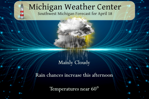
NWS Forecast
We will see some sun this morning but it will cloud back up by noon with showers moving in during the afternoon. The rain ends tonight as the low-pressure system pushes east of the area. Northwest winds on the backside of this system will draw down a cooler air mass for the end of the week.
Weather History
1880: A tornado struck Chester, in Eaton County where barns were destroyed and livestock was killed. A quarter-mile-wide swath of trees was leveled in a forest by the tornado.
On April 18, 1975, 2.69 inches of precipitation fell in Flint. This is the maximum precipitation record for April in Flint.
1880: More than two dozen tornadoes were reported from Kansas and Arkansas to Wisconsin and Michigan. More than 150 persons were killed, including 99 people in Marshfield, Missouri.
1906: At 5:12 AM, a magnitude 7.8 earthquake hits San Francisco. A devastating fire soon broke out in the city and lasted for several days. About 3,000 people died, and over 80 percent of San Francisco was destroyed. For more information from the USGS.
Forecast Discussion
- Rain Showers Tonight into early Friday

The day starts out dry as mid-level shortwave ridging traverses the
area. A few showers are then possible in the afternoon with highs
today ranging from the mid 50s for our northwest CWA to the mid
60s for our southeast CWA.

More widespread rain is expected tonight into early Friday morning
as a surface low tracking to our southeast and a 700mb shortwave
supports robust low-level FGEN banding across our area. As this
banding comes into focus, QPF forecasts have been trending upward,
with a general 0.2-0.5 inches of rain expected and locally higher
amounts possible. Isolated thunder is possible near I94 as LI values
approach zero or go slightly negative tonight. However,
instability has trended down over the last 24 hours and with it
thunder chances.

Overall, this is a pretty progressive system with showers clearing
the area near sunrise Friday morning. As surface and upper-level
ridging and associated dry air slide in behind the showers,
Friday should feature ample sunshine. Model RH forecasts suggest a
pocket of mid- level moisture may keep some mid-level clouds in
place across Central Michigan while a few cirrus clouds may sneak
into southern Michigan but overall mostly sunny to sunny skies are
likely with highs in the 50s.

- Cold Pattern For the Weekend

Northwest flow at 850 mb prevails Saturday sending temperatures down
to well below normal values.  The 850 mb temperature anomaly reaches
13 degrees below normal during the day.  The thermal trough at this
level pushes through during Saturday, with temps bottoming out at
around -9 deg C.  These values will hold daytime highs in the 40`s.
There might be some lake effect clouds around as the delta T values
suggest some lake moisture may get drawn into the cool air mass.
Water temps were 4 to 6 deg C. Temps start to rise Sunday with
850 mb values climbing to around 0 deg C by evening. This will
allow for max surface temps to make a run above 50 degrees if we
can mix to that level. Overnight lows will likely dip below
freezing for inland locations Saturday night and possibly Sunday
night.

- Rain showers for Tuesday

A digging mid level shortwave arrives Tuesday.  This feature will be
generating precipitation during the day.  Models do vary on the
track of this wave.  The GFS is further south and allows for enough
cold air to filter into the north side of this system to lead to
some snow over our northern zones.  We are not ready to include that
in the forecast.  However the incoming ECMWF is sending temperatures
lower Tuesday afternoon/evening and ensemble temperature trends in
the models are lower.  We will lower max temps on Tuesday to try and
capture the trends.
Whew!! Gotta take a break from golf this weekend! Too many great golf days to count already this year, need to focus on some indoor projects this weekend!
More horrible golf weather is on tap this weekend! 20 to 40 mph winds all weekend with wind chills in the 30’s and 40’s! WOW, just wow, WOW!
From TWC. Looks like this could be a hot summer: https://weather.com/forecast/national/news/2024-04-16-summer-temperature-outlook?cm_ven=dnt_social_facebook&fbclid=IwZXh0bgNhZW0BMQABHabZ8cvymI-AmDNSl-Tpl6a-ShelCifPQh9_GxseKW4uFcdZPrMPoSgIEA_aem_ATItp_-ELW53wHIBpulx3vtIk4ELUzGQX8xWUVoTW3L5Ut6WHy8e2GOX5d4Knzulxfo
BRING IT!!
I just looked at a site that combines the long range guess from ECMWF, UKMO, and NMME models. They say “We like using different forecasting systems, as it helps us to see more potential scenarios and see how well the models agree on a certain outcome.” Now while many things can still change the general trend is for a warmer and dryer summer season.
Slim
The warmth just keeps going as the cold weather crazies keep trying to tell themselves that our 3 week winter didn’t die months ago!
A little sample of the adverse effects of governments intervening in climate and weather. The results can be catastrophic!
https://www.bnnbloomberg.ca/dubai-grinds-to-standstill-as-cloud-seeding-worsens-flooding-1.2059771.amp.html
Are you really that ignorant? Unbelievable ignorance!
https://www.nbcmiami.com/news/national-international/what-is-cloud-seeding-dubai-floods/3288670/?amp=1
Nope, they have been cloud seeding for a while there and catastrophes can happen like this when you meddle in natural processes. Of course NOAA was quick to jump in and say nothing to see here, it’s climate change! They get more federal funding by pushing the narrative.
Wow, too funny! You really have crawled down the rabbit hole! You have my condolences!
Nope, just putting out the truth!
Too funny ! Truth? More like ridiculous conspiracy theories! Ignorance off the charts!
We have average highs in the 60s stating tomorrow through mid-October. So the “warmest” 6 month period is about to begin. I think we are safely finished with the snow (besides some crazy random 1 day event)
The official H/L yesterday at Grand Rapids was 69/51 there was 0.43” of rainfall. The sun was out just 4% of the time. The average wind speed was 15.8 MPH and the highest wind was 45 MPH out of the W. For today the average H/L is 59/38 the record high of 86 was set in 1973, 2002 and 2004. The record low of 22 was set in 1926 and 1983. The most rainfall of 3.30” fell in 2013 and the most snowfall was 3.0” in 1912 the most on the ground was 2” in 1961. Last year the H/L… Read more »
The storm yesterday produced heavy rain, gusty winds, and small hail. Low level severe. Agreed, the forecast was pretty darned accurate.
1/3 of the days this month have been in the 70s. I think it’s a safe bet that this month will again finish above average. I think we’ve only had one month in the past six or so months that has been below average. That’s a remarkable long term pattern.
It has been a mild pattern that we have been in for some time. I am sure it will end it is just a matter of when. As for yesterdays severe weather the line of storms did intensify as they move east of Grand Rapids. Here in my back yard there was heavy rain, some wind, no noted thunder or lightning. GRR did report a thunderstorm but that only needs one detected lightning event. So severe storm in NW Grand Rapids well not so much.
Slim
Get ready for another cold, windy, below normal temp weekend! Incredible!
It looks to turn colder this weekend and into next week for sure. But the fact remains that this month has a current mean of 50.2 that is a departure of +5.3
Slim