
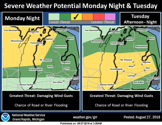
We begin the work week adding some rain and storms into the mix of heat and humidity. Our best chance of storms will come later today through Thursday. [columns] [span4] [/span4][span4] [/span4][span4] [/span4][/columns] There is a marginal risk of severe weather this afternoon. The main threats will be damaging winds and locally heavy rains. There […]
Wild night From Grand Rapids to the north. WOOD is reporting power outages from winds. A 66 mph gust was recorded at Muskegon, a 55 mph gust at Grand Haven and 53 mph south of Fremont. Consumers outage map can be found here. As of 6:30am these are the reported outages: Ionia County: 982 Kent […]
This is the day one outlook from the SPC, it is linked back the the SPC site so it should update if it changes. It shows we are in the marginal risk for storm activity. Marginal, Slight, Enhanced, Moderate, and High risks represent progressively larger threats for organized severe storm episodes. These risks, along with […]
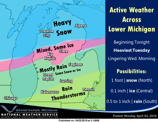
Hope you all had a good Easter/April Fools Day. Though it was cool and breezy outside most of the time was spent in fellowship inside. Depending on where you live in the state today will probably be the warmest day of the week – unless you live in south southern Michigan. Tuesday is going to […]

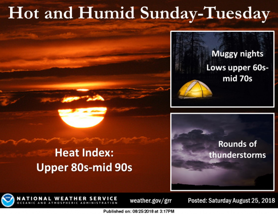
We have a very warm and moist airmass heading into Michigan. There is a flood watch through 5pm Wednesday for most of the state with perhaps record setting temperature and rainfall amounts. 1 to 3 inches of rain is expected from today through Wednesday morning. Locally higher amounts are likely. As the Gulf moisture continues […]