
We begin the work week adding some rain and storms into the mix of heat and humidity. Our best chance of storms will come later today through Thursday.
[columns] [span4]
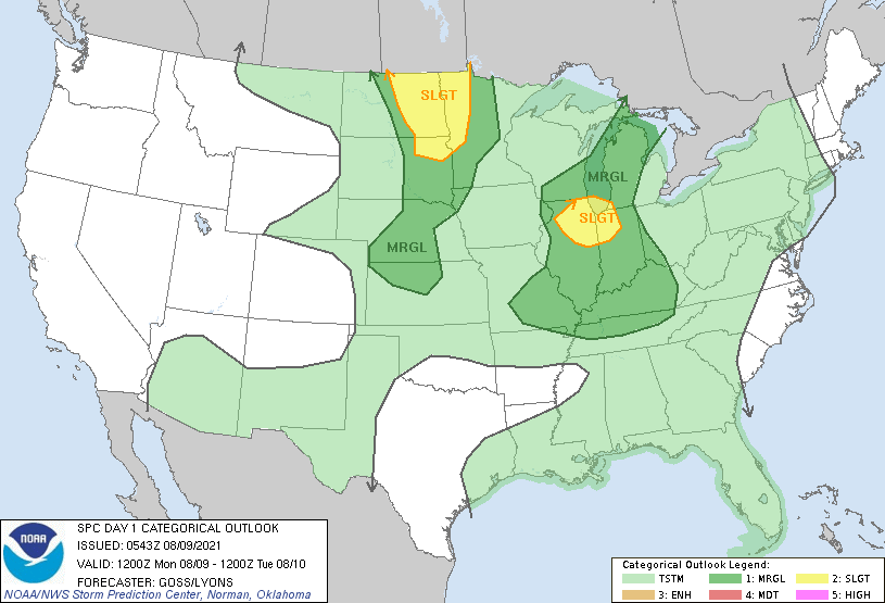
Day One
[/span4][span4]
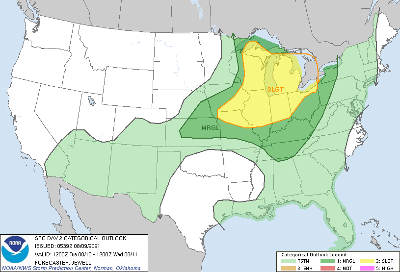
Day Two
[/span4][span4]
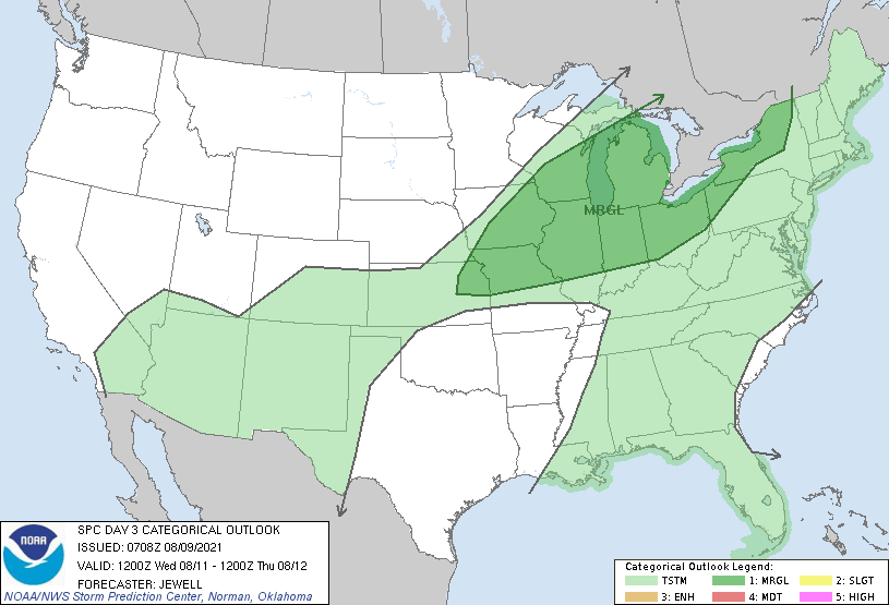
Day Three
[/span4][/columns]
There is a marginal risk of severe weather this afternoon. The main threats will be damaging winds and locally heavy rains. There is a slight risk of severe weather Tuesday evening. The main threats will be damaging winds and locally heavy rains.
There is a marginal risk of severe weather Wednesday. The main threats will be damaging winds, large hail and locally heavy rains. Severe weather is also possible on Thursday as a cold front moves through. The main threats will be damaging winds, large hail and locally heavy rains.
This is the NWS outlook for the workweek:
Forecast Discussion
We are in a Marginal Risk of severe weather this afternoon and a
Slight Risk on Tuesday afternoon/evening. Similar environmental
conditions for both events although the shortwave trough on
Tuesday is a bit stronger and storms may be more widespread. The
main threat will be downbursts from collapsing rain/hail cores in
multicell pulse type storms as deep layer shear is relatively
weak, but instability is impressive. CAPE values are forecast to
be around 2500 J/kg this afternoon and around 4000 on Tuesday
afternoon. Rain rates may be excessive given precipitable water
values close to 2 inches.

The Wednesday/Thursday time frame will see the continuation of the
threat for severe storms as upper trough axis moves into eastern
Canada with a belt of strong westerlies across the Great Lakes and
a surface cold front advancing into the steamy airmass.

A welcome cooler and drier airmass moves in for the end of the
week with dew points in the much more comfortable 50s over the
weekend as Canadian high pressure brings fine weather.
Not a drop of rain here yet today.
Can you say another rainfall forecast bust? Horrendous!
It is warm and humid here today here is the 4 pm readings from GRR
Humidity 79%
Wind Speed S 15 mph
Barometer 29.90 in (1011.9 mb)
Dewpoint 71°F (22°C)
Visibility 10.00 mi
Heat Index 80°F (27°C)
Last update 9 Aug 3:53 pm EDT
Here at my house it is cloudy and t 80 with a dew point of 72.
Slim
So the dew point in GR yesterday was higher than Ft Myers. Yup, thicker air here than in Florida. Yuck.
In Florida the closer you are to the Gulf the more humid it can be. Yesterday at Page Field (that airport is on US 41 just south of town) there the highest DP yesterday was 78 vs 75 at GR but the highest heat index was 106 vs 94 at Grand Rapids. The dew point was lower at Southwest international airport there but before the storms moved in at 10 am the temperature was 88 with a dew point of 74 and a heat index of 97. At 4 pm the Page Field temperature was 90 with a dew point… Read more »
Big cold front coming through this week! Get ready for low dew points and highs in the upper 70’s! Fantastic! It has been a summer with no heat waves! Who would have thought?
The overnight low here at my house was 73 at the airport they reported a overnight low of 70. At this time it is cloudy and 77 here with a dew point of 71. The last reading at GRR was 75 with a dew point of 71.
Slim
While not all that hot it has been very humid for the last 3 days. At Grand Rapids the dew points have been in the upper 60’s to as high as the mid 70’s over the last 3 days. The dew points at GRR have been a few degrees higher than other locations around the area. As I said while the humidly has been high the air temperatures have not been that high. The warmest accrual air temperature has been just 87 the highest dew point at Grand Rapids so far has been 75 and the reported highest heat index… Read more »
Phew! 72 degrees for a low yesterday. The heat and humidity is back on.