The Longest Days
June 19th 20th and 21st are the longest days of the year. Well not the longest days but the days with the longest amount of daylight. The sun is above the horizon for a total of 15 hours 21 minutes and 26 seconds at Grand Rapids. At Sault Ste Marie it is 15Hours 49 minutes and 36 seconds and at Detroit it is 15 hours 16 minutes and 52 seconds. The Earth is now at 94.438 million miles from the sun. This year the summer solstice is on June 20th at 11:32 pm EDT.
Here is some more information on the summer solstice. For those of us in the Northern Hemisphere, Earth is tilting mostly toward the Sun. As seen from Earth, the Sun is directly overhead at noon 23.5 degrees north of the equator. For those who live in the Southern Hemisphere, this is the shortest day of the year and the arrival of winter. The solstice happens at the same moment for everyone, everywhere on Earth. The term “solstice” comes from the Latin words sol (sun) and sistere (to stand still). At the solstice, the angle between the Sun’s rays and the plane of the Earth’s equator (called declination) appears to stand still. This phenomenon is most noticeable at the Arctic Circle where the Sun hugs the horizon for a continuous 24 hours, thus the term “Land of the Midnight Sun.”
On June 20th the average H/L at Grand Rapids is 81/60. the record high a hot 102 was set in 1953 it has been 90 or better a total of 19 times. The last time was last year with a high of 91. The record low is a cool 41 in 1970. The coolest high 63 was in 1917. It has failed to reach 70 in 10 years the last time was in 2014 when the high was only 68 The warmest minimum was also set in 1953 when the low was a warm 79. It has stayed above 70 in 5 years the last time was in 2012. Up at the Sault the record high for June 20th is 92 set way back in 1893 a high of 88 was recorded in 2012. In 1916 and 1917 the reported high at the Sault was just 48. It did not reach 60 in a total of 12 years. The record low for June 20th is 32 set in 1969. Last year the H/L at the Sault was 85/58.
I hope everyone gets out and enjoy the long days of summer as soon enough we will be heading into the fall and then winter season. Of the seasons I like summer the most by far. I would not mind if it stayed in the 75 to 80° range for highs and lows in the low to mid 60’s all year long. While it looks to stay warm this weekend there are good hints that the start of summer on Monday and Tuesday will be on the cool side.
Slim
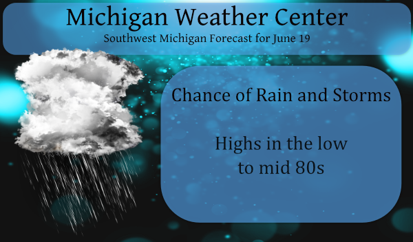
Keep in mind we have a marginal severe weather outlook for today and we are in the slight risk area for tomorrow.
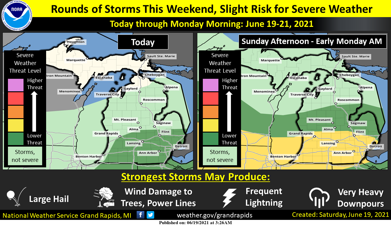
We are expecting a few rounds of showers and storms over the weekend and into Monday morning. The first round is expected between this morning and late this afternoon, and the second should occur between late Sunday afternoon and early Monday morning. A few severe storms are possible during each of these rounds. The biggest concern is small pockets of damaging winds, which could take down a few trees and power lines, and large hail. Heavy downpours are also possible. The risk for severe storms is mostly for Southern Lower Michigan.
Well, this is much more interesting as compared to the last forecast discussion.
https://forecast.weather.gov/product.php?site=GRR&issuedby=GRR&product=AFD&format=CI&version=1&glossary=1
Well…thanks for the 2/10 of an inch, from the final cloud. Solstice already?…great…time to start prepping for Winter then. Life in the Southern Arctic.
Light rain on and off this morning. Windy and pouring now. The length of my lawn has doubled in the past 48 hours.
Ada received a “trace”. Rain falling apart as usual, in it’s approach to Ada. Sprinklers on.
Received just over .75 this morning. So far this month 3.51. Avg June rainfall Grand Junction is a little bit better than that. 3.54. Pasture is starting to perk up. 1st cutting hay was a little better than I expected.
Closed in on the 1-inch mark for rain today which gives us nearly 2.5 inches for the month which is as much as we had in April and May combined.
So far only 0.02″ of rain here today. Cloudy and a cool feeling 66 here at this time.
Slim
Woo woo even know summer is in full effect we start losing daylight all the way to September now bring on Fall ….INDY …
We start losing daylight after Monday and that lasts all the way to December. It is a annual trend.
Slim
* Special Marine Warning for…
Nearshore and Open Waters from St Joseph to Holland MI…
* Until 1015 AM EDT.
* At 815 AM EDT, strong thunderstorms were located 30 nm west of
Saugatuck, and near Milwaukee Wisconsin, moving southeast at 35
knots.
HAZARD…Wind gusts 34 knots or greater and large hail.
SOURCE…Radar.
IMPACT…Small craft could be damaged in briefly higher winds and
suddenly higher waves. Large hail could result in
structural damage.
Light to moderate rain in Otsego – closing in on .50 of an inch at 7:55. Our overnight low was 62.
The overnight low here was 63 at this time it is cloudy and 65.The official overnight low at GRR so far has been 65. There are a lot of clouds to the south of here and there was a red sunrise and there is some rain off to the west and southwest of GR. So far this month the mean is 72.4 that is good for a departure of +5.1 so the month is still well above average in the temperature department. The official rain fall for the month at GRR is now at 1.30″ and that is below the… Read more »