Strong El Nino to La Nina
We had a strong El Nino this past winter and it sure did show it. At Grand Rapids the mean for December 2023 was 38.3° that is a departure of +7.9° There was just 1.3” of snowfall. December 2023 was the 2nd warmest on record and that 1.3” of snowfall was the 2nd lowest for any December. January had a mean of 27.1 that was a departure of +2.3° There was 31.3” of snowfall that mostly fell in a 12-day stretch. February seen a mean of 35.4 that was a departure of +8.8° and that was a new record for the month. The high on February 27th of 73 set a new record high for any day of February at Grand Rapids it was the 1st time it has reached 70 or better in February. March continued the mild side with a mean of 40.9 that is good for a departure of 5.2” of snowfall.
At the current time it looks like we will be heading towards a La Nina this winter. In the past, going back to 1950 there have been 5 years when we went from a strong or very strong El Nino to a La Nina during the summer season 1988. 1973, 1983. 1998. And 2016. 2024 with be the 6th one. The summer of 1988 had many very hot days with 37 days of 90° or better the most ever at Grand Rapids but with mostly dry air the nights were not that warm so the summer mean of 72.1° was +1.2 above the summer average of 70.9. The summer of 1973 was also warmer than average with a mean of 71.6.. 1983 had a 3 month mean of 71.5 (+0.6). 1998 The summer of 1998 had a 3 month mean of 70.6 (-0.3). 2016 The summer of 2016 had a June, July, August mean of 72.7(+1.8) 4 of the 5 past times we went from El Nino to La Nina the summers were warmer than average.
As for the winter in the La Nina stage after a strong or very strong El Nino. The winter of 1973/74 had a December, January, February mean of 24.3°. snowfall for the season was just 64.4”. The winter of 1983/84 had a winter mean of 23.4° For the season there was 71.4” of snowfall. The winter of 1988/89 had a winter mean of 25.8°. That season had a total of 62.2” of snowfall. The winter of 1998/99 had a winter mean of 28.6° snowfall for the season was 76.7”. December 2016 had a mild mean of 30.4° season had 60.7” of snowfall. The 30-year December, January, February mean at Grand Rapids is 27.3°. The average snowfall at Grand Rapids for the season is 77.6”. This past winter the winter mean was 33.6° and there was just 47.5” of snowfall of that 31.3” fell in January. The past 5 times there was a strong El Nino to La Nina the summer mean was 71.7 or +0.8 and the winter after had a mean of 26.5 or -0.8.
The official H/L yesterday at Grand Rapids was 57/45 there was 0.12” of rainfall the sun was out 22% of the time. It was a very windy day with the highest wind of 53 MPH out of the NW there were around 60,000 customers without power yesterday afternoon. For today the average H/L is 57/36 the record high of 80 was set in 1941and 2023 and the record low of 16 was set in 1957. The most rainfall of 1.09” fell in 1983 the most snowfall of 2.8” fell in 1962 the most on the ground was 1” on several years the last time was in 2007. Last year the H/L was that record high of 80 and a low of 56.
AREA FORECAST DISCUSSION
NATIONAL WEATHER SERVICE GRAND RAPIDS MI
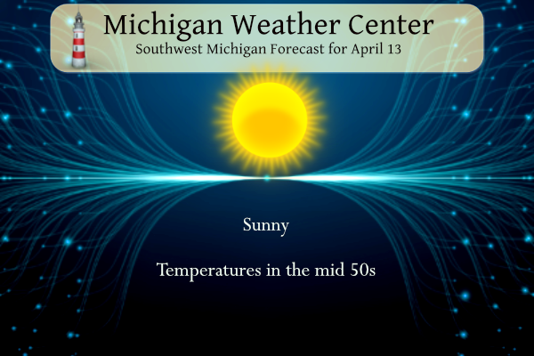
316 AM EDT SAT APR 13 2024
KEY MESSAGES
– SUNNY TODAY/SUNDAY, CHANCE OF RAIN/STORMS TONIGHT NORTH.
– WARM TEMPERATURES EARLY NEXT WEEK, BUT TURNING STORMY
– COOLER WEATHER WITH A CHANCE FOR SHOWERS LATE NEXT WEEK
DISCUSSION
ISSUED AT 316 AM EDT SAT APR 13 2024
– SUNNY TODAY/SUNDAY, CHANCE OF RAIN/STORMS TONIGHT NORTH.
HIGH PRESSURE IS SETTLING IN OVER THE STATE. LATEST IR LOOP SHOWS
CLEAR SKIES ACROSS ALL BUT THE FAR NORTHERN PORTION OF THE LOWER
PENINSULA. WE’LL SEE ABUNDANT SUNSHINE TODAY AND NEAR NORMAL HIGHS
IN THE MID 50S.
THE RIDGE WILL FLATTEN OUT A BIT TONIGHT AS A SHORT WAVE MOVES
ACROSS NORTHERN LOWER. A 45 KT LLJ WILL SUPPLY SOME MOISTURE AHEAD
OF THE SYSTEM. ELEVATED LI’S FALL TO AROUND -4C WHILE MUCAPE
CLIMBS TO NEARLY 1K J/K OVERNIGHT ACROSS THE NORTHERN HALF OF THE
CWA. NOT A LOT OF SURFACE-BASED INSTABILITY, THOUGH. THE NORTHERN
HALF OF THE CWA WILL BE FAVORED FOR PRECIPITATION. THIS IS A QUICK
HITTING SYSTEM AND WILL BE OUT OF THE CWA BY SUNDAY MORNING.
HIGH PRESSURE WILL QUICKLY BUILD INTO THE REGION AGAIN LEADING TO
SUNNY SKIES SUNDAY. H8 TEMPS RISING TO AROUND 12C SHOULD SEE
SURFACE TEMPERATURES CLIMBING INTO THE 70S.
– WARM TEMPERATURES EARLY NEXT WEEK, BUT TURNING STORMY
UPPER RIDGING EARLY NEXT WEEK WILL BRIEFLY TAKE HOLD OF THE REGION,
ALLOWING FOR MILD TEMPERATURES TO STICK AROUND FOR A FEW DAYS. NBM
GUIDANCE CURRENTLY FAVORS HIGHS IN THE MID 60S TO AROUND 70 MONDAY
THROUGH WEDNESDAY. BY TUESDAY, ENSEMBLE GUIDANCE AND DETERMINISTIC
MODELS CONTINUE TO INDICATE AN UPPER LOW DEVELOPING ACROSS THE
CENTRAL PLAINS AND MOVING INTO THE MIDWEST. AT 500 MB, A SPLIT FLOW
PATTERN IS INITIALLY FAVORED ACROSS THE MIDWEST BUT EVENTUAL PHASING
OF THE UPPER LOW WITH ANOTHER UPPER LOW DIVING SOUTHEAST OUT OF
ALBERTA IS LIKELY TO OCCUR WEDNESDAY. EARLIER GUIDANCE SHOWED THIS
PHASING AND DEEPENING OCCURRING QUICKER AND FURTHER NW OF OUR
REGION, AND CURRENT GUIDANCE INDICATES THIS PHASING MAY OCCUR
SLOWER, AND AS A RESULT THE ASSOCIATED SURFACE LOW IS A BIT SLOWER
TO ARRIVE AND FURTHER SOUTH AS WELL. THE TRANSLATION HERE IS THAT
PRECIPITATION MAY NOT BEGIN UNTIL LATER TUESDAY AND COULD LAST
THROUGH LATE IN THE DAY WEDNESDAY.
INCREASING CLOUD COVER IS HIGHLY LIKELY FOR TUESDAY AS A LOW LEVEL
JET TAKES AIM AT LOWER MICHIGAN AND A SURFACE WARM FRONT MOVES INTO
THE REGION. DEPENDING ON THE TIMING OF PRECIPITATION ARRIVAL, WE MAY
NEED TO BUMP HIGH TEMPS DOWN ON TUESDAY, BUT THERE IS TIME TO WATCH.
SURFACE FLOW LOOKS PRIMARILY EASTERLY NOW FOR TUESDAY. SOME WEAK TO
MODEST ELEVATED INSTABILITY COULD WORK INTO THE REGION, AND COMBINED
WITH SOME SUBSTANTIAL LOW LEVEL SHEAR COULD ALLOW FOR SOME STORM
ORGANIZATION THAT MAY POSE A HAIL THREAT.
ADDITIONAL THUNDERSTORMS ARE PROBABLE TUESDAY NIGHT INTO WEDNESDAY,
SOME OF WHICH COULD BE STRONG TO SEVERE WITH STRONG WINDS AND HAIL
DEPENDING ON THE DEGREE OF DESTABILIZATION IN THE WARM SECTOR OF
THIS SYSTEM AND HOW QUICK THE SURFACE LOW OCCLUSION AND COLD AIR
ADVECTION ON THE BACK SIDE OF THE SYSTEM WORKS INTO THE REGION.
TIMING OF FROPA IS TOO UNCERTAIN TO PIN DOWN, BUT THAT WILL PROVE
IMPORTANT FOR SEVERE WEATHER CHANCES. LOW AND MID LEVEL JETS OF
AROUND 50 KTS ARE LIKELY TO IMPACT THE REGION, THOUGH ORIENTATION OF
LOW LEVEL CONVERGENT FLOW MAY FAVOR LOCATIONS SOUTH AND EAST OF OUR
REGION. A LIMITING FACTOR FOR THIS EVENT MAY BE QUESTIONABLE SURFACE
BASED INSTABILITY AND ALSO DECREASING DEEP LAYER SHEAR DURING THE
DAY WEDNESDAY, BUT BOTH OF THESE PARAMETERS ARE TOO DIFFICULT TO PIN
DOWN AT THIS JUNCTURE. THE BOTTOM LINE IS THAT A RISK FOR
THUNDERSTORMS REMAINS TUESDAY INTO WEDNESDAY, AND WILL NEED TO BE
WATCHED CLOSELY IN THE COMING DAYS.
– COOLER WEATHER WITH A CHANCE FOR SHOWERS LATE NEXT WEEK
UPPER TROUGHING SETTLES INTO THE GREAT LAKES FOLLOWING THIS MIDWEEK
SYSTEM, WITH DISTINCT COLD AIR ADVECTION OCCURRING AT 850 MB WITH
TEMPERATURES FALLING INTO THE -5C TO -10C RANGE PER ENSEMBLE
GUIDANCE. AS THIS MOVES OVER LAKE MICHIGAN, ENHANCED CLOUD COVER AND
SOME LAKE EFFECT RAIN AND SNOW SHOWERS LOOK POSSIBLE BY THE END OF
THE WEEK AND WEEKEND. THERE WILL BE NO IMPACT FROM ANY SNOW SHOWERS
THAT MAY OCCUR. BY LATE NEXT WEEKEND, IF ANY CLEARING WERE TO TAKE
PLACE AT NIGHT, A FROST OR FREEZE THREAT COULD MATERIALIZE ACROSS
THE REGION.
Detailed Forecast For Grand Rapids
Today
Sunny, with a high near 57. West wind 8 to 16 mph, with gusts as high as 24 mph.
Tonight
A slight chance of showers, then a chance of showers and thunderstorms after 2am. Partly cloudy, with a low around 48. South southwest wind 7 to 15 mph. Chance of precipitation is 30%.
Sunday
Partly sunny, then gradually becoming sunny, with a high near 73. West southwest wind 11 to 15 mph, with gusts as high as 23 mph.
Sunday Night
Clear, with a low around 43. North northwest wind 5 to 10 mph becoming light north after midnight.
Monday
Sunny, with a high near 68. Light and variable wind becoming west 5 to 10 mph in the morning.
Monday Night
Partly cloudy, with a low around 47.
Tuesday
Showers likely, mainly after 2pm. Mostly cloudy, with a high near 69. Chance of precipitation is 60%.
Tuesday Night
Showers, with thunderstorms also possible after 2am. Mostly cloudy, with a low around 56. Breezy.
Wednesday
Showers and possibly a thunderstorm. Mostly cloudy, with a high near 68. Breezy.
Wednesday Night
Showers likely, mainly before 8pm. Mostly cloudy, with a low around 46. Breezy.
Thursday
A chance of showers. Partly sunny, with a high near 56. Breezy.
Thursday Night
Mostly cloudy, with a low around 38. Breezy.
Friday
Partly sunny, with a high near 48. Breezy.
Well, no more snow so the plow came off the Deere and I put the 42-inch deck on ready for repetitious mowing. YEAH!!!
Last weekend, I moved all the winter stuff to the back of the garage and brought all the summer stuff to the front. I’m gonna change the oil on the mower today and I’ll be ready for the season.
Winter stuff mostly collected a lot of dust this past winter! Haven’t had to use that stuff since mid-January. It was a nice mild mostly snowless winter!
Barry and I can attest to the brutality of the summer of 88. Ridiculously hot and dry.
I grew 30 rows of popcorn that year, I’m surprised they didn’t pop on the stalks.
Spent a lot of time at the beach that year. Crazy hot!