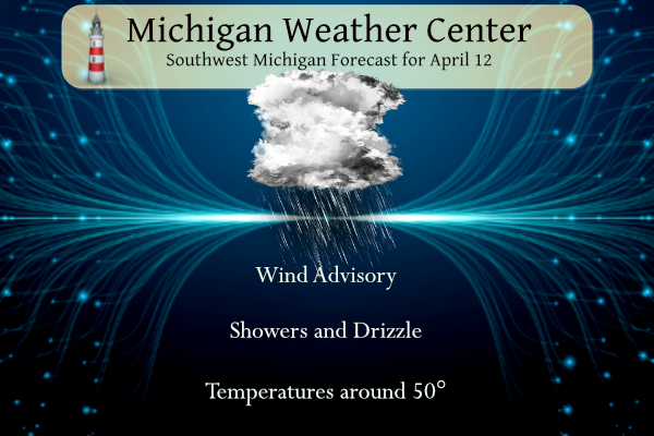
Today won’t be pleasant to be outside unless you like standing out in wind-driven rain and drizzle. Temperatures will improve this weekend with mostly sunny skies and temperatures near 70 on Sunday.
There is a Wind Advisory for the whole of Michigan today:
...WIND ADVISORY REMAINS IN EFFECT FROM 8 AM THIS MORNING TO 2 AM
EDT SATURDAY...

* WHAT...Northwest winds 20 to 30 mph with gusts up to 40 to 50 mph
  expected.

* WHERE...Portions of central, south central, southwest, and west
  central Michigan.

* WHEN...From 8 AM this morning to 2 AM EDT Saturday.
NWS Forecast
Weather History
1972: A tornado put down an intermittent damage path about four miles long southeast of Ludington in Mason County. A barn was destroyed, but there were no injuries.
1974: A brief tornado damaged a building in Vicksburg in Kalamazoo County.
2014: Severe downbursts with winds over 80 mph struck from near Muskegon to Big Rapids. Damage to trees was widespread along with some structural damage. Heavy rains and melting snow resulted in severe flooding along the Muskegon and Pere Marquette Rivers following the storms.
On April 12, 2014, showers and thunderstorms were prevalent along a warm front in Southeast Michigan. One storm in particular grew strong enough to produce damaging winds to 70 mph from Flint to Detroit. The damage included uprooted trees, downed power lines, and some building damage. The storm was also a prolific hail producer, covering the ground with hail up to a couple of inches deep.
Also on April 12, 1976, the overnight temperature dropped to 18 degrees in Detroit, which is the record-low temperature for the day. The very next year, in 1977, the daytime temperature rose to 89 degrees, which is the record-high temperature for the day!
1927: A tornado wiped out the town of Rock Springs Texas, killing 72 persons and causing 1.2 million dollars in damage. The tornado was more than one mile in width and destroyed 235 of 247 buildings, leaving no trace of lumber or contents in many cases. Many survivors were bruised by large hail that fell after the passage of the tornado.
1934: Winds atop Mount Washington New Hampshire, averaged 186 mph for five minutes, with a peak gust of 231 mph, the highest wind speed ever clocked in the world at that time. In a report released by the World Meteorological Organization (WMO), that record was toppled in 1996 at Barrow Island, Australia during Typhoon Olivia. The new world record is now 253 mph. The 316 mph wind speed recorded at Moore, Oklahoma on 5/3/1999 logged during an F5 tornado was not recorded at ground level.
1945: A series of significant tornadoes raked Oklahoma, Arkansas, Missouri, and Illinois. Antlers, Oklahoma were nearly obliterated by a massive F5 tornado that zigzagged from southwest to northeast across the town. 69 people died in the twister. Another tornado killed eight people in Oklahoma City, Oklahoma. The disaster was overshadowed by the loss of President Franklin Roosevelt, who died suddenly at his vacation home in Warm Springs, Georgia.
Forecast Discussion
- Wind Increases This Morning

A large low pressure system currently centered north of Lake Erie in
southern Ontario (as of 07z) deepens this morning as a mid-level
trough phases with a southern stream shortwave. Northwest surface
winds will ramp up considerably this morning as a tight pressure
gradient sets up over lower Michigan. Model soundings indicate a
deepening boundary layer while 40 to 55 knot 850mb winds build
across lower Michigan. Sustained northwest winds up to 20 to 30 mph
are expected today with peak gusts to 40 to 50 mph. The highest
winds are expected to occur inland, especially across north
central Lower Michigan where there is closer proximity to the
surface low.

In the meantime, rain showers will diminish in coverage as
moisture is steadily stripped away and PWATs fall to 0.5 to 0.75
inches. Light rain will linger this morning and early afternoon.
Another few hundredths to 0.25 inch of rain is expected for
today.

The surface low continues to progress northeast this evening with
showers ending late in the afternoon and winds gradually weakening
this evening and tonight.

- Chance for Showers and a Few Storms Saturday Night/Sunday AM

The forecast remains status quo for Saturday night into Sunday
morning with a chance for showers and a few storms mainly near and
north of I-96. A strong push of warm air advection aloft is forecast
to occur, with some increase in low to mid level RH as a weak
surface front moves through. Elevated instability on the order of
500-1000 J/kg is forecast, thus some thunderstorms may occur. The
00z NAM 3km appears to have an excellent handle on the expected
evolution of this precipitation, with showers and a few clusters of
storms moving through the region north of I-96 and exiting by mid
morning on Sunday.

- Warmer Next Week With Strong Storms Possible Tuesday/Wednesday

Little question that warmer temperatures are on the way with 60s and
70s overspreading the region Sunday into the middle of next week.
Synoptically, ensemble guidance is pointing to an impactful storm
system developing across the central Plains by Tuesday. GEFS mean
500 mb heights indicate a closed and negatively tilted upper low
moving into the Midwest by Tuesday afternoon and evening. What this
will do in the lower levels is push a warm front into Lower Michigan
sometime Tuesday. A vigorous 850 mb LLJ on the eastern side of this
upper low will crank 50-60 kt winds into IL/IN, pointing toward
southern Lower Michigan by Tuesday night, riding up over the surface
warm front. We may be looking at a high shear, low CAPE environment
setting up over Lower Michigan depending on where the warm front
sets up and the timing of the upper low`s movement. Sample GFS
soundings across southern Lower Michigan Tuesday afternoon and
evening near the vicinity of an expected warm front indicate 40-50
kts of 0-3 km shear, which is significant. A few rounds of
thunderstorms are looking likely Tuesday into Wednesday, some of
which may be strong to severe based on how the models are handling
the potential synoptic setup, though how much of this activity may
be elevated in nature vs. surface based is not entirely clear yet.
Nevertheless, this period of time does bear watching.

Beyond this period, ensemble guidance favors upper troughing moving
into Lower Michigan by Thursday or Friday. An additional chance for
some showers and perhaps some thunderstorms may exist across the
region until that upper trough moves through. Temperatures should
cool off late next week as this pattern transition occurs.
In the news again….2 years since our fire.
https://www.wzzm13.com/video/news/local/zeeland-restaurant-owners-thankful-to-rebuild-reopen-after-fire/69-3a006df0-7e6f-4c77-acc8-6076294db53d
Could be some strong/severe storms entering the picture next week. Still a ways out so no way to know forsure if we will or not but the possibility is there and something to keep an eye on!
Starting Sunday, some nice summer type weather coming up!! BRING IT!
https://forecast.weather.gov/MapClick.php?lat=42.9655&lon=-85.6702
Too funny! What a joke!
Looking forward to the sunny weekend. I have an eye infection so hopefully it’s better by Sunday. I can’t really open my eye. And when closed it fills with water and I have to open it… so basically a constant cycle all day… not fun!
Hope you get better soon, Nathan!
Looks like my area has been the jackpot for rain. Radar estimates over 2” has fallen in this area.
There is quite a bit of standing water in these parts.
Facts! No summer type weather is in sight!
Despite all the cold weather propaganda, yesterday was another warmer than average day. This weekend looks very summery!
Don’t look now, but below normal temps are right around the corner (by next weekend)! Enjoy the temps around 70 degrees on Sunday and Monday, because that will be the end of it for awhile! Get ready to Rock!
Our local forecast shows 70 or better for five consecutive days next week. Keep in mind, the average high right now is only 56.
Rocky doesn’t look at the facts
Spring typically has up and down temps, we don’t get sustained warm weather until mid-May. For April this is a pretty good pattern I’d say
Rocky also said this five days ago as well…
Rocky (Rockford)
There is a very small chance that GR hits 70 degrees tomorrow, but after that no 70’s in sight for weeks on end, despite the constant hype! WOW!
April 7, 2024 8:55 am
He’s always wrong
Looks like another great gold day!
“Golf”
Yesterday was mild.
How’s the snowshoeing been the past week here in Kent County??
The official H/L yesterday at Grand Rapids was 56/46 there was 0.61” of rainfall (here in MBY I recorded 0.42”) The average windspeed was 11.4 MPH and the peak gust was 26 MPH out of the NW. There was no sunshine. For today the average H/L is 56/36 the record high of 82 was set in 1977 and the record low of 19 was set in 1939 and 1950. The most rainfall of 1.12” fell in 2019the most snowfall of 1.2” fell in 1989. The most on the ground was 3” in 2007. Last year the H/L was 77/59.
Slim