 Cold out there this morning – when I let the dogs out for their morning constitutional it was a quick process – our indoor cat decided to check out the snow, she spent out 30 seconds out there before she scampered back in. 19° in Otsego at 7am – temperature is pretty consistent around the area.
The lake effect snow band has set up from Holland to just west of Kalamazoo. Not snowing here in Otsego – I will be heading to Allegan shortly where it is snowing – we have the typical M-40 snow line with the NW winds.
The winter storm warning continues for Mason, Oceana, Muskegon, Ottawa, Allegan,Van Buren and Kalamazoo counties until 7am tomorrow. For Kalamazoo and Allegan Counties the warning will effect the western areas.
Heavy lake effect snow squalls will continue into early tonight in the warning areas. Plan on very difficult travel conditions, including during the morning and evening commute. Due to the high snowfall rates and blowing and drifting snow, snow plows may not be able to keep up with keep the roads clear. Sections of some local roads may be impassable at times due to the extreme drifting with the heavy snow squalls. Additional snow accumulations of 7 to 10 inches, with localized amounts up to 16 inches.
 The first intrusion of true arctic air of the season will result in very typical Southwest Michigan winter weather today and tonight. However for locations near and mostly west of US-131, today will be anything but typical.
Very strong winds will combine with bands of heavy snow to create snow squalls that will make travel challenging at best.
The next storm moves into the ares Wednesday with a system type snowfall that will bring most areas some snow but the I-94 area will see 3 to 5 inches of snow by late Wednesday as that system moves through.
Then there will be more lake effect snow showers Thursday only to have another system bring more snow Friday. Yet another system moves through the area this coming weekend and that will bring warmer temperatures but not warm enough for rain, so we get yet another snowfall event Saturday into Sunday.
So, it appears we will continue with a true Michigan winter pattern through the rest of the week.
Today: Snow showers. Areas of blowing snow. High near 22. Blustery, with a north northwest wind 15 to 20 mph. Chance of precipitation is 80%. Total daytime snow accumulation of around 3 inches.
Tonight: Snow showers, mainly before 1am. Low around 14. North northwest wind 6 to 11 mph becoming light north after midnight. Chance of precipitation is 80%. New snow accumulation of around 2 inches.
Wednesday: Snow showers. High near 23. South southeast wind 7 to 13 mph, with gusts as high as 21 mph. Chance of precipitation is 90%. New snow accumulation of around 5 inches.
Wednesday Night: A 50 percent chance of snow showers, mainly before 1am. Cloudy, then gradual clearing toward daybreak, with a low around 11. East northeast wind 5 to 9 mph becoming light and variable after midnight.
Thursday: A 50 percent chance of snow showers. Partly sunny, with a high near 23. Calm wind becoming west 5 to 9 mph in the morning.
Thursday Night: Snow showers. Low around 19. Chance of precipitation is 90%. New snow accumulation of less than one inch possible.
Friday: Snow showers. High near 29. Chance of precipitation is 80%.
Friday Night: Snow showers likely, mainly before 1am. Mostly cloudy, with a low around 22.
Saturday: A chance of snow showers. Mostly cloudy, with a high near 32.
Saturday Night: A chance of snow showers. Mostly cloudy, with a low around 26.
Sunday: A chance of snow showers. Mostly cloudy, with a high near 34.
Sunday Night: A chance of snow showers. Mostly cloudy, with a low around 25.
Monday: A chance of snow showers. Partly sunny, with a high near 37.
Read Detroit NWS’ forecast discussion re: dry slot concerns.
Yippee. Winter Storm Warning. This will be kinda fun. Most of our snow events seem to occur during the overnight hours.
Happy hUMp day…aka Wasted Wednesday….
The Allman Brothers Band – Wasted Words – YouTube
https://www.youtube.com/watch?v=FnT5yHcjq90
Hi Mr. Jack. Nice to see you here. I hope you are well.
Thank Mark….I Just Getting OVER That CRUD That’s Been Going Around. Nasty CRUD……Good To Be Back.
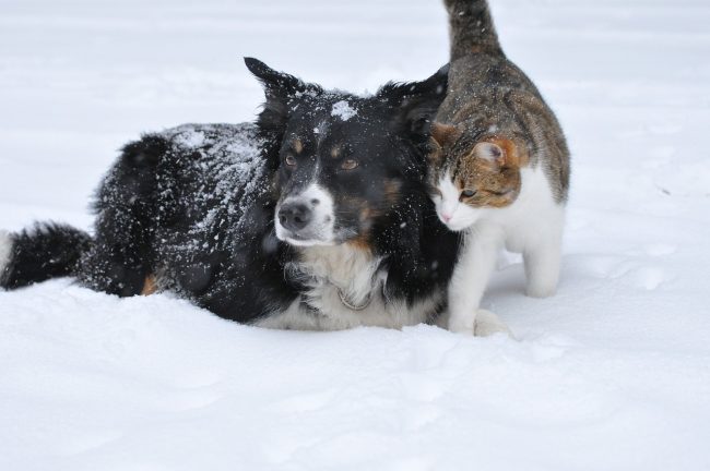
Nice PIC. MV..of Your Dog & Cat
RigHt NOW @ Thee YARDofCUES..Big Fluffy Flakes Falling Peacefully.
Cue—>> I’ll Be Here In The Morning (Townes Van Zandt) – YouTube
https://www.youtube.com/watch?v=AjGOxo0KDMs
CUE~~~~~–> Please Come Home For Christmas – YouTube
https://www.youtube.com/watch?v=kNnU-8TocSI
HEAR @ Thee YARDofCUES….We Have NOT GOT…SQAUT in The 24-36Hrs. Keep The BUSTS….Coming I LOVE IT….
Stay MEAN GREEN Christmas Cued….
NWS GR update: .UPDATE… Issued at 946 PM EST Tue Dec 12 2017 No major changes to the ongoing forecasts for the evening. Lake effect snow bands continue generally west of Highway 131. Radar estimates rates up to an inch per hour in the main band around Zeeland. Estimated accumulations since 4 pm are approximately 2 to 4 inches across western Ottawa…much of Allegan except the far east…and also for Van Buren to western Kalamazoo counties. The main band was pushing inland with persistent bands developing further west. Satellite imagery shows colder clouds overspreading the ongoing lake effect near the… Read more »
Wow Rocky winter is rolling .. thank you INDYDOG!!
You know it INDY! ROCK n ROLL will never die!
Check out this little Christmas present!
http://www.instantweathermaps.com/GFS-php/showmap-conussfc.php?run=2017121218&time=PER&var=ASNOWI&hour=384
This map is off the charts! I can only hope!
http://www.weather.gov/images/erh/gis/GRR_Snow.png
Maybe the next WWA will actually be real!
http://wxcaster.com/gis-gfs-snow-overlays2.php?STATIONID=GRR
First time I’ve had a WWA and haven’t measured any snow :).
Getting cold outside we are down to 16* degrees right now out at thee YARDofBRICKS .. single digits not out of the question tonight . I hope all the homeless are of the streets tonight.. Thank you .. INDYDOG!
Not quite enough to qualify as “dusting” here today. Just checked around the yard and out back in the fields, and the average snow depth is pushing 2 whole inches around here. Some spots with less and grass poking out, some spots a little more, but pretty much a 2 inch average everywhere. Odd trend we are in.
Just about 5 inches of snow on the ground out at thee YARDofBRICKS it’s cold temps are falling we could be in the single digits tonight cold for this time of year I just started a fire for tonight with lots of Sprites RACKING STACKING AND TRACKING tomorrows snow storm …thank you .. INDYDOG!!
Well, another “snowstorm”, and another day the snow blower is left untouched in the garage.
I started mine this morning just for fun. They’re calling for 3-7″ here. Prolly get 2.5″.
I ran ours last week just to make sure it still runs good. Most of what fell last week on our driveway melted off, but i did manage to blow off about an inch or two then. Didn’t need to, but it was looking lonely in the garage.
Weather advisory back out for Kent County 3 to 6 inches of snow coming tomorrow yeaaaa haaaaa!! Thank you !! INDYDOG!
High temp today 20* sofar out at thee YARDofBRICKS cold December day!! Thank you INDYDOG!!
No storms on the horizon wait to Sunday!! Loving the cold and snow thank you .. INDYDOG!
You mean cold and NO snow. 2 month trend now of cool with little to no snow, keeping us below average on snowfall.
I have snow here from the other day when it snowed.
4 inches on the ground out at thee YARDofBRICKS .. anther 6+ coming Wednesday .. Thank you!! INDYDOG!
NWS GRR says only light snow Sunday – nothing significant at this time.
Sunshine here!
The latest NAM hammers Kent County over the next 2 or 3 days. I am not buying it especially because I think the NAM model = Never Accurate Model! It is fun to look at it but is really accurate!
http://wxcaster.com/gis-snow-overlays.php?STATIONID=GRR
BUST! “We made some adjustments to the headlines. We dropped headlines for Kent, Barry, and Osceola, and transitioned form warnings to advisories for Lake and Newaygo.” UPDATE… Issued at 1005 AM EST Tue Dec 12 2017
The dry pattern continues.
Good because based on the NWS track record when they drop the headlines we start picking up heavier snowfall! Bring it!
Well, the warning was correct about one thing, it is very hard to see since this December sunshine we are getting is in fact making it very hard to see. Still waiting for our FIRST snowflake here in Zeeland! This is always a hard one to explain to the kids as to why school was cancelled for them.
They actually cancelled school in Zeeland? Incredible!
Yes, and there is a fair amount of head scratching among other parents and kids. It’s one thing to predict a pile of snow and maybe you only get half of that, or a portion. But it’s quite another to predict a pile of snow and then have clear blue skies without even a flake coming down.
Agreed!
What a waste of a snow day 🙁
So you tell me has the GR National Weather service missed the mark completely with snowfall estimates for the GGR area? The current map shows GR picking up 6 to 8 inches of snow in the next 2 days! This is rapidly becoming a total bust for GR! Tell me I am wrong or will the clipper on Wednesday hammer the GR area?.
http://www.weather.gov/images/erh/gis/LP_state_Snow.png
The NAM is even more impressive?
http://wxcaster.com/gis-snow-overlays2.php?STATIONID=GRR
Which is why I never trust these maps. The times when it shows a inch or two will be the times we get a foot.
While not perfect one of the better snow fall guess maps is this one
http://www.wpc.ncep.noaa.gov/wwd/day2_psnow_gt_04.gif
Slim
Interesting because this is showing the heaviest snow from the next clipper tracking to the South of GR and the NAM and GFS show it hitting GR directly?
Good point and this just confirms my views that the NWS is one of the worst and in reality they should be one of the best.
Climatology for today December 12th At Grand Rapids, MI
The average H/L at Grand Rapids on this date 36/24°
The record high is 60° set in 1949. The coldest maximum is 18° set in 1995
The record low is -5° set in 1972. The warmest minimum is 42° set in 2006
The largest snow fall is 6” in 1972
The most snow on the ground at 7 AM is 12” in 2000
Last year the H/L was 34/22° there was 0.2” of snow reported and the snow depth at 7AM was 9”
Slim
Well, it’s December 12th and GR has only received about 6″ of snow for the month. This is below average snowfall so far since GR normally receives 21.9″ in December. And doesn’t take into account the lack of November snowfall either.
Still no big storms in sight. The dry pattern prevails.
The total snow fall the the season at GR is now at 6.6″. And yes no major storms on the horizon at this time’
Slim
In Otsego the sun was shining, beautiful sunrise! As I drove to Allegan the snow band started around 24th street on into Allegan. We are seeing periods of moderate snowfall.
Here at my house the sun is out and there is NO new snow on the ground. I now have 3” of snow on the ground here at my house. At this time the heavier snow is to the SW of the GR metro area and should stay that way for today. Here in the GR area we may very well not see any new snow today at all. I have a current temperature of 18° with clear skies (that can change quickly today) and at the airport they have 19° Here are some snow depths around southern Michigan Grand… Read more »
INDY is ready!! Sprites on ice what a winter delight so far 4 inches of snow on the ground out at thee YARDofBRICKS since last week looking to add to that this week and now a big storm coming Sunday! Winter is here .. Yeaaaaa!! INDYDOG!
Storm after storm and COLD and SNOW for months! The best time of year is finally here!!
Another one for your viewing pleasure! Enjoy!
http://wxcaster.com/gis-gfs-snow-overlays2.php?STATIONID=GRR
Lets hope this map is even close to being correct! Bring it on!
http://www.weather.gov/images/erh/gis/LP_state_Snow.png
Can you say White Christmas?
http://www.instantweathermaps.com/GFS-php/showmap-conussfc.php?run=2017121206&time=PER&var=ASNOWI&hour=324
GREEN!!!!
Could we get some Kent County snow totals since last night? So far up in Northern Kent County we have seen a whopping dusting. Lets hope the snow licks up in the GGR area soon!
depending on where that narrow snow band set up Kent county may or may not see more snow from the next system. That will be a hit or miss system
Slim