 4 PM Update
WINTER STORM WARNING IN EFFECT TO 7 AM EST WEDNESDAY for Mason, Oceana, Muskegon, Ottawa, Allegan and Van Buren Counties.
Heavy lake effect will develop tonight. Travel will be
very difficult including during the morning commute on Tuesday.
Snow accumulations of 9 to 13 inches, with localized amounts up
to 17 inches, are expected.
WINTER WEATHER ADVISORY IN EFFECT FROM 10 PM THIS EVENING TO 7 AM EST WEDNESDAY for Lake, Osceola, Newaygo, Kent, Barry, Kalamazoo counties and to the east.
Lake effect snow will develop tonight. Plan on difficult
travel conditions. Additional snow accumulations of 4 to 7
inches, with localized amounts up to 10 inches in the western
portions of the counties, are expected.
 A low pressure system will track south southeast from Northwest Minnesota early this morning to near Chicago by late this afternoon. That will bring snow to the area today into this evening. Tonight and arctic front comes through bringing in the coldest air of the season with very strong winds.
Heavy lake effect snow squalls are expected near the Lake Michigan shore tonight into Wednesday morning. Travel in that area will be challenging Tuesday. Outside of that expect snow showers and highs only in the lower 20s. We get a break between systems Wednesday but by late Wednesday the next system will bring more snow to the area into Thursday.
This is a dangerous situation as there will be heavy snow squalls from with winds will be gusting to over 40 mph resulting in near zero visibilities in the heavier snow bands.
We will will have two periods of snow. The first one is the warm advection part of the event, which will last only about 3 hours in any one place. It will for the most part occur from around 8 am near Muskegon end by Jackson by 1 pm. That should be a 1 to 2 inch snowfall event. The second part of this is the deformation zone snow band that from most of the high resolution models (for several runs in a row) to occur near I-94 from around 4-5 pm till around 9 pm. This will have heavier snow with it, more like 2 to 3 inches. I considered an advisory for this event but the event tonight into Wednesday morning seems to this forecast to be a much more significant event so to keep the headlines simple I only have headlines for the Lake Effect event tonight into Wednesday morning.
I am seeing Holland and South Haven and areas along the lakeshore picking up over a foot of snow with amounts decreasing to three or four inches towards 131 from both events. The main hazard will be the wind blowing the snow around.
There is more snow in the forecast for Thursday with another system moving through, BUT I think will we see the jet start to move south bringing us warmer temperatures by the weekend which may last through the 20th – temperatures may get into the fifties towards the end of that period…
Just got in from shoveling. Not enough to fire up the new snowblower. About 2″ of very light snow on the ground.
Two solid hours of Frezing Rain in Ada this evening…10pm-12am. Flurries beginning to mix in, but precip continues as very light rain. Cars and driveways are ice covered. Take extra care tomorrow morning.
BLIZZARD CONDITIONS TOMORROW!! Get ready now … INDYDOG!!
Bring it on!
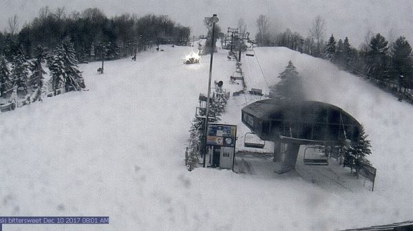
Quite a change from this morning – snow is already developing south of Kalamazoo and over the lake – so, we are starting a bit earlier than earlier thought…. Mason-Oceana-Muskegon-Ottawa-Allegan-Van Buren- Including the cities of Ludington, Hart, Muskegon, Grand Haven, Jenison, Holland, and South Haven 1025 AM EST Mon Dec 11 2017 …WINTER STORM WARNING NOW IN EFFECT UNTIL 7 AM EST WEDNESDAY… * WHAT…Heavy lake effect snow occurring. Travel will be very difficult to impossible, including during the evening commute on Tuesday. Additional snow accumulations of 10 to 14 inches, with localized amounts up to 18 inches, are expected.… Read more »
The week before Christmas = below normal temps and then the weeks that follow = below normal temps! Bring it on!
http://www.cpc.ncep.noaa.gov/products/predictions/814day/814temp.new.gif
http://www.cpc.ncep.noaa.gov/products/predictions/814day/814temp.new.gif
http://www.cpc.ncep.noaa.gov/products/predictions/WK34/gifs/WK34temp.gif
Thanks for the updates – I was just getting ready to post these….
I got the following from Wood TV8 Michigan Weather Alerts Winter Storm Warning The following areas are affected: Berrien Cass St. Joseph IN-Elkhart-Berrien-Cass MI- Including the cities of South Bend, Mishawaka, New Carlisle, Walkerton, Elkhart, Goshen, Nappanee, Niles, Benton Harbor, St. Joseph, Fair Plain, Benton Heights, Buchanan, Paw Paw Lake, Dowagiac, Cassopolis, and Marcellus 1253 PM EST Mon Dec 11 2017 …WINTER STORM WARNING IN EFFECT FROM 1 AM TUESDAY TO 7 AM EST WEDNESDAY… * WHAT…Heavy lake effect snow possible. Plan on difficult travel conditions, including during the morning and evening commute on Tuesday. Total snow accumulations of 5… Read more »
We are under the warning now. They changed it.
Temps may get into the 50’s by the end of the period?? If this holds up, we seem to be looking at an exact copy of last years December! Almost to the day to no less. That is really bizarre!
I am not sure what models or maps or stations you are getting your temps in the 50’s from, however maybe you and the others that are looking at temps in FL? Here are the facts:
1. We have a brief warm up coming this weekend (temps in the mid to upper 30’s).
2. Then we have a few days near normal and then go back to below normal with snow well before the Christmas holidays.
3. We will be having a white Christmas!
4. The CPC is predicting Cold and SNOW during the holidays. I will post the maps above.
Same place Michael is. Read his write up above.
Good point and he must be looking at some of the GFS long range models. This models will end up being incorrect! Get ready for a long period of winter weather!
Climatology for today December 11th At Grand Rapids, MI The average H/L for Grand Rapids for today is 36/25° The record high is 63° set in 1949. The coldest maximum is 10° in 1995 The record low is -3° set in 1962. The warmest minimum is 49° set in 1899 in recent times 40° in 1979 The most precip is 1.12” in 1899, in more recent times 0.99” in 1967 The most snow fall is 14.2” in 2000. The most on the ground at 7 am 14” in 1970 Last year the H/L was 30/22 Grand Rapids has 8.9” of… Read more »
Good morning, all. Had a great time in Midland at the boy’s hockey tournament this weekend. It’s been a long time since I’ve been there. They have really revitalized the downtown area. It’s a really nice town. So proud of our kids. They finished 1st in their division and 3rd overall. GRAHA (Grand Rapids for those that do not know) steamrolled over everyone. All the teams were very good, but GRAHA was incredible. The outscored all their opponents 54-3 (five games) over the entire weekend. Came home to only a dusting yesterday. But it’s snowing at a pretty good clip… Read more »
The snow from this first event is now winding down. Here at my house I have measured 1.4” of new snow and now have a total of 4.5” on the ground. In looking at tonight in to tomorrow forecast I have to bring out one issue to the way forecast are issued. I live in far western Kent county about 1.5 miles east of the Ottawa/Kent county line. At this time Ottawa county has a winter storm warning starting at 10 PM and Kent county has a winter weather advisory starting at 10 PM I know there has to be… Read more »