The end of September was warm with highs of 70 and 79 on the 29th and 30th. October had the warmest start to any October at Grand Rapids and for much of Michigan. It was the 1st time that the 1st 4 days of October all had highs of 80 or better. Several record highs were recorded in the UP and norther lower Michigan and here in Grand Rapids and Muskegon.
In looking back at past Octobers with very warm starts I found 1919, 1922 and 1953 with start of 3 days in a row of 80 or better. 1897 had two. I will look at these past October’s and see how the rest of the month played out and how the fall and winter season played out. I would like to point out that like 2023, 1919, 1922, 1953 and even 1897 all had days of 90 or better in September.
1st off 1919. 1919 had 3 days in a row of 90+ in a September that ended with a mean of 65.3. At the start of October the 1st had a high of just 62 but then there were 3 days in a row with highs of 84,85 and 83. Lows were also warm with lows of 62,66 and 63. There were 3 more days with highs in the 70’s. The low for the month was 34 on the 20th November was below average with a mean of 37.2 (-2.8) there was just 3.5” of snow. December, January and February were all very cold with a December mean of 21.4 (-9.0), January had a mean of 16.0 (-8.8) and February had a mean of 21.3 (-5.3) There was 1” of snow on the ground from November 30th all the way to March 11th. For the season there was a reported 56.6” of snow fall.
- Like 1919 the year 1922 had several days of 90+ is September and the high for the month was 95. While mid month was cool it warmed up at the towards the end and it reached 77 on the 27th 83 on the 29th and 85 on the 30th the 1st of October was cooler with a high of just 70 but then it warmed up to 84 on the 2nd and 3rd and 4th and then 85 on the 5th The low for the month was 28 on the 20th November was +2.4 above average and December was -2.7 below average January was +1.4 and February was cold come in with a mean of 19.6 and that is -7.0 below average. There were long periods with no snow on the ground. There was a reported 54.8” of snow fall but the season lasted to May with 9.6” in March, 3.7” in April and a record 5.5” in May.
- There was a major heat wave at the end of August that carried over into the start of September. There were a total of 10 days of 90 or better from August 25 to September 3rd it reached 97 on two days August 31st and September 1st While it got as cold as 36 on 3 nights that September it reached 93 on September 29th and that is the latest 90 days at Grand Rapids. October started out with highs of 81, 84 and 85. There were more 80+ days in mid October when 5 of 6 days reached the 80’s with highs of 80,81,76,83,85, and 82 from October 17th thru the 22nd The low for the month was 28 on 29th. November and December were warmer than average. January was colder than average then February was much warmer than average with a mean of 32.6 +6.0 but did have 10.9” of snow fall. The winter season did have 78.3” of snow fall with 21.9 falling in March.
- While not a complete match 1897 did have a September that had 7 days of 90 or better with the highest at 95. The mean that September was 65.4. The end of September did turn warm with highs of 71, 75 and 82 to end the month. October started out with 6 days in a row of highs of 89, 74, 79, 83, 76, and 78. The coldest it got that October was 34. November and December were colder than average. January was warmer than average and February was back to colder than average. Snow fall in missing for November and December but January and February were snowy.
This winter we are on tap to have a strong El Nino. Of the years 1897, 1919, 1922 and 1953 only the 1953/54 winter was a know El Nion winter. So that is the history of past very warm starts to October. We can now set back and see how the winter of 2023/24 will play out.
The official HL yesterday at Grand Rapids was 63/44, there was 0.93” of rain fall. The sun was out 35% of the possible time. There were 11 HDD’s the highest wind speed was 32 MPH out of the W. For today the average H/L is 65/45 the record high of 87 was set in 1951 and the record low of 25 was set in 1964. The record rain fall amount of 1.27” fell in 1951 the most snow fall was a reported 0.1” in 2000. Last year the H/L was 50/36. Here in MBY I recorded 1.12” of rain fall since 7 AM yesterday. The current temperature is 43 with partly cloudy skies.
AREA FORECAST DISCUSSION
NATIONAL WEATHER SERVICE GRAND RAPIDS MI
359 AM EDT SAT OCT 7 2023
LATEST UPDATE…
SHORT TERM/LONG TERM
SHORT TERM
(TODAY THROUGH SUNDAY)
ISSUED AT 358 AM EDT SAT OCT 7 2023
WINDS ACROSS THE AREA ARE SHIFTING TO NORTHWESTERLY AS A SURFACE
TROUGH MOVES ACROSS THE AREA. WITH THE EXITING OF THE UPPER-LEVEL
SHORTWAVE THAT DROVE A COLD FRONT ACROSS THE AREA EARLIER TODAY,
WE’RE SEEING A TRANSITION TO LAKE-EFFECT BASED SHOWERS AS DELTA TS
ARE NEAR 20C WITH LAKE TEMPERATURES IN THE MID TO UPPER 60S AND
850 MBAR TEMPS BEING BELOW 00Z.
LAKE EFFECT SHOWERS ONGOING ACROSS OUR FAVORED LAKE EFFECT ZONES
GIVEN OUR NORTHWEST FLOW PATTERN WILL SPREAD INLAND DURING THE DAY
TODAY DUE TO DIURNAL ENHANCEMENT BEFORE DECREASING AGAIN SATURDAY
NIGHT AS THE PASSAGE OF A SHEAR ZONE ASSOCIATED WITH OUR 500 MB
TROUGH OVERHEAD CAUSES INVERSION HEIGHTS TO FALL. EXPECT A DREARY
FALL DAY TODAY WITH CLOUDS SKIES AND GUSTS IN THE 20-30 MPH
RANGE. PATCHY FROST IS POSSIBLE INLAND ON SATURDAY NIGHT AS MODELS
CONTINUE TO SUGGEST CLEARING SKIES AND TEMPERATURES FALLING INTO
THE MID 30S WITH THE BEST CHANCE IN OUR TRADITIONAL COOLER
NORTHEAST CWA. GIVEN UNCERTAINTIES IN CLEARING AS WELL AS HOW
MUCH BOUNDARY LAYER WINDS MAY DECREASE, WILL LEAVE ANY HEADLINE
DECISIONS TO DAY SHIFT AS WE CONTINUE TO MONITOR GUIDANCE AND
OBSERVATIONAL TRENDS.
WITH LAKE INDUCED INSTABILITY CONTINUING AS WE REMAIN UNDER
TROUGHING INTO SUNDAY LAKE EFFECT SHOWER CHANCES CONTINUE, ALBEIT
LOWER THAN TODAY AS THE 500 MB COLD POOL MOVES OFF TO THE EAST. BEST
CHANCES FOR ANY SHOWERS WILL BE PREDOMINANTLY NEAR AND WEST OF
US131.
LONG TERM
(SUNDAY NIGHT THROUGH FRIDAY)
ISSUED AT 358 AM EDT SAT OCT 7 2023
THE UPPER LEVEL LOW HANGS OUT OVER ONTARIO AND QUEBEC THROUGH MID
WEEK ROTATING POCKETS OF POSITIVE VORTICITY ADVECTION OVER THE AREA.
THE POSITION OF THE UPPER LEVEL LOW WILL ALSO KEEP US IN NORTHWEST
FLOW. WITHIN THIS REGIME THE LAKE AND POCKETS OF POSITIVE VORTICIY
ADVECTION WILL CONTINUE CHANCES (20-40%) FOR SHOWERS THROUGH THE
BEGINNING OF NEXT WEEK. RAINFALL AMOUNTS WILL BE LIGHTER DURING THIS
PERIOD AS CLOUD DEPTHS, MOISTURE, AND COVERAGE WON’T BE AS HIGH. THE
BEST CHANCES FOR ANY RAIN WILL BE ALONG THE LAKESHORE AND NORTH OF M
46. WE WILL HAVE TO WATCH A POTENTIAL FOR FROST SUNDAY NIGHT, ALONG
AND EAST OF M 66. IT WILL DEPEND ON THE CLOUD COVER. IF CLOUDS CLEAR
THEN CHANCES INCREASE WITH LOWS IN THE MID 30S.
HEADING INTO THE SECOND HALF OF NEXT WEEK THE PREVIOUSLY MENTIONED
UPPER LEVEL LOW ISN’T GIVING UP ON US. LATEST GUIDANCE IS HONING IN
ON A SOLUTION WHERE THE LOW PHASES WITH AN APPROACHING TROUGH TO THE
WEST. ENSEMBLES SHOW DECENT AGREEMENT IN BRINGING RAIN TO THE AREA
WITH THIS NEXT SYSTEM WHICH ISN’T SURPRISING WITH THE SWATH OF ABOVE
NORMAL PRECIPITABLE WATER VALUES THAT ADVECTS IN WITH THE SYSTEM.
WHAT MAY CHANGE WITH THE FORECAST THOUGH IS THE TIMING AND THE EXACT
TRACK OF THE LOW AS WE ARE SEVERAL DAYS OUT. EITHER WAY A STRETCH OF
DRY WEATHER IS CLEARLY NOT ON THE HORIZON.
Detailed Forecast for Grand Rapids
Overnight
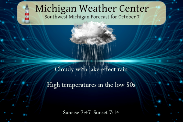
A 30 percent chance of showers. Mostly cloudy, with a low around 44. Northwest wind around 9 mph.
Saturday
A 30 percent chance of showers, mainly between 9am and 2pm. Mostly cloudy, with a high near 52. Northwest wind 10 to 17 mph, with gusts as high as 30 mph.
Saturday Night
A 10 percent chance of showers before 7pm. Partly cloudy, with a low around 39. Northwest wind 6 to 11 mph becoming light after midnight.
Sunday
A 40 percent chance of showers, mainly after 11am. Mostly cloudy, with a high near 52. West northwest wind 5 to 13 mph.
Sunday Night
A 30 percent chance of showers, mainly before 2am. Partly cloudy, with a low around 37. Northwest wind 3 to 8 mph.
Columbus Day
Partly sunny, with a high near 51.
Monday Night
Mostly cloudy, with a low around 44.
Tuesday
Partly sunny, with a high near 52.
Tuesday Night
Mostly cloudy, with a low around 43.
Wednesday
Mostly sunny, with a high near 59.
Wednesday Night
A chance of showers. Mostly cloudy, with a low around 44.
Thursday
A chance of showers. Mostly cloudy, with a high near 57.
Thursday Night
Showers likely. Mostly cloudy, with a low around 46.
Friday
Showers likely. Mostly cloudy, with a high near 55.
25 MPH wind gusts and wind chills in the low to
mid forties! Wow, what a cold Fall day! Just a sign of things to come! Get prepared now!
Amazing sunrise this morning with the dark clouds to the West, then an even more amazing rainbow to the NW in front of the dark clouds.
It certainly is beginning to feel like autumn. Looking at the radar, it appears there are lake effect/enhanced showers occurring.
Yup! Interesting to see lake effect/enhanced rain this far inland.