The days continue to get shorter and darkness settles in by late afternoon. When I lived in Maine in the early 1970s the sun was below the horizon shortly after I got home from school. Today the sunset is at 4 pm. I lived in the wilds, a quarter mile in any direction you were in the wilderness so there wasn’t any light pollution like we have here in Michigan. We had many bears, moose, bobcats, deer, and caribou many of which would come into town at night.
The city of Grand Rapids proclaimed Monday “Bill Steffen Day” to celebrate the career of longtime meteorologist Bill Steffen, chief emeritus for Storm Team 8. U.S. Sen Gary Peters, D-Bloomfield Township, congratulated Bill with a special proclamation. Congratulations Bill! For more on Bill’s 48 years in the weather industry go here. Bill and Gayle are some of the nicest folks I have met and I can vouch for the fact he likes to talk about the weather.
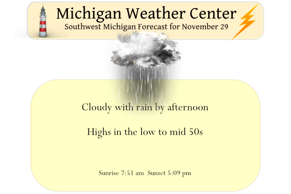
Yesterday’s high was 44° and the low was 29°. Low pressure will bring rain this afernoon and evening that will change to snow showers by Wednesday morning. It will also become windy Wednesday with isolated power outages possible.
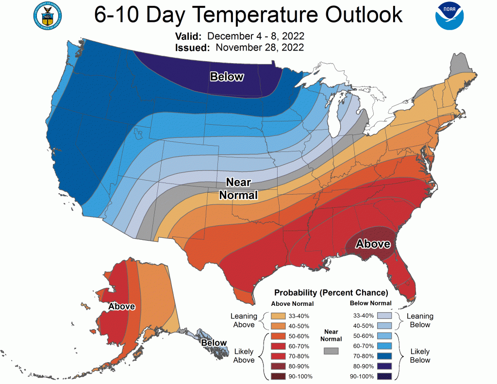
Looking ahead, as we make our way into December a colder wetter pattern will creep its way into SW Michigan.
Forecast Discussion
-- Today and This Evening, The Warm Side --

Well advertised Colorado low with strengthening jet dynamics will
hook from Kansas to Lake Superior today. The increasing southerly
low-level wind field over our area this afternoon into evening
will boost temperatures into upper 40s to lower 50s until the cold
front sweeps through during the night. There may be a short
window of clearing skies this afternoon in southern Michigan and
northern Indiana, which would help to slightly boost temperatures
and wind gusts there. South-southeast winds may peak around 40 mph
late this afternoon. Most high-resolution models point to high
temperatures for the day being achieved during the night due to
strong warm-air advection, just prior to cold front arrival.

A 50 to 60 knot low-level jet between 2000 and 7000 feet aloft
this evening, with its strong moisture transport beneath modestly
supportive midlevel lapse rates, will touch off some elevated
showers and perhaps thunderstorms starting around sunset.
Instability for theoretical downdraft parcels does not seem
particularly suitable to mix down severe wind gusts, though gusty
winds could be stirred down nonetheless.

Some of the HREF members show another narrow ribbon of
instability, this time in the lower levels more likely affecting
the surface, occuring in the vicinity of the cold front. Low-
topped convection in this case would be capable of wind gusts over
45 mph.

-- Late Tonight into Wednesday, The Cold Side --

Of the 00Z HREF members, the HRRR brought the soonest arrival of
the cold front and the NAM-Nest brought the latest arrival, with a
timing difference envelope of about 2 hours. The front should
arrive at the Lake Michigan shore between 10 PM and Midnight, and
clear the Lansing/Jackson area between 2 and 4 AM.

Temperatures should drop from near 50 just ahead of the front to
below freezing in most areas by sunrise. Precipitation should be
rather light during the morning, however, as midlevel moisture is
paltry and any precipitation would form in the lake-enhanced
boundary layer which would be limited by low inversion heights and
a lack of upstream moisture.

Deeper cold air flowing in during the day Wednesday and thus
higher inversion heights climbing into the DGZ may increase lake
effect snow, possibly enough to cause some travel issues from late
morning through the evening. Due to the strong winds, the heavier
snow showers should be displaced inland away from the lakeshore
communities, and we think the HRRR does a good job of favoring
snow accumulation centered near US-131. The quick departure of the
coldest air and arrival of strong upper level ridging should
diminish the snow intensity Wednesday night.

The bulk of model guidance is painting frequent gusts of 35 to 45
mph on Wednesday. A few gusts above 45 mph are possible.

-- Late Week, Another Up And Down --

A progressive synoptic wave pattern across the CONUS late in the
week will bring us another wave of mild temperatures for Friday
followed by falling temperatures on Saturday. This trough will
likely be less amplified and have less moisture to work with, so
most ensemble members are outputting very little precipitation.
Winds could gust to 40 mph again on Saturday though.


I’m outside the WOOD-TV viewing area but thanks to the miracle that is the internet, I was able to watch Bill’s tribute. Very nicely done.
https://www.youtube.com/watch?v=KaiwxhFtfXY
We are entering an early December pattern it seems… up and down temps in the 30s and 40s, cloudy, early sunset. It won’t be long before winter sets in again though (which I am looking forward to).
And happy (late) Bill Steffen Day. I think he’s the best meteorologist ever in West Michigan
I lived just south of Alpena for several years in my younger day. It got dark a little later than in Maine as we are further west and more south. But like MV said there was less light pollution. But the thing that I remember (and it is still like that today) were the stars that were out on clear nights. Down there you just cannot see the sky like you can up there. And not to mention how cold it can get on clear calm nights even in the summer time.
Slim
Congrats to Bill and his special day. Yesterday was a typical late November day with an official H/L of 43/32. There was no rain or snow fall and just 8% of possible sunshine. The overnight low here at my house was 37 the official overnight low was 35. For today the average H/L is now down to 41/29 the record high of 65 was in 1998 and the record low of 6 was in 1929. The record snow fall for today is 4.5” in 1960. The rest of this week there will be a brief cool down before temperatures rebound… Read more »
That proclamation is cool. Bill Steffen is a great meteorologist and a great person. I’ve watch Storm Team 8 my whole life and always trusted him and everyone on the team.
I was unaware of the Bill Steffen Day proclamation. That is so cool!