Yesterday’s high in Otsego was 41.5° and the low was 33°.
We begin another roller coaster week today with temps in the 40s. Monday and Tuesday should be uneventful weather-wise. The most impactful weather of the week will occur Wednesday after a rainy Tuesday night. Temperatures on Wednesday will fall throughout the day from the 50s very early in the morning into the 20s by afternoon or evening. Winds could gust to 40 mph along with light snow at times. This could make for slushy and slick roads in some locations by late Wednesday.
Looking into early December, odds favor below-normal temperatures and slightly favor above-normal precipitation. Normal highs for early December are in the upper 30s to around 40, and normal lows are in the mid to upper 20s. Normal precipitation (liquid) is about 0.60”-0.70” and normal snowfall is a few inches.
Forecast Discussion
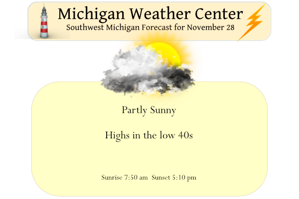
-- Today --

Temperatures today will be near normal with light winds as short-
wavelength split flow in the upper levels and lower-level ridging
and high pressure translate through the area. The challenge is
figuring out the extent that the stratus will clear today, with
the absence of advection. Subsidence in the cloud layer this
morning should act to thin out and evaporate the clouds, which
already seems to be happening north of GRR. However, the RAP,
HRRR, and ARW maintain enough moisture and deep enough mixing in
the boundary layer to maintain some clouds. So a partly sunny
forecast seems fair to deal with whichever way it balances out.

-- Midweek --

The Colorado low that will develop later today, in response to an
amplifying Rossby wave trough with advection of +PV anomaly, will
hook toward Wisconsin and Lake Superior while deepening Tuesday
night. Ahead of this surface low, southerly winds will transport
mild air into Lower Michigan Tuesday afternoon through part of
Tuesday night. Showers will develop Tuesday night as moisture is
transported northward by a 50 knot low-level jet.

Cold frontal passage in the early morning hours of Wednesday may
have just enough instability according to the NAM and GFS to
support a chance of thunder. Cold air advection behind the front
should support mixing of roughly 40 mph wind gusts to the surface
on Wednesday. Rain should change to snow by the daylight hours of
Wed morning, but the snow from the synoptic cyclone won`t last
very long as mid-to-upper-level subsidence and dry air advection
desaturates the DGZ. There may be sufficient depth of cold air
from the surface into part of the DGZ for lake effect snow showers
to persist into part of Wednesday night, though limited upstream
moisture should reduce the intensity. The most likely impact would
seem to be icy patches forming on roads (bridges and overpasses
first) where snow showers persist as temperatures drop into the
20s late Wednesday.

-- Late Week --

The wave pattern across the CONUS remains fairly progressive late
in the week, and milder air should advect back into the area on
Friday, ahead of the next trough and surface low to pass through
on Saturday. Moisture appears to be limited with this wave, and
QPF in most of the ensemble members is paltry.
Check out the first couple weeks of December coming looks cold and snowy stay tuned …INDY
This is going to be a wild winter and the RDB snowfall forecast is right on track! Incredible!
Just think it is not even winter yet and we have seen 28 inches of Snow! What a winter we have in store! Rock n roll baby!
Dixie Alley may be hit with a significant severe weather event Tuesday night. It’s something worth monitoring.
Wow that is quite late in the season. I saw James Spann post a map of Alabama counties this morning on facebook… that explains why, although the worst looks to their west in Mississippi
Yesterday was not as nice as the 4 days before it. The official H/L at Grand Rapids was 44/36 there was 0.25” of rain fall there was no snow and no sunshine. There is no snow on the ground but there are still snow piles around. The overnight low here in MBY so far is 33 and that is the current temperature. The official low so and current temperature at GRR is 36. For today the average H/L is 42/29 the record high of 67 was way back in 1905. The record low of 5 was set in 1969. The… Read more »