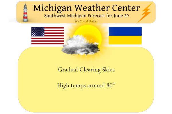
We have light rain moving through Otsego this morning with heavier rains north as was predicted. Our temp is 62° at 5:30, I will put up the rain total later. Yesterday’s high was 81° the low was 46°. Rain will clear out this morning as will the clouds. Our high will be around 80°.
We had .03 of an inch of rain in Otsego this morning. Below is what we have had thus far this month.

Weather History for SW Michigan
June 26
1956: A tornado struck Gratiot County near Perrinton. Two homes and five barns were destroyed and fifty other buildings were damaged. Two people were injured.
June 27
1875: Tornadoes struck Detroit and Jackson during the late afternoon and early evening. The Detroit tornado killed two people and injured 25 others.
1914: A tornado struck Gratiot County, destroying several buildings as it moved from North Star to three miles north of Edgewood. A barn door was carried nearly a mile.
1944: A three-day heat wave peaked with high temperatures of 97 degrees in Grand Rapids and 93 degrees at Lansing.
1968: Cool and cloudy weather prevailed with high temperatures only in the upper 50s to lower 60s.
June 28
1959: Hot weather prevailed with a high temperature of 92 degrees at Grand Rapids and Lansing. At Grand Rapids, the low temperature was 78 degrees, second only to the 79-degree low on June 20, 1953, for the warmest low temperature on record for the month of June.
June 29
1930: Severe weather struck Lower Michigan. A tornado and downburst event destroyed a church and several barns with an intermittent path of damage from Scottville to Cadillac.
1943: Very cool summer weather prevailed with a record low temperature of 43 degrees and a record cool high temperature of 61 degrees at Grand Rapids. Another record low of 40 degrees would follow on the morning of the 30th.
1995: As much as four inches of rain within an hour left streets and basements flooded in the city of East Grand Rapids and in southeast sections of the city of Grand Rapids. Water standing two to three feet deep stranded cars along one street, but most damage was due to flooded basements.
2005: A weak tornado moved across rural areas of Newaygo County, causing no damage. The tornado was a type known as a landspout. Several photos captured its brief but impressive existence.
June 30
1931: June ended on a hot note with highs in the upper 90s after morning lows in the mid-70s.
July 1
1999: A weak tornado made intermittent touchdowns during the early afternoon in Newaygo County. A few tree limbs were downed, but otherwise, there were no damage reports, as the tornado remained over rural areas.
2009: The coolest July in Grand Rapids history begins with a record cool high of only 64 degrees as clouds and scattered showers prevail.
July 2
1973: A tornado struck two miles east of Leslie in Ingham County, damaging a car, mobile home, and several farm buildings.
2001: Frost and freezing temperatures were observed in some locations with a 29-degree temperature recorded in Grant, Michigan in Newaygo County. The 39 degrees at Muskegon was the coldest July temperature on record there.
2008: A line of severe thunderstorms brought high winds, large hail, and some flooding from Muskegon to Grand Rapids and Lansing, south to Kalamazoo. In western Allegan County, winds estimated up to 75 mph brought down dozens of trees and snapped eight power poles. A roof was blown off a home in Kalamazoo County. Hail up to 1.75 inches in diameter caused damage in Muskegon County.
Weather History for SE Michigan
June 26
On June 26, 2021, overnight training showers and storms dumped 6 to 8 inches of rain over areas from Ann Arbor to Dearborn to Grosse Pointe. This led to extensive flash flooding with dozens of cars and trucks abandoned on flooded freeways including I-94. Flooded basements and streets occurred throughout the Metro Detroit area and the governor declared a State of Emergency. Later that day, another round of storms produced an EF2 tornado in Port Austin, leaving six people injured and numerous homes damaged.
On June 26, 1973, A severe thunderstorm wind gust of 94 mph occurred at Detroit Metro Airport at 458 PM EDT.
June 27
On June 27, 2010, a warm front lifting north through Southeast Michigan spawned three tornadoes. The community of Willow in southwest Wayne County was hit by an EF1 tornado. Later another EF1 tornado hit a campground outside of Wadhams in St. Clair County. Unfortunately, there was one death and four injuries as a result of that tornado. Finally, a brief EF0 tornado touched down on the far southeast side of Marlette in Sanilac County.
Also on June 27, 2007, thunderstorms anchored themselves over northern Shiawassee County. Estimates of around 8 inches of rain fell near Henderson, washing out several gravel roads.
June 28
On June 28, 1934, the temperature soared to a high of 104 degrees in Detroit! Many were treated for heat exhaustion and three people died from the hot temperatures.
June 29
On June 29, 2000, lightning struck our National Weather Service office in White Lake, damaging computers and electrical equipment!
June 30
On June 30, 1927, the overnight temperature dropped to only 75 degrees in Detroit!
July 1
On July 1, 2014, a derecho produced a swath of wind damage across Southeast Michigan during the pre-dawn hours. The damage mainly consisted of downed trees. A wind gust of 74 mph was measured in Wixom!
Also on July 1, 1965, the temperature bottomed at 40 degrees for the lowest reading of the month. This is shared with a low of 40 degrees on the 2nd in 2001 for the lowest temperatures in the month.
July 2
On July 2, 2019, a round of severe thunderstorms moved through the region, mainly along the I-96 corridor southeast from southern Shiawassee/northern Livingston to the coast of Lake St. Clair and east along the Washtenaw-Lenawee and Wayne-Monroe County lines. These mainly produced wind gusts to 60 mph and some hail up to 1 inch was reported near the Livingston-Washtenaw County line.
On July 2, 2011, a hot and humid day with heat indices around 100 degrees ended with numerous severe thunderstorms across southeast Michigan as a cold front moved through the region. There were over 50 reports of severe weather including hail up to 2 inches in diameter and measure wind gusts to 65 mph at Willow Run and Detroit Metro Airports.
On July 2, 2009, high temperatures only reached the mid to upper 60s across Southeast Michigan including 68 at Detroit, 65 in Flint and 67 in Saginaw. This was just a day past high temperatures of 72 in Detroit, 67 in Flint, and 63 for Saginaw. The cold start to July 2009 continued through most of the month as both Flint and Saginaw recorded their coldest July on record, and Detroit recorded the 3rd coldest July.
Also on July 2, 1997, A strong cold front spawned a very notable severe weather event over Southeast Lower Michigan which was marked by 13 tornadoes. This is the largest number of tornadoes in SE Mich reported in a single day since records have been kept! The tornadoes included two F3s in Genesee county and an F2 tornado in Detroit-Highland Park. Two deaths resulted from the tornadoes (one in Genesee County and one in Oakland) and 5 deaths from severe thunderstorm winds in Wayne County, Grosse Pt Farms.
Forecast Discussion
- A shower or storm this morning, then dry through Thursday

Leftover showers and a few storms from earlier convection in
Wisconsin will traverse the region this morning. Most locations
will get less than 0.25" but a few localized bullseyes of over
0.25" are possible. There is still a risk for a thunderstorm with
this activity given a corridor of modest elevated instability
across eastern Lake Michigan and extending into central Lower MI.

Clouds will gradually decrease throughout the day and dry conditions
will dominate through Thursday. The MSLP gradient increases on
Thursday in advance of a cold front slated to move through on
Friday. As a result, breezy conditions along with warm air advection
aloft pumping in 20C air into the region will occur. Model
guidance continues to suggest highs around 90F, though with many
locations experiencing very dry soils and vegetation lately I
would not be surprised if highs reach the low to perhaps mid 90s
away from the lake.

- Scattered showers and perhaps a few storms on Friday

A cold front is poised to move through on Friday underneath jet
entrance divergence across the region. Some surface based
instability could develop mainly near and south of I-96 during the
day. However, significant cloud cover is expected, so it is unclear
at this point how much SBCAPE will be possible. Scattered showers
appear to be the more likely scenario but a few storms are possible
nonetheless. Model guidance is not bullish on rainfall totals. Most
locations will once again skirt by with a few hundredths up to a
quarter inch, with only isolated areas getting more than a quarter
inch.

- Dry conditions should prevail this weekend, maybe into the 4th

Good confidence in dry and warm weather this weekend with seasonable
temperatures in the low to mid 80s as upper level heights build.
Winds should be fairly light as well. Ensemble guidance as well as
medium range deterministic guidance has indicated a period of
increasing PWAT values early next week as there appears to be some
synoptic support for thunderstorms / potential MCS development
across the Midwest and possibly Great Lakes region. Too many sketchy
details at this point, but there may be another risk for some
showers or thunderstorms as early as the 4th but potentially delayed
until next Tuesday or so.
Off topic, but does anyone know when the fall colors peak in the western Upper Peninsula? We are planning a family trip to the Porcupine Mtns and want to time it right. Also may head to Houghton and Copper Harbor for the day as well. Something I’ve always wanted to do and never been to that part of Michigan.
This might help.
https://mymichiganbeach.com/michigan-fall-color-map/
ADA – Noisy thunderstorms passed us to the South between 4-5am. We received a “generous” half inch of rain.
We missed most of the rain as well, only 4 hundredths here. A lot of the fields are really starting to look bad around the area.
Added rainfall totals from my station for the month at the top of the post.
06/29/2022
Finally received a good rain fall over night with 0.66” falling here in MBY. The official H/L yesterday at Grand Rapids was 83/48 there was no rain reported before midnight and there was 90% of possible sunshine. For today the average H/L is 83/61 the record high of 97 was set in 1913 and the record low of 43 was set in 1943. The overnight low here in MBY was 61 to go along with that 0.66” of rain fall and at this time it is cloudy and 63.
Slim
Hardly a drop of rain here. My rain gauge says not even .01 of an inch. Getting very dry.
Getting some much needed rain to move through parts of the area this morning. Got a little thunder and lightning at my house so far.
I think that same precip just came through here. Moderate rain, which ended much too soon, and some T&L.
Getting some more T&L now. One bolt struck nearby – startled me.
Yes just had another thunderstorm rumble through here as well. Couple pretty good claps of thunder.
And another round coming through here. 🙂
There was some lightning here as well. My feelings on the term “thunderstorm” well I feel that a “thunderstorm” should include a lot of vivid lightning and many loud thunder claps and heavy rain. At lot of what has became a thunderstorm is what used to be called a thundershower.
Slim
Agreed. There should difference between thunderstorm and thundershower based on the intensity.
I agree. The stuff this morning I considered thunderstorms. The lightning show to the west before sunrise was fun to watch out the bedroom window.