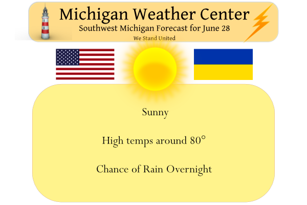
We have a cool 47° at 5 am this morning. Yesterday we had a high temp of 71° and the low was 51°. Today we have 15 hours and 16 minutes of daylight, down 24 seconds from yesterday. According to Walgreens billboard thermometer, the temp has been stuck at around negative 181° in Plainwell. They apparently don’t have it hooked up to any weather equipment.
Tonight’s chances of rain and amounts of rainfall increase the further north you are. We have a 60% chance in Otsego with only a couple of tenths of rainfall. Grand Rapids is at an 80% chance with up to a quarter-inch, and Lansing is predicted to have a 60% chance and around a quarter inch. Big Rapids is at an 80% chance of rainfall amounts between a quarter and half of an inch possible. These are all NWS predictions. Timing of frontal passages and moisture available has been the reason our rainfall has been minute the past couple of weeks. Seems the cold fronts pass overnight as the storms dry out when they hit the drier air masses which have been over Michigan.
Forecast Discussion
- Showers and a few thunderstorms possible tonight, early Wednesday

An upper low moving over Hudson Bay will swing a trough through the
Great Lakes late tonight. A 100 kt upper level jet driving this
feature will be aimed at WI and MI with the left exit region (upper
level divergence) moving into central WI and Lower Michigan near and
north of I-96 in particular. The juxtaposition of upper level
forcing and marginal surface based instability (~1000 J/kg) will
help fire scattered to numerous thunderstorms across central
Wisconsin during the afternoon. These storms will likely consolidate
into a broken or potentially solid line as they propagate SE
toward Lake Michigan closer to 00z.

The environment across central and southern Lower MI tonight is
supportive of showers and less supportive of thunderstorms, but
enough residual instability could help keep the threat going past
00z. CAM soundings suggest if thunderstorms hold together over the
lake after 00z, some locally gusty winds of 40-50 mph are possible
given the mid level jet present. However, enough CIN in the sfc-850
mb layer after sunset may prevent these winds from materializing at
ground level. Hail does not look to be much of a threat with this
event. Any residual showers or thunderstorms early Wednesday morning
should be moving out of the region by 12z or so.

- Dry and warmer for the midweek period

Dry conditions are expected from Wednesday afternoon into Thursday
evening with mid level height rises occurring after the weak front
passes through Wednesday morning. The warmest air at 850 mb (19C-
20C) will hold off its arrival until Thursday afternoon and evening.
As such, Thursday looks the hottest with most locations away from
the lakeshore reaching the upper 80s to low 90s, with a few inland
locations possibly reaching the mid 90s, which is shown by the EPS
25%-75% range.

- Showers possible Friday with a few storms not out of the question

Mainly showers are possible on Friday but some modest instability
could support some thunderstorms as well. The right entrance of a
fairly vigorous upper level jet for late June / early July standards
(125-130 kts) moves in on Friday. At 500 mb, a shortwave trough is
slated to traverse the region late in the day. The 850 mb winds will
be mostly divergent across the area however. While showers and
storms are not a "slam dunk" the chance looks halfway decent.
Roughly half of the EPS members feature 0.10" or more. Our current
POPs of ~40% during the day seems reasonable. Depending on cloud
cover and shower coverage, high temperatures may be brought down
into the 70s as opposed to the 80s, but there is some time to watch
yet.

Reminds me a bit of 1988. Rain was scarce, days were hot and sunny, and the nights would cool down a bit because it was so dry. Six 90 degree days here already and it’s not even July yet. Makes for a lot of great beach days!
06/28/2022 As can happen with dry air and dry conditions ,Yesterday was a very cool day for late June. The official H/L was 73/52. The high of 73 was the 6th coolest for the date and the low of 52 was the 8th coolest for the date. The official overnight low at Grand Rapids looks to have been 48 and for June 28th that ties for the 2nd coolest low for today. That ties 1923 and 1930 for the 2nd coolest low the record low of 43 was set in 1992. For today the average H/L is 82/61 the record… Read more »
Loving the Fall feel mornings we are having especially coming up on the hottest part of the year before we know it September will be here yeahhhhhhh…INDY
Yesterday and the overnight low for today were(are) some of the coolest readings for any June 27th and 28th. When it is dry and the dew point is low big temperatures swings can happen.
Slim
Great Scotty…..INDY
Who knew?
Michel, I have taken a pic and sent that to family down south and see it is really cold!!! Lol
Let’s hope the rain moves through we sure could use it!!!
Raspberries are coming on. Will have to makes some raspberry jam. I went out yesterday since I had jeans on to remove some big weeds in them.
Also tied flying a kite…kite eating tree got it, but we were able to get it down unharmed!!! 🙂