Yesterday’s high was 84° and the low was 62° in Otsego with .03 of an inch of rain bringing our total for the month to 2.62 inches which is below normal for the area. Looking at the long-range outlook into the middle of next week we may see increasing chances of rain as this dry pattern we have been in breaks down.
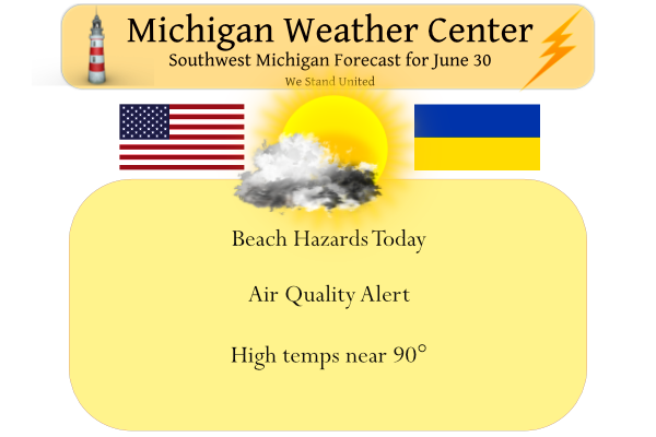
We close out the month of June on a hot and dry note with temps near 90° predicted for SW Michigan. We have an Air Quality Alert and Beach Hazards Statement in place for the lakeshore counties.

Large waves and strong currents are expected on Lake Michigan today, especially any beach north of Holland, toward Ludington and beyond. Grand Haven State Park and Pere Marquette Beach in Muskegon will be especially dangerous places to swim. The best way to stay safe is to stay out of the water.
Air Quality Alert
Muskegon, Ottawa, Kent, Allegan, Van Buren

People and businesses are urged to avoid activities which lead
to ozone formation. These activities include refueling vehicles
or topping off when refueling, using gasoline powered lawn
equipment, and using charcoal lighter fluid. Positive activities
include car pooling, biking to work, delaying or combining
errands, and using water based paints.
Forecast Discussion
-- Warm But Not Overly Humid Today --

The surface front which has been wavering over southern Michigan
since yesterday will move north as a warm front as southwesterly
low-level flow increases ahead of a cold front associated with
northern Ontario low pressure. Away from Lake Michigan,
temperatures are expected to climb into the upper 80s to around
90. Models are suggesting that moisture this morning is shallow,
and an area of relatively low theta-e air at 850 mb will be
advecting toward Michigan during the day. As boundary layer depth
/ diurnal mixing increases, dew points may drop this afternoon and
be held in the 50s, making the heat a little more bearable (not to
mention the breeze). As relative humidity drops into the 30s,
today may even lean toward fire weather concerns.


-- Chance of Showers and Storms Friday --

Rain for everyone is far from guaranteed, but there will be enough
ingredients present for a chance of thunderstorms Friday morning.
A surface cold front in the area, upper level troughing and the
right entrance region of an upper level jet streak (suggesting
upper level divergence) combined with 850 moisture advection
underneath modest to moderately steep mid-level lapse rates will
yield enough elevated instability, lift, and effective shear for
some convection. The potential for hail or locally strong wind
gusts will largely on the amount of MUCAPE present, and at least
some models show a ribbon of over 1000 J/kg possible, so if this
setup eventually evolves to feature some marginal local severe wx
concerns will have to be monitored.


-- Outlook For the Weekend Into Next Week --

The holiday weekend still looks seasonably warm with small chances
for a shower or storm from Sunday onward. A tendency for weak
upper level ridging and WNW flow would generally reduce the chance
of precip though shortwave troughs / compact vorticity maxes
embedded within this synoptic pattern may throw a wrench in the
forecast. Toward the middle of next week, the pattern across the
northern CONUS trends toward quasi-zonal in the upper levels with
an extension of the low level Bermuda High reaching the
southeastern US. This may increase the chance of thunderstorms.
Just hit 90 for the 4th time this summer at my house
Here is the new updated 30 day CPC guess for July.
https://www.cpc.ncep.noaa.gov/products/predictions/30day/
Slim
Nice, not above normal temps! Bring it!
On a side note – we have had an explosion of the chipmunk population this year. I had to have my mechanic friend remove the cowling which enclosed the blower motor on my car because the blower was making a heck of a racket. He pulled out six walnuts that were stored in there. This past week I have been putting moth balls around my sheds, wood piles, and under the car and truck to keep them at bay. This seems to have worked well, they hate the smell. Works for woodchucks too.
06/30/2022 Yesterday with a official H/L of 83/61 was one of the rare days that was exactly average. There was a official rain fall amount of 0.53” and that brought the June total to 1.42” and that means this June will now be just the 14th driest in Grand Rapids recorded history. The was 53% of possible sunshine yesterday. For today the average H/L is 83/62. The record high of 99 was in 1931 and the record low of 40 was in 1943. The overnight low in MBY was 63 and at the current time it is cloudy and 65.… Read more »