There has been a lull in the snowfall overnight in much of SW Michigan. Overnight there has been around 0.2” of new snowfall. Here in MBY at 6AM there is light snow falling and the temperature is 31. The temperature has hung around 32 for many hours now and the snow that has fallen is very wet and sloppy.
I know there are some who love the cold and snow and some who do not like it as much. While the start of this winter season has been one for the people who do not like the snow and cold the winter of 1978/79 was one for the ones who do like it.
Starting on November 27th 1978 Grand Rapids had 2” of snow on the ground and there was at least 1” of snow on the ground for every day up to March 14th 1979 that is a string of 108 days in a row of 1” or more on the ground. All 31 days of December 1978 had 2” or more topping out at 8”. The end of December seen a snowstorm with 8” on New Year’s Eve 1.8” more on New Year’s Day. On New Year’s Day there was 11” of snow on the ground that was the least amount of snow on the ground that month. As every day in that January had more than 11” on the ground. There was a several day snow event with a total of 21.8” in mid month. The most snow on the ground was 23” The most on the ground at Muskegon was 33” Back at Grand Rapids every day in February 1979 had over 12” of snow on the ground. With the most being 17” At Muskegon every day had oner 11” in February. The most there was 21” March started off with 11” at Grand Rapids and Muskegon the snow pack was gone in GR by March 14th it held on to March 19th at Muskegon. I am sure there were parking lot piles on the ground at the start of April. The meteorological winters of 1978/79 and 1903/04 are the only ones with 1” or mote of snow on the ground for the whole meteorological winter season.
For January 12th the official H/L at Grand Rapids was 34/28. There was 0.71” of precipitation and a reported 7” of snowfall. There was 3” of snow on the ground yesterday at 7AM the highest wind gust was reported at 38MPH our of the E. For today the average H/L is 31/19 the record high of 58 was set in 1932 and the record low of -5 was set in 2015. The most snowfall of 10.5” fell in 1979 the most on the ground was 20” in 1918. Last year the H/L was 35/24. The official snowfall at Grand Rapids was 7” yesterday here in MBY I had 4.2” of very wet snowfall and there is now a total of 7” on the ground here in my yard. Some other snowfall totals from yesterday are 3.9″ at Lansing, 4.5″ at Muskegon. 4.6″ at Detroit, 3.3″ at Saginaw.
AREA FORECAST DISCUSSION
NATIONAL WEATHER SERVICE GRAND RAPIDS MI
403 AM EST SAT JAN 13 2024
LATEST UPDATE…
LONG TERM
SHORT TERM
(TODAY THROUGH SUNDAY)
ISSUED AT 400 AM EST SAT JAN 13 2024
-LAKE EFFECT SNOW EXPECTED THROUGH THE SHORT TERM
BOTTOM LINE UP FRONT, NO ADJUSTMENTS WITH HEADLINES PLANNED FOR THIS
PACKAGE. SYNOPTIC SNOW WILL TRANSITION TO LAKE EFFECT TODAY AND
CONTINUE THROUGH THE SHORT TERM. THIS IN COMBINATION WITH GUSTY
WINDS OF 30-45 MPH AND BLOWING SNOW WILL KEEP TRAVEL HAZARDOUS. ANY
NEEDED ADJUSTMENTS TO HEADLINES THROUGH THE REMAINDER OF THE DAY AS
WELL AS FOR OUR SUBSEQUENT LAKE EFFECT EVENT WILL BE HANDLED BY
FUTURE SHIFTS.
AREAS SOUTH OF I96 HAVE SEEN A BREAK FROM SNOW OVERNIGHT AS DRY AIR
HAS WRAPPED IN FROM THE SOUTHWEST, WHILE DEFORMATION SNOW HAS
CONTINUED NEAR AND NORTH OF I96. RADAR SHOWS SNOW IS CURRENTLY
WRAPPING BACK INTO SOUTHERN MICHIGAN THIS MORNING AS THE SURFACE LOW
MOVES INTO LOWER MICHIGAN AND THE TROWAL AIRSTREAM WRAPS AROUND THE
LOW. THIS SNOW WILL ALSO GAIN LAKE ENHANCEMENT AS WINDS SHIFT TO THE
NORTHWEST BEHIND THE LOW PROVIDING ADDITIONAL MOISTURE.
THE ARRIVAL OF A COLDER AIRMASS TODAY SENDS HIGHS FALLING FROM NEAR
FREEZING THIS MORNING INTO THE LOW TO MID 20S BY TONIGHT. THIS WILL
HAVE THE ADDED EFFECT OF OUR SNOW CHARACTER BECOMING DRIER AND
LIGHTER AND BY EXTENSION MORE BLOWABLE. GUSTY NORTHWEST WINDS WILL
BOTH HELP CARRY THIS LAKE ENHANCED SNOW WELL INLAND AND CAUSE
OCCASIONAL WHITEOUT CONDITIONS TODAY. ADDITIONAL SNOW WILL BE 2-6
INCHES NORTH AND WEST OF I69, AND 1-3 INCHES SOUTH AND HIGHEST WEST
OF 131 TRAVEL WILL REMAIN HAZARDOUS THROUGHOUT THE DAY. IT WILL ALSO
BE BITTER AS WIND CHILLS FALL INTO THE SINGLE DIGITS.
-IMPACTFUL LAKE EFFECT CONTINUES TONIGHT
TONIGHT INTO SUNDAY MORNING WE TRANSITION AWAY FROM SYNOPTIC SNOW AS
THE SURFACE LOW EXITS TO THE NORTHEAST. AT THE SAME TIME, 850MB
TEMPS PLUMMET TO NEAR -20C, GENERATING AMPLE OVERLAKE INSTABILITY
AROUND 100 J/KG. PAIRED WITH DEEP MOISTURE (20-25 KFT OVER THE LAKE)
THIS SETS THE STAGE FOR LAKE EFFECT SNOW. LOOKING AT BOTH SURFACE
AND NAM12 MEAN FLOW TO 700MB, BOTH LAKESHORE CONVERGENCE WILL EXIST,
AND A CONVERGENCE BAND NEAR I96 AS WNW FLOW NORTH OF I96 INTERACTS
WITH WSW WINDS SOUTH. THIS WILL PROVIDE AMPLE DEEP VERTICAL MOTION
(AS SHOWN IN 1000-700MB OMEGA AND DGZ OMEGA). DEEP LAYER FLOW NEAR
30 KNOTS IN THE BACKGROUND WINDS WILL THEN CARRY LAKE EFFECT WELL
INLAND.
THE RESULT OF THIS IS A PLUME OF SNOW SHOWERS WELL MODELED IN HIGH
RESOLUTION GUIDANCE TO SET UP IN THE COUNTIES AROUND I96 TONIGHT,
EVEN AS FAR INLAND AS NEAR US127 GIVEN THE STRONG BACKGROUND FLOW.
THE STRONGEST SNOW SHOWERS WILL BE BETWEEN 00Z AND 15Z SUNDAY AS
THAT TIMEFRAME WILL HAVE THE BEST AVAILABLE FORCING. SNOW SHOWERS
THEN BEGIN TO DECREASE IN INTENSITY AFTER 18Z SATURDAY AS DEEPER
MOISTURE AND FORCING DECREASE.
THE END RESULT WILL BE 4-8 INCHES OF SNOW NEAR AND WEST OF US131, AS
WELL AS POTENTIALLY FURTHER INLAND WHERE THE HEAVY SNOW BAND SETS
UP. OTHERWISE INLAND AREAS WILL SEE 1-4 INCHES OF SNOW SATURDAY
NIGHT INTO SUNDAY. GUSTY WINDS NEAR AND SOUTH OF I96, WHERE THE
COLDEST AIRMASS WILL BE THANKS TO SOUTHWEST FLOW, WILL ALSO KEEP THE
POTENTIAL FOR BLOWING SNOW AND REDUCED VISIBILITIES.
SUBSEQUENT SHIFTS WILL EVALUATE THE NEED FOR HEADLINES TO COVER THE
LAKE EFFECT PORTION OF THE EVENT AS HIGH RESOLUTION GUIDANCE REFINES
THE BAND LOCATION. THE LAKE EFFECT SNOWFALL WILL KEEP TRAVEL
CONDITIONS POOR DURING THIS TIMEFRAME. WIND CHILLS SUNDAY NIGHT WILL
FALL INTO THE NEGATIVES, POSSIBLY BELOW -10F THANKS TO THE GUSTY
WINDS AND COLD AIRMASS.
LONG TERM
(SUNDAY NIGHT THROUGH FRIDAY)
ISSUED AT 402 AM EST SAT JAN 13 2024
– LINGERING LAKE EFFECT SNOW AND ARCTIC AIR
THERE WILL BE SOME LINGERING POSITIVE VORTICITY ADVECTION WITHIN THE
BROAD TROUGH OVER THE AREA THAT MOVES FROM SOUTH TO NORTH SUNDAY
NIGHT INTO MONDAY. MOISTURE WILL BE LIMITED ALOFT THOUGH WITH ONLY
A SHALLOW LAYER OF MOISTURE CLOSER TO THE SURFACE AND WITHIN THE
DENDRITIC GROWTH ZONE JUST A COUPLE THOUSAND FEET FROM THE SURFACE.
WE’LL STILL HAVE A DECENT FETCH OFF OF LAKE MICHIGAN FOR LIGHT LAKE
EFFECT SNOW TO CONTINUE WITH THE LAKE SURFACE TEMPERATURE AND 850MB
TEMPERATURE DIFFERENCE OF ABOUT 20 TO 25 DEGREES THROUGH THE LONG
TERM FORECAST. DUE TO THE SHALLOW MOISTURE LAKE EFFECT ACCUMULATIONS
ARE EXPECTED TO REMAIN LIGHT WITH ACCUMULATIONS AVERAGING AROUND 0.1
TO 0.2 INCHES PER HOUR. WE’LL HAVE TO WATCH FOR A FEW SHORTWAVE
TROUGHS THROUGH THE UPCOMING WEEK THOUGH AS THEY COULD HELP AMPLIFY
ANY LAKE EFFECT SNOW.
THE COLDEST AIR OF THE SEASON ARRIVES FOR NEXT WEEK WITH HIGHS IN
THE SINGLE DIGITS TO TEENS THROUGHOUT THE WEEK. LOWS OVERNIGHT WILL
BE IN THE POSITIVE TO NEGATIVE SINGLE DIGITS THROUGH MOST OF THE
WEEK WITH WIND CHILLS IN THE NEGATIVE SINGLE DIGITS TO NEGATIVE
TEENS INTO WEDNESDAY MORNING. WIND CHILL ADVISORIES MAY BE NEEDED
DURING THIS TIME.
Wow, wow, Wow!!
The snow intensity is picking up as we speak! WOW, just wow, WOW!!!
Nice 10 day snow map! Forget about a warm snowless winter! Those fantasies and delusions have been crushed. I love it!!
https://www.pivotalweather.com/model.php?p=snku_acc-imp&rh=2024011318&fh=240
What a storm and pattern! Winter at its best! I may go for a snowshoe hike tomorrow! Dress for the cold and get out outside enjoy our winter wonderland! Nothing better!!!!!
We will test the past statements that a warm/open lake in mid January should produce a good lake event. At this time that looks like the potential set up for tonight. The NWS is calling for this and we will see if that plays out or not. At the current time in MBY I am getting light snow with a temperature of 25. I will point out that the roads in Grand Rapids area at this time are good and well plowed. I hope everyone has their driveways cleared of the wet snow as that will become as hard as… Read more »
Parts of Kent County (including GGR) will be absolutely hammered with snow tonight! The Lake and the cold mean business! Mark it down and take it to the bank!
That wind is really starting to blow. Takes your breath away. I feel sorry for anyone needing to go outside.
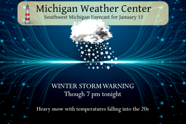
…WINTER STORM WARNING NOW IN EFFECT UNTIL NOON EST SUNDAY…
* WHAT…Lake effect snow, heavy at times. Additional snow
accumulations of 3 to 6 inches but localized amounts of up to
one foot possible. Winds gusting as high as 40 mph.
* WHERE…Portions of south central, southwest and west central
Michigan.
* WHEN…Until noon EST Sunday.
Get ready Grand Rapids for another 6 to 8 inches of snow by Monday! What a storm and what a huge pattern change! Bring it!
Our power was out for about 5 hours during the night. I was so grateful to see it come back on.
+1
GR has had 8.1” reported so far, exactly how much I measured here. One tree just fell in my neighborhood from the weight of the snow as well. However, roads do not seem too bad aside from unplowed side streets
By the way, I think Andy predicted 8”. Nice guess 😀
Yes but the system snow is not done yet, so the total will be higher, before we transition to pure lake effect! Mark it down!
One other point that 8.1 inch total was only through 7 am today and the storm was and is still rocking and roll8 g!
Thank you!
Just looked thru the comments and will weed out some of the hype. 1. yes this was by far the biggest snowstorm of this winter season. 2. The snow that fell so far this week had been a very wet and heavy snowfall. While at the airport a reported 4.1″ on Tuesday and 7.0″ yesterday. 3. Some of the snow that fell melted. 4. The last measurement I took here in my yard I had 7″ of wet snow on the ground. 4. The county has now plowed the road so will do the end of driveway thing in a… Read more »
NWS GR will be updating the headlines shortly as well. They will keep the warning in effect for Muskegon, Ottawa, Kent, Ionia, Allegan, Barry, Van Buren, and Kalamazoo Counties through noon Sunday.
This is what I call wow to the wow WOW!
Update from NWS GR:
“Bands near I-96 should intensify by 10 PM and will be fairly narrow so amounts tonight into early Sunday will be quite variable. Where bands persist it would not be surprising to see localized amounts upward of one foot by Noon Sunday, especially within a triangular polygon bounded by roughly MKG-BIV-Ionia, including GRR. The wind regime later tonight very much favors the GRR area/Kent County for some higher end L.E.S. amounts.”
I picked up 6.5” of fresh snow last night. Currently 8” total on the ground. Looks like more to come.
We got 14-16” on the ground. We picked up 7-8”, but we had significant snow still on the ground from the previous 2 snowfalls.
Obviously this was a major, monster snowstorm! I just got done snow-blowing and we have 9 fresh inches and 14 inches on the ground and still snowing! The snow we are currently getting is still part of the system snow (deformation), so the NWS and the RDB model were spot on again! Wait until the lake effect kicks in later today and tonight! Incredible Big Daddy event! WOW, just wow, WOW!!!!!!!!!
What a storm! Huge pattern change with tons of SNOW and now the polar vortex! INCREDIBLE!!!!!! WOW!!!
Just plowed over 4 inches of hardpack out of the driveway and the dog run with my JD x330. Just like pushing cement around. I have a big snowblower but I think that would have struggled. Put out the bird food and about got swarmed. I counted around 3 dozen scrambling for a bite to eat. It is 27 and light lake effect falling.
We had around 8 inches here. So kind of a “standard” snow storm. But the snow is REALLY sticking to the trees and weighing them down. Let’s hope no one else loses power.
Losing power is the worst!
I have numerous branches down in my yard this morning.
Decent snow squall moving through and getting windier. Power is flickering here at the moment. Haven’t gone out to measure yet but looks like a decent amount out there.
It’s been 12 hours since the snow stopped. My driveway is still clear from my shoveling at 8p last night. Still sitting at 3” here. West side of Lansing got 4”. They’re calling for possibly 1-3” more by tomorrow. The overall total for this area may end up being lower than expected, but I am not faulting the mets one bit. I think they did a solid job. It was difficult to lock in on a forecast for this area, as we were so close to the rain/snow line.
Totally different story over here! GR is up or around 9-10 inches so far and still moderate snow as we speak and then lake effect tonight! Epic monster storm!!!
That’s significantly more than what has been reported on the NWS GR website. I’m glad you got some decent accumulation. I got a little and you got a bunch. That’s a win-win. 👍
It is a bit hard to measure..but about 5 ish inches here. Probably a little more ..
The amount the NWS is reporting does not include all the snow from this morning! Wait till you see the totals after this event is done! Incredible!
I was looking at the reports made at the same time you reported.
Also, there was more snow on the northern parts of GR and the county, a little less by the airport!
Welcome to the Polar Vortex to the first visit of the year! Wowee!!!!
Yeah it looks to be very cold. We may even go below zero for the first time in two winters.
Hope it kills off some of the ticks!!!
It will.
The epic storm continues with no let up in sight! Cold and snow as far as the eye can see!!!