While we did not have much of a meteorological winter, we are none the less now in meteorological spring. This past meteorological winter with a mean of 33.6 was the 2nd warmest at Grand Rapids. For March the 30-year average temperature at Grand Rapids 35.7° the 15 year average is 36.3° The average 30 year total precipitation is 2.39” the 15 year average is 2.58” the 30 year average snowfall is 7.6” and the 15 year average is 5.4” The warmest mean average temperature was 50.7 in 2012 the coldest mean temperature was 23.9 in 1960. The wettest March was in 1948 with 5.77” the dryest was in 1910 with 0.08” the snowiest March was in 1965 with 36.0” (that is the 2nd longest running record for snowfall, May is the longest with the record going back to 1923) The least snowfall for March is 0 in 1910 1945 and 2021 had just a trace of snowfall. The record high for March is 87 on March 21, 2012, the record low was -12 on March 8th 1943 it was -8 on March 3rd 2014. The most snowfall for one day is 13.6” on March 2nd 2002 the storm total was 15.3” The most on the ground was 20” in 2014 the most days with 1” or more on the ground was 29 in 1965 in 1960 there were 27 days and in 2014 there were 20 days. For meteorological spring the 30 year average mean temperature is 47.5° the 15 year average is 48.0° the 30 year average precipitation is 10.30” the 15 year average is 10.71” The 30 year average snowfall amount is 9.6” the 15 year average is 7.6” The most snowfall for any meteorological spring is 41.4” in 1965 the least snowfall for spring is a trace in 1945.
As you may already know February 2024 was the warmest on record at Grand Rapids, Lansing, Muskegon and Holland and many other locations across Michigan and the Great Lakes area. The meteorological winter would have been the warmest on record if not for a cold and snowy 9 days in January. As for the winter season Grand Rapids has had only 40.3” of snowfall and is on track for one of the least snowy winters of record. And there so far there have only been 25 days with 1” or more on the ground while 23 is the least we are still in the running for 2nd place of 30 days set in 1931/32.
The official H/L yesterday at Grand Rapids was 49/25 there was a reported trace of rainfall and the sun was out 62% of the time. For today the average H/L is 38/23 the record high of 60 was set in 1961 and 1983 the record low of -8 was set in 1978. The wettest and most snowfall was in 2002 when 1.26” fell as 13.6” of snowfall. The most snow on the ground was 20” in 2014. Last year the H/L was 40/29.
AREA FORECAST DISCUSSION
NATIONAL WEATHER SERVICE GRAND RAPIDS MI
237 AM EST SAT MAR 2 2024
KEY MESSAGES
– DRY AND WARMING THROUGH THE WEEKEND
– RECORD WARMTH MONDAY, SHOWERS/STORMS MONDAY NIGHT
– CHANCE OF RAIN LATE WEEK
________________________________________
DISCUSSION
ISSUED AT 235 AM EST SAT MAR 2 2024
-DRY AND WARMING THROUGH THE WEEKEND
NO SIGNIFICANT WEATHER CONCERNS ARE EXPECTED THIS WEEKEND. SHORTWAVE
RIDGING BUILDS IN TODAY, GIVING WAY TO SOUTHWEST FLOW ON SUNDAY.
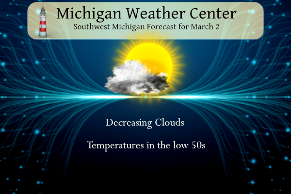
CLOUDS THIS MORNING WILL DECREASE INTO THE AFTERNOON FROM WEST TO
EAST, BRINGING PLENTY OF SUNSHINE BY EVENING. PARTLY TO MOSTLY SUNNY
SKIES CONTINUE INTO THE DAY ON SUNDAY. CONDITIONS TURN BREEZY SUNDAY
AS INCREASING GRADIENT WINDS AND A 35-45 KNOT LLJ MOVE OVERHEAD.
THOUGH THE WARM AIR ADVECTION PATTERN WILL LIMIT MIXING, GUSTS COULD
APPROACH 25-30 MPH.
SPEAKING OF ROBUST WARM AIR ADVECTION, THE WARMUP UNDERWAY CONTINUES
THROUGH THE SHORT TERM AS 850 MB TEMPS CLIMB FROM THE 3-5C RANGE
SATURDAY TO THE 10-12C RANGE BY SUNDAY AFTERNOON THANKS TO SOUTHWEST
FLOW. THIS WILL TRANSLATE TO HIGHS IN THE LOW 50S TODAY (COOLER FOR
THE LAKE MICHIGAN SHORELINE NORTH OF HOLLAND) AND THE MID 60S BY
SUNDAY.
-RECORD WARMTH MONDAY, SHOWERS/STORMS MONDAY NIGHT
A LARGE UPPER TROUGH ENTERING THE PACIFIC NORTHWEST EARLY THIS
WEEKEND WILL HELP TO BUILD UP THE RIDGE OVER THE EASTER HALF OF THE
COUNTRY. HEIGHTS WILL RISE OVER THE GREAT LAKES AND WARMER
TEMPERATURES WILL FOLLOW. STRONG SOUTHWEST FLOW WILL HELP H8 TEMPS
RISE TO 12C MONDAY. NEAR-RECORD TO RECORD HIGHS ARE EXPECTED WITH
TEMPERATURES RANGING FROM THE MID 60S NEAR US-10 TO LOWER 70S SOUTH
OF I-96. SEE THE CLIMATE SECTION FOR SPECIFIC RECORDS.
ONE VARIABLE THAT COULD PUT A LID ON HIGH TEMPERATURES IS CLOUD
COVER. THE AFOREMENTIONED UPPER TROUGH WILL PRODUCE A NORTHERN PLAINS
LOW IN SOUTH DAKOTA WITH A TRAILING COLD FRONT SOUTHWEST TOWARD THE
FRONT RANGE. A SECONDARY LOW IS PROGD TO FORM ON THIS FRONT IN
COLORADO AND RIDE NORTHEAST ALONG IT AS THE FRONT MOVES EAST TOWARD
THE GREAT LAKES SUNDAY NIGHT AND MONDAY. CLOUDS WILL NO DOUBT SPREAD
IN FROM THE WEST DURING THE DAY MONDAY AND SHOWERS MAY DEVELOP AFTER
3PM IN THE SOUTHWEST CWA. SO, TIMING IS EVERYTHING. IF THE CLOUDS
AND PRECIPITATION HOLD OFF FOR A FEW HOURS, WE’LL SEE HIGHS IN THE
70S, MOST LIKELY.
CONFIDENCE IS INCREASING THAT WE’LL SEE SHOWERS AND SCATTERED
THUNDERSTORMS MONDAY NIGHT. BOTH THE ECMWF AND GFS ARE SIMILAR IN
STRUCTURE AND TIMING OF THE FRONTAL MOVEMENT. INSTABILITY ISN’T THAT
IMPRESSIVE THOUGH; MUCAPE MONDAY NIGHT IS IN THE 400-600 J/KG
RANGE…ENOUGH FOR STORMS, BUT MOST LIKELY NOT SEVERE STORMS. ONCE
THE FRONT MOVES THROUGH TUESDAY MORNING, THE CLOUDS WILL GO EAST
WITH THE FRONT AND WE SHOULD SEE SOME SUN BY TUESDAY AFTERNOON.
TEMPERATURES WILL BE COOLER BEHIND THE FRONT, BUT STILL WELL ABOVE
NORMAL; HIGHS IN THE 50S ARE ANTICIPATED FROM TUESDAY THROUGH FRIDAY.
-CHANCE OF RAIN LATE WEEK
PRECIPITATION CHANCES LATE IN THE WEEK HINGE ON THE PHASING OF
NORTHERN AND SOUTHERN STREAM WAVES AS THEY MOVE EAST FROM THE WEST
COAST. BOTH THE ECMWF AND GFS SHOW A HIGH AMPLITUDE TROUGH
DEVELOPING OVER THE MIDDLE OF THE COUNTRY AS THE WAVES MOVES EAST.
SURFACE CYCLOGENESIS OVER THE GULF COAST PRODUCES AN INVERTED TROUGH
OVER THE SOUTHERN GREAT LAKES FRIDAY. STRONG SOUTH FLOW WOULD RESULT
IN RAPID MOISTURE TRANSPORT NORTHWARD RESULTING IN SHOWERS OVER THE
CWA. IT’S ALSO POSSIBLE THAT THE ENOUGH COLD AIR COULD GET INTO THE
SYSTEM FROM THE NORTHERN WAVE THAT WE COLD SEE SOME SNOW MIX IN TOO.
ENSEMBLE MEANS SUGGEST A 50-60 PERCENT CHANCE OF SEEING A TENTH OF
AN INCH OF RAIN, BUT ONLY A 10-20 PERCENT CHANCE OF A TENTH OF AN
INCH OF SNOW BY 7AM SATURDAY. THUS, CONFIDENCE ON P-TYPE IS LOW AT
THIS POINT, BUT SOMETHING TO WATCH.
Detailed Forecast for Grand Rapids
One final note if it does not fall below 40 before midnight today will set a new record for the warmest minimum for any March 2nd
True…this Winter deserves a gold star so far. Forecast showing this anomaly ending next week.
Not really….
https://weather.com/weather/tenday/l/52aab230ef88e4f2bb12857231a5dd58392e78a71b90e01d57a11d827658eb55
If anyone wants winter with tons of cold and snow every year, you need to move out to the Sierra Nevadas in CA and enjoy winters that constantly have like 30 feet of snow and frigid! Horrible weather out there!
If anyone wants winter like this ever year, you need to move down around TN and enjoy summers that are constantly mid 90’s and humid! Horrible weather down there!
This has been one of the most fantastic winters of my lifetime!! Absolutely perfect!! If only every winter could be like this!
Horrible winter so far! Pathetic as a matter of fact! Hopefully we see a couple more snowstorms yet this month and then we get hammered next winter to make up for this horrendous winter this year! Bring it on!
I would not be too surprised if we get a spring time snow storm in late March or early April but we shall see.
Slim
That is the spirit!