A leap year is a year with 366 days, instead of the usual 365. Leap years are necessary because the actual length of a year is nearly 365.25 days, not 365 days as commonly stated. Leap years occur every four years, and years that are evenly divisible by four (2020, for example) have 366 days. This extra day is added to the calendar on February 29.
However, there is one exception to the leap year rule involving century years, like the year 1900. Since a year is actually slightly less than 365.25 days, adding an extra day every four years results in about three extra days being added throughout 400 years. For this reason, only one out of every four century years is considered a leap year. Century years are only considered leap years if they are evenly divisible by 400. Therefore, 1700, 1800, 1900, and 2100 are not leap years. But 1600 and 2000 are leap years. The early Romans had a 355-day calendar year. and to keep festivals occurring around the same season each year, a 22- or 23-day month was created every second year. Julius Caesar decided to simplify things and added days to different months of the year to create the 365-day calendar; the actual calculations were made by Caesar’s astronomer, Sosigenes. Every fourth year following the 28th day of Februarius (February 29) one day was to be added, making every fourth year a leap year.
In 1582, Pope Gregory XIII further refined the calendar with the rule that leap day would occur in any year divisible by four.
At Grand Rapids the warmest February 29th I can find is 58 in 2000 and the lowest I can find is -2 in 1986. The wettest of 0.27” was in 2008 and that year also had the most snowfall along with 1960 with 4.1” the most snow on the ground was also in 1960 with 10.”
The official H/L yesterday at Grand Rapids was 47/24 there was a reported 0.01” of precipitation that fell as 0.1” of snowfall. Here in MBY there was just a trace of snowfall. There was a reported 48% of possible sunshine. For today the average H/L is 36/21 the record high of 57 was set in 1930 and 1976 the record low of -9 was set in 1989. The most rainfall of 1.09” fell in 2001 the most snowfall of 7.6” fell in 2016 the most snow on the ground was 17” in 2014. Last year the H/L was 29/22 there was a trace of snowfall and 1” on the ground. With clear skies the overnight low and current temperature here in MBY is 15.
It will be cold today and warmer on Sunday through Tuesday then cooler to end the month with the current mean for February at 34.5 and the record warmest February at 34.7 in 2017 we will have to wait and see how this month ends up but is 2nd warmest looks good and maybe even a record warmest at Grand Rapids.
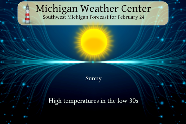
AREA FORECAST DISCUSSION
NATIONAL WEATHER SERVICE GRAND RAPIDS MI
322 AM EST SAT FEB 24 2024

KEY MESSAGES

- PARTLY TO MOSTLY SUNNY THIS WEEKEND

- MEDIUM/HIGH CONFIDENCE IN RAIN MOVING IN BY TUESDAY

- MEDIUM CONFIDENCE IN DETAILS FOR WEDNESDAY THURSDAY
DISCUSSION

ISSUED AT 322 AM EST SAT FEB 24 2024

- PARTLY TO MOSTLY SUNNY THIS WEEKEND

HIGH PRESSURE WILL SETTLE OVER THE STATE TODAY BEHIND THE
DEPARTING COLD FRONT. H8 TEMPERATURES NEAR -16C EARLY THIS
MORNING WILL RISE TO -4C BY THIS AFTERNOON. THAT CHILLY AIR
WILL BE TEMPERED BY QUITE A BIT OF SUNSHINE, THANKS TO HIGH
PRESSURE NOSING IN FROM THE NORTHWEST. AS THE RIDGE AXIS MOVES
EAST, WINDS WILL BECOME SOUTHWESTERLY AND THE WARMER AIR
WILLHOWEVERCONTINUE TO MOVE IN. MID AND HIGH CLOUDS WILL
ACCOMPANY THE SOUTHWEST WINDS TONIGHT AND RENDER THE SKY
OVERCAST FOR MUCH OF THE NIGHT. THOSE CLOUDS WILL THIN SOMEWHAT
SUNDAY ALLOWING SOME SUNSHINE TO FILTER THROUGH, BUT LIKELY NOT
AS MUCH AS TODAY.

HIGHS TODAY WILL BE A COUPLE OF DEGREES EITHER SIDE OF FREEZING
BUT IN THE 45 TO 50 RANGE SUNDAY.

- MEDIUM/HIGH CONFIDENCE IN RAIN MOVING IN BY TUESDAY

WE WILL KEEP A DRY FORECAST FOR SUNDAY NIGHT AS A WEAK FRONT MOVING
THROUGH HAS LITTLE MOISTURE TO WORK WITH. MOISTURE RETURN INCREASES
ON MONDAY AHEAD OF THE PROGRESSIVE WESTERN CONUS LONGWAVE TROUGH
MOVING EAST.

BUILDING WARM ADVECTION PATTERN AND AREA OF ISENTROPIC LIFT WITH
RAIN BREAKING OUT BY TUESDAY MORNING AND BECOMING WIDESPREAD TUESDAY
NIGHT. NBM CATEGORICAL POPS APPEAR JUSTIFIED GIVEN STRONG SUPPORT
FOR DEEP MOISTURE AND LIFT WITH UPPER LEVEL COUPLED JET. AT THIS
POINT IT APPEARS HIGHEST QPF WILL BE ACROSS SOUTHERN LOWER
MICHIGAN WHERE MODEL SOUNDINGS SHOW ENOUGH INSTABILITY FOR DEEP
CONVECTION.

- MEDIUM CONFIDENCE IN DETAILS FOR WEDNESDAY THURSDAY

MODEL GUIDANCE HAS INDEED TRENDED TOWARDS THE ECMWF WITH A MORE
PROGRESSIVE LONGWAVE TROUGH BRINGING THE COLD FRONT THROUGH TUESDAY
NIGHT. COLD AIR RUSHES IN WEDNESDAY WITH THE POSSIBILITY FOR ENOUGH
LINGERING MOISTURE IN AN ANAFRONT SITUATION RESULTING IN SNOW ON
WEDNESDAY, THEN ENDING WEDNESDAY EVENING AS SURFACE HIGH BUILDS IN.
Detailed Forecast For Grand Rapids
A good chunk of Lower Michigan already in the slight risk for severe weather Tuesday evening/night. Don’t see that this time of year very often.
Another big cold front will be coming through on Wednesday! Incredible!
It’s incredible that humans so long ago could calculate the length of days and years with great accuracy without the use of technology.
The local ten-day forecast shows two days with highs in the 30s – today and Wednesday. It also shows three days with highs in the 60s – Tuesday and then the following Sunday and Monday.
Looks like March starts with continued warmth:
https://www.mlive.com/weather/2024/02/extreme-warm-spell-tweaks-near-70-degrees-one-day-1-cold-day-moved-up-early-march-crazy-warm.html
Wow, 15 degrees outside! Now that is cold! Looks like another below normal temp day is on tap!
I would say barely below average. My area average is low of 18 and high of 34. Today is 14 low and 34 high. Just feels much below normal because it’s been so dang warm. Haha.
The average temps in GR is a low of 21 and high of 36 degrees! Very cold night and below normal high temps as well!