Yesterday’s high was 54° and the low 40° in Otsego. We had .23 of an inch of rain as of 6 am. This brings our total to 1.30 inches for the month and 3.43 inches for the season.
My least favorite thing during the fall is leaf removal, with the strong winds we have a lot of them on the ground. I generally mulch them back into the ground with the lawn tractor, but there are too many of them this time and they are wet. Now I will blow them into long lines with the tractor then put them into my tractor wagon.
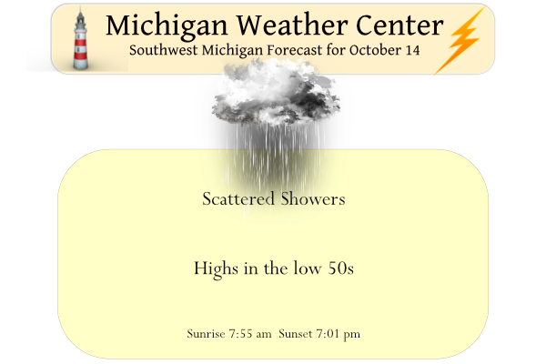
Today will be much the same as yesterday with lake-effect rain showers continuing to be possible. The best chance will be closer to the lakeshore. Highs will be 45 north to 55 south. Another round of showers is expected tonight. Some snow could mix in with the rain later tonight for the higher terrain of west-central Lower Michigan.
Forecast Discussion
- Continued Cold and Wet -

As a stacked low pressure system remains in place across the
northern Great Lakes Region over the next 6-7 days, below average
temperatures and wet conditions will be the story for the next
week. A few boosts in precipitation can be expected as a series of
shortwaves rotate around the base of the broader upper trough.
Lake effect clouds and rain persist in the meantime with
perpetual northwest flow supporting cold advection across Lake
Michigan.

Following the showers last night, our next uptick in precipitation
is expected tonight into early tomorrow morning as a shortwave moves
along the base of the upper trough into our area. A low level jet
will set up across southern MI ahead of the front, supplying a
reservoir of winds to mix down to the surface. Winds will turn breezy
this afternoon and evening prior to and along with the arrival of
the rain, with southerly gusts to 30 to 40 mph possible. Showers and
a few storms will arrive after 8pm this evening.

The system today will be followed with another reinforcement of
cold air. 850mb temps will continue to fall through the weekend
reaching around -5C by Monday. This will result in highs in the
low 40s Monday through Wednesday and morning lows below freezing.

- Snow Possible Early Next Week -

As stated previously, 850mb temps will plummet between the Monday to
Wednesday time range. Lake effect clouds and rain are expected to
persist into the start of next week due to persistent northwest
flow. Still expecting some snow to mix in with the rain,
particularly during the Monday morning and Tuesday morning time
frames. Impactful snow amounts are not expected, but could see a
slushy accumulation on grassy surfaces, particularly across our
typically colder higher elevation Central Lower MI locations.

Building high pressure to our west across the Central Plains appears
to finally break us of our wet period after mid-week.
Get ready! Extreme October cold is coming!
Currently 52 here at my house with some sunshine. Not to far to our northwest there is some snow showers and temps in the low to mid 30s across Wisconsin.
First snow flakes of the season early I must say but who is complaining?? Lol bundle up if you are going outside tenps in the 30’s currently in my hood happy November I mean October….INDY
49 here. No frozen precip yet, but maybe next week.
I take up the pine needles that fall at use it as mulch around my flower beds. We have so many info this in the fall and then take up a garbage can full to save for spring. I will have to wait for them to dry to do that though!!!
Should be rake instead of take… Fat fingers… Ugh!!
Welcome to Friday the 14th The official H/L at Grand Rapids yesterday was 53/43 there was officially 0.19” of rain fall and there was a trace of snow fall. I would report that snow fall as small hail as that is what fell here in MBY. There was 18% of possible sunshine between showers. Here in MBY I recorded 0.66” of rain fall as of 7 AM. The overnight low here in my yard was 38 and that is the current temperature with light rain falling. For today the average H/L is 62/43 the record high of 83 was recorded… Read more »