My wife and I are going to Ohio to see the total solar eclipse on Monday. We are going to the town of Bucyrus. It is a rather small town about 40 miles SSW of Sandusky. The eclipse will be total there for about 3 minutes and 43 seconds. While not the longest period of total in Ohio (around 3 minutes 52 seconds is) I have booked a hotel for both Sunday and Monday nights. We will view the eclipse from the parking lot. The will give us a nice base for the viewing (depending of course on how the sky conditions play out) So we will have a bathroom if needed and a place to get food and drinks as needed. During the last eclipse in 2017 we went to the Tennessee-Kentucky state line. We had a space at a drive in movie theater. That worked out great as we had the above bathroom and there was food and they had several people from the University of Western Kentucky give presentations on the eclipse. That drive-inn is right on the state line and you could walk into Tennessee and or Kentucky. That eclipse the time of totally was 2M and 32S so this year it will be just over a minute longer than that one was. The day that year was great with a clear sky and the temperature was in the low 90’s before the start and yes it did indeed get much cooler at its peak. The biggest issue wat the huge traffic jam that happened after. I went to get on north bound I 65 and in the road leading to the interstate the right lane was stopped about 3 miles before the exit. I took the back road up the Bowling Green it was not bad on the road but there was still a lot of traffic. We had dinner in Bowling Green and I thought the traffic would be broken up by there. Well it was not. The line to get on I 65 was now around 10 miles long. I decided to take a back two lane road north. So I got on US 31 north. This was a good idea for about 70 miles. On I 65 it is about 125 miles to Louisville and less than 2 hours. Well after about 70 miles US 31 was also backed up and we were just crawling along at bout 20 MPH. It took us until past 12 midnight to get to Louisville. As I did not know how to cross the river on the back road and the city streets in Louisville. I got back on 65 it was moving now but it was only about 40 MPH. It was a long trip home that night so this time I am staying a 2nd night at the hotel. While it is still a ways out and things could change but this AM weather guess for Sunday in Bucyrus is Mostly sunny, with a high near 71. Southeast wind around 11 mph. So we shall see.
Weather history for April 6
1882: A tornado outbreak strikes Lower Michigan, killing 10 people and injuring more than 50 others. Tornadoes struck Midland and Kalamazoo Counties, killing one person each. Four people were killed in a tornado that moved between Bedford and Charlotte. Three people were killed in Oakland County by a tornado that passed between Clyde and West Highland. A tornado that struck east of Dansville in Ingham County killed one person. A barn and home were destroyed by a tornado a mile west of Charlotte, but no one was killed.
On April 6, 2010, a prolific hail storm moved from southern Livingston County to southern Macomb County. The storm produced 1.5 inch diameter hail in Brighton, 1.75 inch in Commerce, and 2.25 inch hail in Sterling Heights.
On April 6, 2009, a low pressure system tracking northeast through the Ohio River Valley produced a late season heavy snowfall across Southeast Michigan. Snowfall totals averaged 1 to 4 inches south of I-94, 4 to 8 inches between I-94 and I-69, and 1 to 4 inches north of I-69. Due to the heavy snow and winds to around 30 mph, tree branches came down which resulted in power outages focused along the M-59 corridor. Some of the higher snowfall included Grand Blanc 6.3 inches, Elba 7.0 inches, Cement City 6.0 inches, Howell 6.3 inches, Shelby Township 6.4 inches, White Lake 7.8 inches, Deckerville 6.0 inches, Ann Arbor 6.0 inches, and Romulus 6.7 inches.
On April 6, 1886, the biggest snowfall ever recorded in Detroit in a 24 hour period occurred with 24.5 inches. This snow had a very high water content (2.43 inches) and was therefore very heavy and packed. This made it difficult for residents and services, such as police and medical, to travel anywhere. Amazingly, the next day temperatures rose to 40 degrees and up into the 50s later in the week.
Also on April 6, 1882, the earliest recorded Michigan tornado outbreak hit Southern Lower Michigan. Six tornadoes rolled across the southern part of the state including Midland, Bay, Livingston and Oakland Counties. In the state there were 10 deaths and 54 injuries as a result of the outbreak. The Midland tornado started just north of Midland and ended near Inwood in Bay County. This tornado was responsible for 1 death and 15 injuries. The Livingston tornado started near Hartland and moved to Clyde in Oakland County. Five homes were destroyed near Clyde where the 3 deaths and three injuries were reported.
1997: A strong cold front moved through with a line of thunderstorms producing wind gusts to 70 mph and causing widespread damage across much of southern Lower Michigan.
The official H/L yesterday at Grand Rapids was 50/36 there was no rain/snowfall. The sun was out 51% of the time. The average wind speed was 9 MPH. For today the average H/L is 54/34 the record high of 81 was set in 1921 and 1991 the record low of 18 was set in 1943 and 2003. The most rainfall of 1.87” fell in 2010 the most snowfall of 3.5” fell in 1914 the most on the ground was 7” in 1982. Last year the H/L was 45/34.
AREA FORECAST DISCUSSION
NATIONAL WEATHER SERVICE GRAND RAPIDS MI
337 AM EDT SAT APR 6 2024
KEY MESSAGES
– WARMER, DRY, AND MOSTLY SUNNY SATURDAY
– CLOUDING UP SUNDAY, AFTERNOON-EVENING SHOWERS
– CLEARING LIKELY FOR THE ECLIPSE MONDAY, WARMER
– UNSETTLED, COOLER FOR MID TO LATE WEEK
DISCUSSION
ISSUED AT 337 AM EDT SAT APR 6 2024
– WARMER, DRY, AND MOSTLY SUNNY SATURDAY
SURFACE HIGH PRESSURE AND SUBSIDENCE IN THE MID-UPPER LEVELS WILL
PROVIDE A WARMER DAY WITH A GOOD DEAL OF SUNSHINE. JUST ENOUGH
LINGERING MOISTURE IN THE BOUNDARY LAYER MAY CREATE SCATTERED
CUMULUS NEAR/EAST OF BATTLE CREEK TO LANSING, BUT DRY AIR MIXING
SHOULD EVENTUALLY PREVAIL. NUDGED DEW POINTS DOWN A LITTLE AGAINST
THE NBM, RESULTING IN AFTERNOON RELATIVE HUMIDITY DROPPING TO ABOUT
30 PERCENT, POSSIBLY LOWER IN SOME AREAS. THE DRY AIR, CLEAR SKIES,
AND LIGHT WINDS WILL MAKE TONIGHT FAIRLY COLD, BELOW FREEZING IN
MANY SPOTS, BUT THIS IS NOT MUCH COLDER THAN NORMAL FOR EARLY APRIL.
– CLOUDING UP SUNDAY, AFTERNOON-EVENING SHOWERS
CIRRUS AND ALTOSTRATUS WILL STREAM IN FROM THE SOUTHWEST AHEAD OF
THE CENTRAL PLAINS LOW ON SUNDAY. INITIALLY DRY AIR IN THE LOW
LEVELS MAY LIMIT AFTERNOON PRECIPITATION TO VIRGA OR SPRINKLES.
BETTER PRECIP PRODUCTION LATER SUNDAY EVENING MAY RESULT IN RAIN
TOTALS AROUND 0.10 INCH. THE CHANCE OF LIGHTNING LOOKS FAIRLY LOW,
LESS THAN 10 PERCENT.
– CLEARING LIKELY FOR THE ECLIPSE MONDAY, WARMER
CONFIDENCE CONTINUES TO INCREASE THAT ENOUGH CLEARING WILL TAKE
PLACE FOR ADEQUATE ECLIPSE VIEWING ON MONDAY AFTERNOON ACROSS
WEST/MID MICHIGAN. BAND OF RAIN SHOWERS WILL BE EXITING EARLY IN THE
DAY WITH A DRY SLOT FOLLOWING FROM THE SOUTHWEST IN TIME FOR THE
ASTRONOMICAL EVENT WHICH OCCURS BETWEEN 2 AND 4 PM (PEAKING SHORTLY
AFTER 3 PM).
THE CLEARING OCCURS DUE TO SUBSIDENCE IN THE WAKE OF A DEPARTING MID
LEVEL SHORTWAVE, ALTHOUGH WOULD NOT RULE OUT A SCATTERED TO BROKEN
DIURNAL CUMULUS DECK DEVELOPING SOUTH AND EAST OF GRR BY ECLIPSE
TIME, AWAY FROM THE COOLER/STABLE MARINE AIR. LOW LEVEL FLOW WILL BE
OUT OF THE SOUTHWEST WHICH SHOULD YIELD A HIGHER CHANCE OF CLOUD
FREE SKIES FOR THE LAKESHORE AREAS. MILDER HIGH TEMPS OF 65 TO 70
EXPECTED ON MONDAY INLAND FROM LK MI WITH ARRIVAL OF H8 THERMAL
RIDGE AS A WARM FRONT LIFTS NORTH THROUGH THE REGION.
WARMTH CONTINUES INTO TUESDAY AND PWATS/DEW PTS CONTINUE TO CREEP UP
IN SOUTHERLY FLOW PRECEDING AN APPROACHING SFC COLD FRONT. SCATTERED
SHOWERS EXPECTED, AND WE MAY HAVE SOME TSTMS TOO DEPENDING ON TIMING
OF THE COLD FRONTAL PASSAGE.
– UNSETTLED, COOLER FOR MID TO LATE WEEK
A PERIOD OF COOLER WEATHER ARRIVES FOR THE MID TO LATE WEEK PERIOD
BEHIND THAT COLD FRONT, WHICH EVENTUALLY STALLS ACROSS THE OHIO
VALLEY REGION. MODELS/ENSEMBLES DIFFER ON TIMING OF THE MAIN WAVE
LIFTING NORTH ALONG THE STALLED FRONTAL BOUNDARY, BUT CONSENSUS
SEEMS TO FAVOR THAT WAVE AND A DECENT SLUG OF RAIN COMING THROUGH ON
THURSDAY, FOLLOWED BY FAIRLY STRONG COLD ADVECTION NEXT FRIDAY WITH
A PERIOD SUB-ZERO H8 TEMPS AND BRISK NORTHWEST WINDS. THE PATTERN
LOOKS PROGRESSIVE THOUGH WITH UPPER TROUGHING AND COLD AIR LIFTING
OUT QUICKLY FOR NEXT WEEKEND AND TEMPS WARMING BACK TO NEAR OR ABOVE
NORMAL VALUES.
Detailed Forecast For Grand Rapids
Today
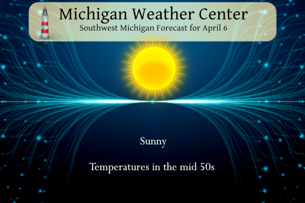
Sunny, with a high near 57. North northeast wind 5 to 9 mph.
Tonight
Clear, with a low around 33. Calm wind becoming east around 6 mph after midnight.
Sunday
A 30 percent chance of showers after 2pm. Increasing clouds, with a high near 56. East southeast wind 8 to 17 mph, with gusts as high as 26 mph.
Sunday Night
Showers likely, mainly between 8pm and 2am. Mostly cloudy, with a low around 42. East southeast wind 14 to 16 mph, with gusts as high as 24 mph. Chance of precipitation is 70%. New precipitation amounts between a tenth and quarter of an inch possible.
Monday
A 10 percent chance of showers before 8am. Mostly sunny, with a high near 68. East southeast wind 13 to 17 mph becoming south southwest in the afternoon. Winds could gust as high as 25 mph.
Monday Night
Partly cloudy, with a low around 46.
Tuesday
A 30 percent chance of showers after 8am. Partly sunny, with a high near 65.
Tuesday Night
Partly cloudy, with a low around 43.
Wednesday
A chance of showers after 2pm. Partly sunny, with a high near 62.
Wednesday Night
A chance of showers. Mostly cloudy, with a low around 45.
Thursday
A chance of showers. Mostly cloudy, with a high near 59.
Thursday Night
A chance of showers. Mostly cloudy, with a low around 40.
Friday
Mostly sunny, with a high near 54. Breezy.
All the wishcasting in the World did not prevent winter from happening and we saw multiple snowstorms despite the constant warm weather hype! Fact people facts!! I love it!
Nice short three week winter and only 46 inches of snow! All the wishcasting in the world did not help this winter!
Feels great outside finally Spring has started let’s keep it going ready to hang outside and get a sun tan ….INDY
Could it be? Is it possible? Maybe, just maybe? Winter weather might be done? After all it is going into the second week of April! The warm weather nuts declared winter over in December, January, February and March! Every time that made those ridiculous statements it would get cold and SNOW! Incredible!
We finally have sustained weather in the 50s and 60s… and that takes us towards the end of April. So I think we are generally entering the warmer half of the year now
What’s better than golf, pickleball, tennis, or kayaking in early April? Get ready for a long summer!
LETS GO MOOKIE!!!!
Snowshoeing or skiing in the beginning good April is dramatically better! Who knew?
Yeah no one agrees with that.
Phenomenal golf weather all week coming up! Maybe I’ll leave work early on Monday and golf during the eclipse!
Eclipse = ? I am not sure what the big draw is to see the eclipse? It seems like a waste of money and time to me! I would much rather drive to the UP for a ski trip!