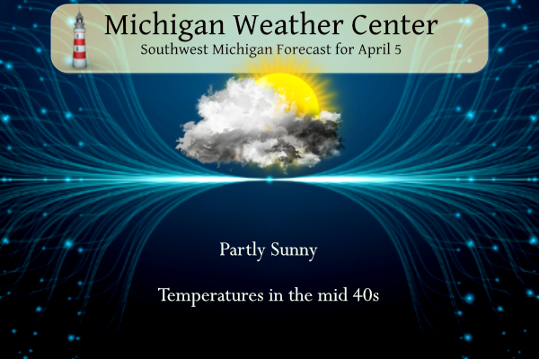
After several days of gloomy wet weather, we should (hopefully) see some peeks of the sun today and temperatures will finally begin a warming trend. This weekend looks to have lots of sun with temperatures in the mid-50s. We had .83 of an inch of rain this week and 4.34 inches thus far this spring.
NWS Forecast
Weather History
1982: Arctic air pours into Lower Michigan in the wake of a snowstorm and lake effect snows pile up over a foot across western Lower Michigan. The 12 inches of snow at Muskegon makes this the snowiest April day on record there.
On April 5, 1995, Flint had a record low of 13 degrees for the day. The day before, on the 4th, Flint had the same record low of 13 degrees for that day.
Also on April 5, 1982, a snowstorm hit Southeast Michigan in the evening hours and continued into the 6th. The storm moved across the Ohio River Valley and left Detroit with 7.4 inches of snow, Flint with 7.1 inches, and Saginaw with 4.0 inches.
1815: The Tambora Volcano in Java began erupting on this day. A few days later on the 10, Tambora produced the largest eruption known on the planet in the last 10,000 years. Ash from the volcano would circle the globe, blocking sunlight and leading to the unusually cold summer in 1816. On 6/6/1816, snow would fall as far south of Connecticut with some places in New England picking up 10 inches. On July 4th, 1816, the temperature at Savannah GA plunged to 46 degrees. Eastern North America and Europe had freezing nighttime temperatures in August.
1936: Approximately 454 people were killed in the second-deadliest tornado outbreak ever in the U.S. More than 12 twisters struck Arkansas to South Carolina. An estimated F5 tornado cut a path 400 yards wide through the residential section of Tupelo, Mississippi. At least 216 people were killed, and 700 were injured. The tornado had a 15-mile-long path and did $3 million in damage. One of the survivors in Tupelo was a baby of an economically strapped family who had an infant they’d recently named Elvis Aaron Presley. Gainesville, Georgia had at least 203 fatalities and 934 injuries from an estimated F4 tornado that occurred early the following morning.
1972: An F3 tornado, touched down at a marina on the Oregon side of the Columbia River, and then tore through Vancouver, Washington. The tornado killed six people, injuring 300 others, and causing more than five million dollars in damage. It was the deadliest tornado of the year and the worst on record for Washington.
Forecast Discussion
- Isolated showers and partial clearing today

The large upper-level low (the eastern foot of the Omega block
planted over North America) is now centered over the Northeast US,
though there is one more lobe of troughing and vorticity that will
be swinging through our area from the north today. Lingering low-
level moisture and steep lapse rates from the surface into the
bottom of the DGZ may produce a few more isolated showers today,
with relatively higher chances in southern Michigan. Skies in
western portions of Lower Michigan are favored to get clearing later
in the day.

- Drying out and warming with sunshine on Saturday

Finally a respite from the cold and clouds on Saturday as a high
pressure ridge in the mid to lower levels replaces the low. Despite
a light breeze from the north, high temperatures will return to near-
normal with highs in the mid 50s (away from the immediate shoreline
of Lake Michigan).

- Showers Likely Late Sunday into Early Monday

Rain chances increase from southwest to northeast Sunday afternoon
and evening as ridging and confluent flow aloft is broken down and
replaced by an incoming shortwave rotating around the nrn Plains
upper low. Warm conveyor belt with a Gulf connection preceding the
shortwave and its associated occluded sfc front helps send a band of
showers through the area, although generally light amounts expected
at this time due to a dry southeasterly low level flow preceding the
incoming rain.

- Potential for Some Clearing for Monday Eclipse; Milder

Passage of the aforementioned shortwave and occluded front could
provide enough of a decreasing cloud pattern for decent eclipse
viewing on Monday, especially over southern sections of the area.
From a probabilistic standpoint, the grand ensemble approach
indicates a 60-70 pct chance of less than 50% sky cover south of
Interstate 96 and 35-55 pct chance north of I-96. Even though some
optimism currently exists for some clearing, there will be a large
upper low to our west which may complicate cloud forecasts going
forward. Milder air arrives from the southwest on Monday with highs
in the 60s expected.

- Unsettled Mid to Late Part of Next Week

The middle to late part of next week looks to turn unsettled with
numerous shower chances as waves ride northeast along a stalled
frontal boundary situated from the Ohio Valley to the Gulf coast.
Temps should be near or perhaps cooler than normal since we will be
on the cool side of that boundary with northeast or northerly low
level flow prevailing.
Tomorrow afternoon, great golf weather! Get your tee times early! Upper 50’s and light winds! Fantastic for golf!!
Horrible snowmobiling weather tomorrow!
Horrible golf weather tomorrow morning with wind chills in the 30’s, then better in the afternoon with sun and temps in the 50’s then Sunday 20 to 30 mph winds with clouds rolling in! Incredible!
Great golf weather starting tomorrow!! Get out there this weekend and enjoy it!
Horrible cross country skiing weather this week!!
Wind chill still 39 degrees and mostly cloudy! Horrible golf weather!
Facts people! This has been a cold, windy and wet start to April! WOW!
Breaking news! We are nowhere near summer and nice warm temps despite the constant hype! Incredible!
Another cold golf day! Wind chills are still in 30’s at 1:30 pm! WOW, cold, cold, cold!!!!!!!
How’s the snowshoeing today??
Heard from friends in NY they felt the quake…
Starting Saturday, 55-65 degrees everyday with lots of sun. Pure heaven on earth as we climb into summer!
It’s also remarkable that for all the pondering about how “cold” it is, we are almost average temps for April so far. With a blowtorch on the way!
Well, so much for all the snow that some on here promised for this week. Better luck next winter? As I’ve been saying for a long time now, our 2.5 week winter is over.
Looking forward to the eclipse Monday. I’ll be headed to Ohio. We got a hotel in Toledo Sunday night and will drive Monday morning a little further south to go where the longest duration of totality will be. Hopefully there is plenty of clearing.
Still some great skiing in the UP! WOW, just wow, WOW!!!! Winter keeps rocking!!!
https://skibrule.com/brule-mountain/snow-conditions/
How is that possible?
Big time snows up there! Incredible!
The overnight low here in MBY was 36 at the current time it is partly cloudy and 37.
Slim
The official H/L yesterday was 45/65 there was 0.16” of rainfall the highest wind gust was 23 MPH out of the NE there was just 3% of possible sunshine. For today the average H/L is 53/33 the record high of 81 was set in 1988 the record low of 12 was set in 1995 the most rainfall of 1.87” was in 1947 the most snowfall of 8.6” was in 1952 the most on the ground was 6” in 1975. Last year the H/L was 71/44 and there was 1.87” of rainfall.
Slim
Yesterday was yet another below normal temp day with wind chills below freezing, yet all we hear from the warm weather fanatics is about how warm it is! Too funny! Reality baby! Time to face the music! It has been a cold start to April! WOW!