Last week I posted about the winter of 1978/79 that had at least one inch of snow on the ground for the whole meteorological winter. In recorded history at Grand Rapids here is a is a list of winter seasons with the greatest number of days with at least one inch of snow on the ground. 1st place 1903/04 with 124 days. 2nd place 1977/78 with 116 days. 3rd place 1958/59 with 114 days. 4th place 1978/79 with 111 day. In 5th place 2013/14 with 109 days. Now here is a interesting fact so far this winter Grand Rapids has only had 12 days so far. So here is a list of the years with the least number of days with one inch or more on the ground. 1st place 1982/83 with 23 days with 9 of them in March. In 2nd place 1931/32 with 30 with 19 of them in March. 1952/53 with 33 with 15 of them in January. In 3rd place 1952/53 with 33 for 4th place there is a two winter tie with 34 in 2011/12 and 1936/37. In 5th place with 35 is 1943/44. So even with all of the snow we now have on the ground we are still in the running for one of the lowest number of days with one inch or more on the ground. Note I am not saying we will end up with a top least number of days with snow on the ground just that we are in the running. I will update this later in the season.
The official H/L yesterday at Grand Rapids was 21/9 there was 0.8” of snowfall and a reported 12” on the ground here in MBY I have 14” on the ground. There was 54% of possible sunshine for one of the sunniest days this year so far. For today the average H/L is 31/18 the record high of 64 was set in 1906 and the record low of -15 was set in 1984. The most snowfall was 6.8” in 1963 the most on the ground was 21” in 1979. Last year the H/L was 36/31 and there was a trace of snow on the ground. Here are some snowfall totals as of January 19th at Grand Rapids for January 30.8” and for the season 42.1” with 12” on the ground (14” here in my yard. At Muskegon for January 23.7” for the season 41.1” and 11” on the ground. At Lansing 16.8” for January, 21.6” for the season and 6” on the ground.
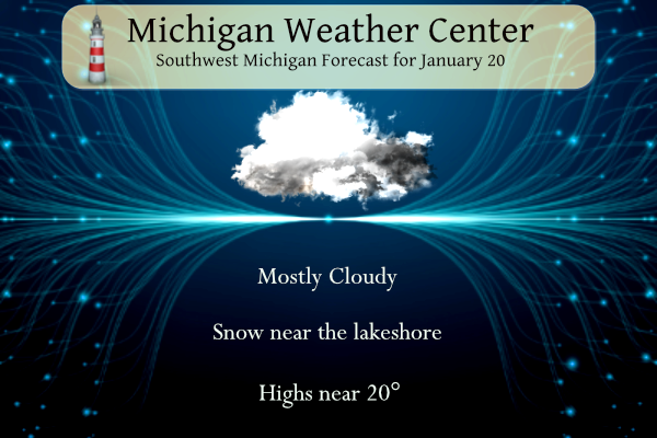
DISCUSSION
ISSUED AT 356 AM EST SAT JAN 20 2024
-ACCUMULATING LAKE EFFECT SNOW THROUGH THIS EVENING
EXTENSIVE CLEARING HAS TAKEN PLACE AND TEMPERATURES CONTINUE TO
PLUMMET WITH DEEP SNOW PACK PRESENT. MOST LOCATIONS WILL BE BELOW
ZERO TO START THE DAY; POSSIBLY AS COLD AS 10 BELOW IN SPOTS.
RESULTANT LAND BREEZE/MESO-HIGH HAS PUSHED IMPRESSIVE SNOW BAND
WHICH PRODUCED 30″ AT LAPORTE IN WELL OFFSHORE. MEANWHILE
STRONGER NORTHWEST FLOW OVER THE NRN PART OF LK MI IS SENDING
SNOW SHOWERS INTO AREAS NORTH OF MKG ALTHOUGH THESE LOOK TO BE
OF LIGHTER INTENSITY THAN THE BAND IN THE CENTER OF SRN LK MI.
ONCE DIURNAL EFFECTS KICK IN BY MID/LATE MORNING, LOOK FOR LAKE
EFFECT CLOUDS AND SNOW SHOWERS TO SPREAD BACK INLAND. WILL NOT BE
MAKING ANY CHANGES TO THE CURRENT WINTER WEATHER ADVISORY WITH
GENERALLY A 4-7″ SNOWFALL EXPECTED IN THE SOUTHWEST COUNTIES AND
2-4″ IN THE NORTHWEST COUNTIES. OF COURSE WITH LAKE EFFECT YOU
CAN NEVER RULE OUT LOCALLY HIGHER AMOUNTS.
INVERSION HEIGHTS WHICH ARE AROUND 10K FT TODAY COME CRASHING DOWN
BELOW 5K FT AFTER 00Z TONIGHT AS RIDGING BUILDS IN. SNOW SHOWERS
WILL DIMINISH ACCORDINGLY AND LITTLE OR NO ADDITIONAL
ACCUMULATIONS ARE EXPECTED AFTER MIDNIGHT.
FINALLY A QUIET/DRY WEATHER DAY IN STORE FOR SUNDAY ALTHOUGH
SOMEWHAT BREEZY AND CHILLY AS LARGE SFC HIGH SLIDES BY TO OUR
SOUTH. THE COMBINATION OF HIGHS 20-25 AND SOUTHWEST WINDS OF
10-20 MPH WILL HOLD WIND CHILLS IN THE SINGLE DIGITS AND TEENS.
– WINTRY MIX LIKELY MONDAY INTO TUESDAY
WARMER AIR BEGINS TO INFILTRATE THE SOUTHERN GREAT LAKES ON MONDAY
OVER THE TOP OF A SLOWLY RETREATING COLD AIRMASS NEAR THE GROUND.
THIS WILL SET THE STAGE FOR A MIXTURE OF PRECIPITATION FROM MONDAY
INTO TUESDAY. THE BULK OF THE WINTRY MIX WILL OCCUR ON MONDAY AND
MONDAY NIGHT ASSOCIATED WITH A SHORTWAVE MOVING QUICKLY THROUGH THE
NORTHERN GREAT LAKES. FOR THAT REASON (A SHORTWAVE THAT IS NORTH OF
THE AREA) THE PRECIPITATION DURING THIS TIME FRAME IS ON THE LIGHTER
SIDE. THERE ARE STILL IMPACTS THAT WILL BE POSSIBLE THOUGH,
ESPECIALLY TO TRAVEL, GIVEN THE COLD ROAD TEMPERATURES. WE ARE NOT
EXPECTING BIGGER ISSUES THAN THAT AT THIS POINT. WE WILL CONTINUE TO
MONITOR TRENDS IN THE PRECIPITATION TOTALS AS THE EVENT DRAWS NEAR.
MONDAY AND MONDAY NIGHT WILL BE A TIME FRAME WE WILL BE WATCHING AS
IT IS NOT OUT OF THE REALM OF POSSIBILITIES THAT WE MAY NEED A
WINTER WEATHER ADVISORY BOTH FOR A MIX AND FOR SNOW. MONDAY NIGHT
ACROSS CENTRAL LOWER MICHIGAN ESPECIALLY COULD SEE A SWATH OF
ACCUMULATING SNOW ON THE ORDER OF SEVERAL INCHES.
THE MORE SIGNIFICANT PUSH OF PRECIPITATION COMES IN ON TUESDAY AT A
TIME WHEN THE WARMER AIR WILL SURGE IN BOTH AT THE SURFACE AND
ALOFT. SO, WHILE THERE MAY BE A PERIOD OF RAIN AND SNOW ON TUESDAY
ACROSS CENTRAL LOWER MICHIGAN, WE ARE NOT EXPECTING BIG MIXED
PRECIPITATION ISSUES AS WE SHOULD FLIP OVER TO RAIN FAIRLY QUICK
GIVEN THE WARM AIR ADVECTION.
– WARMER WITH RAIN MID TO LATE NEXT WEEK
ONCE WE GET THROUGH THE EARLY PART OF THE WEEK WE SHOULD BE IN A
FAIRLY STEADY PATTERN WITH WARMER AIR IN GENERALLY SOUTHWEST FLOW
ALOFT. 850MB TEMPERATURES WARM FROM SLIGHTLY BELOW ZERO C TO BEGIN
THE WEEK TO +1 TO +5 FROM WEDNESDAY INTO THURSDAY. WE SHOULD BE
LOOKING AT A COLD RAIN IN THE MID WEEK TIME FRAME WITH HIGHS AROUND
40. LATE IN THE WEEK THERE ARE SOME MODEL DISCREPANCIES AND LOWER
CONFIDENCE IN FORECAST DETAILS ARE A RESULT. THE ECMWF IS MORE
PROGRESSIVE WITH A SHORTWAVE TROUGH IN OUR REGION, WHEREAS THE GFS
HAS A DEEPER SLOWER TROUGH. WE DO TREND COLDER FOR LATE IN THE WEEK
SO SOME LIGHT SNOW MAY CREEP BACK INTO THE FORECAST. AT THIS TIME
HOWEVER WE HAVE ALL RAIN IN THE FORECAST FROM WEDNESDAY THROUGH
FRIDAY.
>>>>>Breaking>>>>>a snowstorm is coming! Get ready for a few inches of heavy wet snow! WOW!
It is pathetic how some people constantly post CPC maps! Meanwhile back to reality! Great weekend for outdoor winter sports! Skiing here I come! Incredible!
https://www.cnn.com/2024/01/19/weather/winter-pattern-cold-temperatures-climate/index.html
Stupendous mid 30’s to 40’s for weeks on end! Screw this garbage arctic weather, send it back to the frozen hell where it belongs! LOL!! Mookie, check out that low temp on Wednesday at 36. That’s only 30 degrees off from what Kirkwood said it would be! What a joke!!
https://weather.com/weather/tenday/l/b523690bfd952b86fef3627c919dd9855281a8da16b83c10bdd381c64ae12cbc
Just Lovely!!!


MAGNIFICENT!!!!


Warm and Dry for WEEKS on end upcoming!! BRING IT!!!
Let me describe the snow conditions up at Boyne! Absolutely fantastic! Basically Heaven on Earth! Who wouldn’t want snow!
There are places in NW Indiana that got over 30” of lake effect snow. That is impressive. So much for lake effect being better early in the season!
That is impressive. I have friends down there and they said they got hammered. Considering the late start to winter this year (lakes are still relatively warm, Soo Locks just closed, etc), it would appear that lake effect will/can be in play for quite some time.
One side note- we are about 1 month past the winter solstice. The sunlight is finally starting to increase at a decent rate… I’ve especially noticed in the evening. It’ll be light past 6PM in a couple weeks
Sun rises in Barrow, AK in a couple days too
Just think some said winter would be cancelled and we would not see more than 30 inches of snow! How wrong could they be?
Remarkable- 9 straight days with measurable snowfall in GR! What a great stretch of winter!!!
The forecast for the next 2 weeks: MELT
We’ve only had a two week winter so far. I love it!
And it didn’t even start til mid January! Even though the cold weather crazies have been blabbering on about cold and snowstorms since October!
Definitely bitter cold this morning. Thankfully we are almost done with the arctic air for a while. I don’t mind the snow, but let’s keep the temperatures at least in the teens
Agreed. Yesterday with the sun and the temps in the teens, it was bearable.
Give me all the arctic possible, because no snow
melt!
Give me all the warm temps and melting Nathan! Good thing we are heading for that on Monday for weeks on end!
Thanks for the info, Slim. Over halfway through meteorological winter and only 12 days with snow on the ground? That is remarkable.
Funny how the warm weather nuts keep posting CPC maps and we keep getting snow and cold! Facts! 1. January has been an awesome winter month with well above normal snowfall! 2. It is currently below zero in Grand Rapids! Incredible cold! 3. Funny how the warm weather fanatics think if we have above normal temps that it can’t possibly snow! Did they already forget about last winter? Above temps and well above SNOWFALL! How could it be? 4. They keep talking warm and the models keep showing SNOW! 5. Winter is the best and this weekend we have perfect… Read more »