We have a few errant snowflakes blowing in the wind this morning, nothing of concern with the exception of a feels like temp of 17°. Temp as of 5:30 am is 24°. Yesterday’s high was 39° and the low was 20°. Snow will remain contained in northern Michigan and the U.P. today with breezy and cold for the rest of the state.
Weather History for SW Michigan
December 19
1929: Cold and snowy weather prevails with high temperatures only around 10 degrees and heavy lake effect snow. Ten inches of snow falls at Grand Rapids on this date, with a three-day total of almost 20 inches from the 18th to the 20th.
1983: A massive area of arctic high pressure dominates the weather across much of North America during a historic cold wave. Grand Rapids falls to 18 degrees below zero, setting their all-time December record low.
2008: A record 10.2 inches of snow fell at Grand Rapids during one of the snowiest months on record in southwest Lower Michigan. Some of the impressive monthly snow totals are: 88.7 inches at Hart in Oceana County, 68.6 inches at Muskegon and 54.6 inches at Grand Rapids. 2008 is also the snowiest calendar year on record at Hart, with over 200 inches and at Grand Rapids with 140.7 inches for the year.
December 20
1923: A long stretch of balmy December weather continues with highs reaching the lower 50s. The low temperature for the entire month at Grand Rapids is only 18 degrees and no day has a high temperature below freezing. It is the warmest December on record for many locations, including Grand Rapids and Muskegon.
1951: Grand Rapids receives seven inches of snow during one of the snowiest months on record, with a monthly total of more than 50 inches of snow.
December 21
1967: Temperatures soared to record highs around 60 degrees across Lower Michigan on the winter solstice. A sharp cold front came through in the evening and was followed by 2 to 4 inches of snow on the following day.
1989: It is one of the coldest December days in history across Lower Michigan. The high temperature at Muskegon and Grand Rapids is only 5 above zero, the lowest maximum temperature ever recorded in the month of December at both sites.
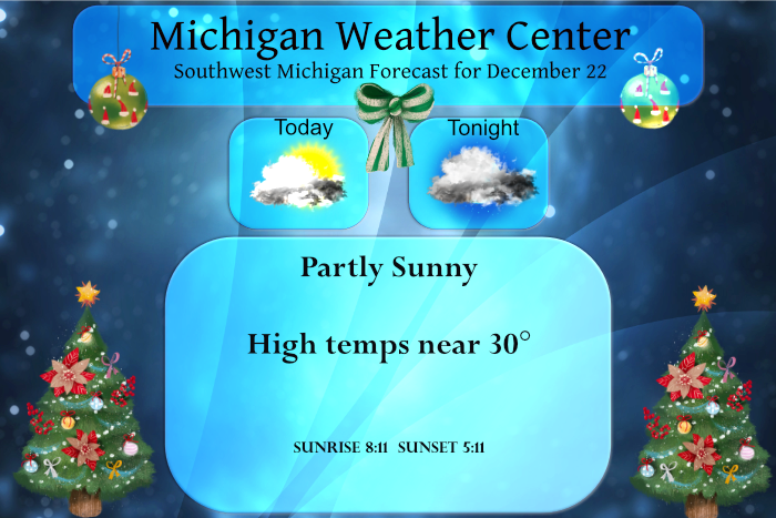
December 22
1957: Balmy weather prevails with highs in the mid-50s. Muskegon sets a record high of 55 degrees.
2000: A long siege of arctic air and lake effect snow continues across Lower Michigan. The high temperature at Lansing is only 9 degrees with lake effect snow showers swirling. It will be the coldest December of the 20th century at Lansing.
December 23
1941: Lower Michigan is in the midst of a three-day spell of mild weather with highs in the 50s from the 22nd to the 24th. The high temperature at Muskegon on this date is a record 54 degrees.
1989: Temperatures fall to record lows of 5 below zero at Muskegon and 11 below at Grand Rapids during the coldest December on record at both sites.
December 24
1993: A Christmas Eve snowstorm drops from 3 to 8 inches of snow across Lower Michigan and ushers in several weeks of severe winter weather.
December 25
1982: Southerly winds push temperatures into the 60s during the warmest Christmas on record for Lower Michigan. The unusual warmth is punctuated by scattered thunderstorms.
1983: Only one year after the warmest Christmas on record, southwest Lower Michigan is setting record lows with temperatures plunging below zero as a long siege of arctic air dominates the last half of the month.
2000: Lansing falls to 17 degrees below zero for their coldest Christmas on record.
Weather History for SE Michigan
December 19
On December 19, 2008, a winter storm moved across Illinois, Indiana and Ohio on December 19th. There were numerous reports from spotters of thunder with the heaviest bursts of snowfall. Sleet mixed with the snow as far north as Flint, and freezing rain was mixed in Lenawee and Monroe Counties. Up to 5 inches of snow fell across Lenawee and Monroe. Washtenaw and Wayne counties recorded 5 to 8 inches of snow. North of 8 Mile Road, snowfall was generally 8 to 10 inches. However, there were two bands of heavier snow with 10 to 13 inches. The first band of heavier snow fell across Northern Oakland and Macomb Counties. The other band of heavier snow extended across the M-46 corridor from Saginaw and Northern Genesee Counties across to Tuscola and Sanilac Counties.
Also on December 19, 1929, a two-day snowstorm dropped 13.8 inches of snow on Detroit and 16.9 inches of snow on Saginaw! This placed the 1929 storm as the fifth heaviest snowstorm for both Detroit and Saginaw. Flint recorded 12.1 inches of snow with the storm.
December 20
On December 20, 1973, a two-day snowstorm dropped 11.2 inches of snowfall on Detroit and 9.5 inches on Flint. This storm ranks as the 10th heaviest storm in Flint and the 17th heaviest in Detroit history.
December 21
On December 21, 1989, the daytime temperature rose to only 5 degrees in Flint! The normal high temperature for this time of the year in Flint is 32 degrees. Saginaw only reached 6 degrees and Detroit had a high of 8 degrees. These highs occurred after morning low temperatures below zero, including 6 below for Saginaw, 7 below for Flint and 3 below for Detroit. This was just one of many cold days during December 1989 which is the coldest December on record for Saginaw and Flint, and the second coldest for Detroit.
December 22
On December 22, 2013, an ice storm impacted locations from the northern Detroit suburbs to the Saginaw area as significant moisture became entrained along a frontal boundary. Widespread ice accretions of 0.5 to 0.75 inches were reported and numerous trees and power lines were downed. The ice storm even prompted Shiawassee County to declare a state of emergency due to unsafe traveling conditions. Further south, the precipitation fell as heavy rain while Bay, Midland, and Huron counties saw 2 to 4 inches of snow.
Also, on December 22, 1872, the temperature dropped to -24 degrees overnight in Detroit. This temperature reading is unofficially the lowest temperature ever recorded in the city of Detroit.
December 23
On December 23, 2004, a strong storm system lifted northeast out of eastern Texas and moved through the Ohio Valley. Snow tapered off by early afternoon with most locations receiving between 6 to 10 inches. Strong northerly winds to 30 mph, and up to 45 mph near Lake Huron, also caused blizzard conditions with significant blowing and drifting of snow. Here are some of the higher snowfall totals: Burton 7.5 inches (Genesee), Caseville 8.0 inches (Huron), Dryden 7.5 inches (Lapeer), Deerfield 9.0 inches (Lenawee), New Baltimore 9.0 inches (Macomb), Dundee 8.0 inches (Monroe), Bloomfield Hills 9.3 inches (Oakland), Saline 8.2 inches (Washtenaw), Romulus 8.8 inches (Wayne), and Port Huron 10.0 inches (St Clair)
December 24
On December 24, 2017, a storm strengthened and pulled in cold air as it moved from west to east across the area. Snow totals ranged from 2-4″ west of US-23 to 4-7″ to the east. Peak measurements of 6.1″ and 6.8″ were made in Macomb County.
Also On December 24, 1983, was a very cold day across Southeast Michigan. Detroit only had a high temperature of 3 degrees above zero, and the low was 9 degrees below zero. Flint and Saginaw were not much warmer with respecitve highs of 6 and 7 degrees, and lows of 5 below and 3 below zero. December 1983 was the 5th coldest December for Detroit and Flint, and it was the 3rd coldest December for Saginaw.
December 25
On December 25, 2000, Christmas morning dawned clear and frigid, with a morning low of 13 degrees below zero at Flint, setting an all-time mark for the month of December (the old record was -12 on Dec 23, 1989). Saginaw reached 3 degrees below zero. Three nights later, Flint would give the new record a run for its money, coming up just short with a low of -11 on the 28th (this was still a new record for the day). Saginaw fell to 5 below zero on the 28th. The arctic weather would take a toll on pipes. Both Ypsilanti High School and Chelsea High School had pipes burst over Christmas weekend, damaging classrooms. Several buildings on the University of Michigan campus in Ann Arbor had similar ruptures,including the School of Dentistry and Wolverine Tower. The cold also hampered shipping interests. Ice formation was extremely rapid on the Great Lakes and the connecting waterways. Several freighters got stuck in ice on both the Detroit River and Lake St Clair, blocking the shipping channel and bringing dozens of ships to a halt. Icebreaker assistance was needed to free the freighters. This arctic outbreak helped to seal December 2000 into the records with the 4th coldest December in Detroit, and the second coldest December for both Flint and Saginaw.
Also on December 25, 1982, record daily high temperatures of 64, 65, and 63 degrees were respectively set in Detroit, Flint, and Saginaw. This made for a record warm Christmas Day in 1982! Curiously enough, the very next year in 1983, the record low for Christmas was set with -10 at Detroit!
Forecast Discussion
- Brisk Start to the Day -

We`re still brisk and breezy early this morning with westerly winds
gusting to around 30 MPH. Meanwhile temperatures are currently (as
of 3am) sitting in the low to upper 20s. These temps will drop a few
degrees further by daybreak, and combined with breezy winds, wind
chills temps  will only be in the teens to single digits during the
morning commute.

- Snow Possible Thursday -

An upper level jet max with a corresponding weak surface reflection
will turn the flow southerly late Wednesday into Thursday with warm
advection and isentropic lift supporting some snow development.
Models have converged a little more on a possible solution, with the
GFS now having backed off a touch on snow amounts. Generally
accumulations up to 1 inch look to be the general consensus, but
higher totals will still be possible given our proximity to the
strong left exit region dynamics from the 160kt upper jet overhead.

- Mild and Wet Christmas -

The flow turns more zonal by Friday and into the Holiday weekend. A
broad surface trough lee of the Rockies will join with a central
Canadian low and progress east positioning southwest MI in the warm
sector. Temperatures look to be mild both days with highs into the
40s with deep southerly flow supporting mainly light rain across the
area. This unsettled pattern will continue beyond Christmas as the
strong upper level jet sends rounds of shortwaves across the region
bringing frequent chances for precipitation. Meanwhile ensemble mean
temps keep highs above normal for much of next week.
Let it snow let it snow let it snow..INdY
Just another below normal temp snowy day! Incredible!
Chicago is now breaking records for the latest measurable snow ever and getting close to the longest stretch in their history for # of days without measurable snow. We’re not the only ones in a snow drought.
Up to one inch and still snowing! Wow!
In looking at the past for Christmas miracle snow events. Here at Grand Rapids Michigan they are not very common. The biggest Christmas snow miracle snow event in my life time was in 1965 when here at Grand Rapids there was no snow on the ground as of late in the day on the 24th the high for the 24 was 50. But after sunset the snow started and here in GR there was 6″ by Christmas morning. So other years that snow fell on the 24 just in time to make a white Christmas were in 1966, 1997 and last… Read more »
Getting some light snow fall here. The temperature is just 27 but the snow on the road and driveway has mostly melted and a good bit of the snow on the roofs has melted as well.
Slim
Very odd driving around yesterday and still having to deal with road construction. Don’t ever remember that this late in the year!
We are getting hammered with snow as we speak! We are already up to .5 inches and still rocking!
Believe it or not there is snow on the ground here this morning. Of course not much snow but there is a whopping 0.2″ of snow on the ground. And yes the ground is white here at this time! The overnight low and current temperature with all that new snow was 21. While there may be some more light snow tomorrow that still looks to be all gone by Christmas Eve. The CFSv2 is now showing hints of it becoming colder and snowier as we head into January.
Slim
This time the CVSv2 is spot on! We will be getting hammered with cold and snow starting the first of the year!
Once again our current conditions = COLD and SNOW! Incredible!
Hey Indy check this out!
https://www.pivotalweather.com/model.php?p=snku_acc&fh=384
Beautiful I must say…INDY
Another below normal temp day with snow! Who would have thought? More snow on Thursday and then the first week of January the hammer will drop! Get prepared now! Rock n roll will never die!
We are prepared! We have been prepared!
🤣🤣🤣
Excellent!
🤘