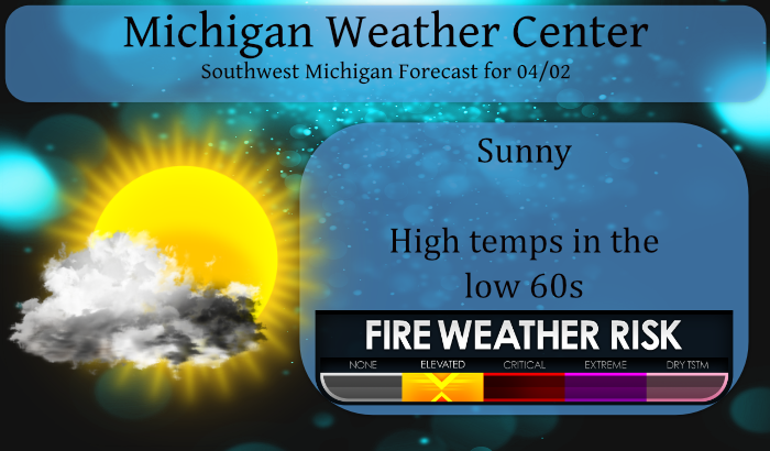
65 Years ago!!!
April 3, 1956, was one of the wildest days in west Michigan weather history, when a violent tornado tore a path through several West Michigan communities. It was one of several strong tornadoes to hit Michigan that day. Unlike this year March 1956 was cold with a mean temperature of 30.1 -5.5 below average. The high for the month was just 49 and that occurred on March 1st 8.4” of snow fell on the 23rd and the low fell to +10 on the 24th April started out a little warmer with highs of 54 on the 1st and then 68 and the 2nd and then.
The afternoon of Tuesday, April 3rd, 1956 was warm and humid. Strong south winds had brought summer-like temperatures and humidity, with record highs of 77 at Muskegon and 78 at Grand Rapids. 80 at Holland and 79 at Kalamazoo. Dew points were in the 60°s even near Lake Michigan. But a strong cold front was approaching from the west and out ahead of it, a line of violent thunderstorms had formed over Wisconsin and Illinois. By 1 PM, a tornado had roared through Bancroft, Wisconsin, killing two people. Another tornado would level the town of Berlin, Wisconsin an hour later, leaving 7 more dead and 50 injured. Michigan was put on alert. The U.S. Weather Bureau (forerunner of the National Weather Service) office in Grand Rapids began notifying the public and civil defense officials that the risk of tornadoes across western Michigan was increasing. Some schools began letting out early, anticipating the severe weather to come.
The storms crossed Lake Michigan, and when they reached the west coast of Lower Michigan by late afternoon, they immediately began producing tornadoes. Three hours of terror would follow. At least four powerful tornadoes would be spawned, tearing their way across the landscape. When it was over, areas from Saugatuck to Traverse City, and inland to Middleville and Rockford were dealing with unprecedented destruction. Almost 20 people were dead and hundreds injured. Dozens of homes were obliterated. Many people’s lives were irrevocably changed.
The worst hit areas were Hudsonville and Standale, where entire neighborhoods were laid waste. Many people, some of them badly injured, helped in the immediate recovery by searching for neighbors trapped under the debris of what had been their homes. Police and National Guard units were dispatched to make sure roads were kept clear of sightseers, allowing the injured to be evacuated to hospitals. Dozens of seriously injured people were brought to hospitals in Grand Rapids, Holland, and Zeeland.
Here is a break down of some of the storms in west Michigan.
The first tornado to strike west Michigan that day began along the beach near Saugatuck at 5:45PM. This tornado would injure seven people, but miraculously cause no fatalities as it destroyed four homes and did heavy damage to several farms. The damage path began just south of Oval Beach in Saugatuck as it damaged or destroyed several buildings at Camp Gray, along with the beach house at Oval Beach. It then flattened the historic Saugatuck Lighthouse.
Shortly after the tornado that hit Saugatuck, Gibson, Graafschap and Holland had dissipated, another storm was bearing down on areas further east. The sky grew dark over Vriesland, a small settlement east of Zeeland, just after 6 PM. People watching it from near Hudsonville would see it grow from a narrow, pencil-like funnel to a large and menacing wedge-shaped tornado as it approached the town. It crossed M-21 near 48th street and then crossed New Holland Street, where several farm homes were demolished, and the tornado would claim its first fatality. Photos taken from the ground and from the air in the following days would show the scope of the destruction here.
The tornado continued to intensify and demolished several homes when it reached the intersection of Van Buren Street and 40th Avenue. Some homes were completely swept away. It continued northeast to 36th Avenue and Port Sheldon Street and claimed eight more victims in this area. Two people died in a car while trying to flee the storm. Witnesses saw the car lifted as high as the tops of the telephone poles before it crashed back to earth. Two people in the car survived.
Another four people died nearby on Port Sheldon Street when they were caught out in the open and struck by flying debris. The tornado would claim one last victim in the Hudsonville area near Baldwin Street and 28th Avenue. The tornado was photographed around this time from about 2 miles south. The photo shows a large tornado funnel in contact with the ground, along with the yellow sky and greenish storm clouds that were mentioned by many eyewitnesses.
The tornado crossed Bauer Road and Cottonwood Drive before roaring across the Grand River and Fennessy Lake. Witnesses observed the funnel turn colors as it moved over the water, and a spectacular display of electrical sparks as high tension wires were ripped apart in this area. A large swath of trees along the Grand River were felled by the winds. The water and mud from Fennessy Lake was picked up and plastered against the houses nearby.
Next in the path was the business district of Standale. Fortunately, it was after hours and the approaching tornado was visible from the higher ground to the east of the river so most people were able to get to shelter. One that didn’t was 89 year-old Anna Hart of Cummings Street. She was carried about 200 feet from the second floor of her house. She was the first of four fatalities in Kent County.
The main business section, centered on the corner of Kinney Avenue and Lake Michigan Drive was devastated. Clothing and other items from stores in this area were lifted up into the storm updraft and carried to the northeast, as far as Gladwin, 100 miles away. The tornado swept away homes on Kusterer Drive and Nixon Avenue before crossing Leonard Street but fortunately there were no fatalities here.
Two more people would be killed on Vinecroft Street, off Bristol Avenue. A father of eight was killed as his house was blown apart and a woman was killed in the Vinecroft trailer park, which was obliterated by the tornado. The tornado crossed 3 Mile Road and then Alpine Avenue and headed into the Comstock Park area where it would take its 17th and final victim as a woman on 4 Mile Road was killed when her house collapsed on her.
The tornado destroyed several more homes on Childs and Leland Avenues before hitting the Lamoreaux Dairy, and some homes on North Division Avenue. The tornado path paralleled West River Drive and the Grand River, and destroyed several more homes along with the Brookhaven Trailer Park in this area, while devastating sections of Wakefield Avenue and Pine Island Drive.
From here, the tornado moved into a more rural area before brushing the western side of Rockford. The tornado continued northeast of Rockford and struck several farms, before ending just north of Trufant in Montcalm County.
As this tornado finally lifted about 7:30 PM, the final tornado of the day was touching down far to the south in Van Buren County.
Slim
Look at all of that SNOW out West! Incredible April pattern!
Accuweathers Paul Pastelok updated his April/June long range guess and it has more loophole and twist and turns and if and buts then a rich persons tax return. My best interpretation (in looking at his maps) of his ideas are for a some what warmer (maybe +1) and a wetter period. There is not much in his written expiation for the Great Lakes area. He feels our best chance of severe weather will come in May. Even for the people at Accuweather it is too early for a summer guess.
Slim
As I stated Paul Pastelok has not written much about the Great Lakes area here is what he has stated for the eastern half of the US. “There has been a delay with the development of the upper high over the Southwest in March. We are expecting an upper high pressure area to develop over the Four Corners region and southern Plains in April. There still can be one more setback during mid-April, but it should be brief. When the upper high pressure area in the interior Southwest forms, this will keep the upper flow moving from the Northwest to… Read more »
Nice read Slim. I live just down the road from Vriesland where the tornado started, and there are still a few old timers who live in the area that can vividly recall that day. The path of the tornado actually cut through the field just SE of our field and back in the ‘70’s my dad would point out the lack of large trees where the tornado went.
Thanks, next week is the anniversary of the 1965 tornado outbreak.
Slim
Get out your clubs!! Another fantastic golf weekend in store!! I love long springs!
The overnight low here at my house was 29 the official overnight low at GRR was 31. Over the next week with highs in the mid to upper 60’s and low in the 40’s to low 50’s the green up should ramp up. That means we should start the grass cutting season soon. At this time it it cloudy and 42 here.
Slim