Happy Easter to all, the celebration of Christians all over the world. One could not ask for a better day for getting out to church and family activities. My wife and I will be getting our second Covid shot at the end of the week so we might consider venturing out into the larger world in a couple of weeks. We did have the kids and grandkids over yesterday with everyone outside of course – it has been since last September we had everyone over.
This is the beginning of a fairly warm week though the weather pattern is looking more unsettled. I have been debating getting the spring fertilizer down on the lawn and am leaning towards its application with the hints of precip increasing for a good portion of the week now.
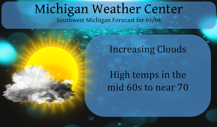
This will be a warm week with highs near 70° and our first rumblings of thunder may be around the area tomorrow and tomorrow night.
Forecast Discussion
--Warm and dry today--

Pleasant weather expected today as surface ridging settles in
behind a weak west-east oriented sfc frontal boundary which
stalls near the MI/IN border. The air mass remains quite dry and
once deeper mixing develops this afternoon we should see relative
humidities dropping to 15-25 percent. Fortunately winds will be
much lighter than on Sat so fire danger not as much of a concern.

Mainly just some high cloudiness riding along the flat upper
ridge today so a mostly sunny fcst should work for most areas,
but clouds may thicken up north of I-96 this afternoon. 70 degrees
is definitely in reach where sunshine prevails today, even for
the lakeshore given a southeasterly low level flow.

--Showers and storms late tonight and Monday--

Decent moisture advection around 850 mb occurs late tonight and
Monday via a 25-30kt southwesterly low level jet stretching from
the Srn Plains northeastward toward srn WI/wrn Lwr MI. Elevated
mixed layer also overspreads the region from the west, with mid
level lapse rates of 8 C/KM arriving late tonight.

CAMs are indicating that a cluster of elevated showers and
thunderstorms will develop over ern WI and central Lk MI around 5
am Monday morning then move southeast across srn Lwr MI during
the daybreak period. Highest potential for some locally heavy
downpours during the morning commute per latest HREF guidance is
in a relatively narrow corridor near and south of I-96.
Additional clusters of elevated showers and storms may impact the
area on Monday with warm front remaining situated over the area.

--Upper low brings late week rain--

After Monday, the coverage/potential for showers and tstms should
decrease somewhat as an upper ridge begins to build/amplify ahead
of the deepening trough/upper low coming across the Rockies.
However the frontal boundary will still be in the area so low
chc/isolated pops will still be needed. Potential exists for
Wednesday to be a very warm and mostly dry day when upper ridging
is most pronounced and H8 temps approach 12C. If we see enough
sunshine on Wednesday, highs could be in the upr 70s.

The big closed upper low begins to impact the area on Thursday as
it moves into Iowa. First band of showers associated with this
system spreads in from the south/southwest and may have some
locally heavy rainfall/tstms with it. This feature moves very
slowly and will likely be affecting MI weather for several days
into next weekend with occasional showers and tstms.
Hope everyone had a great Easter. We spent most of the day outside, boy it felt just like Summer! Hit 73 degrees here, once again 20 degrees over average.
With the current official temperature of 67 today will be at least the 13th warmest April 4th at Grand Rapids.
Slim
With todays forecasted high in the upper 60’s today had a chance to be in the top warmest April 4 in Grand Rapids recorded history. At this time it is mostly sunny and 65 here at my house. The current official reading of 60 is good for the 20th warmest April 4th of record at GRR.
Slim
Awfully quiet around here! Everyone must be enjoying this beautiful day The LORD has made!! HAPPY EASTER!!
Wow!!! Possibly 80 on Wednesday?!?!! Incredible warmth for this time of year!!! BRING IT!!!
https://weather.com/weather/tenday/l/b4ea0280869baa46799dc75eacef8904785ec43ad2f6fb098355fbc208a55e2c
It is still too early to say if it will get that warm on Wednesday or not. But the record high for Wednesday is 81 in 1991. It was 77 in 2001 and it was 75 just last year it was also 75 in 1954 and 1900. In total it has been 70 or better a total of 11 times on April 7th.
Slim