Yesterday we managed 44° with a morning low of 32°. We had .02 of an inch of rain which brings us to 2.31 inches for October and 4.44 inches for the season for Otsego.

It certainly has been windy over the last 24 hours, and it has been rainy for the last 3 days. Below is a map of estimated rainfall totals for the last 3 days. Rainfall amounts are in the table.
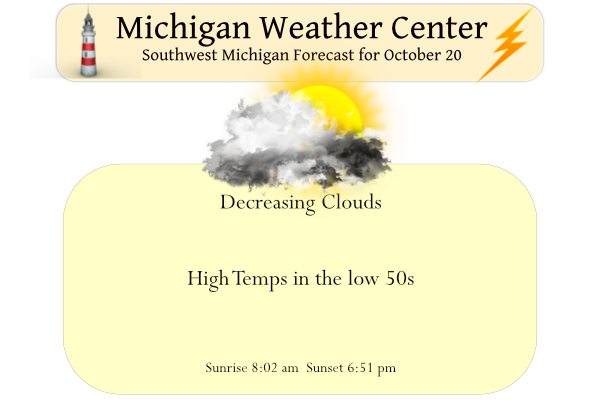
Things are looking up in the weather department finally, after some clouds and a few light showers or sprinkles this morning, we will see gradual clearing by mid-afternoon with temps rising into the low to mid-50s. Warmer air returns to Southwest Michigan by the weekend with highs in the lower 70s and considerable sunshine.
Forecast Discussion
-- Scattered showers today --

A broad mid/upper low remains situated over eastern Ontario early
this morning. Along the western periphery of this low, a vort max is
evident in GOES WV imagery diving southward toward the Great Lakes.
Forcing for ascent ahead of this feature will contribute to
scattered showers today over the northern/eastern forecast area.
Some snow showers may occur early this morning, but WBZ heights
approaching 1400 ft by late morning will likely support all rain.
Still, where precip occurs, amounts are expected to be very light
(under 0.05 in).

-- Dry and becoming much warmer Fri-Sun --

A digging trough over western North America on Fri night and Sat
will foster the development/amplification of a downstream ridge over
eastern North America on Sat-Sun. These height rises will be aided
by broad/sustained low-level warm advection in the region from
Thu night into Sun. Ensemble guidance continues to lend high
confidence in much-above-normal temps this weekend, with highs
near/above 70F likely in many areas on Sat/Sun, along with
plentiful sunshine.

-- Rain showers early next week --

The digging western trough will likely evolve into a closed midlevel
low over the central Rockies by Sun morning. At the surface, a
vigorous lee cyclone will consolidate over the CO plains on Sat
night, then emerge into the central plains on Sun night, likely
reaching the vicinity of the MN/SD/ND tri-border by 12z Mon.

Forecast uncertainty is considerably larger beyond 12z Mon. Global
ensembles (EPS and GEFS) suggest that another, lower-amplitude
midlevel trough may reach the vicinity of British Columbia on Mon,
then possibly interact/phase with the lead trough/low associated
with the plains cyclone. Large normalized spread in the EPS
500-mb height field at 12z Mon and beyond is likely attributable
to the degree of this phasing/interaction exhibited by EPS
members.

With this update, chance PoPs will be maintained for Sun night,
supported by fairly consistent EPS/GEFS probs. Higher chances for
showers are expected Mon and Mon night, when the cold front is
expected to progress through the region. Behind the cold front (Tue
and beyond), ensemble spread in surface temps remains large,
giving low confidence in temps for the midweek period.
INDY Summer this weekend looks good for some leaf burning and a cold sprite…Get outside and enjoy it maybe a while before see sunshine and 70 degrees again..INDY
NOAA just released their winter forecast. Great Lakes favored above average precip and EC for temps. They have parts of the state favored slightly below average.
As with any winter outlook, make of it what you want. In the end we shall see.
https://www.noaa.gov/news-release/us-winter-outlook-warmer-drier-south-with-ongoing-la-nina
Looking good! Bring it!
Some Yooper weather from my brother verified by Karl Bohnak that occurred Tues. in the Ishpeming area west of Marquette:
17.6 inches of snow containing 2.5 inches of water. Wow.
The snow was so heavy it brought down large oak tree branches with lots of power outages.
I’m in Jackson County near the small town of Rives Junction and it’s snowing here currently.
We had a few flakes (first of the year) here about 10:45.
I for one am looking forward to the sunshine returning. Good chance to get out and enjoy whatever leaves the past several days haven’t blown down! Had 1.2″ of rain over the last 3 days at my place near Hamilton.
Agreed. Just as the color started to really kick in here, most of it is on the ground now.
We still have most of the leaves on the trees here… but I’d imagine that won’t be lasting much longer.
The wind definitely did a number on the leaves here as well. Still some nice color to be seen, but the best was before all the rain and wind when we had lighter winds.
Yesterday’s official H/L at Grand Rapids was 46/33 there was a trace of rain all and 14% of possible sunshine. The overnight low here in MBY for today so far is 34. At the current time it is 39 and cloudy here. The average H/L for today is 59/41 the record high of 83 was set in 1953 the record low of 22 was set in 1952 and 1974. The record snow fall of 2.2” was set in 1992. Last year the H/L was 71/47.
Slim