Merry month of May
Monday will start the month of May. May is the last spring month and it is generally the start of the more pleasant time of the year here in West Michigan. At Grand Rapids the month gains about 1 hour of daylight with the sunrise time being 6:36 AM on the 1st and 6:07 AM on the 31st Sun set times go from 8:47 PM on the 1st to 9:14 on the 31st The average H/L rises from 64.6/43.2 on the 1st to 74.9/53.8 on the 31st So by the end of the month most days are very pleasant. The monthly mean for May 59. The average monthly rain fall is 4.0” on average there is no snowfall. The warmest mean for any May is 65.7 in 1977 The coldest mean for any May is 50.3 in 1997. The wettest May was in 2001 when 10.01” of rain fell. The driest May was in 1936 when just 0.72” of rain fell. While on average there is no snow fall in May since 1893 there have been 12 years when 0.1” or more of snow fall was reported. The record of 5.5” fell on both May 10th, 1902, and again on May 9th 1923 on that day Lansing reported that 11.5” fell. It snowed 3’ on May 2nd, 1929, The last time more than 1” fell in May was in 1954 when 1.3” fell on May 3rd and that year it snow the next 4 days. The last time more than a trace fell in May was on May 1st, 1994, when 0.1” fell. The record high for May is 95 set on May 31st, 1934. It reached 94 on May 28th, 2018. The coldest maximum for May is the cool 73 in May 1924 it only reached 75 in May of 2003. The record low of 21 was set on May 1st 1903. In May of 1922 it did not get any colder than 46. Last year the mean at Grand Rapids was 61.5 the high for the month was 87 on 3 different occasions and the low for the month was 36 on the 8th there was a total of 4.07” of rain fall.
The official H/L yesterday at Grand Rapids was 57/42 there was a trace of rain fall and just 1% of possible sunshine. So far the overnight low here in MBY has been 51. For today the average H/L is now up to 64/43 the record high of 90 was set in 1899 and the record low of 28 was set in 1977, 1979 and in 2012 of course that low in 2012 was after the record warmth in that March and there was a lot of crop damage. The record snow fall of 2.2” fell in 1909 there has been just one other time when there was a trace of snow fall on this date and that was a trace that was reported in 2019. Last year the high low was 62/42.
DISCUSSION
(TODAY THROUGH NEXT FRIDAY)
ISSUED AT 306 AM EDT SAT APR 29 2023
– OCCASIONAL SHOWERS THROUGH TUESDAY –
SUBSIDENCE AHEAD OF REINFORCED SHORTWAVE ENERGY WILL SUPPORT A
MOSTLY DRY MORNING TO START OUR DAY. SUBTLE SOUTHERLY FLOW AHEAD
OF AN ADVANCING COLD FRONT AND AFTERNOON EROSION OF THE LOW-LEVEL
STRATUS DECK THROUGH MIXING WILL BOOST AFTERNOON TEMPS TO NEAR 60
THIS AFTERNOON. THE COLD FRONT WILL THEN ARRIVE DURING THE
AFTERNOON AND EVENING AS THE REINFORCED MID-LEVEL SHORTWAVE DIVES
SOUTHWARDS ALONG THE BACKSIDE OF THE BROAD UPPER LOW. IT’S
POSSIBLE THERE MAY BE SOME AVAILABILITY INSTABILITY TO SUPPORT A
FEW RUMBLES OF THUNDER, BUT THE BETTER CHANCES FOR THUNDER WILL BE
FURTHER EAST WHERE AFTERNOON HEATING WILL BE BETTER ESTABLISHED
AHEAD OF THE FRONT.
THE UPPER LOW WILL DEEPEN FURTHER AS IT BECOMES CUTOFF AND SPINS
OVER THE REGION SUNDAY THROUGH TUESDAY. THIS WILL LEAD TO A GENERAL
FORECAST OF RELATIVELY COOL TEMPS WITH HIGHS IN THE 40S AND 50S AND
OCCASIONAL SHOWERS. MONDAY LOOKS TO BE THE COLDEST DAY THIS WEEK AS A
TIGHT WEST-NORTHWEST PRESSURE GRADIENT DEVELOPS AND SUPPORTS
ENHANCED COLD WITH OCCASIONAL SHOWERS. 850MB TEMPS DROP TO NEAR -3
TO -5C, SO EVEN SOME WET SNOW MAY MIX IN WITH RAIN SHOWERS AT TIMES.
– BRIEF DRY WEATHER WEDNESDAY WITH WARMING TEMPS TO END THE WEEK –
THE SURFACE LOW WILL FINALLY PASS EAST OF NEW ENGLAND BY WEDNESDAY.
A WARMING TREND CAN BE NOTED STARTING WEDNESDAY INTO THE END OF THE
WEEK WITH TEMPS GRADUALLY HITTING CLOSER TO MAY NORMS BY THURSDAY
AND FRIDAY.
– LOW CHANCE FOR RAIN THURSDAY AND FRIDAY –
LOW CHANCES FOR RAIN EXISTS THURSDAY AND FRIDAY AS A SHORTWAVE RIDES
DOWN THE LAST REMNANTS OF THE BROAD MID-LEVEL TROUGHING THAT WILL
LINGER OVER THE GREAT LAKES THROUGH THE END OF THE WEEK. GIVEN THE
POOR PROXIMITY TO THE SUPPORTIVE DYNAMICS ASSOCIATED WITH THE MAIN
SURFACE LOW TO OUR EAST, THESE SHOWERS SHOULD STAY LIGHT.
Detailed Forecast For Grand Rapids
Today
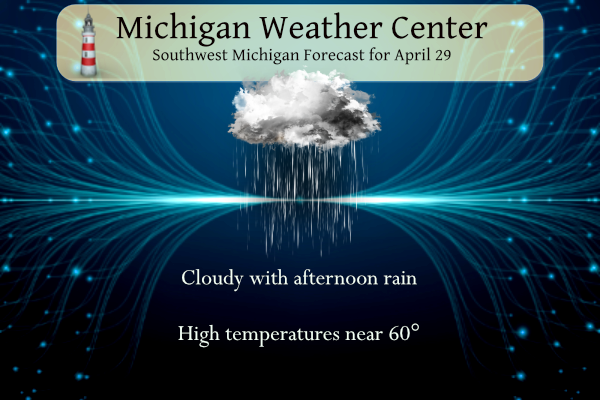
Rain likely, mainly after 4pm. Mostly cloudy, with a high near 60. West southwest wind 5 to 14 mph. Chance of precipitation is 60%. New precipitation amounts of less than a tenth of an inch possible.
Tonight
Rain likely, mainly before 8pm. Mostly cloudy, with a low around 40. West southwest wind around 11 mph. Chance of precipitation is 60%. New precipitation amounts of less than a tenth of an inch possible.
Sunday
A 50 percent chance of rain. Mostly cloudy, with a high near 48. West southwest wind 10 to 17 mph, with gusts as high as 25 mph.
Sunday Night
Rain. Low around 36. West wind 9 to 11 mph. Chance of precipitation is 80%. New precipitation amounts of less than a tenth of an inch possible.
Monday
Rain. High near 43. Breezy, with a west wind 17 to 26 mph, with gusts as high as 38 mph. Chance of precipitation is 90%.
Monday Night
Rain likely, mainly before 2am. Cloudy, with a low around 38. Breezy. Chance of precipitation is 70%.
Detailed Forecast For Holland
Today
Rain, mainly after 2pm. High near 59. Light and variable wind becoming west southwest 8 to 13 mph in the morning. Chance of precipitation is 80%. New precipitation amounts of less than a tenth of an inch possible.
Tonight
Rain likely, mainly before 8pm. Mostly cloudy, with a low around 39. West wind around 10 mph. Chance of precipitation is 60%. New precipitation amounts of less than a tenth of an inch possible.
Sunday
A 50 percent chance of rain. Mostly cloudy, with a high near 48. West southwest wind 10 to 15 mph, with gusts as high as 23 mph.
Sunday Night
Rain. Low around 37. West northwest wind 10 to 15 mph. Chance of precipitation is 80%. New precipitation amounts between a tenth and quarter of an inch possible.
Monday
Rain. High near 43. Breezy, with a west northwest wind 18 to 26 mph, with gusts as high as 39 mph. Chance of precipitation is 90%.
Monday Night
Rain, mainly before 2am. Low around 39. Windy. Chance of precipitation is 80%.
Detailed Forecast For Lansing
Today
A 30 percent chance of rain, mainly after 5pm. Mostly cloudy, with a high near 61. West southwest wind 7 to 11 mph.
Tonight
Rain likely, mainly between 7pm and 2am. Mostly cloudy, with a low around 40. West southwest wind 9 to 13 mph. Chance of precipitation is 70%. New precipitation amounts of less than a tenth of an inch possible.
Sunday
Rain likely, mainly after 8am. Mostly cloudy, with a high near 50. Southwest wind 9 to 13 mph. Chance of precipitation is 70%. New precipitation amounts of less than a tenth of an inch possible.
Sunday Night
Rain likely, mainly after 2am. Mostly cloudy, with a low around 37. West wind around 10 mph. Chance of precipitation is 70%. New precipitation amounts of less than a tenth of an inch possible.
Monday
Rain. High near 43. Breezy, with a west wind 14 to 22 mph, with gusts as high as 33 mph. Chance of precipitation is 90%.
Monday Night
Rain likely, mainly before 2am. Cloudy, with a low around 37. Breezy. Chance of precipitation is 70%
That forecast high of 43 on Monday would be the 2nd coldest high for any May 1st
Incredible 5 day snow map! I may need a road trip to the UP! WOW!
https://www.pivotalweather.com/model.php?p=snku_acc-imp&rh=2023042918&fh=120
Temps are dropping like a rock! Wow just wow!
Seeing some lightning and hearing thunder
Welocome to the 100th cold front since September crazy temps falling as I type away great hoodie weather again…INDY
Yes, but by Sunday night you will need a winter coat, hat, gloves, etc!
Good thing I golf on the weekends! Outstanding golf conditions earlier today and some great golf weather next weekend!! Been getting some good golf weather from the end of March til now! Upper 60’s and low 70’s next weekend!!! WOWEEEE!!!
https://weather.com/weather/tenday/l/b523690bfd952b86fef3627c919dd9855281a8da16b83c10bdd381c64ae12cbc
Already mowed this spring as much as I used the snowblower this whole past winter! Incredible!! Winter spoiled me with how easy it was! Who Knew?!?!!
Parts of MI will be seeing one to two feet of snow! Absolutely incredible snowstorm!
https://forecast.weather.gov/MapClick.php?x=43&y=159&site=mqt&zmx=&zmy=&map_x=43&map_y=159#.ZE1Y-y0pDi0
If you have a golf league for this week Mon or Tuesday forget about it! Horrible golf weather is on tap and it is May! Wow just wow, WOW!
I just mowed my lawn for the 1st time this year! This is right about the normal time for the first mow every year! What a cold Spring! Get ready for wind chills in the 20’s, Incredible cold is coming!
Already low 60’s out with the sun! Just mowed my lawn for the second time already this early in the spring! That is usually unheard of with me this early! Now I’m gathering up my clubs for another perfect early spring day of golf! Who knew with all the nonstop repetitive COLD propaganda on here?!?!!?
Just mowed mine for the third time. Thick and so green. It’s growing like crazy. Love this time of year.
Yep, my lawn is beautiful right now Mark!
What a gorgeous day for golf today!! Gonna have to get out soon with this beautiful weather! I have no idea how Rocky could love temps in the low 40’s with wind and rain?!?! I would bet that 99.999% of people on this blog would take todays weather over Rocky’s Monday weather any day!
Rocky will have to get out and enjoy his type of weather on Sunday and Monday because a big pattern change will be arriving on about Wednesday!! Who knew?!??! BRING IT!!
https://weather.com/weather/tenday/l/b523690bfd952b86fef3627c919dd9855281a8da16b83c10bdd381c64ae12cbc
Quite a nice morning out there. Hope everyone gets to enjoy it before the cooler air moves in. Monday will have feels-like temps stuck in the 20s most of the day (May 1st).
The good news is the temps should moderate later in the week. Next weekend might be pleasant if the forecast doesn’t change.
There was a signal of a pattern change several days ago and it still seems to be on track. As a matter of fact it’s possible we could be heading for a slightly above average but that remains to be seen. I welcome it with open arms I’m ready for spring/summer.
With it being pretty much May now 4 months togo and it will be September already I love cold Springs keep on with the heat waves away yeahh!! And on that thought have a nice cool Saturday…INDY
No hot air is in sight! I love it!
Possible snowmobile trip to the UP in May! Incredible!
https://www.pivotalweather.com/model.php?m=gfs&p=snku_acc-imp&rh=2023042900&fh=96&r=conus&dpdt=&mc=