We are about to close out the month of July, two-thirds of the summer has gone by and daylight begins to make a rapid retreat. Our weather pattern this month has been fairly active in regards to more severe weather and tornadoes than the past few years, at least in certain areas of the state. We had storm cells move through SW Michigan yesterday morning. We can only guess patterns by looking at certain weather dynamics in place, what plays out is up to those patterns making choices of what to do. SW Michigan (south of GR) was the area of choice where heavy rain, wind, thunder and lightning play out. Those areas saw some wind damage. We had a few dead branches, lots of leaves and walnuts in our yard to clean up.
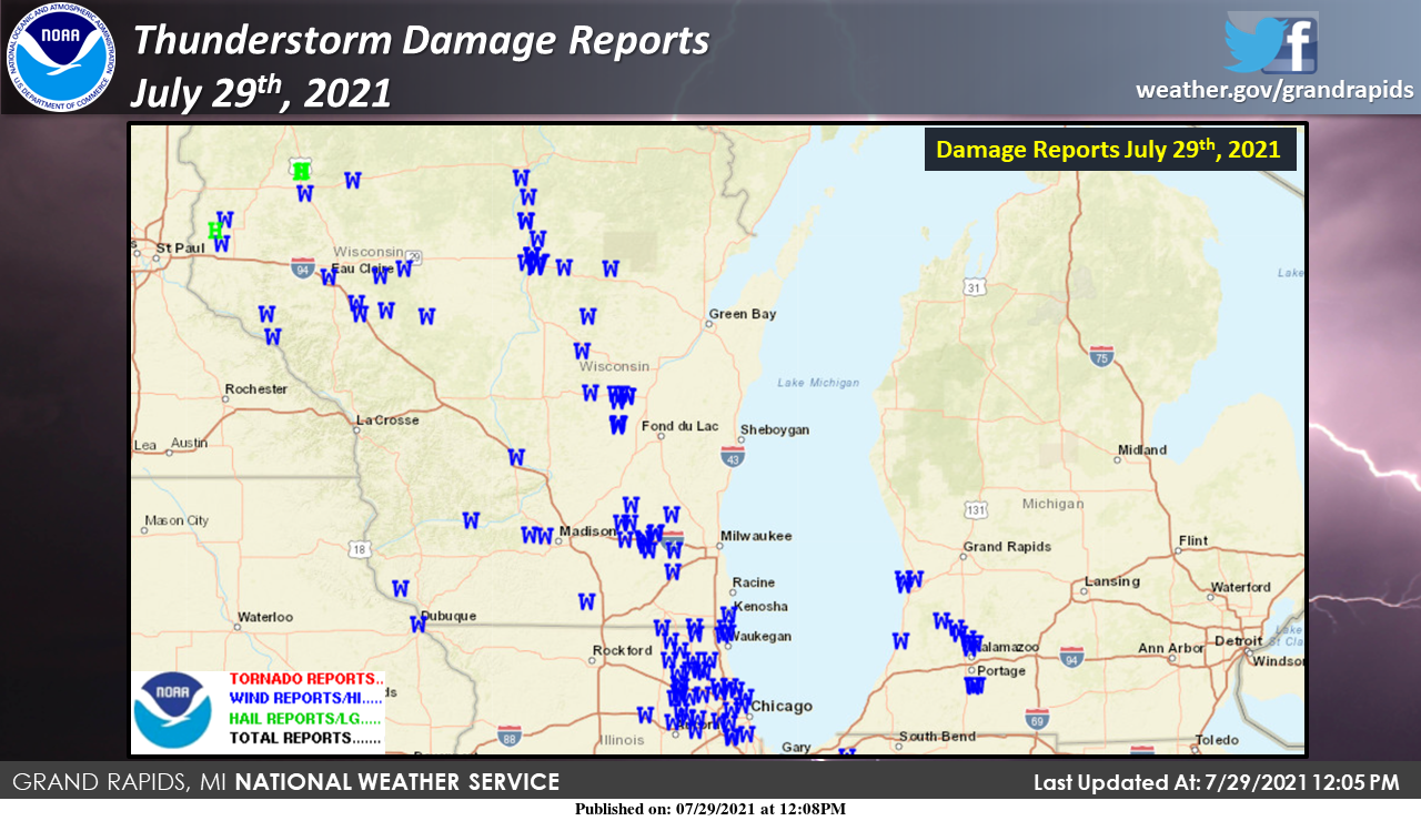
Here are the damage reports from this morning’s storm the went through southwest Michigan. While Michigan was spared the worst damage there were widespread reports in Wisconsin and Illinois.
I am a fearless defender of our Mets as the weather is a guessing game at best, we can only make guesses by what data is available at any certain time. Remember these are the same people who track the storms to help keep us safe.
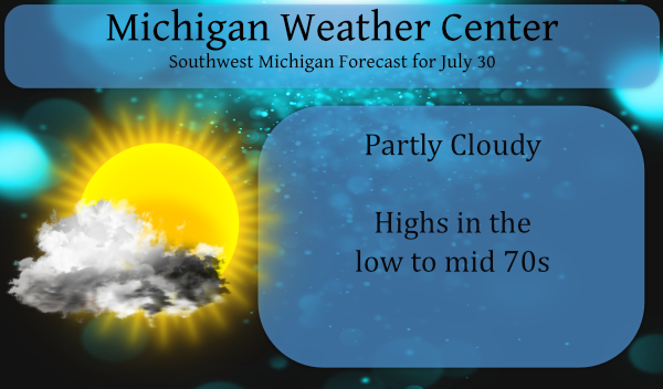
It will be cooler and less humid today with high temperatures topping out in the 70s. It will be dry today, tonight and for much of Saturday. A cold front approaching from the north on Saturday will bring chances for showers and storms starting during the late afternoon across Central Lower Michigan. Saturday evening into Saturday night all areas stand a chance for some rain.
Forecast Discussion
- Dry weather today, tonight and much of Saturday

Cooler and drier air has infiltrated Southwest Michigan this
morning. Temperatures have reached the 50s across Central Lower
Michigan with much less humid dew points (49F at Big Rapids) now
in place. The upper flow will be northwest today and tonight with
a shortwave trough moving into the Northern Great Lakes late
tonight. This shortwave will drive a cold front into the area
Saturday night, but much of Saturday will be dry. The area that
may see some showers and storms in the afternoon will be across
Central Lower Michigan. Very comfortable mid summer temperatures
are expected through Saturday with highs in the 70s (today and
Saturday) and lows tonight in the 50s.

- Chances for showers and thunderstorms Saturday evening/night

The better chance for showers and thunderstorms with our next cold
front will be Saturday evening into Saturday night. This front
will be a bit more moisture starved than recent events given the
deeper moisture has been shunted to the south with the cold front
yesterday. Dew points ahead of Saturday`s front will rise to
around 60F which is significant by July/August standards.
Precipitable water values will only rise to around 1.25 inches
which is also low by mid summer standards ahead of an approaching
cold front. We are expecting a broken line of showers and
thunderstorms to develop late Saturday afternoon and especially
into the evening hours of Saturday. Deep layer shear is on the
order of 30 knots so there will be some storm organization, but
given moisture levels that are down a bit, instability will not be
all that significant. Bottom line, we are expecting some storms,
but they should remain below severe levels. The strongest activity
may be what moves our direction from Northern Wisconsin, but these
storms will be moving over a more stable environment over Lake
Michigan.

- Mainly dry into next week

The Sunday through next Thursday time frame will largely be dry
with high pressure situated over the Great Lakes. The slightly
cooler than normal conditions will likely persist into next week
making for comfortable temperatures.

The caveat to the dry weather will be in the Sunday into Monday
time frame where we have some cooler air aloft and a shortwave
moving through on Sunday. We may need to increase chances for rain
showers during this time frame as the upper pattern is conducive.
Indy is correct – no days of 90 degrees or better in July is simply astounding! Keep those near to below normal temps coming! WOW!
It is great to have the windows open and no a/c on. It is beautiful outside!! You sure can tell the humidity is much lower. Yesterday I picked out first tomato! 🙂
👍
Gorgeous out!! Get these cooler temps in here now, so the warmer weather can get back here for winter!
Great night for a fire and some Sprites thanks for all the facts today Slim! You and MV are the reason I come on here weather smarts ….INDY
Well it is a real cool late July day here today at this time the current temperature here at my house is 70 with full sunshine. The overnight low was 57 both here at my house and at GRR.
Slim
It’s nice to be on the north side of the front for a change. Just went for a walk. The sun is very warm but the low humidity feels amazing.
No doubt! Dew points in the 50’s feels way better than the life sucking dew points in the 70’s!
Currently 61* degrees in my AREA big question today will we even make 80* degrees I bet we don’t …Feels great outside ahhhh INDY
Just about an average July. We just had 7 above average temp days in a row. We’re due for a little reprieve.
Haft to ask Slim when was the last time we had no 90* degree days in the hottest month of year reported?? Is my BIG end of July question?? Crazy when dewpoints is considered hot heat now whats next street temps lol…INDY ..
Irrelevant question. 4 days at 89 degrees in July. 12 days at 85 degrees or hotter. I loved it!
But no 90’s in the hottest month July that has to be a record lol …INDY
The 30 year average number of days at Grand Rapids with highs of 85 or better is 12. This year looks to be average in that department. This July is mostly a all around average July.
Slim
The last time there were no days of 90 or better in July was in 2014. In the last 30 years there have only been 5 years with out officially reaching 90 at Grand Rapids. As for days of 89 or better this year we have had 4 the average number in the last 30 for July is 5 with the most being 20 in 2012 and the least in 2009, 2000 and 1996. As for 88° days this year GR had 6 the average is 7 and for 87 the 30 year average is 8 this year we will… Read more »
The severe weather report map is practically a mirror image of the SPC’s moderate risk area. I’m a glass half full kinda dude.
I have the windows open FINALLY and it feels great. TGIF
Wow low of 54* degrees out in my AREA turn the fans off baby feels like Fall outside with Augusta here now we will start saying that alot!! Summer is fading fast July was easy In the heat department for being the hottest month we will call it a peace of ice cake … Enjoy this below average Friday on tap and have a super weekend MV’s best keep the fire burning…INDY